


Our active weather pattern continues with 2 storm systems in the next couple of days.
We’ve got the potential for flooding rain, damaging winds and even a touch of ice and snow all in the next 48-72 hours.
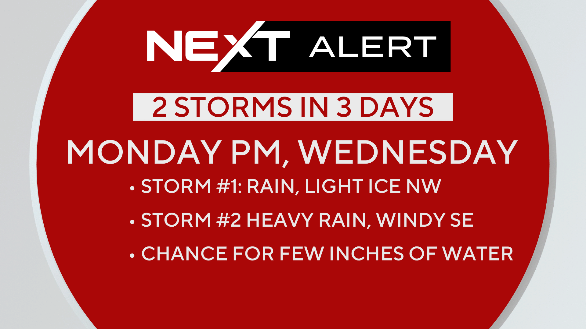
Storm #1
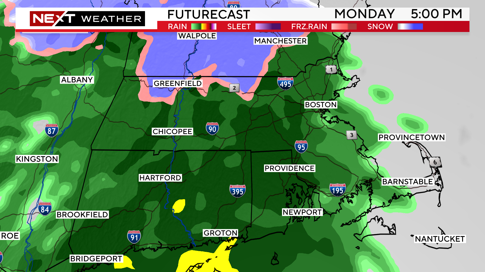
Timeframe: Monday from 2pm-Midnight
The National Weather Service has issued a winter weather advisory for portions of Worcester county, southwestern New Hampshire and much of the Berkshires and Vermont through Tuesday morning.
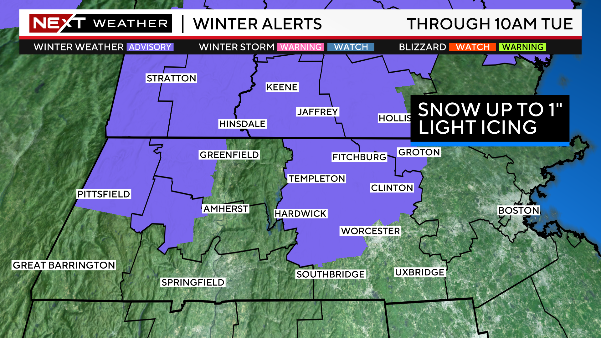
These areas may be just cold enough to allow for some mixing with snow and ice Monday evening.
Any wintry precipitation will be light and spotty, we certainly don’t anticipate any significant snow accumulations outside of the higher elevations of Vermont and New Hampshire.
This storm will largely be a cold rain for most in southern New England.
It will be a quick mover, with about 6-9 hours of rain, largely between 3pm-10pm.
Rainfall totals will generally be between .25-.5″.
Overnight, temperatures will slowly drop back close to the freezing mark north and west of the City, allowing for some black ice to form.
Be careful early Tuesday as you step out on the driveway or walkway and use cation on untreated roadways as well.
Storm #2
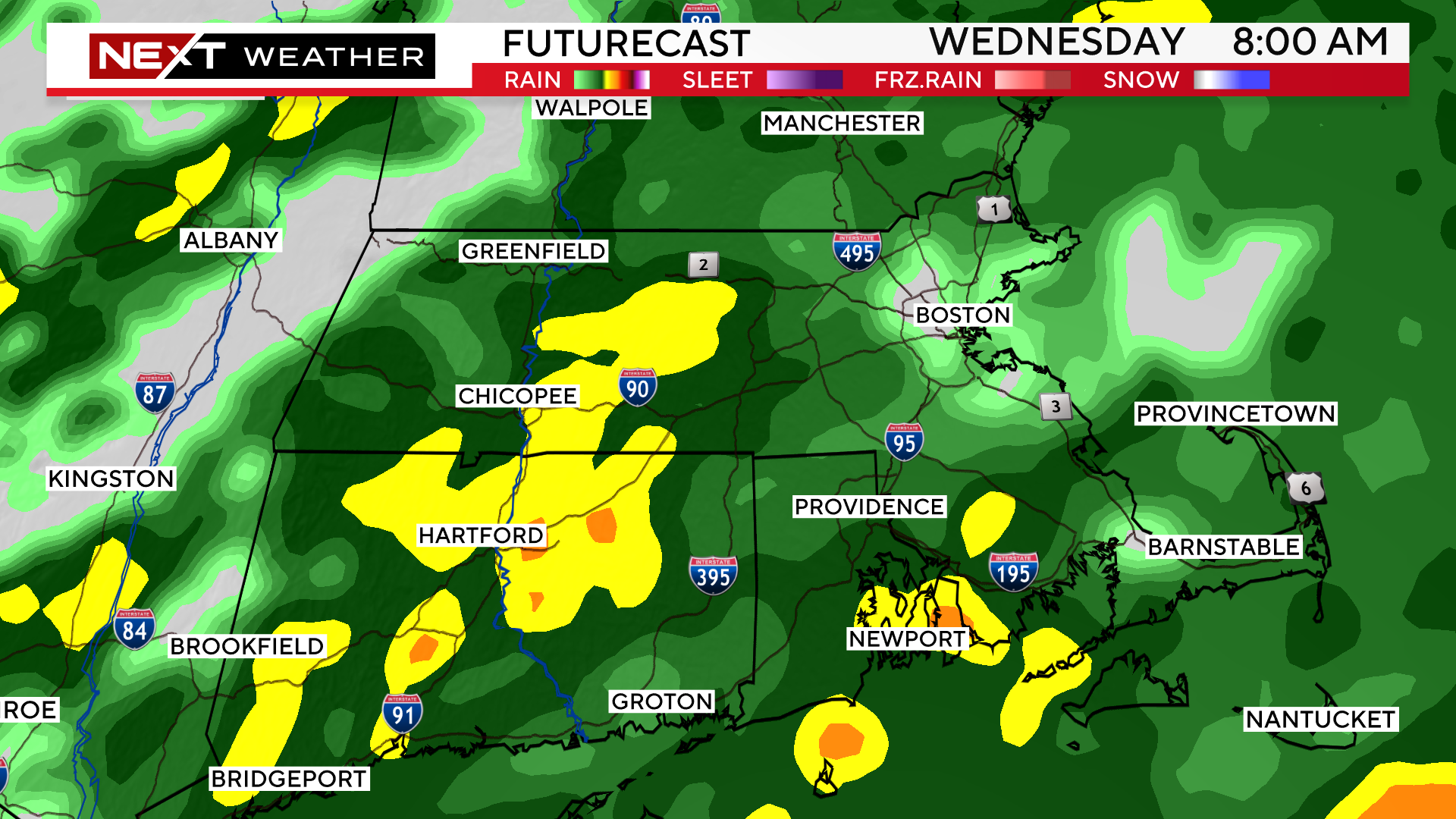
Timeframe: late Tuesday through late Wednesday.
The first showers will arrive Tuesday night.
Steady, widespread rain will arrive by dawn on Wednesday and continue all day long.
There will be pockets of heavy downpours between 3p-11p. There will be some urban, poor drainage and street flooding during this timeframe.
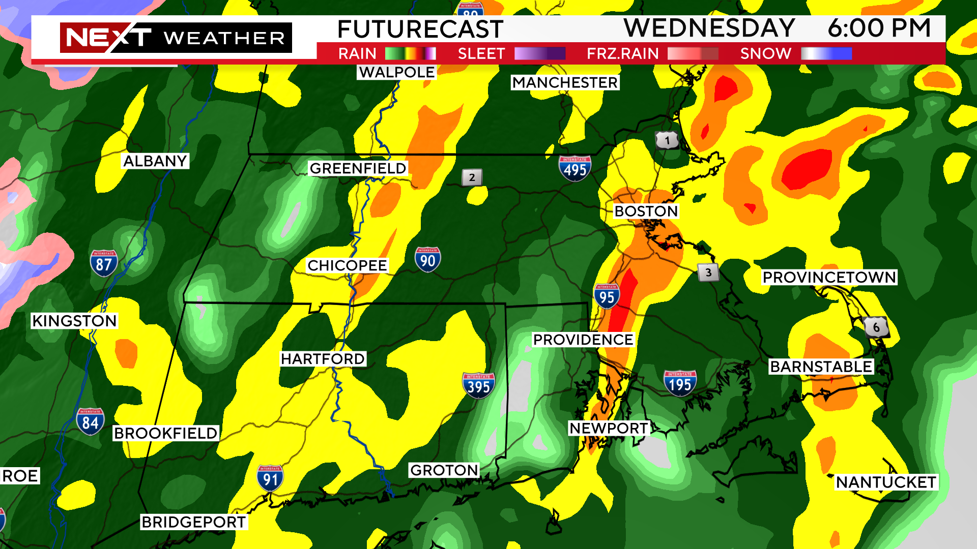
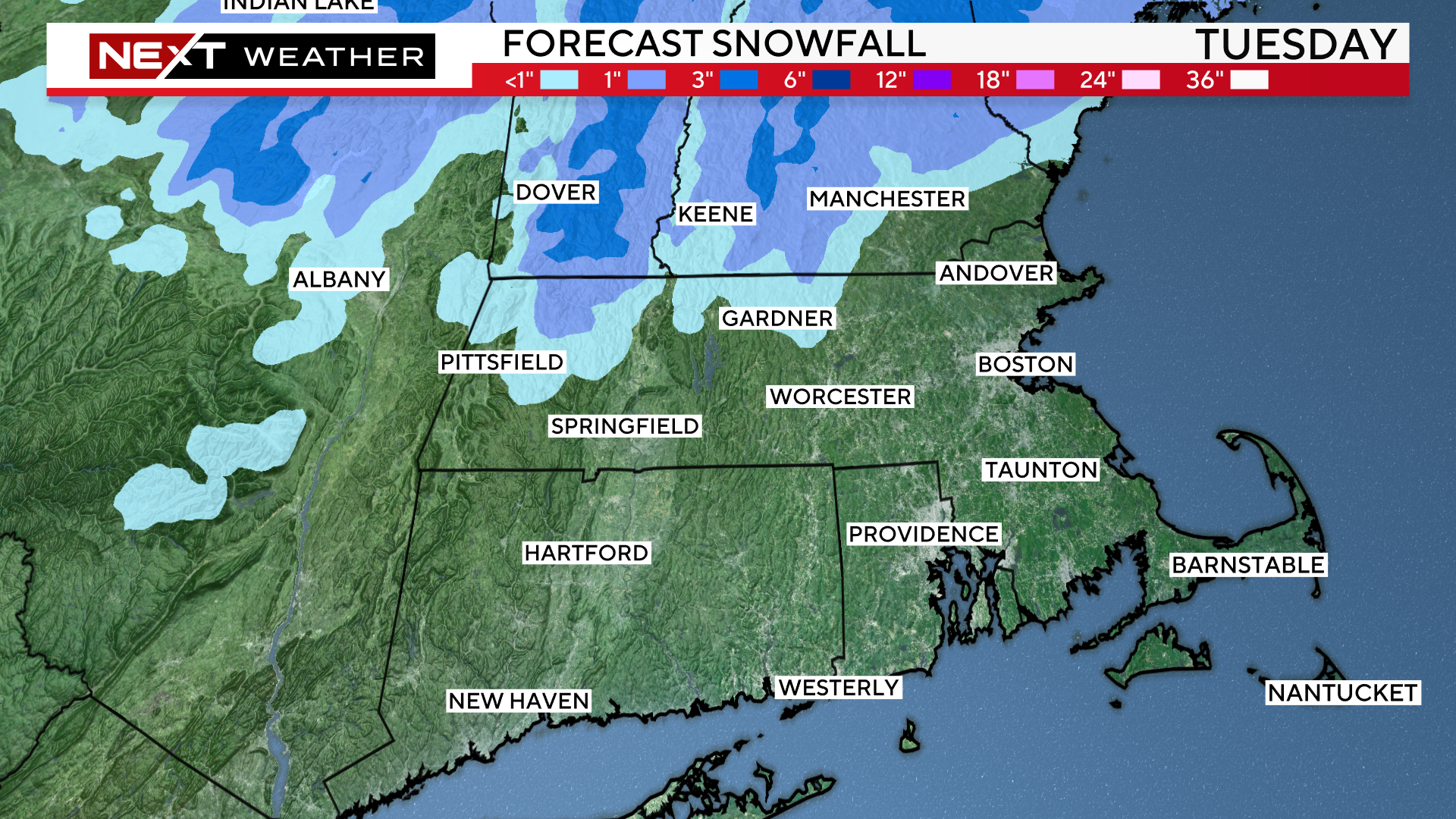
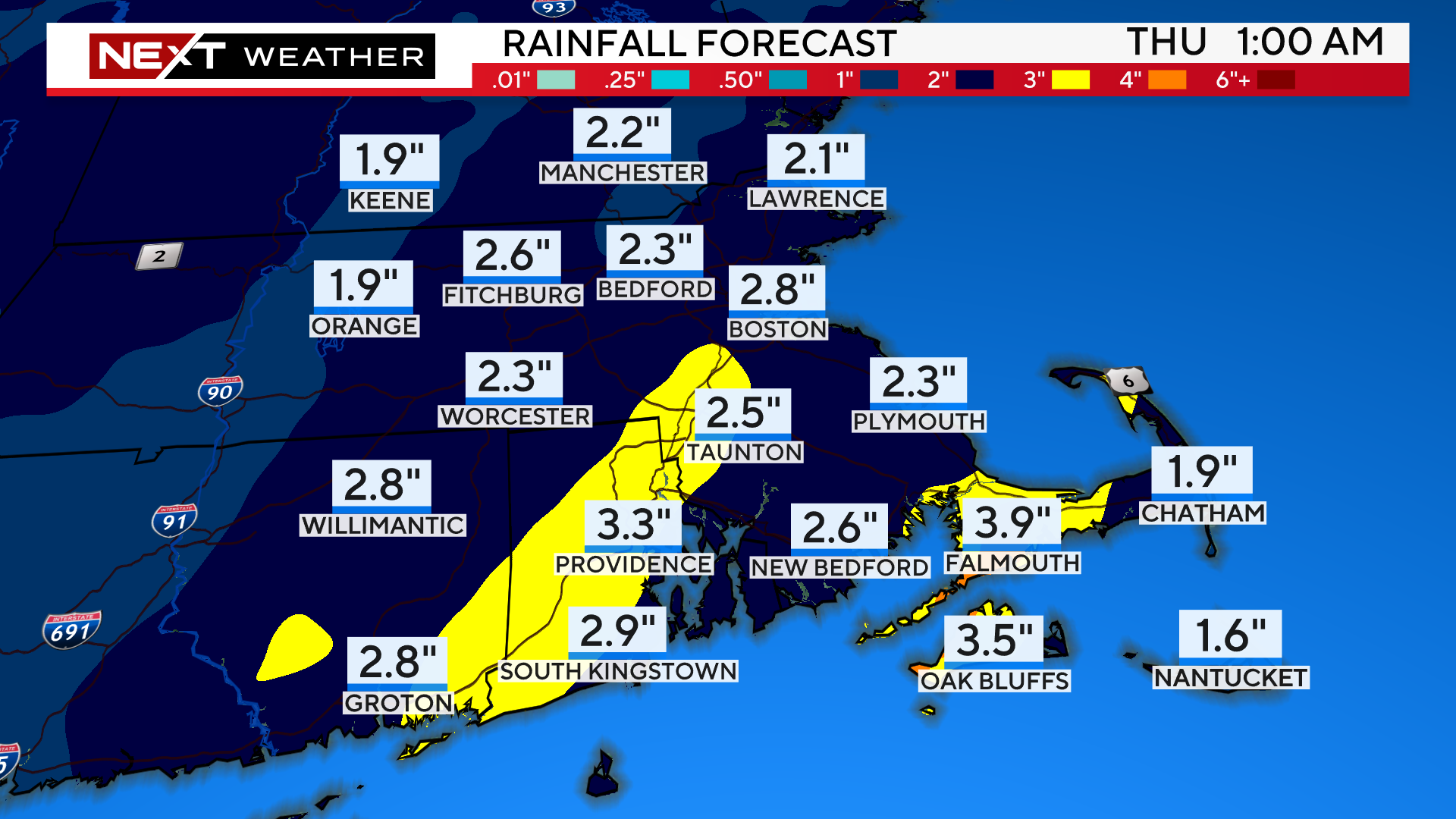
Rainfall totals from Wednesday could reach between 1-3″…this graphic below shows a forecast total from both events.
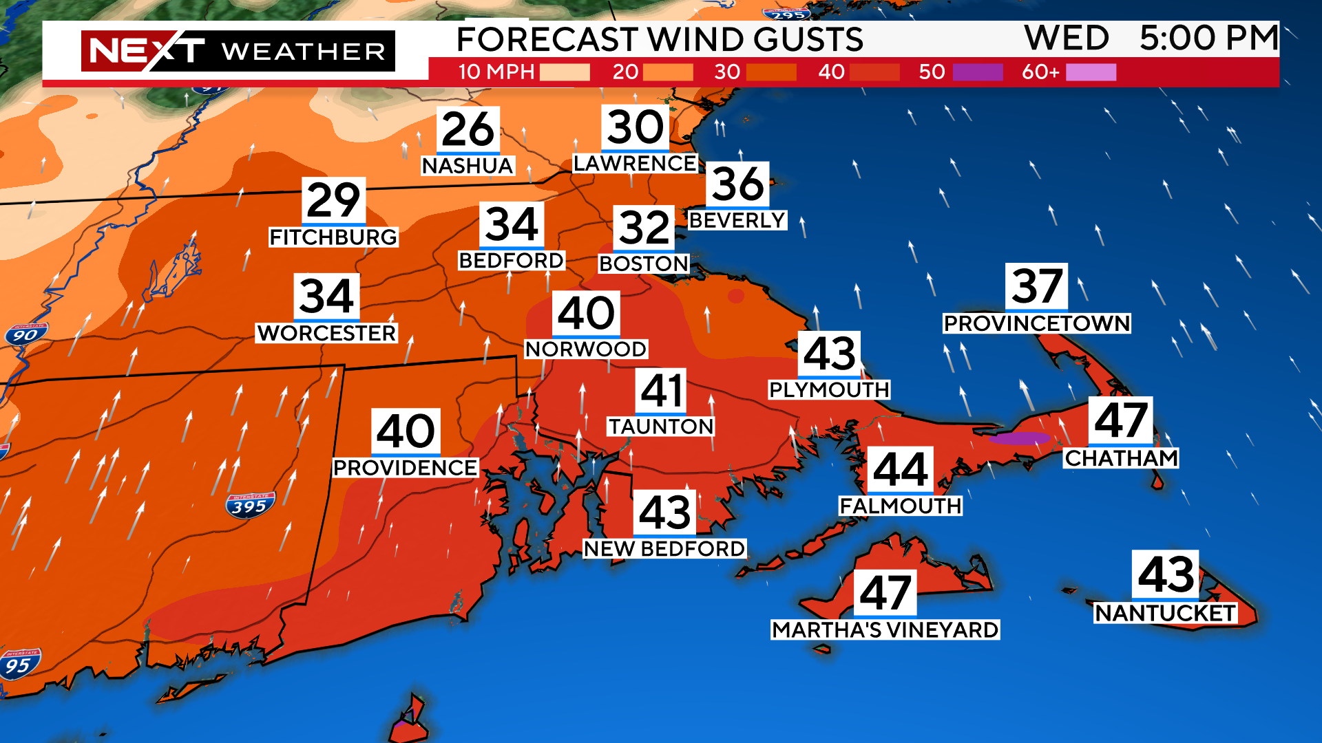
Southerly winds will increase during the day Wednesday and peak during the late afternoon and evening hours. Over southeastern MA, we could see gusts over 50mph, leading to some scattered wind damage.
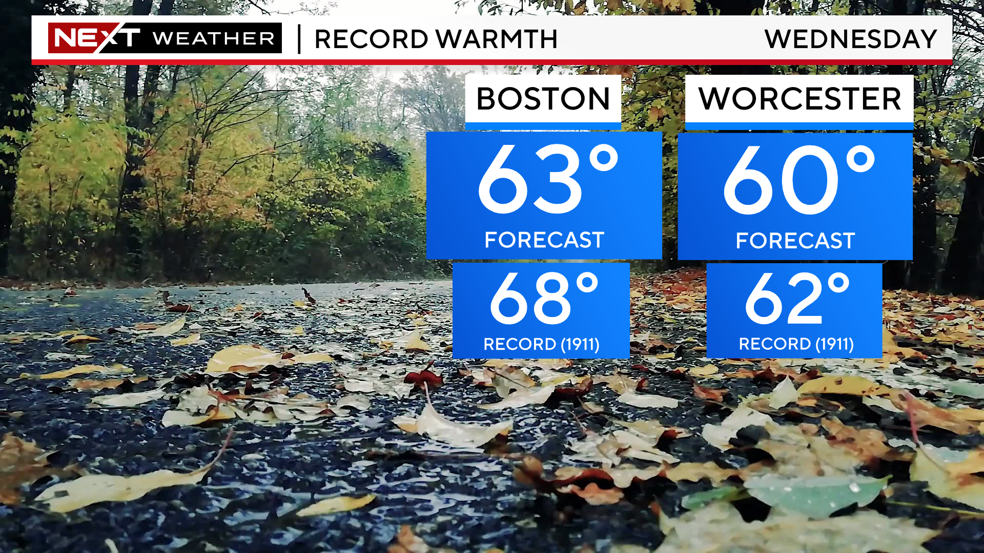
Those strong, southerly winds will usher in some very anomalous temperatures as well.
Many towns will hit or surpass 60 degrees on Wednesday, likely just shy of all-time record highs for the date.
Much colder and quieter weather is expected later this week and throughout the upcoming Weekend. We should have several storm-free days with highs in the 30s and low 40s.
Click here for Westford snow storm data and past totals or select “Winter Snowfall“ under “Pages” on the left hand side.
For more up to date forecast information follow me on Twitter (@terrywbz) or follow the WBZ weather team on Facebook, search WBZWeather
Reader Comments