


Happy Friday! For the purposes of this blog I am going to essentially skip over the next few days and go right to what everyone is talking about…the potential storm next Tuesday.
For the next few days…
-Temperatures dropping this afternoon through tomorrow morning…untreated surfaces ice up again
-Very cold Saturday…morning lows in the single digits in many areas, daytime highs in the 20s
-Few snow showers both Saturday and Sunday…could leave an additional or new coating in some places
On to the potential storm…
You just knew this was going to happen didn’t you?
After looking at bare ground for the vast majority of the winter, spending numerous days in the 50s and 60s and totaling one of the top 10 least snowy winters to date, I guess you could say we are “due”. Wouldn’t be the first time Mother Nature has come to collect payment in the month of March.
I don’t know about you, but I was actually starting to think I may go the whole winter without starting my snowblower! Silly me…
Gas ’em up, it looks like we have an actual snowstorm on the way.
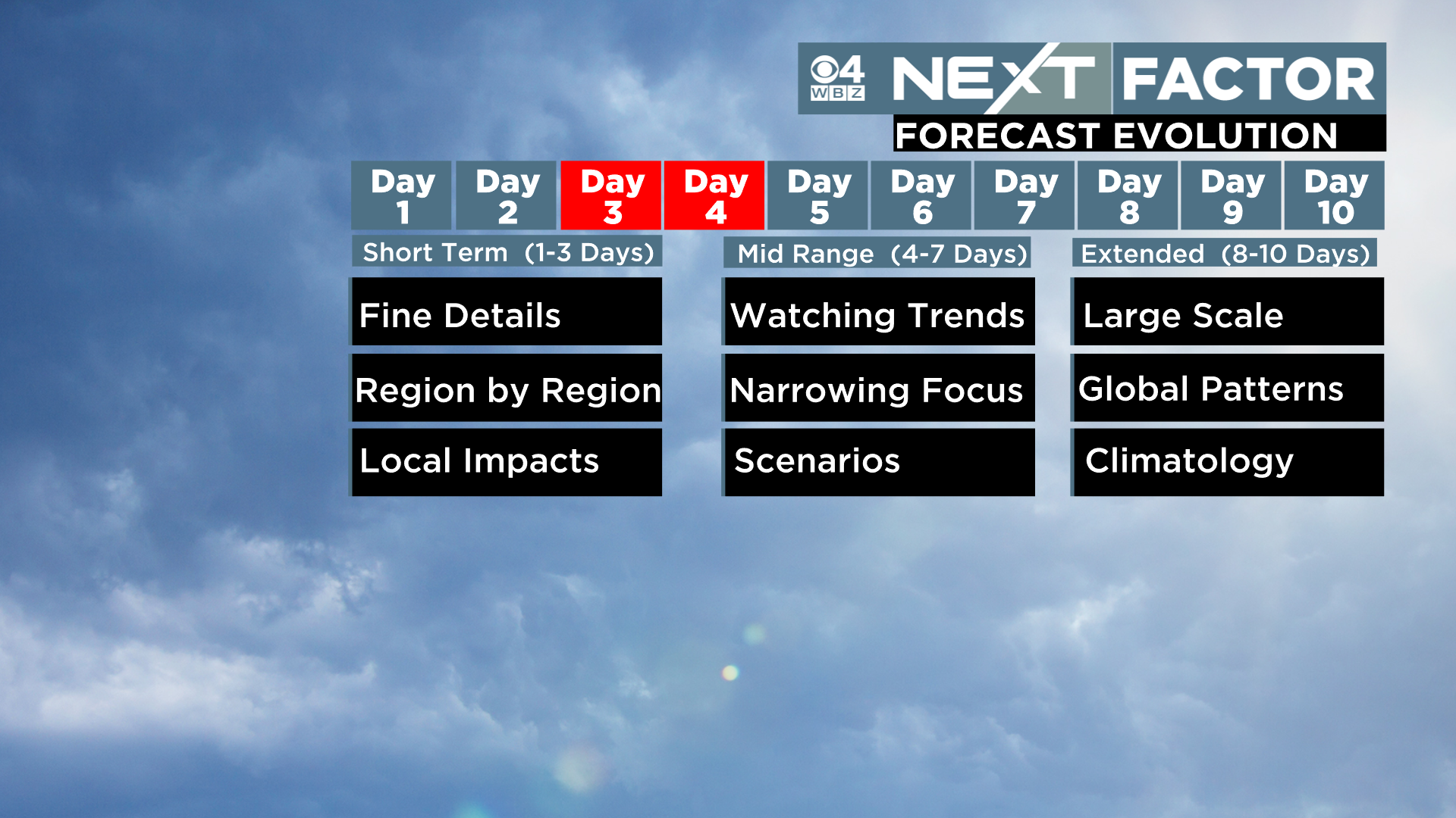
Let me start by saying this blog is being written on Friday morning, about 84 hours prior to the expected arrival of the first flakes. This puts us somewhere between 3 and 4 days out. We have a certain “protocol” that we follow in the WBZ weather office. Typically, we post our first forecasted snowmap about 48 hours prior to the event. There is a reason for this. Around this time, we have not only seen several consecutive runs of the global weather models, but we are also getting a glimpse at the higher resolution models. Sure, you can go on Twitter and likely find all sorts of direct model output as early as a week in advance. This should not be taken seriously. The atmosphere is insanely complex and even the best computer models, doing trillions of calculations, cannot account for all the chaos that is going on in every square inch.
3-4 days out we are essentially watching model trends and attempting to narrow our focus for the upcoming event.
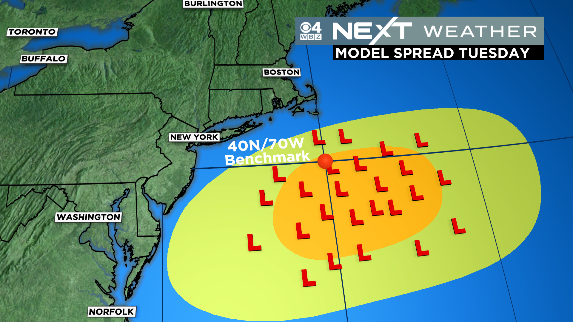
What we have noticed with regards to this storm is a lot of model consistency and agreement. This is important to note and somewhat unusual this far out. All the “L’s” in this graphic represent a model forecast for the position of the center of the storm early next Tuesday. As you can see, they are all fairly tightly clustered around or just south of what we call the “benchmark”. This is the area in the Ocean, south of Nantucket, which is ideal for a storm to pass over if you want a big winter storm in New England. You might also notice that more of the L’s are to the south of the benchmark than north…this also gives us a hint that this could be a colder storm with more snow involved than rain or a mix. That would be a novel concept this winter!
So, what can we say at this point about next Tuesday’s storm?
First and foremost, the storm IS LIKELY to happen. That is more than we can say about a lot of events like these this far in advance.
First flakes would be sometime after dark Monday, more likely after 8pm with the heaviest coming overnight into Tuesaday morning.
Snow could be falling for most of the day Tuesday, perhaps even into Tuesday night.

Second, like I said above, there is higher snow potential with this one than just about any other storm we have seen thus far this year. While you aren’t getting a snowmap today, I will give you this…Chances of “plowable” snow. That would be anything 3″ or greater. Right now, I would put just about all of southern New England in the 50-75% chance, bit lower towards the South Coast, Cape and Islands. Those are very high odds considering the timeframe.

I am sure you are thinking…”how much greater than 3″ are we talking”?
Well, if I knew, I would tell you.
I could certainly envision a scenario where there is a big area of 6-12″ of snow with this storm. That is not an official forecast but also not “going on on a limb” at all given the model agreement up until now.
Few other thoughts…
This is not likely to be a major nor’easter/bombogenesis-type storm. Probably some gusty wind down towards the South Shore and Cape but not trending towards a classic or blockbuster kind of event.
The tides are astronomically low next week so, coastal flooding is not likely to be a major concern.
Assuming the track stays well to the south, the nature of the snow could be lighter and fluffier, especially north and west and in elevated areas.
Lastly, if you are a student hoping for more days off after a week of vacation, I would say Tuesday has a legit chance and I wouldn’t rule out Wednesday either!
As always, we will keep you posted on WBZ-TV, CBSBoston.com and CBS News Boston throughout the weekend.
Click here for Westford snow storm data and past totals or select “Winter Snowfall“ under “Pages” on the left hand side.
For more up to date forecast information follow me on Twitter (@terrywbz) or follow the WBZ weather team on Facebook, search WBZWeather
Reader Comments