


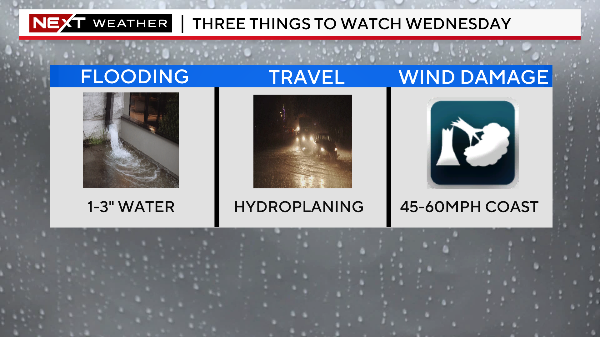
A powerful storm system is set to deliver a Wednesday washout complete with periods of heavy rain, localized flooding and damaging winds.

There are numerous hazards and alerts associated with this highly anomalous storm system.
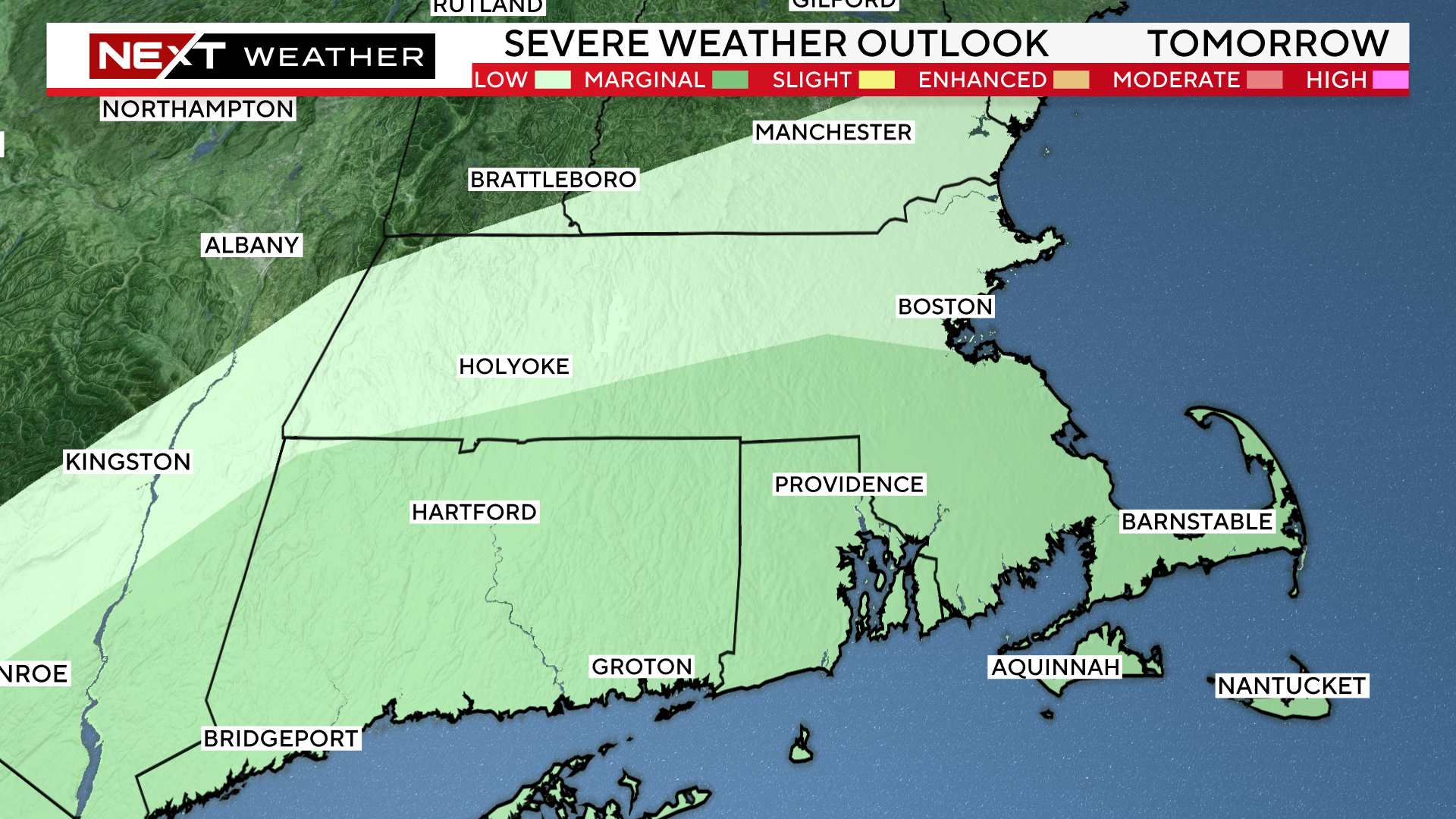
The Storms Prediction Center has placed areas south of the Mass Pike in a “marginal” risk for severe thunderstorms…
The Weather Prediction Center has just about all of New England in a “slight risk” for excessive rainfall…
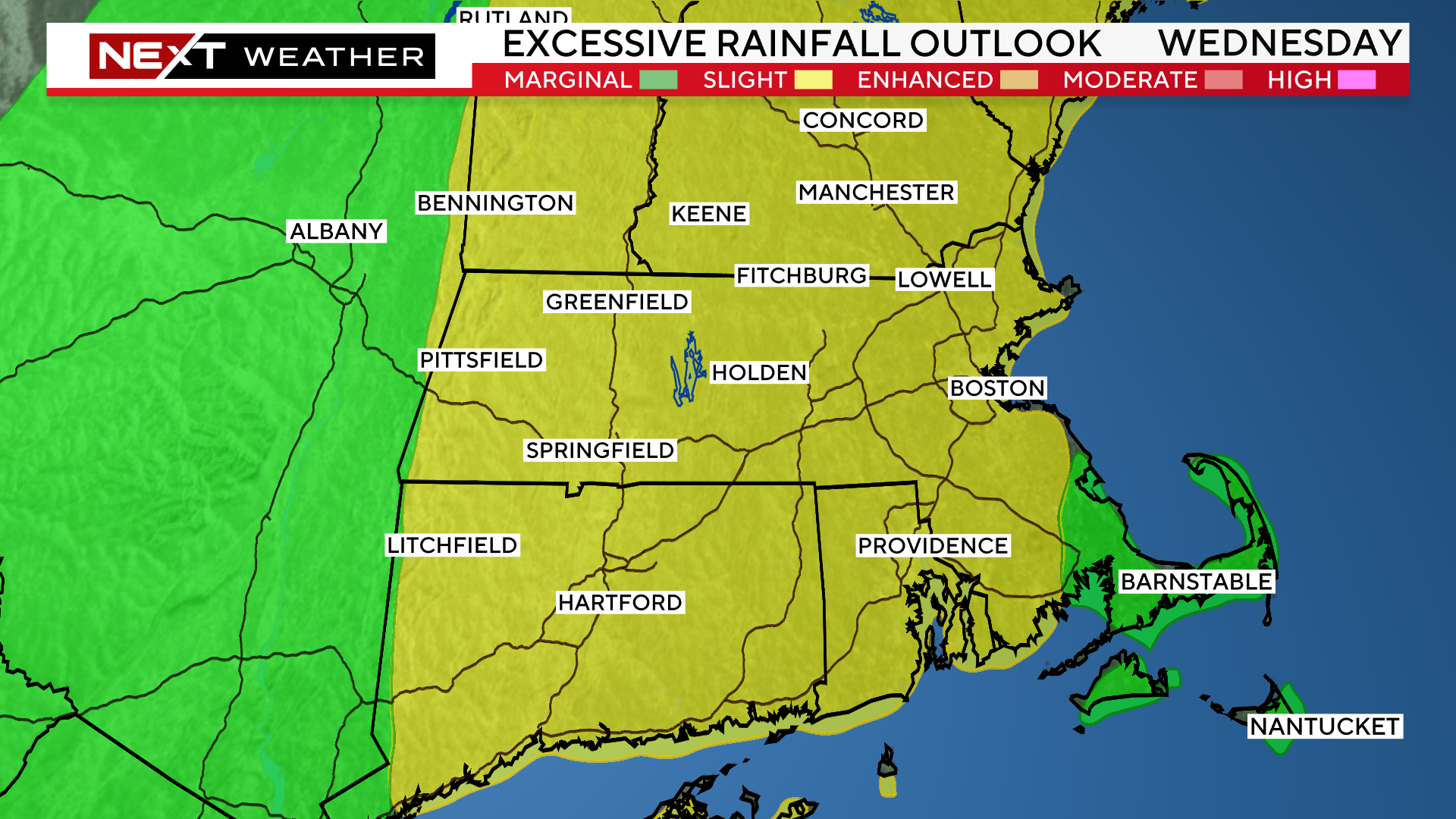
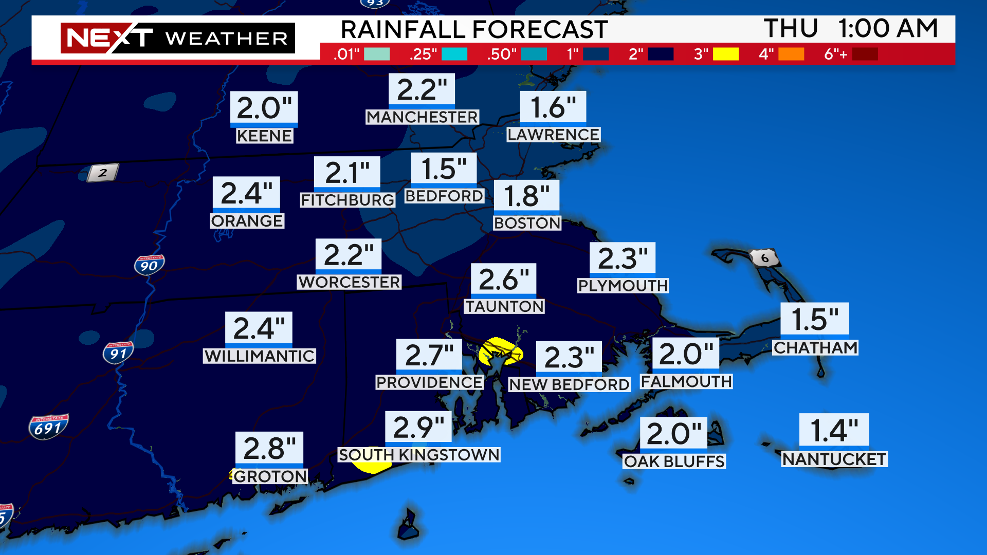
We are forecasting between 2-3″ of rain for most of the area.
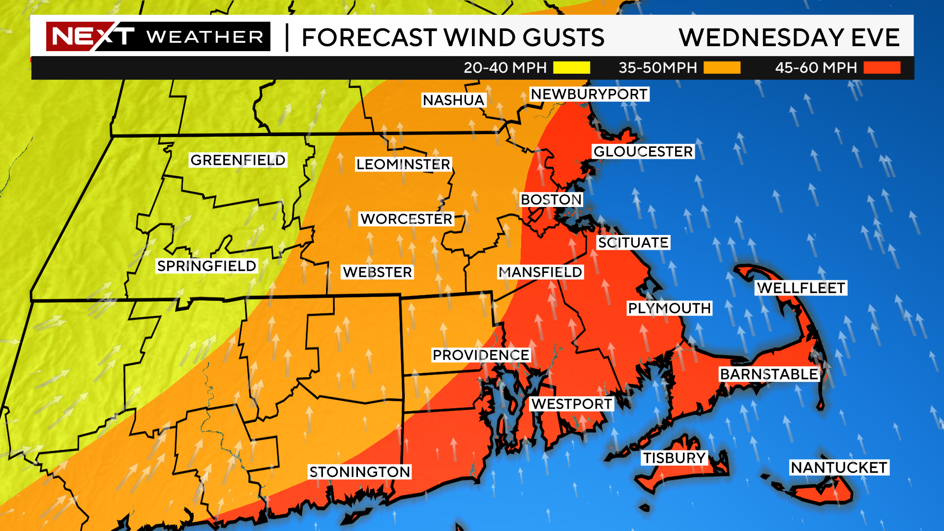
Finally, the National Weather Service has issued a high wind warning for all of eastern MA Wednesday afternoon and evening.
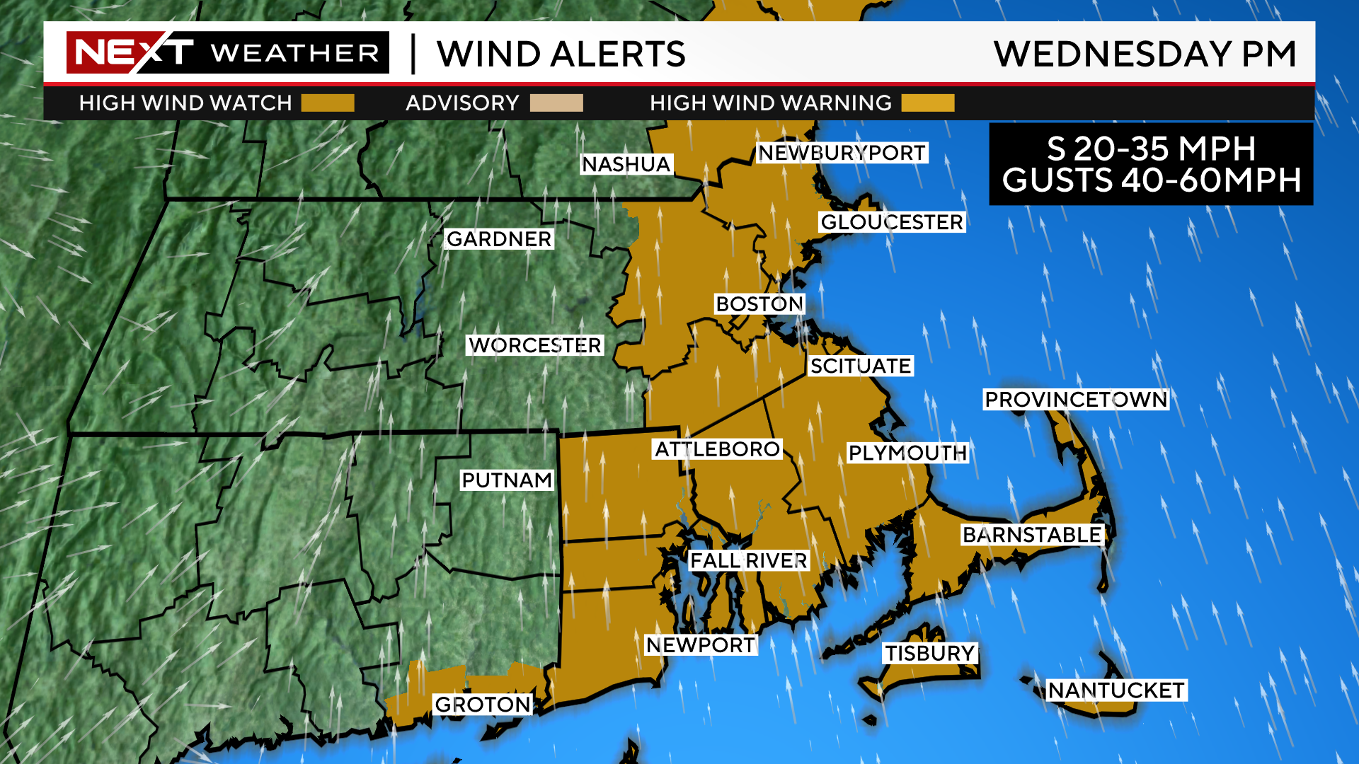
The strongest winds will be along the immediate Coastline, including southeastern MA. Southerly winds will peak between 45-60mph in this area late in the day Wednesday.
A bit farther inland, between 128 and 495 and westward through Worcester county, wind will gust between 35-50mph Wednesday afternoon and evening.
TIMELINE:
Overnight tonight, scattered showers begin to drift in, not expecting any torrential downpours.
Wednesday morning-afternoon…Steady rainfall with some embedded heavy downpours.
There may be a brief lull later Wednesday afternoon and evening before the heaviest line of downpours pushes through between 6pm and midnight.
This is when we are at greatest risk of flooding and wind damage.
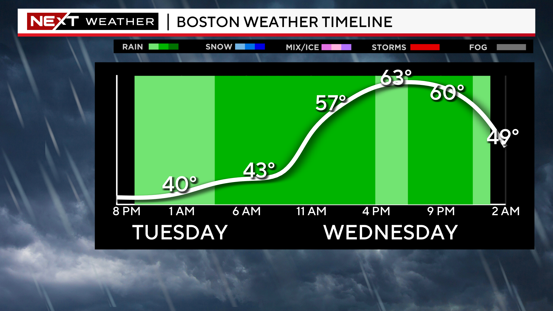
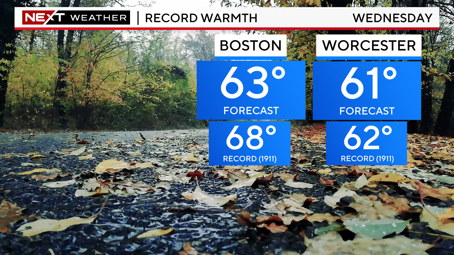
Temperatures will also be quite mild Wednesday. Highs will rise into the low and mid 60s across southern New England, approaching some all-time records.
Thursday will be a much quieter day and it appears as though we may stay dry (and coolish) through the Weekend.
Our next chance of some rain showers would be very late Sunday or early next week.
Click here for Westford snow storm data and past totals or select “Winter Snowfall“ under “Pages” on the left hand side.
For more up to date forecast information follow me on Twitter (@terrywbz) or follow the WBZ weather team on Facebook, search WBZWeather
Reader Comments