


What’s that strange bright, glowing orb up in the sky today? Believe it or not, that is some actual sunshine!
January has been an “interesting” month…
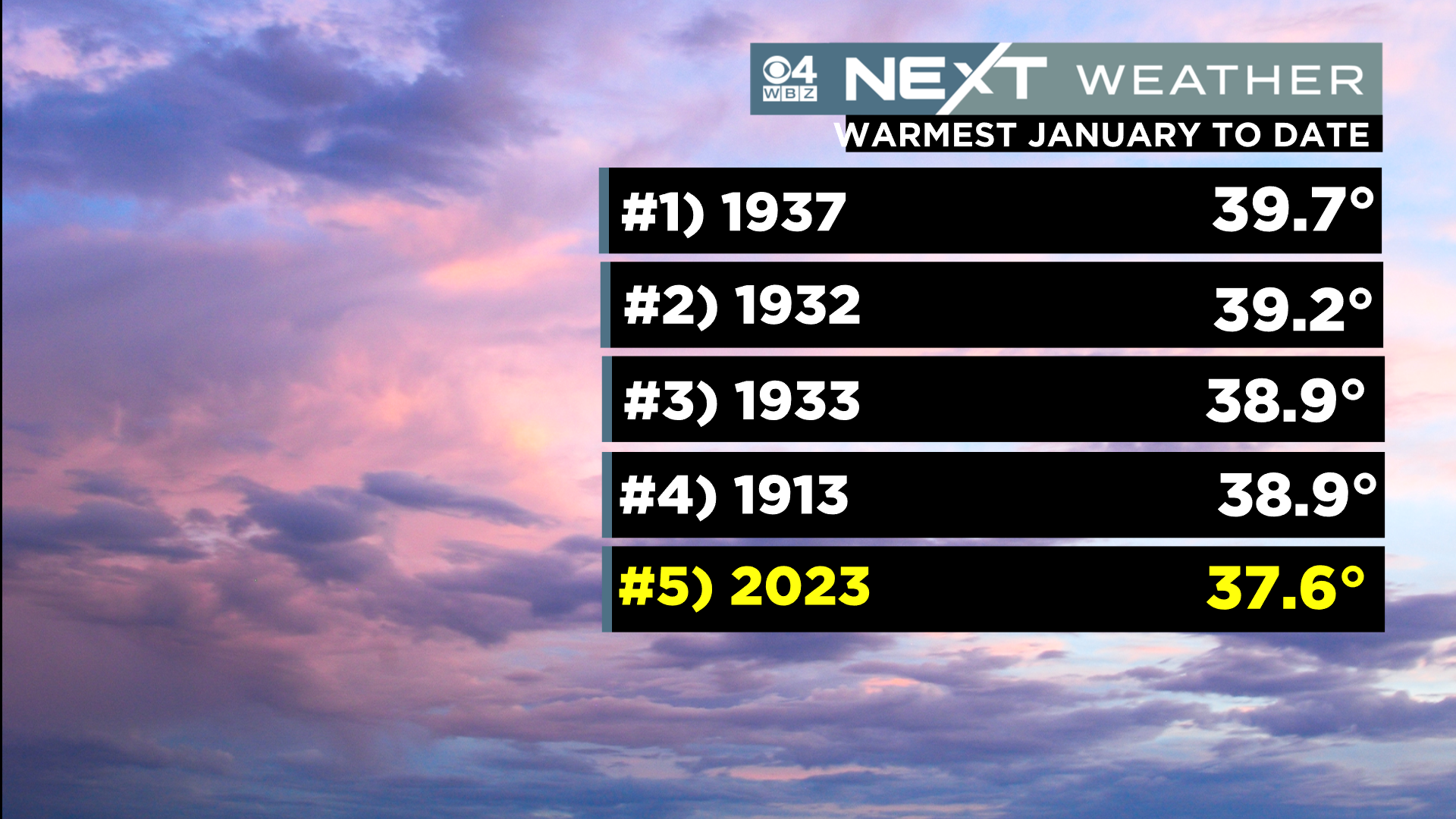
It seems as though we have only gotten a few glimpses of the sun, however temperatures have averaged more than 7 degrees above average per day (the 5th warmest January on record in Boston).
While our daytime highs have been fairly mild, including 5 days 50 degrees or higher, it has been the nighttime temperatures that have really tipped the scales. It simply has not been that cold…at all!
The average nighttime low temperature this month so far has been 32.3 degrees. This, in what should be our coldest month of the year and, when typically our nights dip into the teens and 20s (if not lower).
Another way to look at it…Boston’s average low temperature right now is 22 degrees…amazingly, the City has yet to actually get that low this month! The “coldest” temperature so far this month was 23 degrees on January 11.
Despite all of that, Boston has managed to squeeze out 6.6″ of snow this month and there is more where that come from!
The WBZ Weather Team will be issuing a NEXT Weather Alert, starting at 5pm Tuesday.
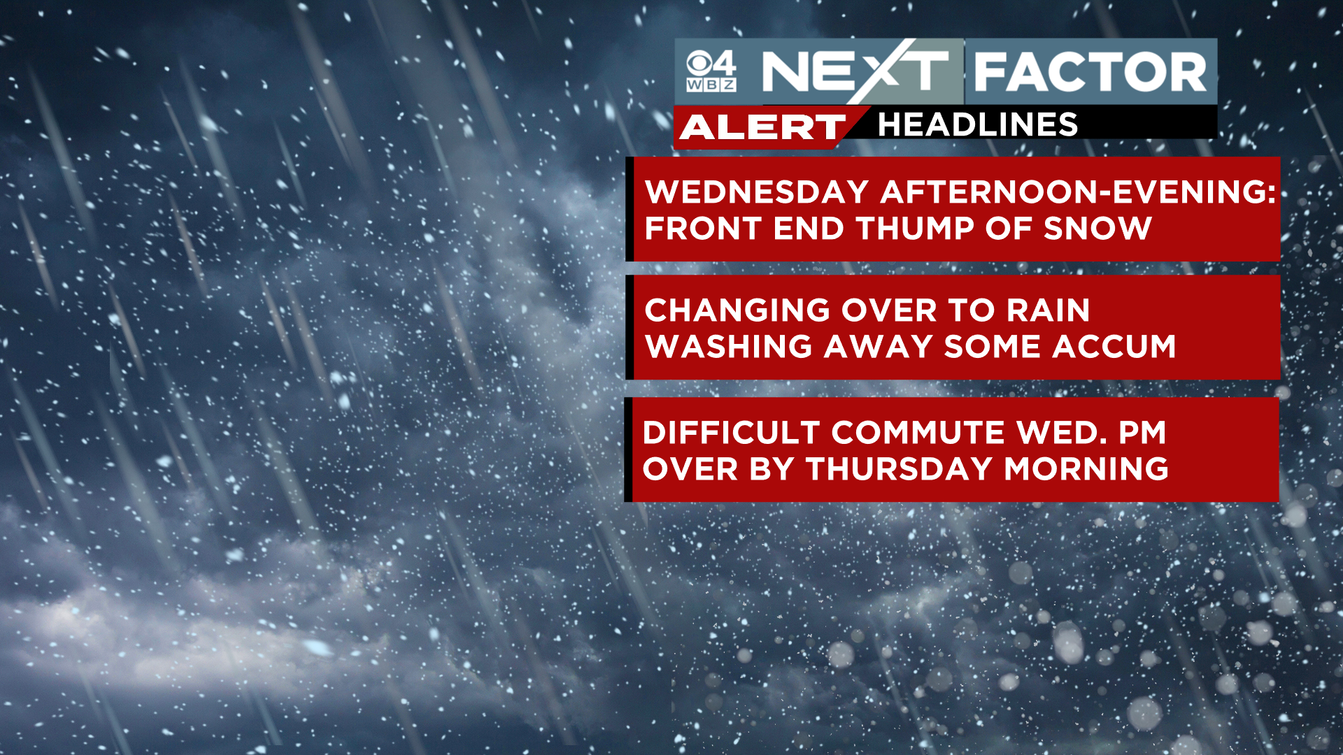
This alert is for a period of snow, followed by a change to rain Wednesday PM.
TIMELINE:
The snow begins Wednesday afternoon. It will be mainly light to start and then gradually fill in by late afternoon and early evening.
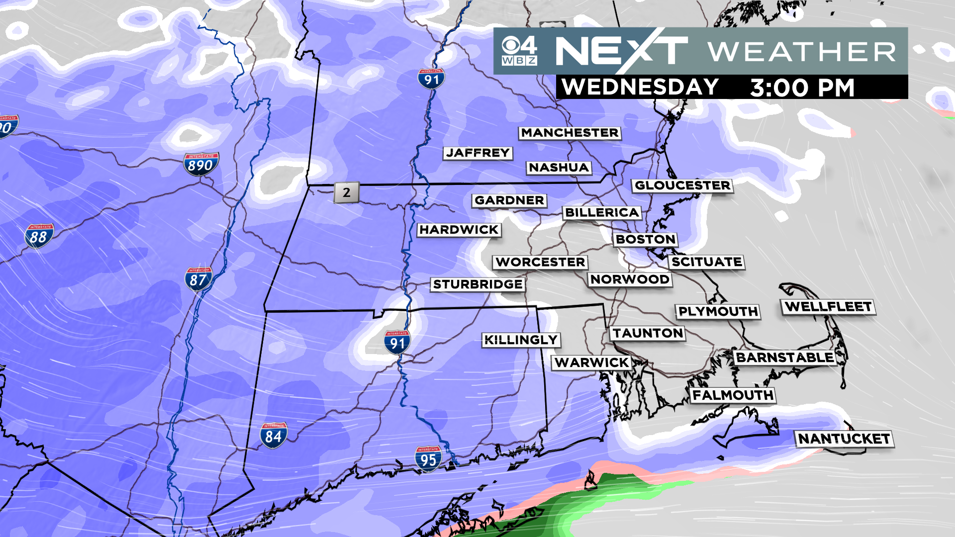
The heaviest snow and most of the accumulation will occur between about 4pm and 10pm.
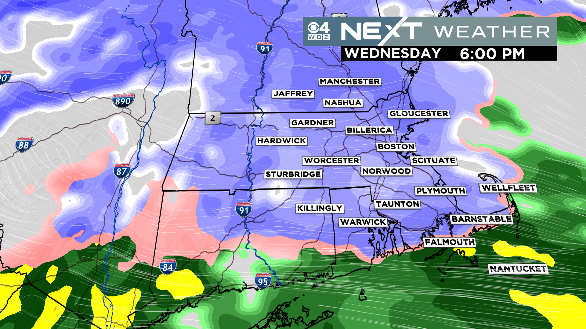
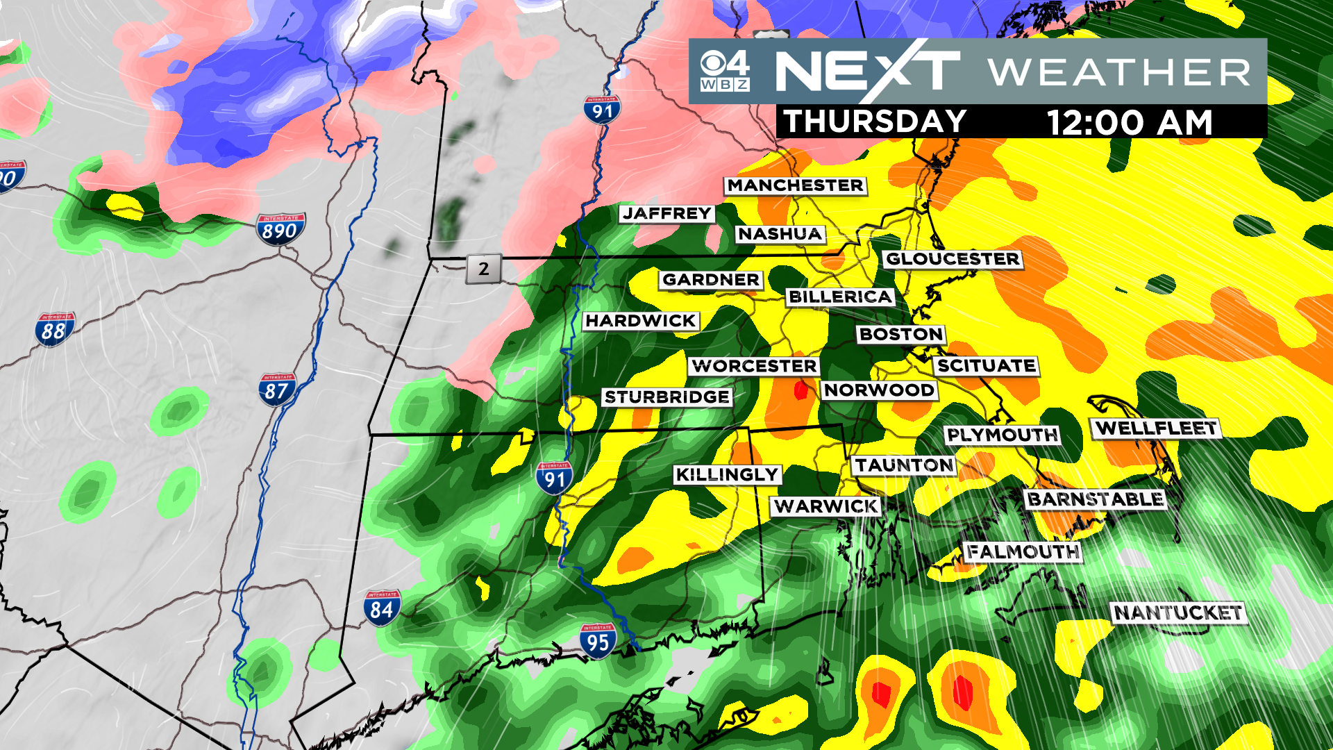
We will be tracking a rain/snow changeover line Wednesday night…it will begin to rapidly push northward after 6pm, reaching Boston around 8-9pm and the MA/NH border by midnight. After this occurs, it will be just plain rain the rest of the night. The rain will taper off before dawn on Thursday.
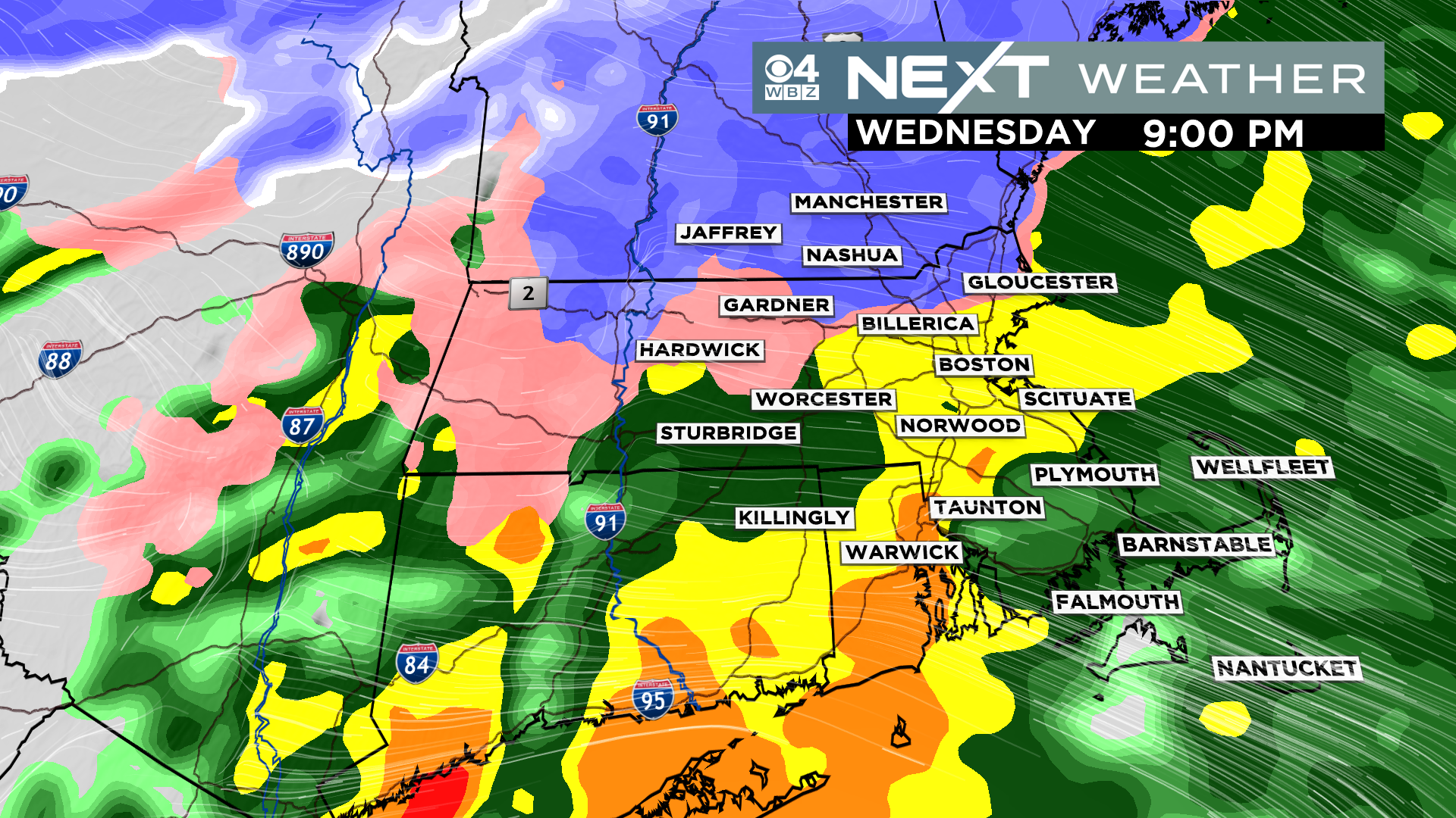
Just as the snow starts to pile up, the change to rain will occur…this will compress the snow quite a bit. It will completely wash the fresh snow away in some areas and create a mushy mess in others.
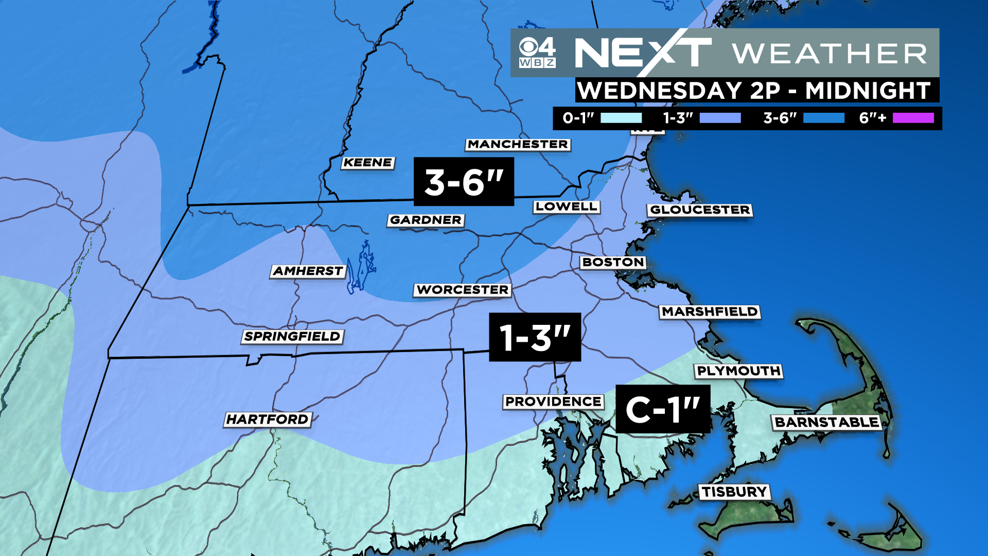
We are expect a Coating to 1″ of snow near the South Coast and down towards Plymouth and the Canal. This will be long gone by morning, washed away.
1-3″ is our forecast from Plymouth up the Coast through Boston and much of the North Shore. Again, most of this will also be washed away by rain.
The highest totals from this storm, 3-6″ will be found north and west of 495, in parts of northern Middlesex county, Worcester county and southern New Hampshire. These areas will also get rain late Wednesday night and will wake up to a slushy mess Thursday.
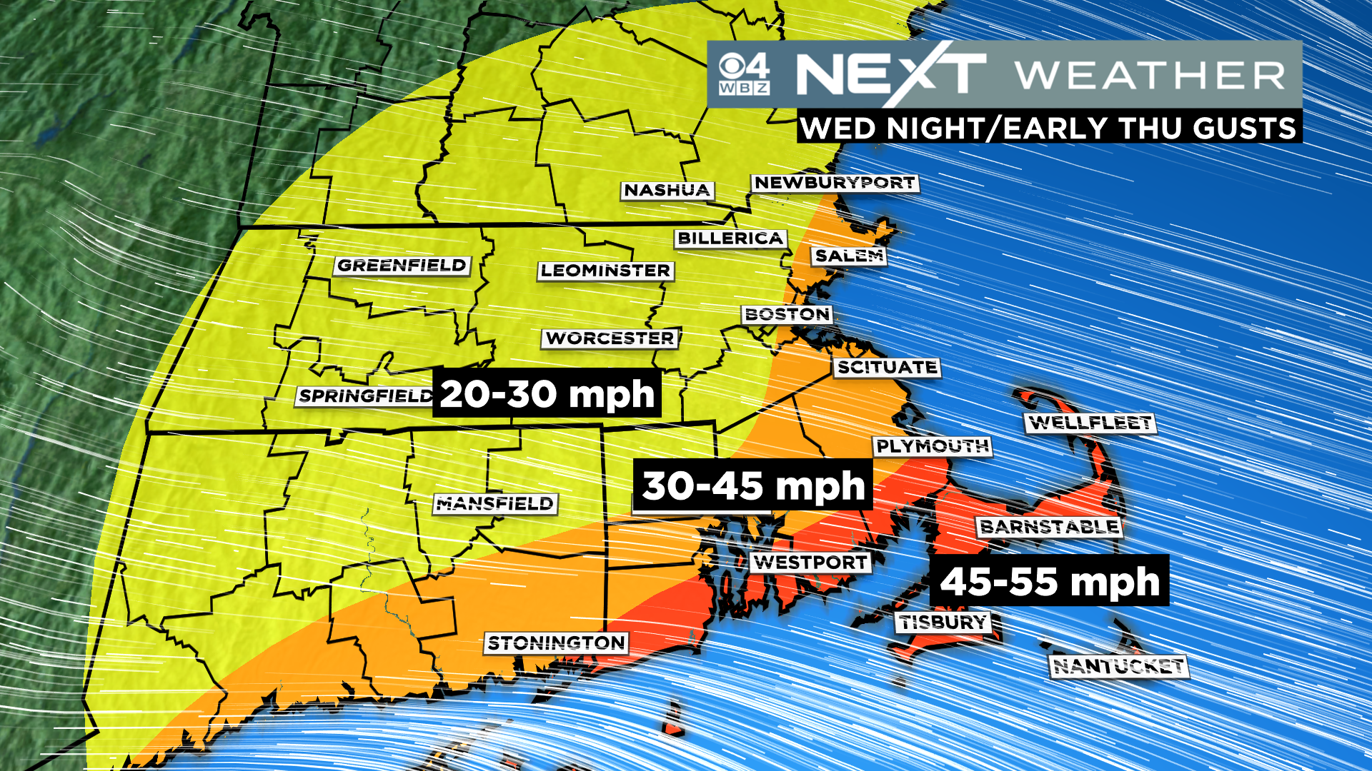
One more factor with this storm, the winds…Late Wednesday night there will be some very gusty south-southeast winds over portions of southeastern MA, including the Cape and Islands. Gusts could briefly top 50mph in this area, potentially leading to some scattered wind damage.
After the storm passes, Thursday will actually turn into a decent day. We will see highs near 50 degrees with a good deal of sunshine. Friday will be a quiet by colder day. The Weekend also looks decent and dry.
BUT…you knew that was coming…it looks like we will pick up next week where we left off as the active pattern is likely to continue for a while. There is a chance of rain or snow both Monday and sometime mid-week. At this point neither of those storms look major, but we will keep en eye on things as they develop.
Click here for Westford snow storm data and past totals or select “Winter Snowfall“ under “Pages” on the left hand side.
For more up to date forecast information follow me on Twitter (@terrywbz) or follow the WBZ weather team on Facebook, search WBZWeather
Reader Comments