


The WBZ Weather Team has issued a NEXT Weather Alert, starting at 5pm Tuesday.
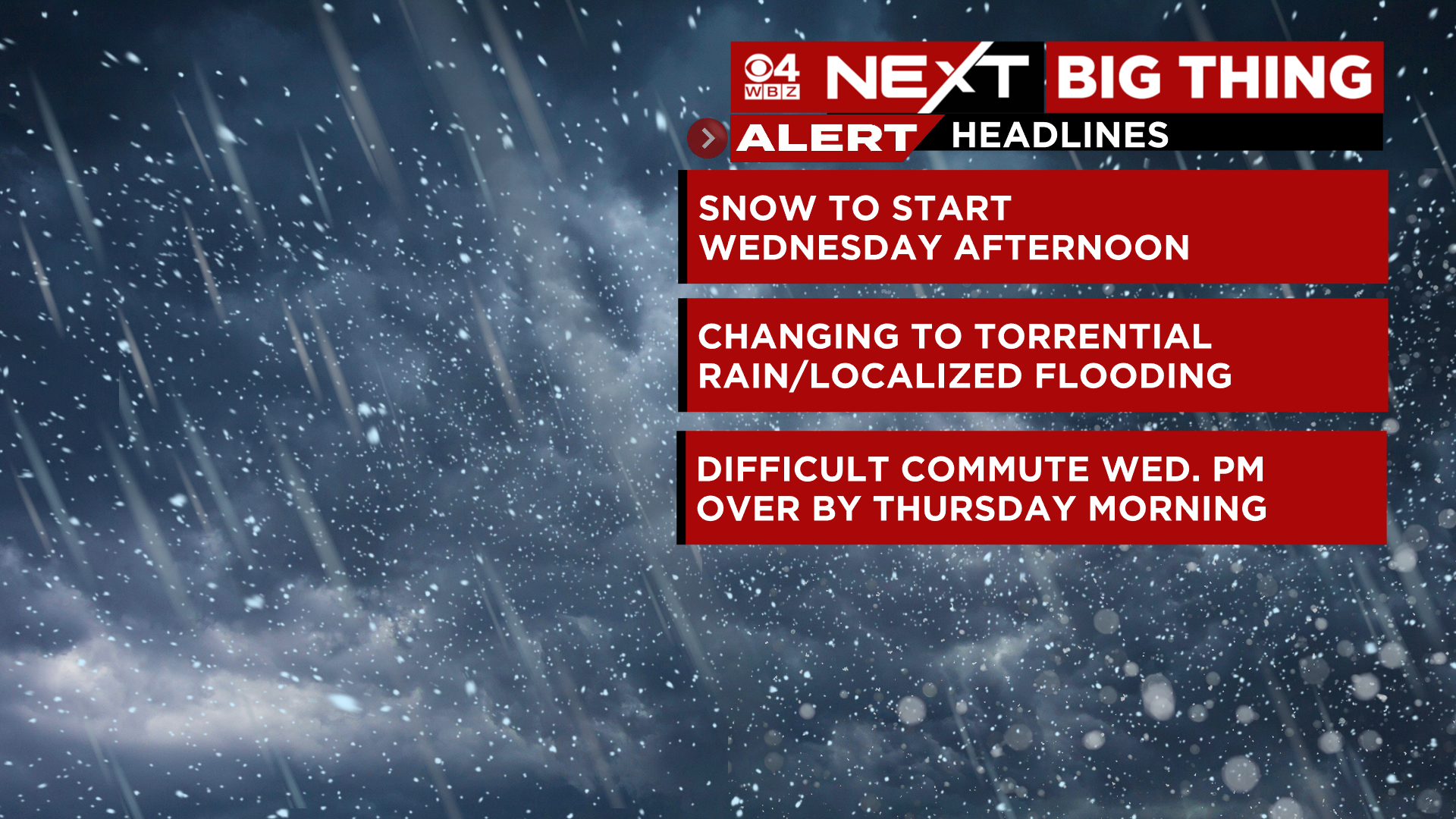
This alert is for a period of snow, followed by a change to rain Wednesday PM along with some strong wind and potential flooding.
TIMELINE:
The snow begins Wednesday afternoon. It will be mainly light to start and then gradually fill in by late afternoon and early evening.
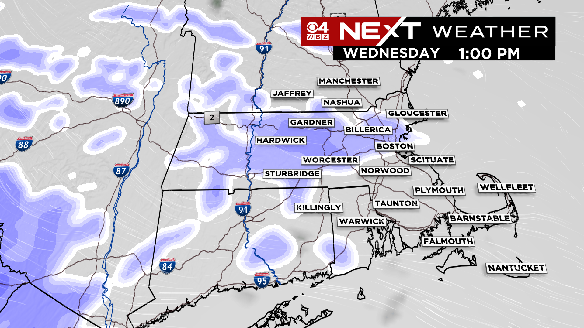
The heaviest snow and most of the accumulation will occur between about 4pm and 10pm.
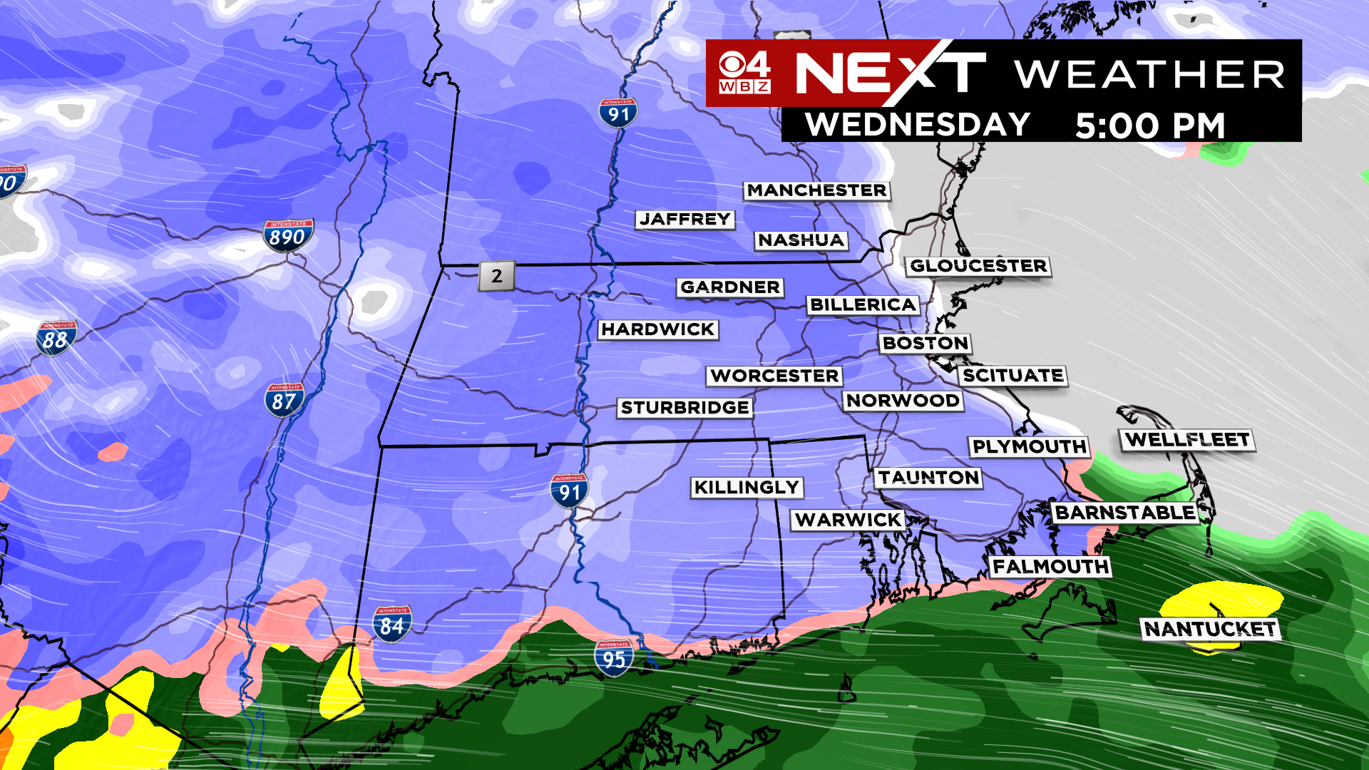
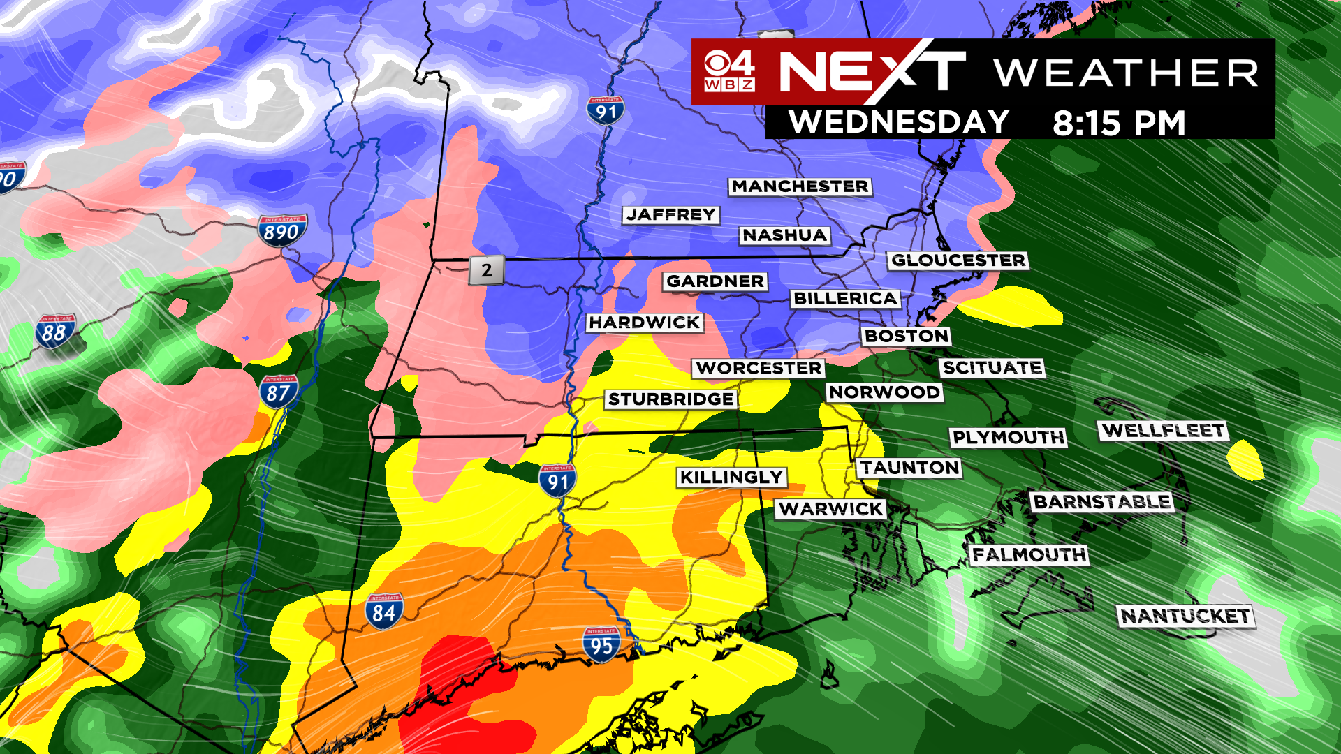
We will be tracking a rain/snow changeover line Wednesday night…it will begin to rapidly push northward after 6pm, reaching Boston around 8-9pm and the MA/NH border by midnight. After this occurs, it will be just plain rain the rest of the night. The rain will taper off before dawn on Thursday.
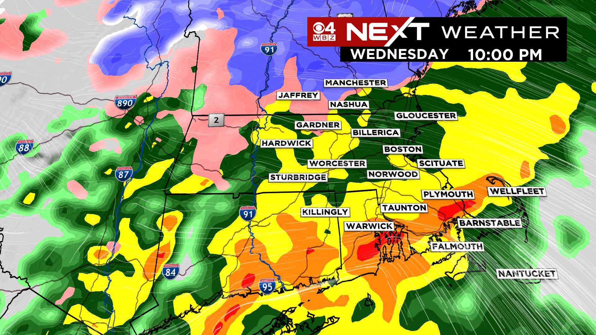
Just as the snow starts to pile up, the change to rain will occur…this will compress the snow quite a bit. It will completely wash the fresh snow away in some areas and create a mushy mess in others.
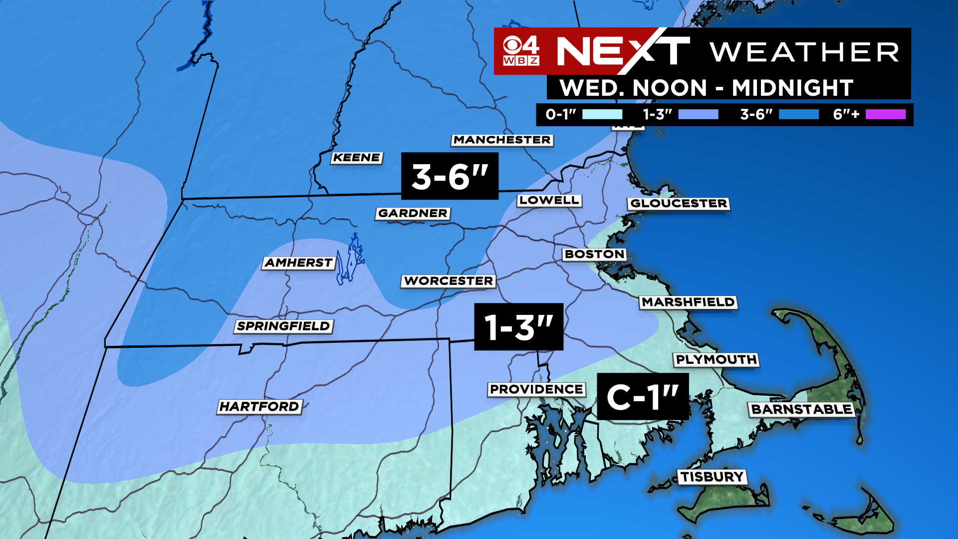
We are expect a Coating to 1″ of snow near the South Coast and down towards Plymouth and the Canal as well as up the immediate Coastline. This will be long gone by morning, washed away.
1-3″ is our forecast for areas just inland from the Coastline, most of Norfolk county, eastern Middlesex county and Essex county. Again, most of this will also be washed away by rain.
The highest totals from this storm, 3-6″ will be found north and west of 495, in parts of northern Middlesex county, Worcester county and southern New Hampshire. These areas will also get rain late Wednesday night and will wake up to a slushy mess Thursday.
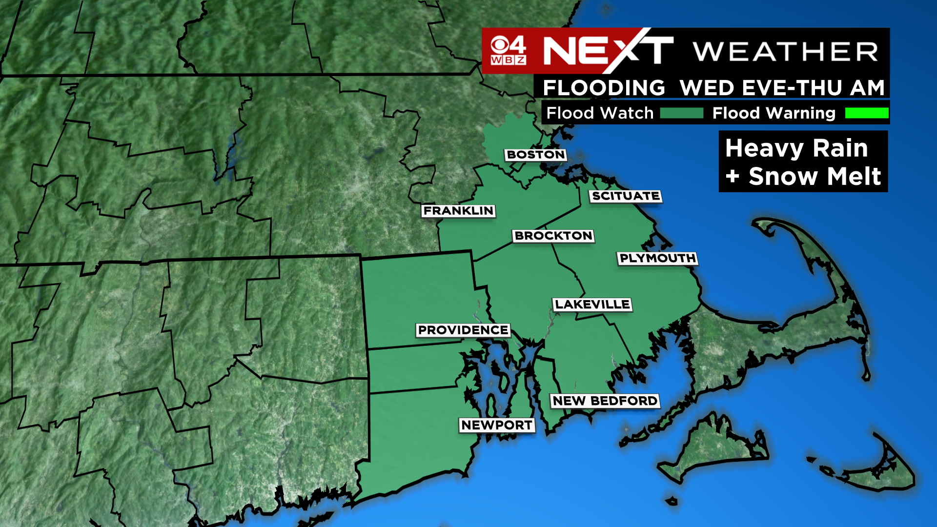
The rain will be heavy for several hours just before and after midnight. Combined with the melting snow, it could cause some localized flooding in parts of the area early on Thursday.
One more factor with this storm, the winds…Late Wednesday night there will be some very gusty south-southeast winds over portions of southeastern MA, including the Cape and Islands. Gusts could briefly reach near 50mph in this area, potentially leading to some scattered wind damage.

After the storm passes, Thursday will actually turn into a decent day. We will see highs near 50 degrees with a good deal of sunshine. Friday will be a quiet by colder day. The Weekend also looks decent and dry.
BUT…you knew that was coming…it looks like we will pick up next week where we left off as the active pattern is likely to continue for a while. There is a chance of rain or snow both Monday and sometime mid-week. At this point neither of those storms look major, but we will keep en eye on things as they develop.
Click here for Westford snow storm data and past totals or select “Winter Snowfall“ under “Pages” on the left hand side.
For more up to date forecast information follow me on Twitter (@terrywbz) or follow the WBZ weather team on Facebook, search WBZWeather
Reader Comments