


Happy Monday!
Pretty typical early December day today with highs in the upper 40s. Keep in mind that our average daily high this time of year is right around 45 degrees (and dropping), so, anything at or around 50 is doing pretty good!
The main story for this week is yet ANOTHER rain event on Tuesday and Wednesday…it seems we are in an every 3-4 day pattern of rain. This one doesn’t look quite as potent as some of the others as it likely won’t come with as much wind.
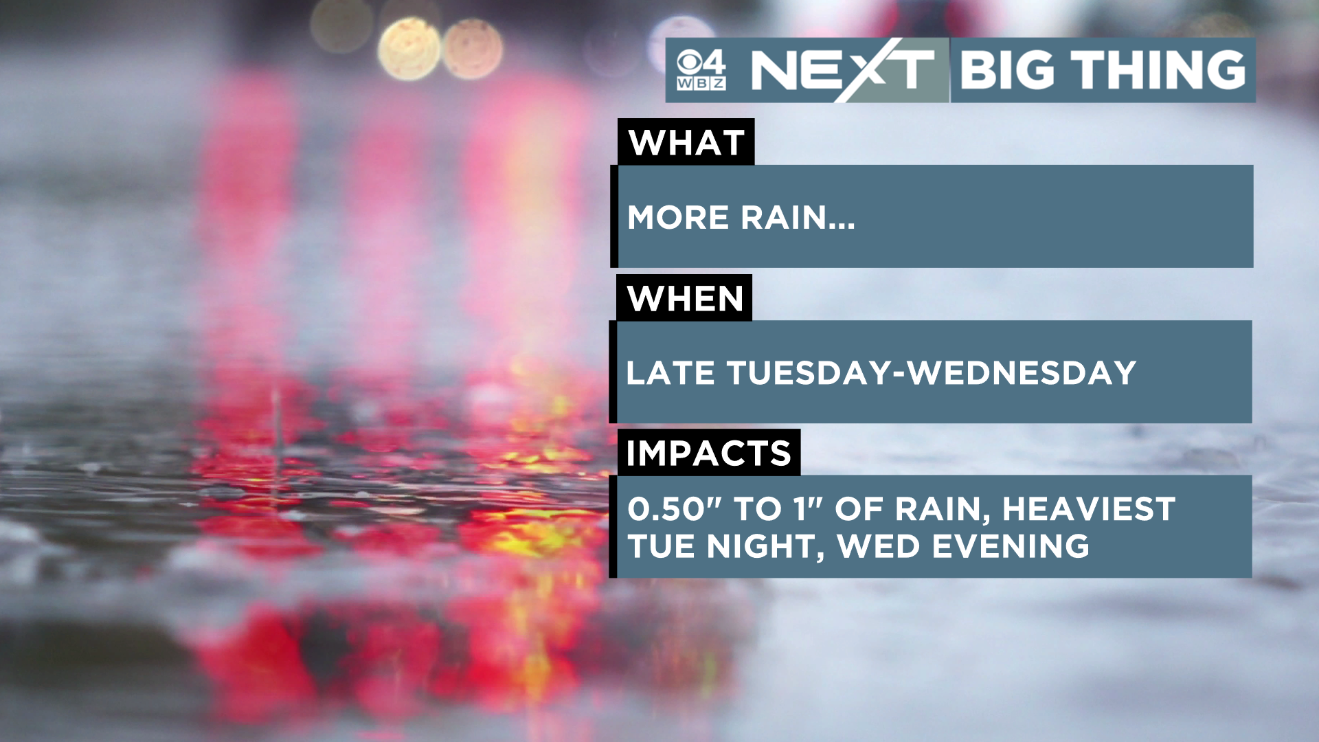
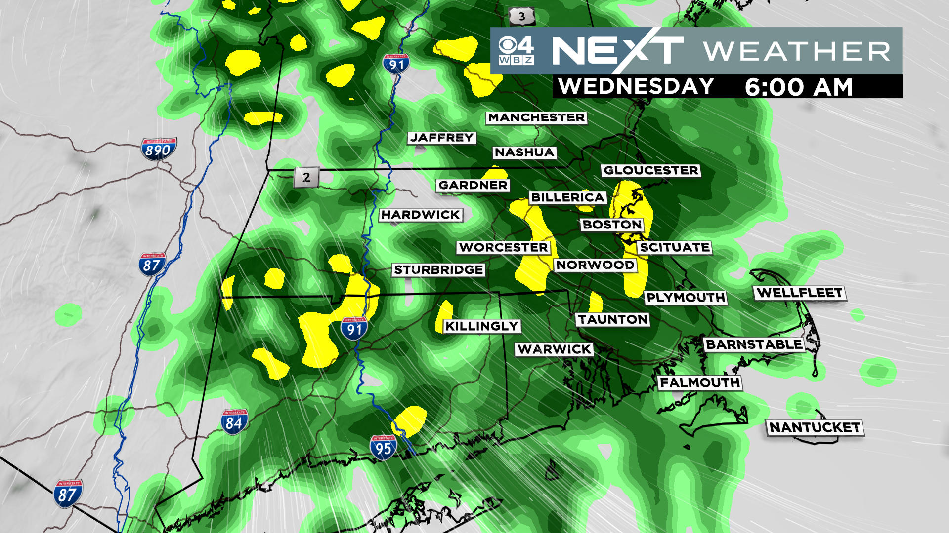
The rain will start off spotty later on Tuesday and then we are likely to get a few rounds of steadier and heavier rain…the first very early on Wednesday…
And the second, later in the afternoon on Wednesday
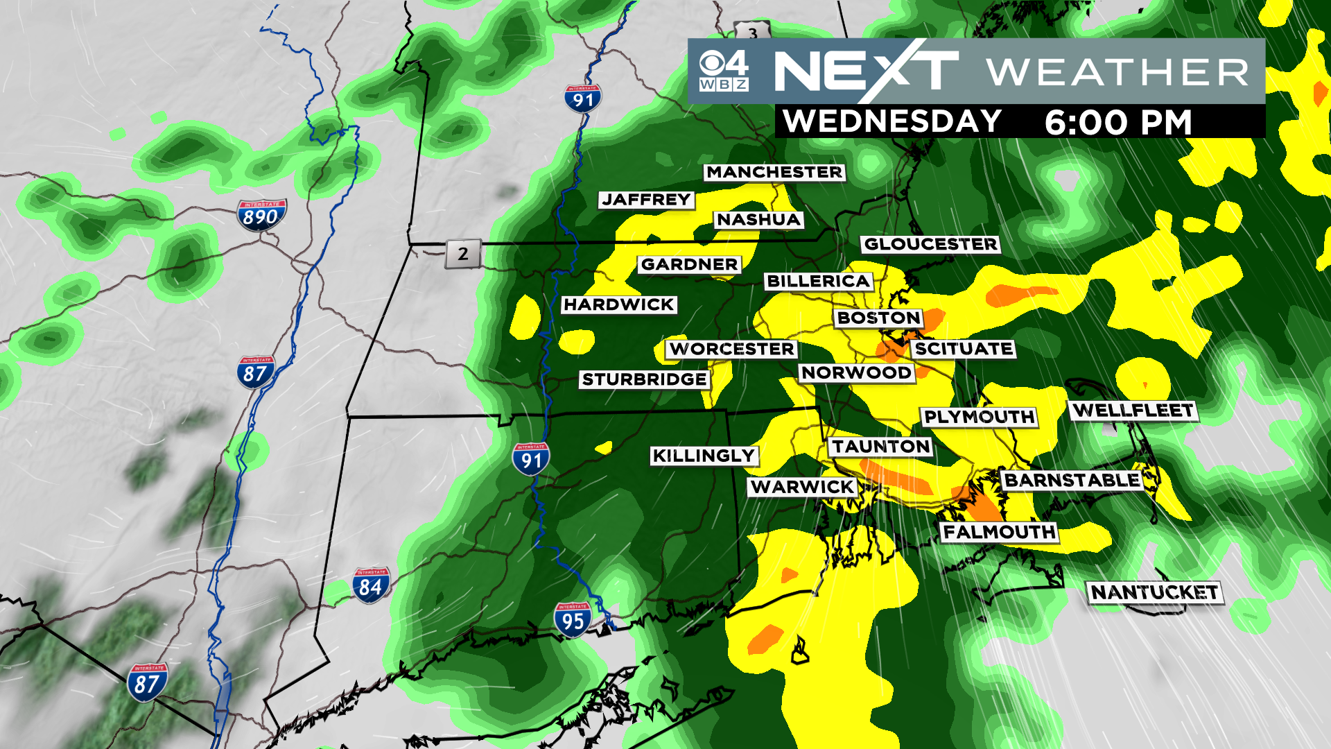
Rain should be coming down pretty steady during both commutes on Wednesday…plan for extra time or perhaps a work from home day.

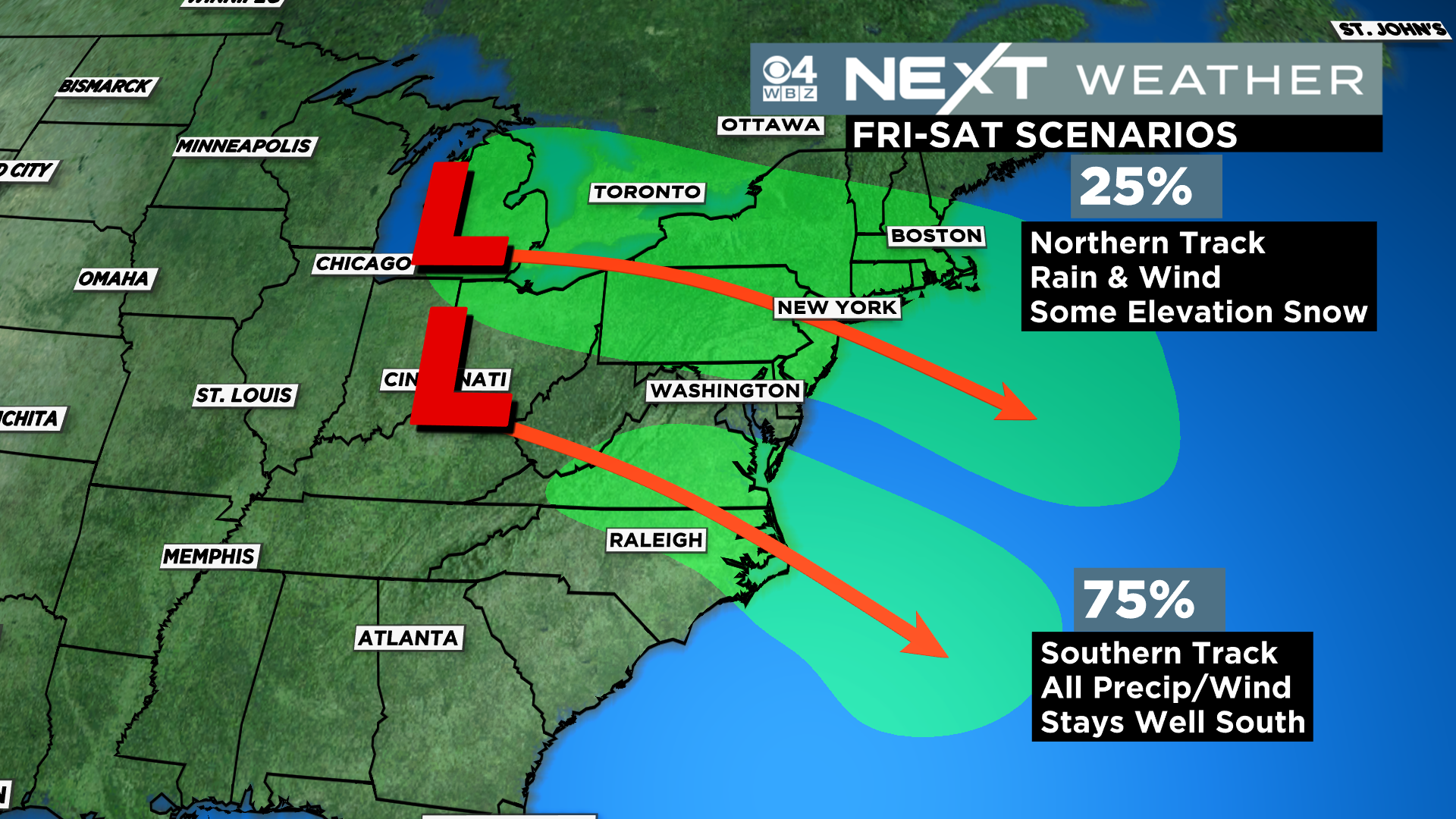
There will be a second storm this week coming out of the Upper Midwest…right now odds favor a more southerly track, which would leave New England cool and dry Friday into the Weekend. However, we cannot yet rule out a track closer to New England and some rain or wet snow (mainly in elevation) later this week.
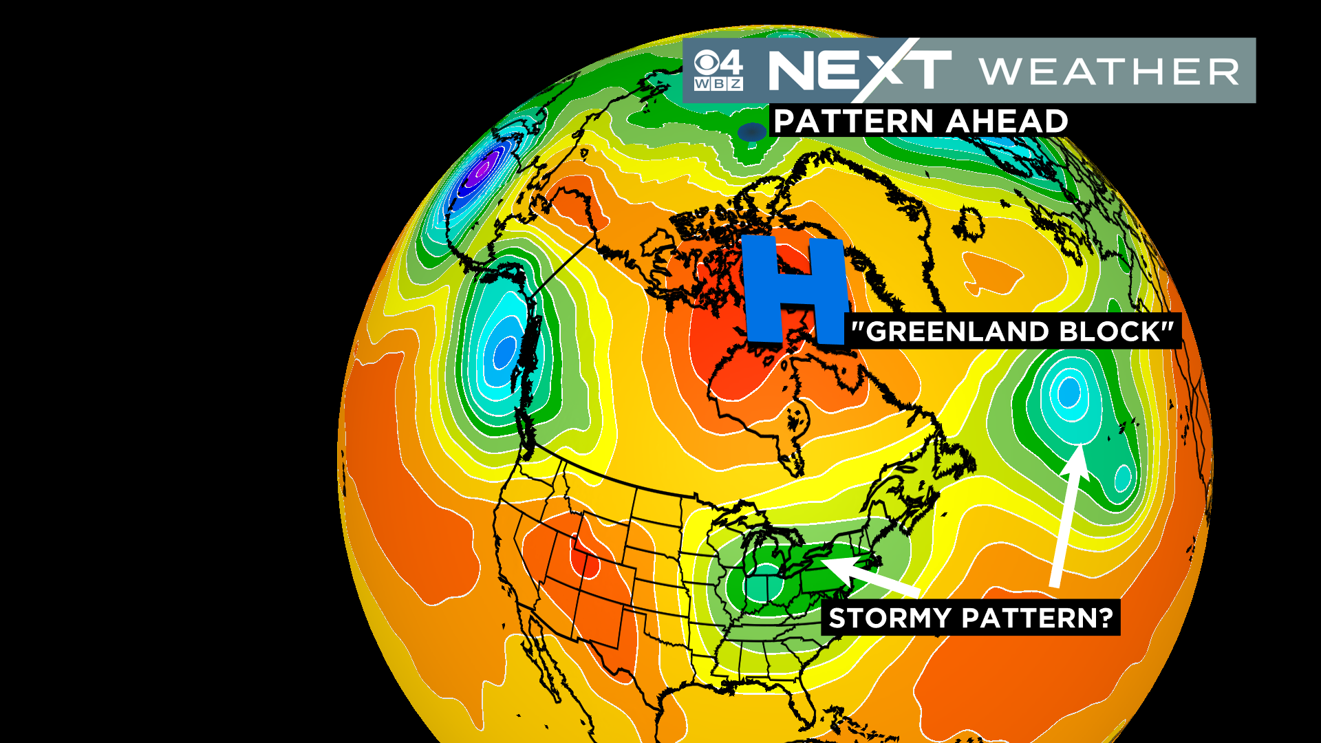
The pattern gets a lot more complex later this week and beyond. We are about to enter a period with a higher risk of weather craziness along the East Coast. Tough to say how it will all pan out right now, but I would circle the next 2-3 weeks as a time frame to watch for winter storminess given all the atmospheric changes ahead.
Click here for Westford snow storm data and past totals or select “Winter Snowfall“ under “Pages” on the left hand side.
For more up to date forecast information follow me on Twitter (@terrywbz) or follow the WBZ weather team on Facebook, search WBZWeather
Reader Comments