


The weather for the next 7 days reminds me a bit of early spring in New England. Lots of clouds…coolish and damp. In a word…blah.
We will likely see some measurable rainfall in eastern MA in 4 of the next 6 days with just a brief break of sunshine squeezed in the middle. As for snow…still nada. There may be some scattered flurries in the area on Sunday, but we have to wait until at least the middle of next week for any real shot at significant wintry precipitation.
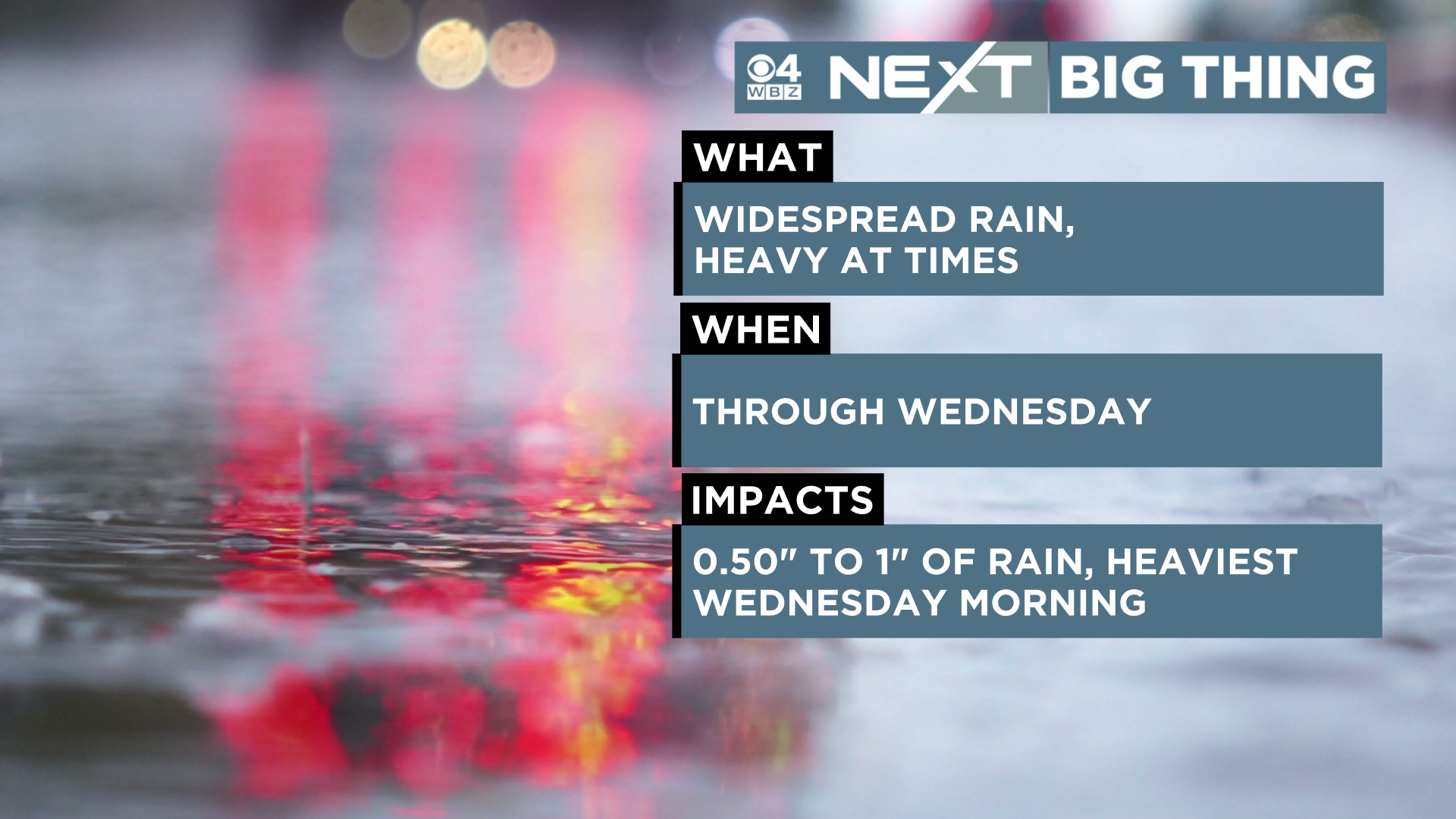
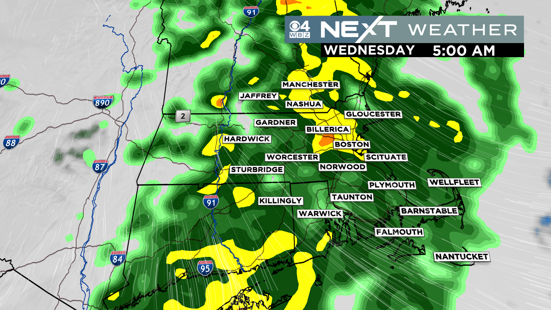
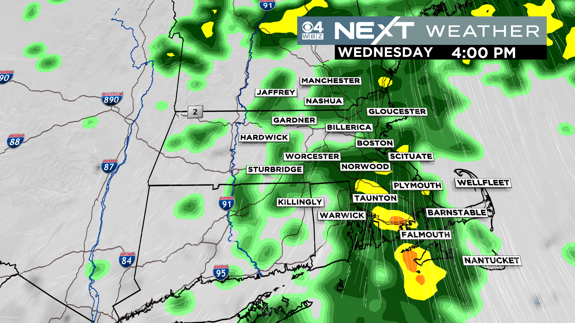
The heaviest rain in the next several days will come later tonight and during the day Wednesday. Some scattered showers arrive Tuesday evening and overnight but it looks like the steadiest and heaviest rain will come in two waves…
The first early Wednesday morning:
And then again Wednesday later afternoon and evening:
Unfortunately, it seems just about perfectly aligned with the two commutes on Wednesday.
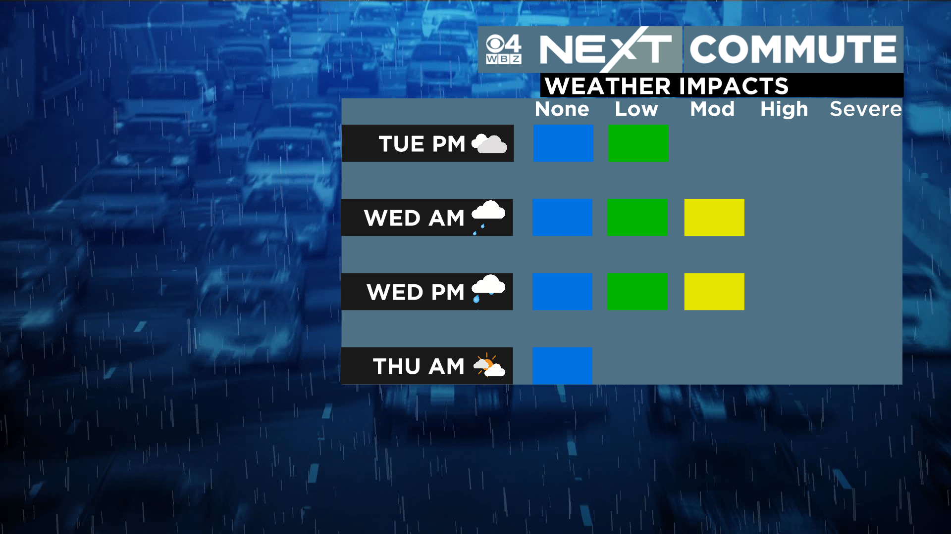
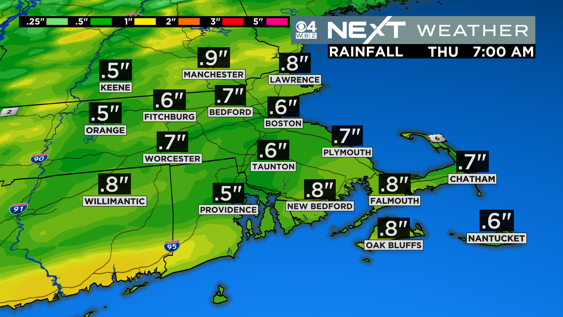
All in all, most of the area should receive between .5″ and 1″ of rainfall.
We get a little bit of sunshine and a break from the rain on Thursday and most of Friday before our next storm arrives.
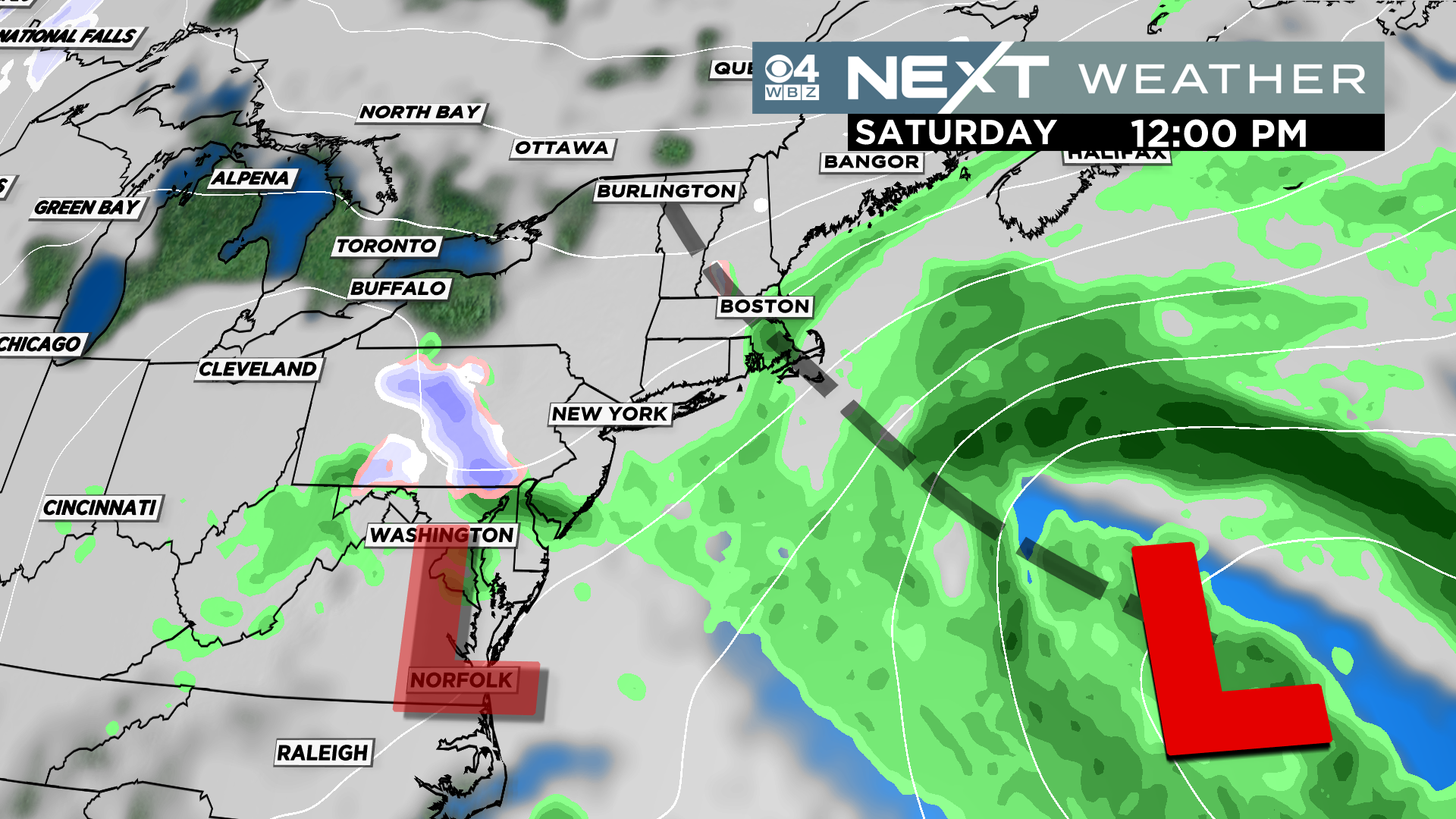
This storm will be a slow mover, essentially spinning around well off our coast for the entire weekend. It won’t be close enough for any major rain or wind, but we do expect to be socked in the clouds for most of the Weekend with periods of drizzle and flurries.
Best chance of wet weather this weekend will be along the Coastline.
There is a chance of some light snow or flurries in the area on Sunday. Not expecting any accumulation at this point.
Click here for Westford snow storm data and past totals or select “Winter Snowfall“ under “Pages” on the left hand side.
For more up to date forecast information follow me on Twitter (@terrywbz) or follow the WBZ weather team on Facebook, search WBZWeather
Reader Comments