


The WBZ Weather Team is continuing the NEXT Weather Alert for at least the next couple of days for the excessive heat and humidity currently being felt across our area.
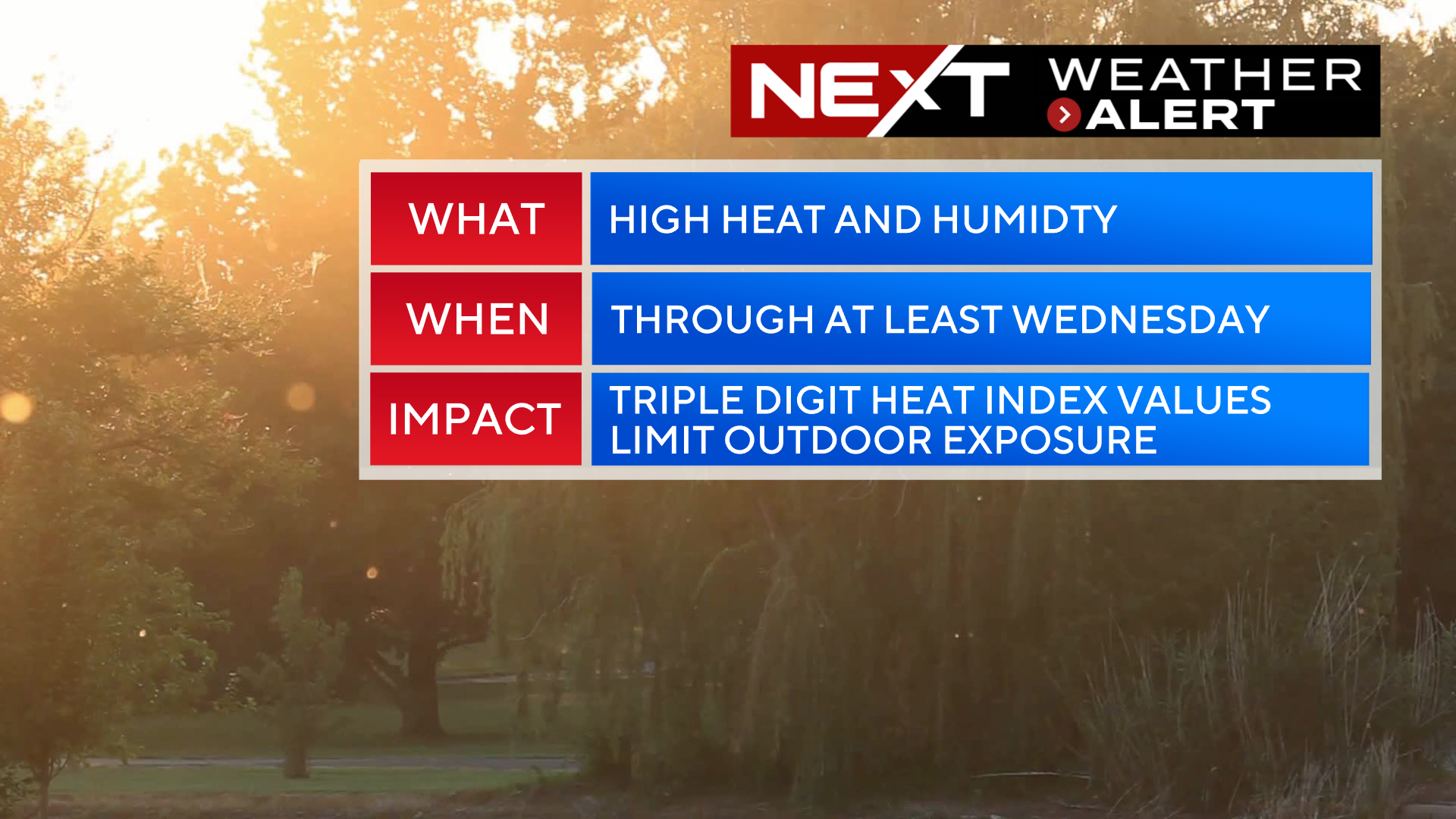
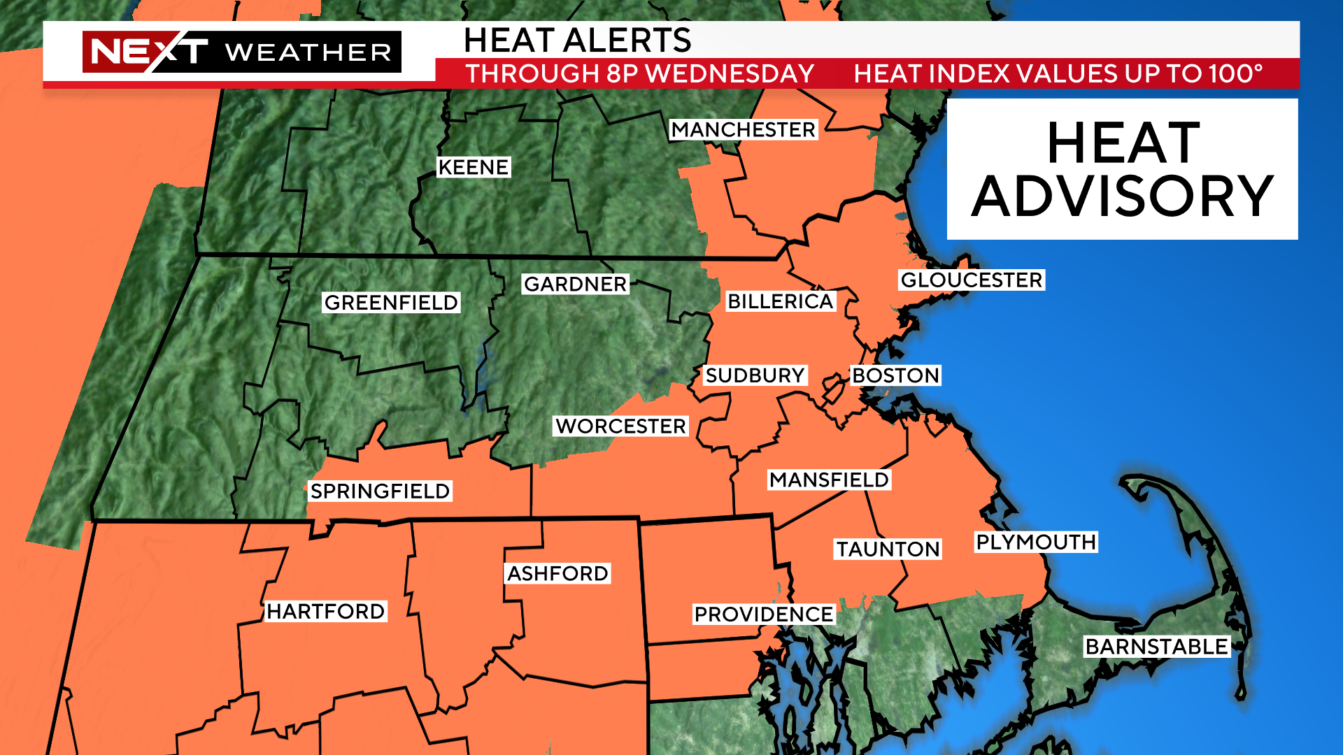
The National Weather Service has extended the Heat Advisory through Wednesday and also expanded the region in the alert all the way to the Coastline to include the North and South Shores and Boston.
Again, just because you are not in the shaded areas does NOT mean that you won’t experience some periods of high heat and humidity. The National Weather Service is simply highlighting the areas most at risk for heat indices between 95-100 degrees.
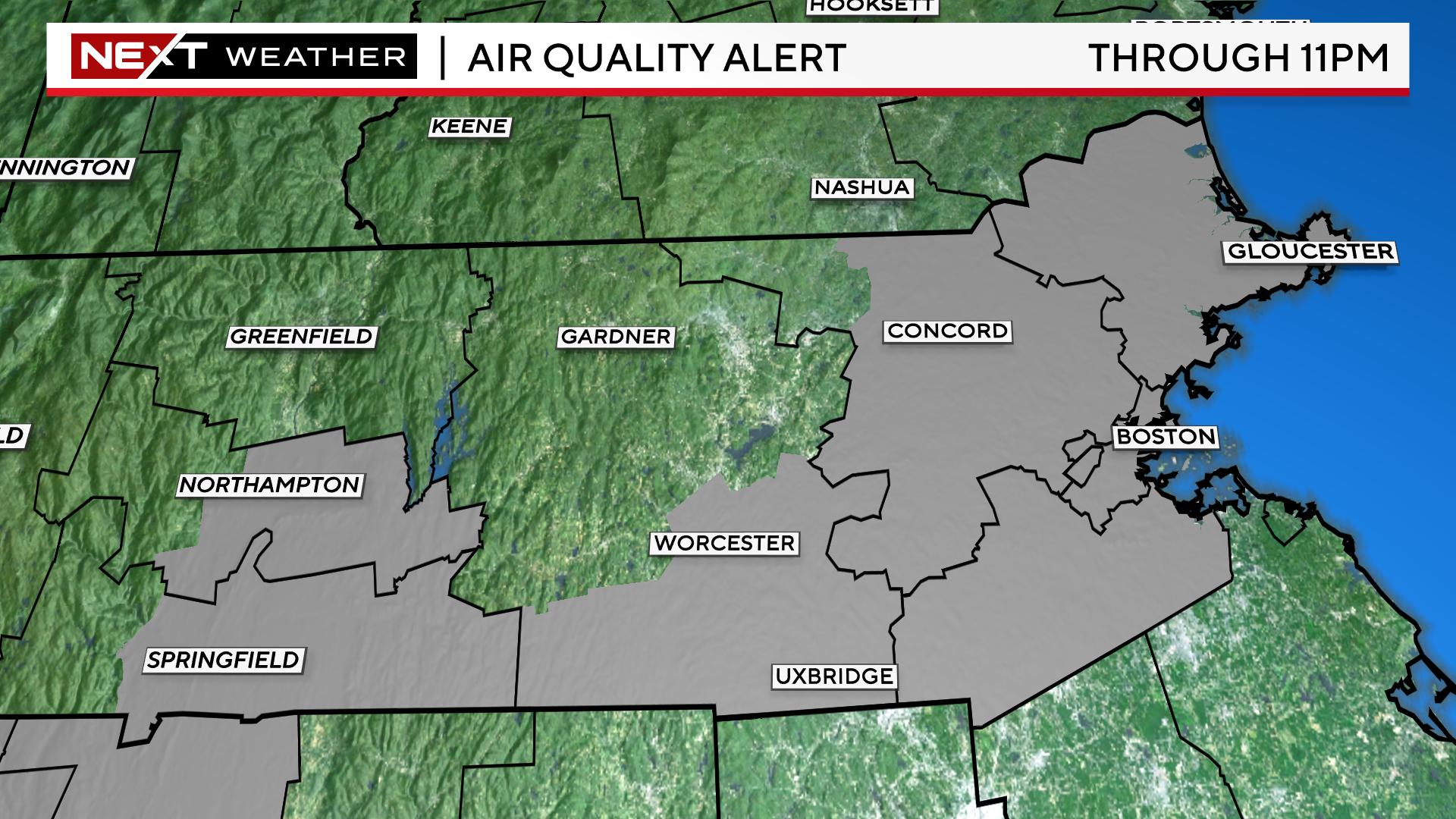
In addition to the Heat Advisory, parts of eastern MA are also under an Air Quality Alert through tonight. This is posted due to higher levels of ozone being detected at ground level and is mainly a concern for sensitive groups such as the elderly, children and those with respiratory issues.
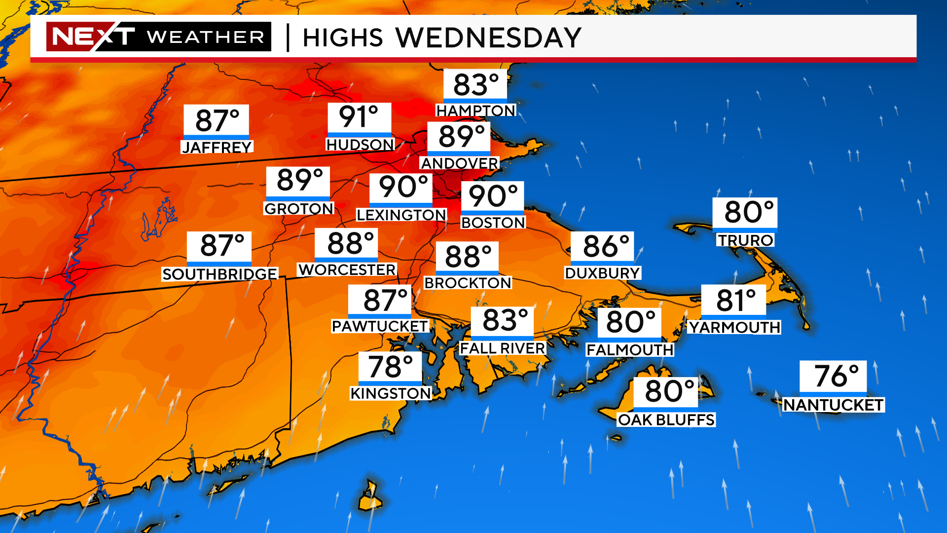
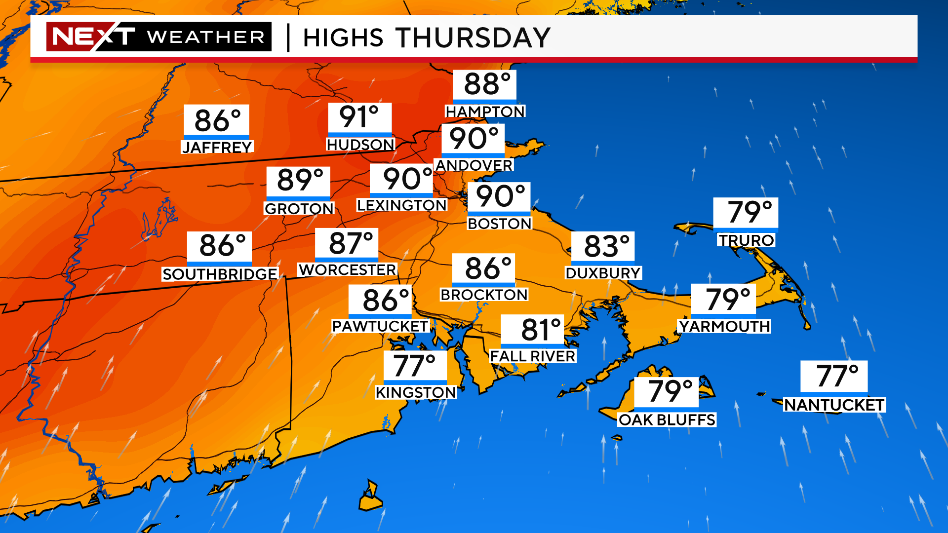
The main headlines today are for more heat and humidity through the remainder of the week and less chances for storms.
We will likely reach or exceed 90 degrees in parts of our area each and every day through Friday.
The temperatures will not reach record levels, staying mainly in the low 90s, but combined with a persistently and oppressively humid airmass, each day will have “feels-like” temperatures nearing 100, especially in and just to the northwest of Boston.
The main reason for extending the heat advisory and the hotter forecast later this week… it now appears the remnants of Beryl won’t have much impact on southern New England.
The center track of what is left of Beryl will move through the Upper Midwest and into Canada later this week, several hundred miles away from our area.
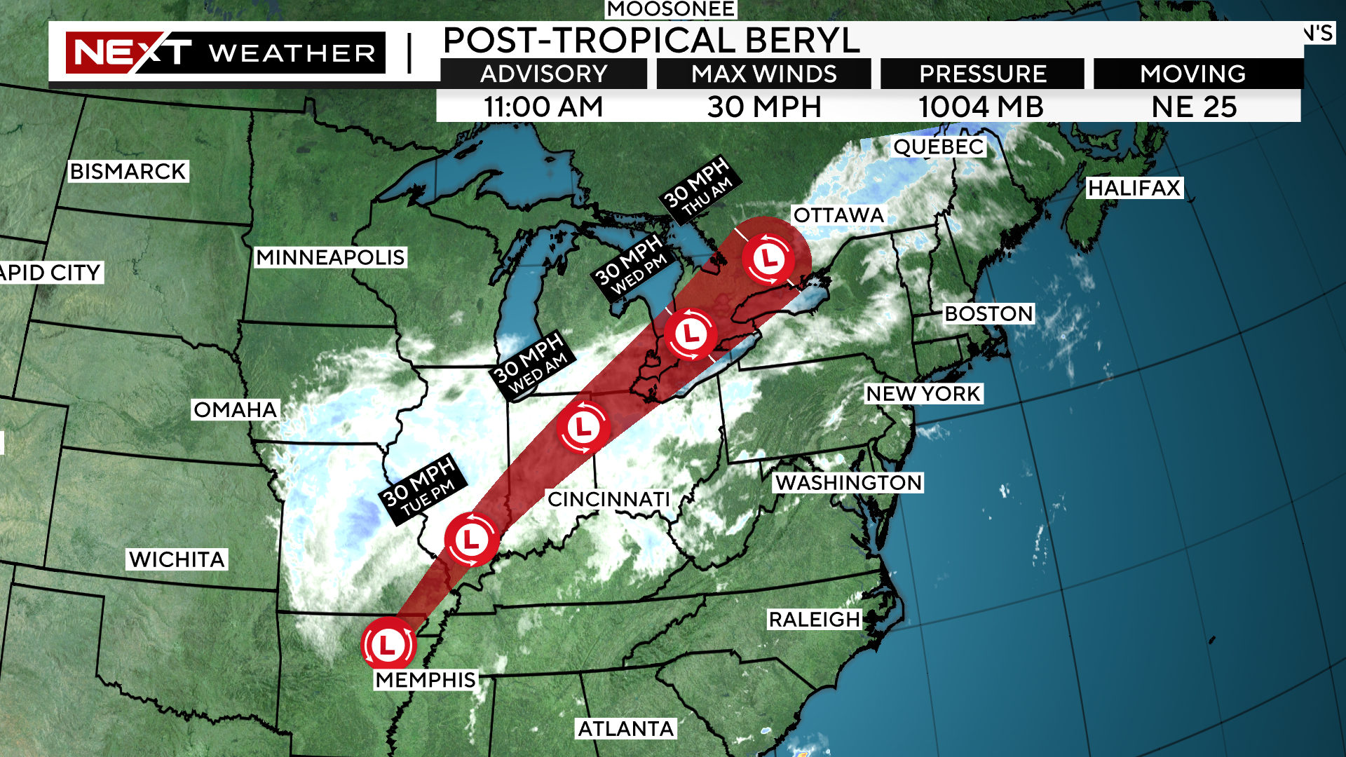
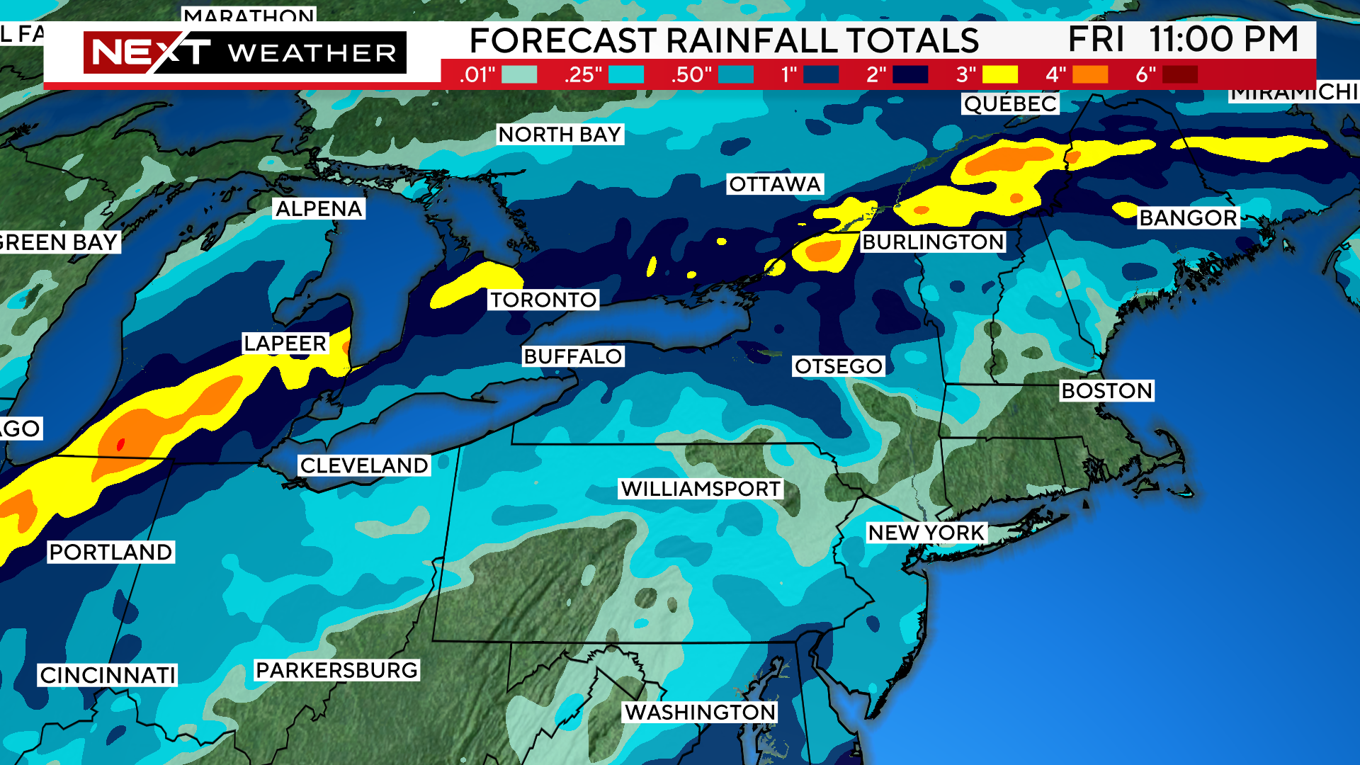
Therefore, the shield of rain will remain quite a far distance away, tracking through Upper New York State and northernmost New England.
In our area there will be a daily, isolated threat for a few showers or thunderstorms but nothing widespread of long-lasting.
We cannot completely rule out a thunderstorm each and every day through Saturday, but no day is expected to be a washout.
We will hone in on the timing of any showers or thunderstorms for Friday and the Weekend as we get closer.
Click here for Westford snow storm data and past totals or select “Winter Snowfall“ under “Pages” on the left hand side.
For more up to date forecast information follow me on Twitter (@terrywbz) or follow the WBZ weather team on Facebook, search WBZWeather
Reader Comments