


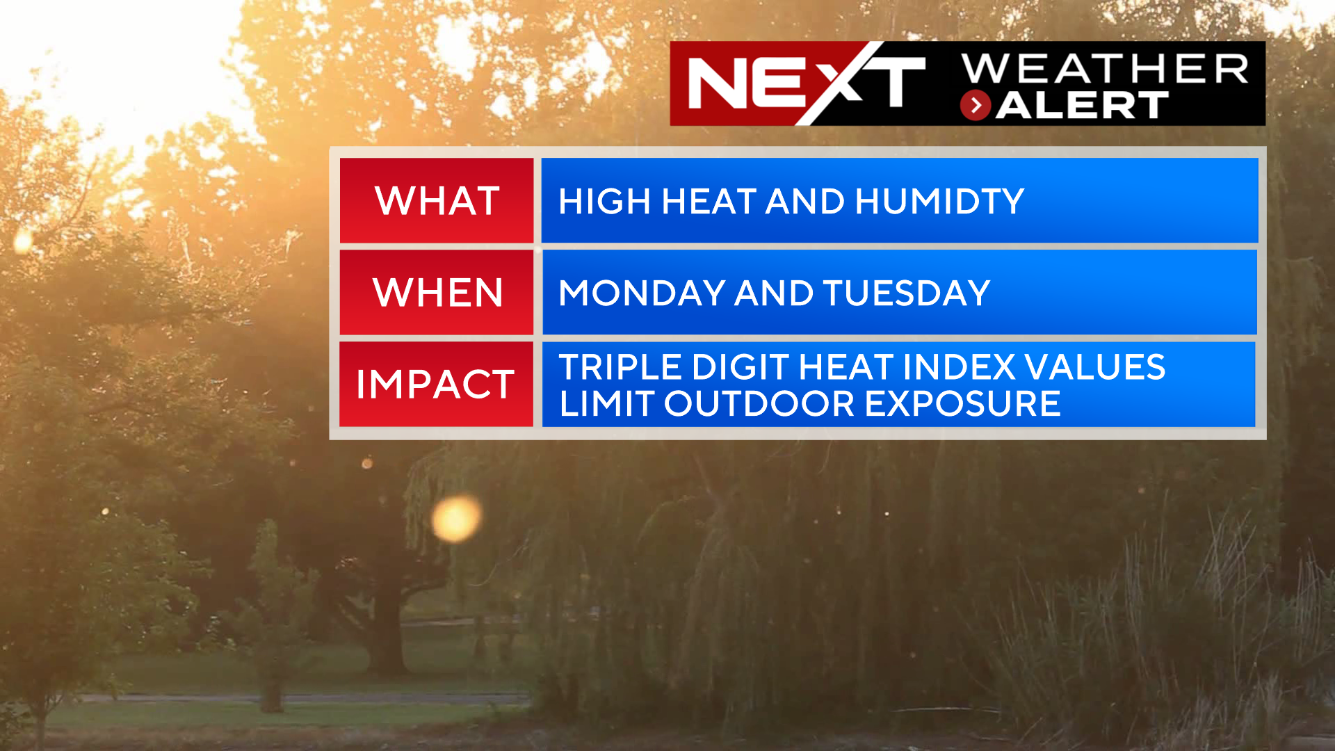
The WBZ Weather Team has issued a NEXT Weather Alert for excessive heat and humidity over the next few days.
It may be summer vacation season, but the weather isn’t taking any breaks. We have a very active week ahead starting with high heat and humidity and then transitioning to an unsettled and stormy pattern, partly due to the remnants of Tropical Storm Beryl.
First things first…
THE HEAT:
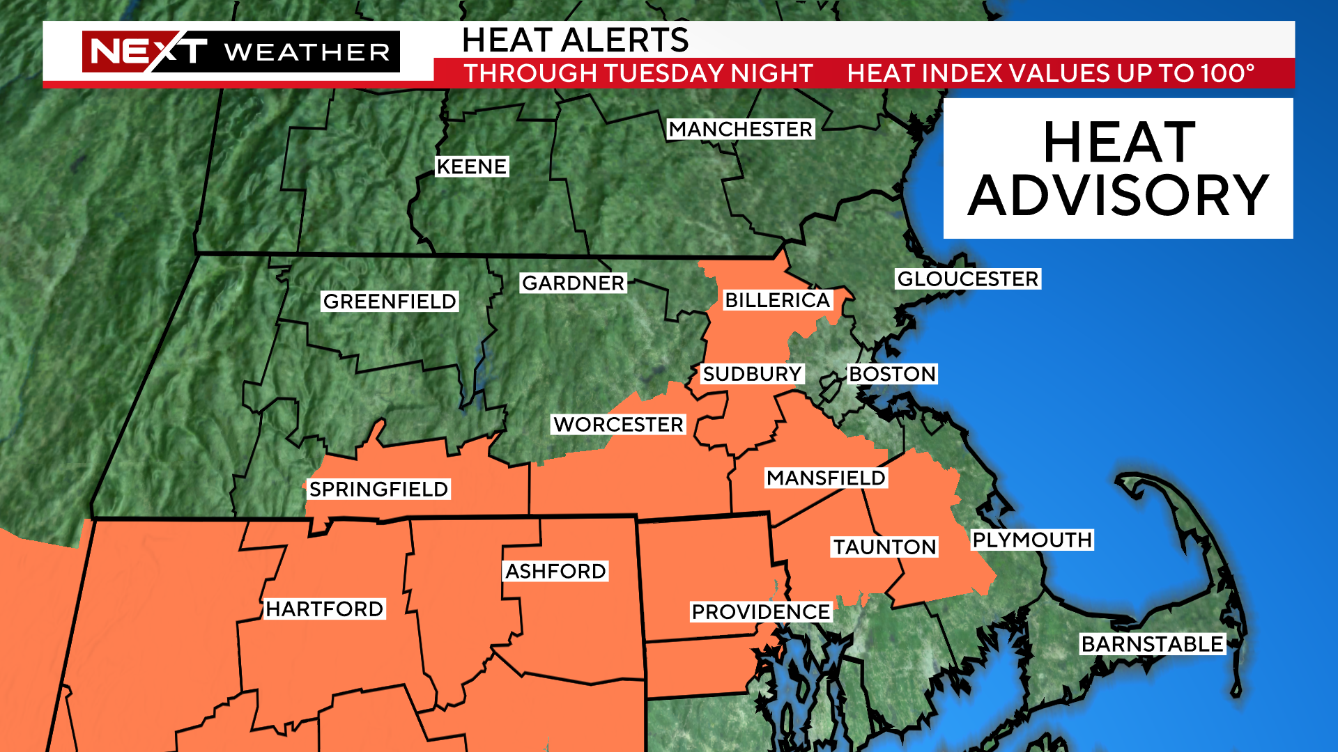
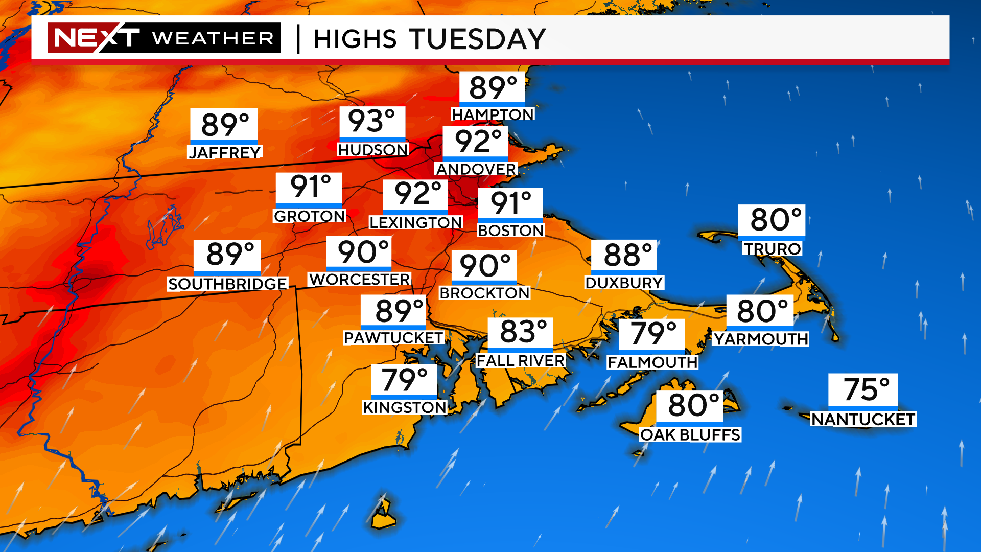
Temperatures will peak today and tomorrow with highs between 90-95 degrees away from the immediate Coastline. The National Weather Service has issued a Heat Advisory through 8pm Tuesday for parts of our area. Areas outside the orange shading could very well experience the same conditions, with feels-like temperatures between 95-100. The highlighting is simply to mark the areas most at risk.
Our last heat wave brought several days of temperatures in the upper 90s. This week will not be as hot (technically) with highs peaking in the low to mid 90s on Tuesday.
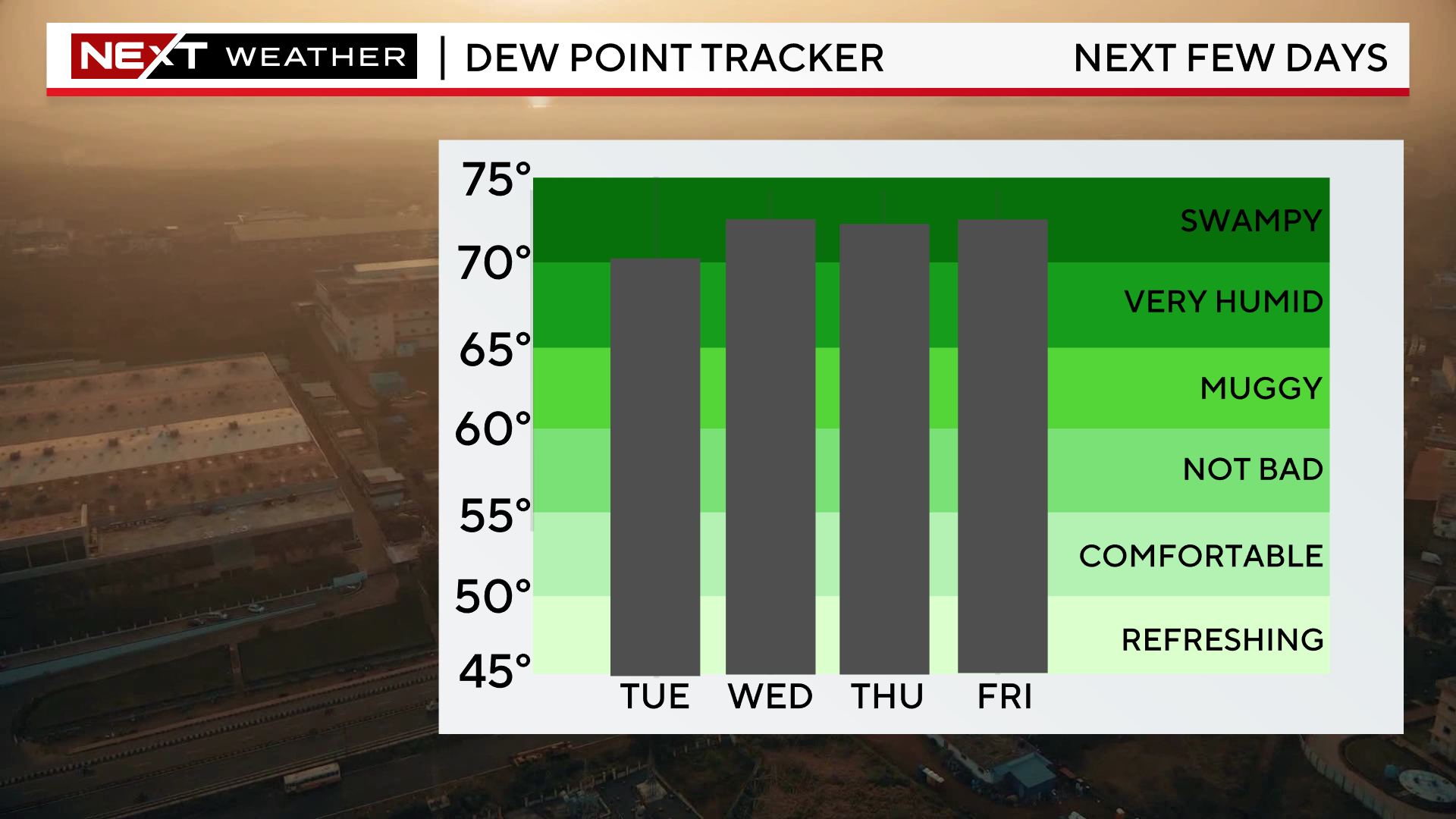
However, the air will be excessively humid each and every day right through this Weekend, making it feel hotter than the readings on the thermometer.
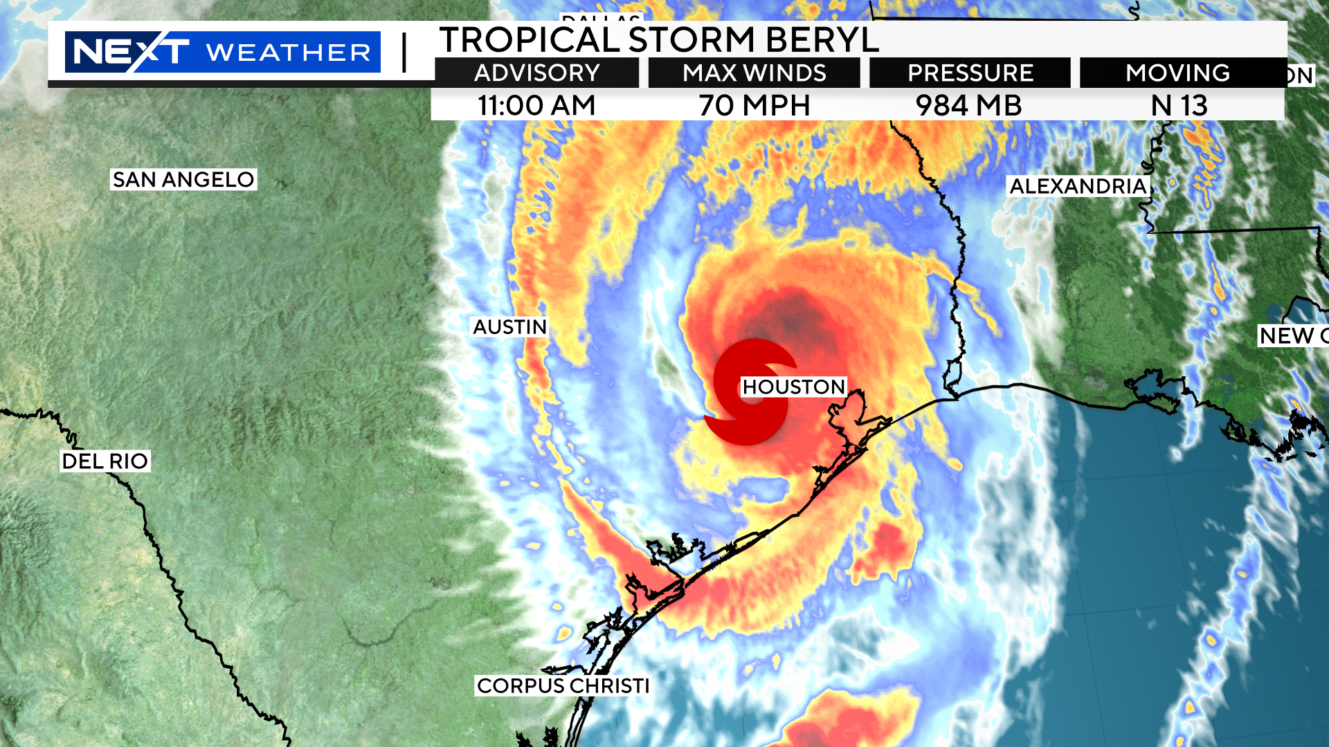
TROPICAL STORM BERYL:
Beryl made landfall Monday morning as a category 1 hurricane southwest of Houston, Texas. It quickly weakened to a Tropical Storm and will continue to slowly erode and weaken in the days ahead.
Its remnants will track through the Ohio Valley and head well to our northwest, into Canada, later this week.
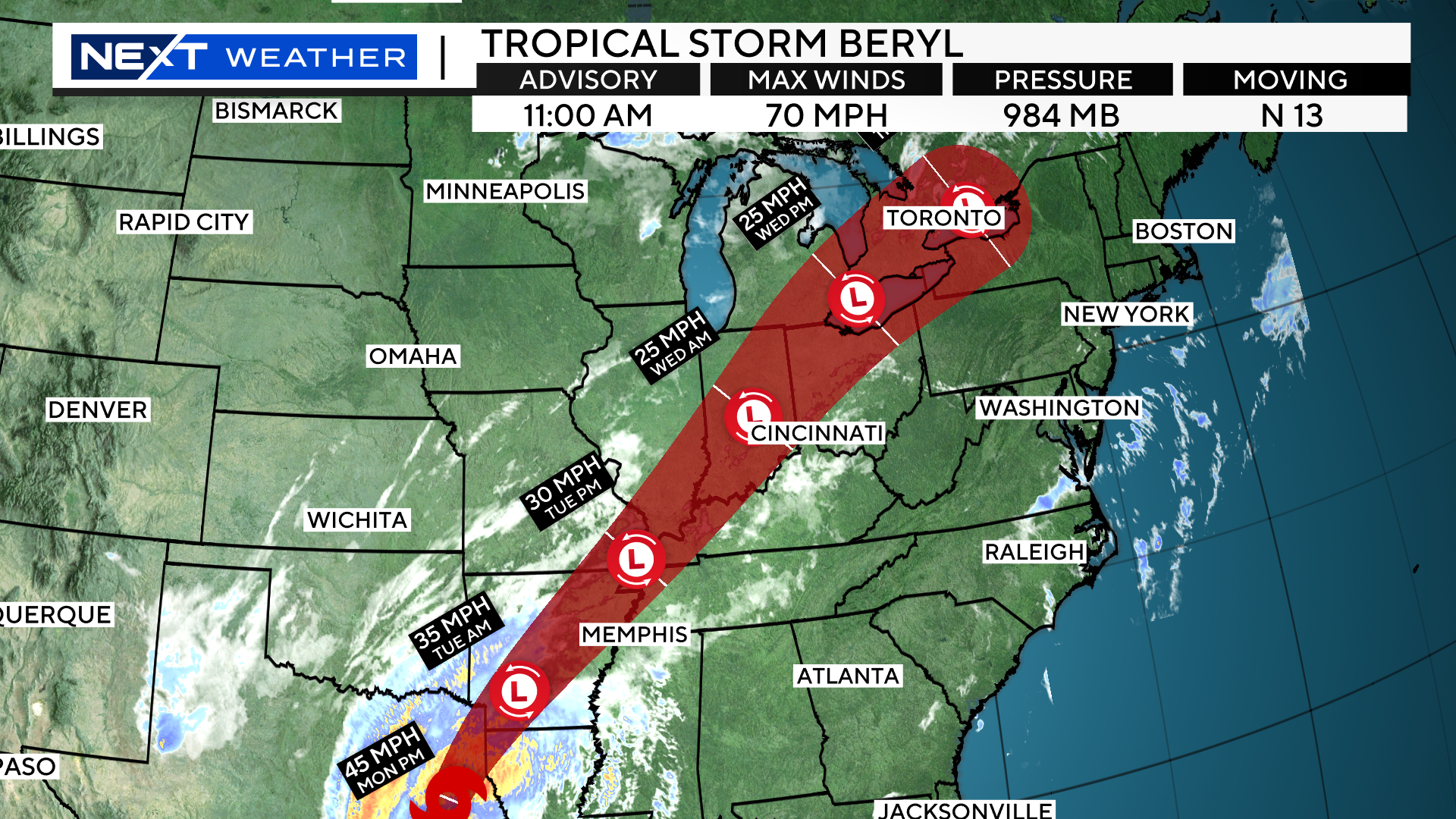
Just because it will not be passing directly over our area does NOT mean we won’t feel some of its lingering impacts.
This energy left with Beryl will combine with a very moist and increasingly unstable atmosphere already in place in New England, leading to the risk of several rounds of very heavy downpours and potentially severe storms.
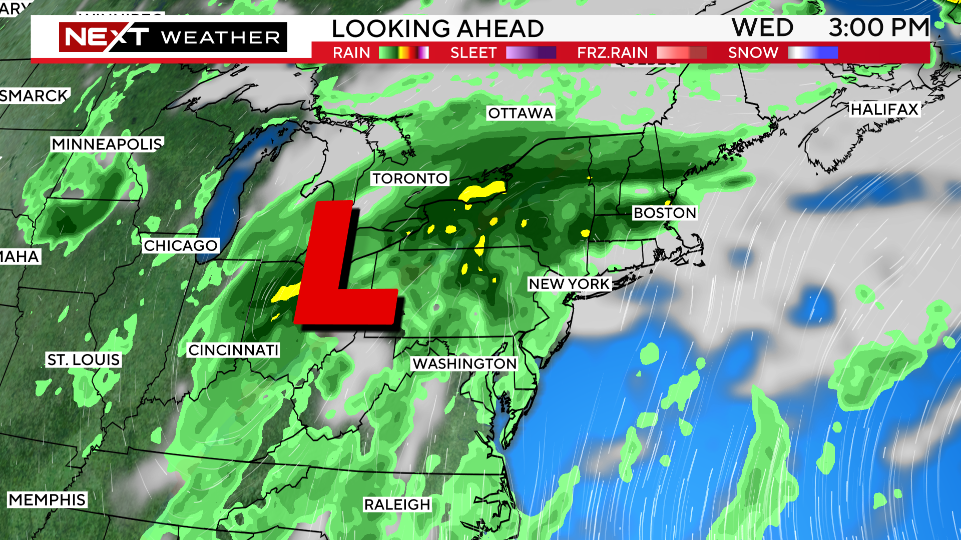
We will be at risk for periods of very heavy rainfall (potentially leading to localized flooding) each day from Wednesday through the Weekend.
It will not be raining all of the time, but there will be a risk each and every day.
Initially, on Wednesday and Thursday, the greatest impact will be in areas north and west of Boston.
That boundary may sink southward later on bringing a greater risk for storms farther into Southern portions of New England by the Weekend.
Click here for Westford snow storm data and past totals or select “Winter Snowfall“ under “Pages” on the left hand side.
For more up to date forecast information follow me on Twitter (@terrywbz) or follow the WBZ weather team on Facebook, search WBZWeather
Reader Comments