


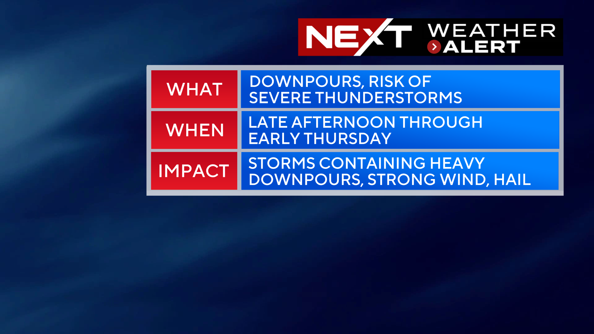
The WBZ Weather Team continues the NEXT Weather Alert through tonight for the chance of torrential downpours and severe thunderstorms.
A hot and humid airmass sits over New England today, soon to be removed by an approaching cold front…the result is likely to be an active night of weather.
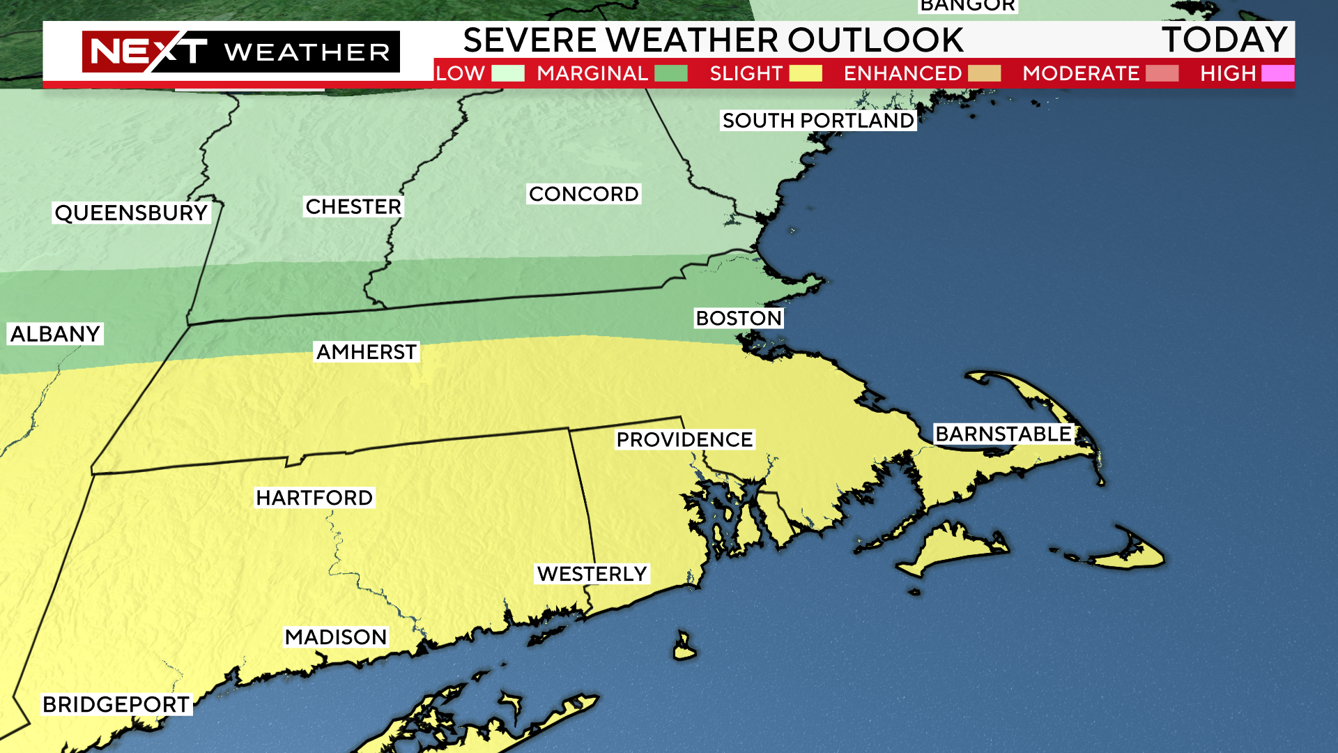
The Storms Prediction Center has upgraded parts of our area from “marginal” risk of severe storms to “slight” risk (area in yellow).
They have also added a 2% tornado risk for far southwestern New England, largely in Connecticut.
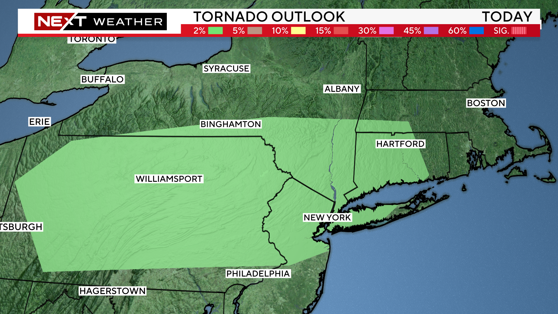
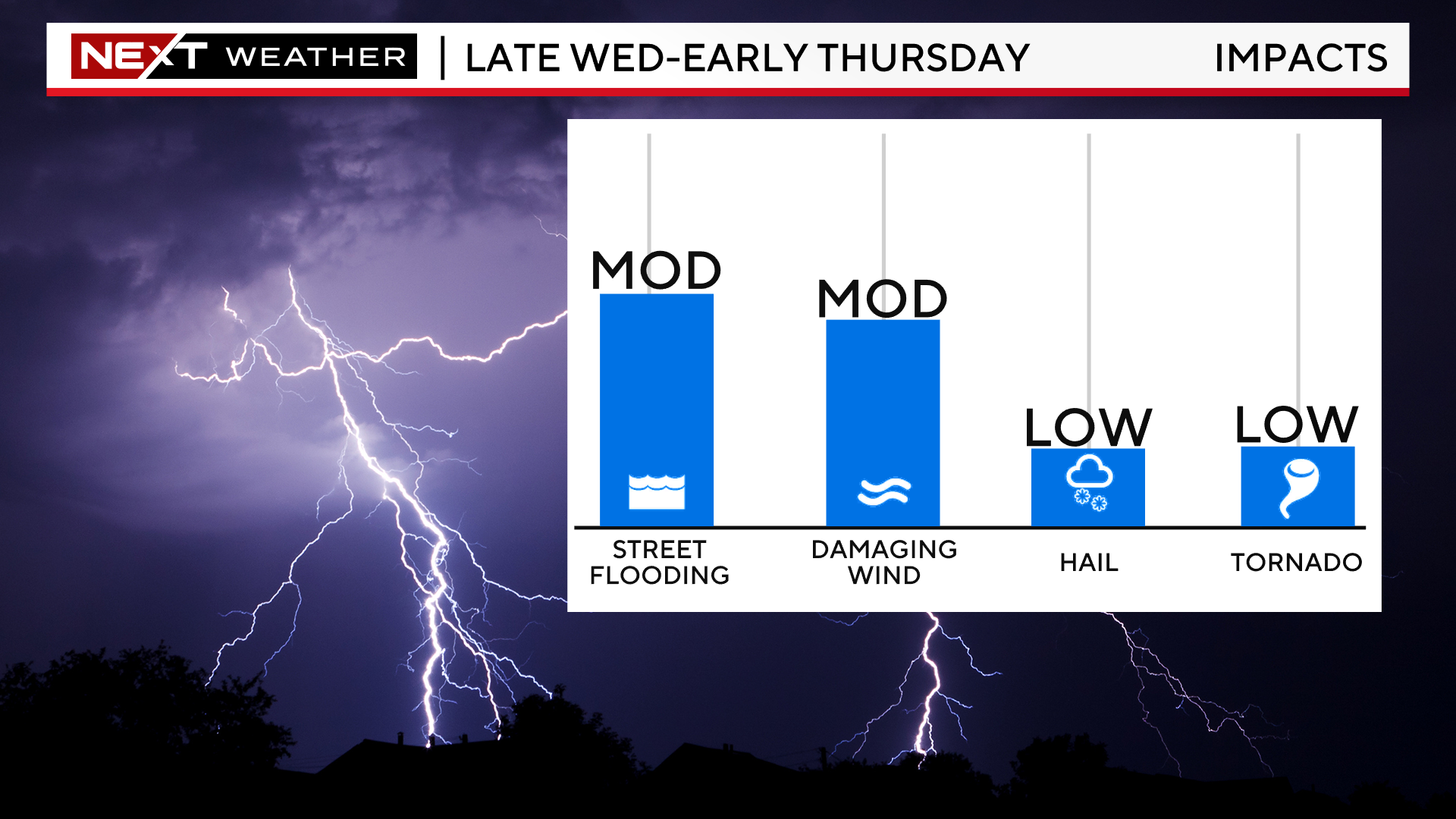
Tornadoes are not high on the list of concerns with the impending cold front here in southern New England. The highest risks are for heavy downpours, localized flooding and damaging wind gusts.
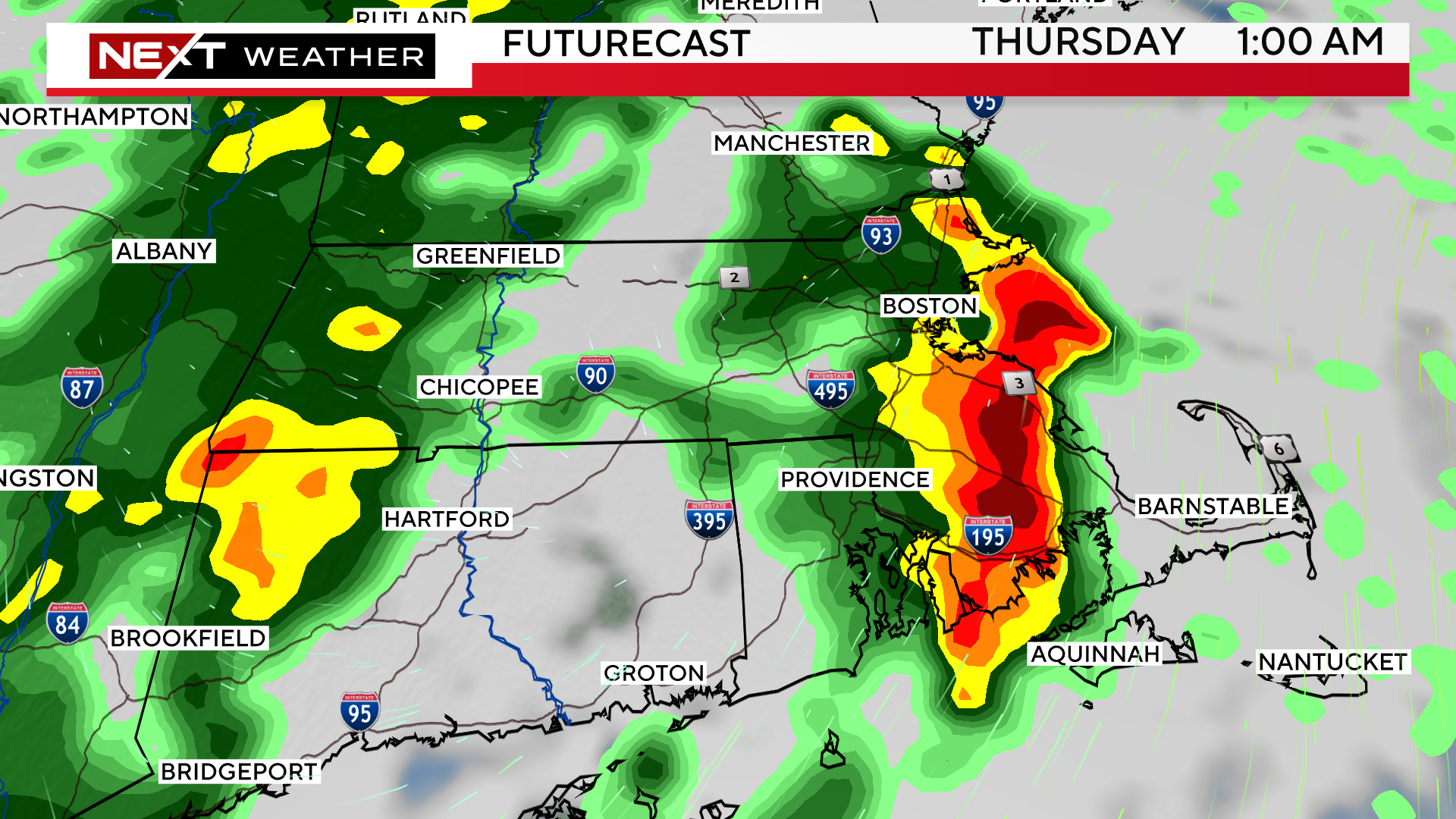
TIMELINE:
Through 8pm Wednesday:
Mainly just building cumulus clouds and a slight chance of a few isolated showers/storms.
8pm-4am:
Most of our weather models are indicating that this is the time of highest risk for downpours and a few severe thunderstorms, particularly between 10pm and 2am.
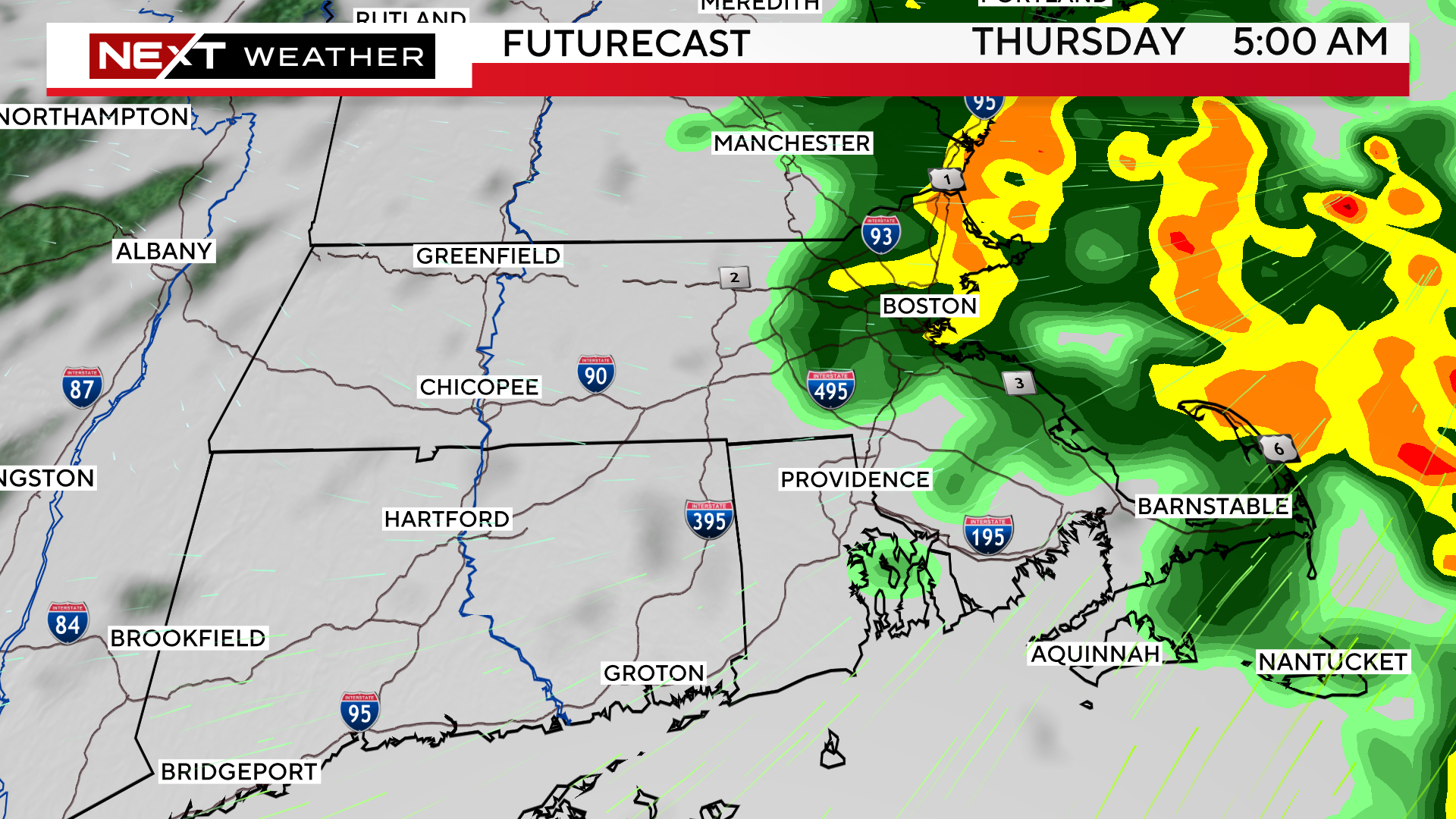
4am-8am Thursday:
There may be a few remaining downpours, mainly in far eastern MA in the early hours on Thursday.
Most of the wet weather should be clearing the Coastline after 7-8am.
Once the storms pass, we are in for a couple of sparkling, comfy days. Thursday afternoon and Friday look lovely with low humidity and ample sunshine.
We will see increasing clouds on Saturday and periods of wet weather Saturday night through Sunday.
Click here for Westford snow storm data and past totals or select “Winter Snowfall“ under “Pages” on the left hand side.
For more up to date forecast information follow me on Twitter (@terrywbz) or follow the WBZ weather team on Facebook, search WBZWeather
Reader Comments