


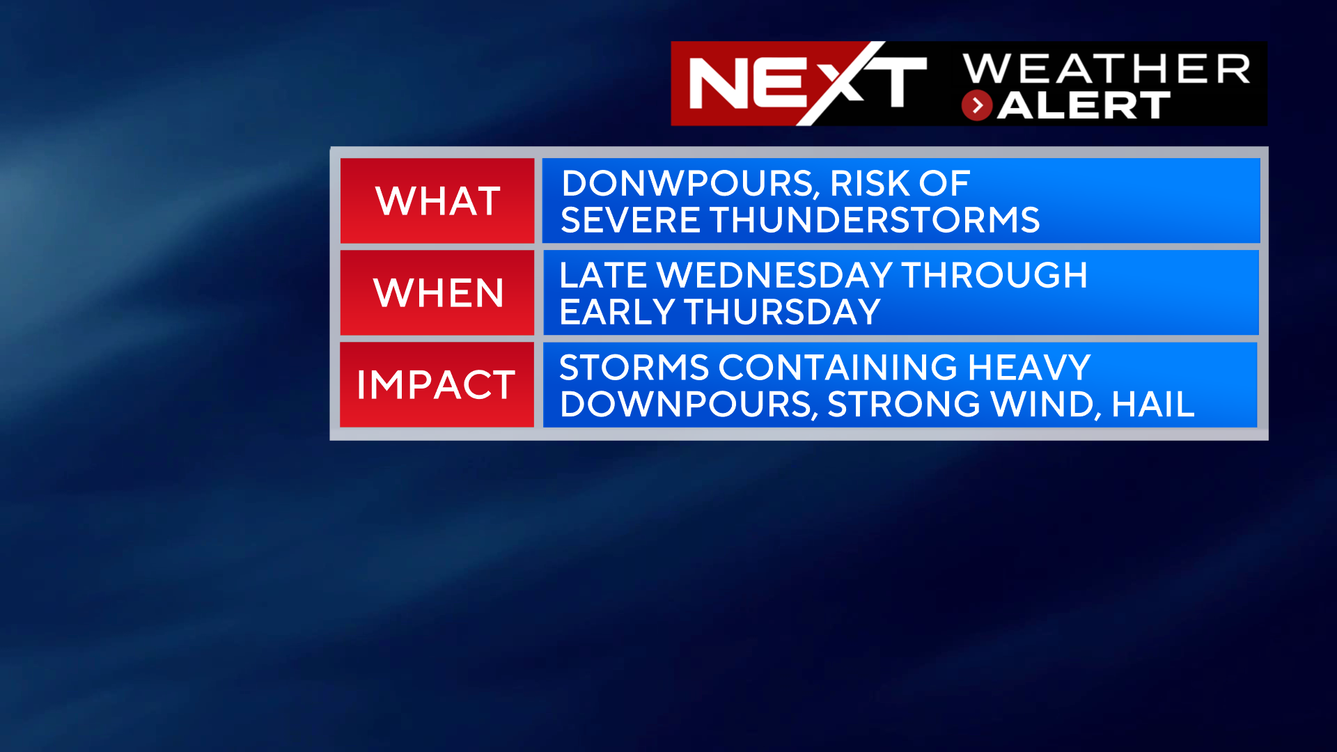
The WBZ Weather Team is issuing a NEXT Weather Alert for the risk of downpours and some severe thunderstorms late Wednesday through early Thursday.
We are in for another hot and humid day on Wednesday, but this time, the oppressive heat will be short-lived. A cold front will arrive late Wednesday ushering in another round of downpours and storms along with some refreshing air to end the week.
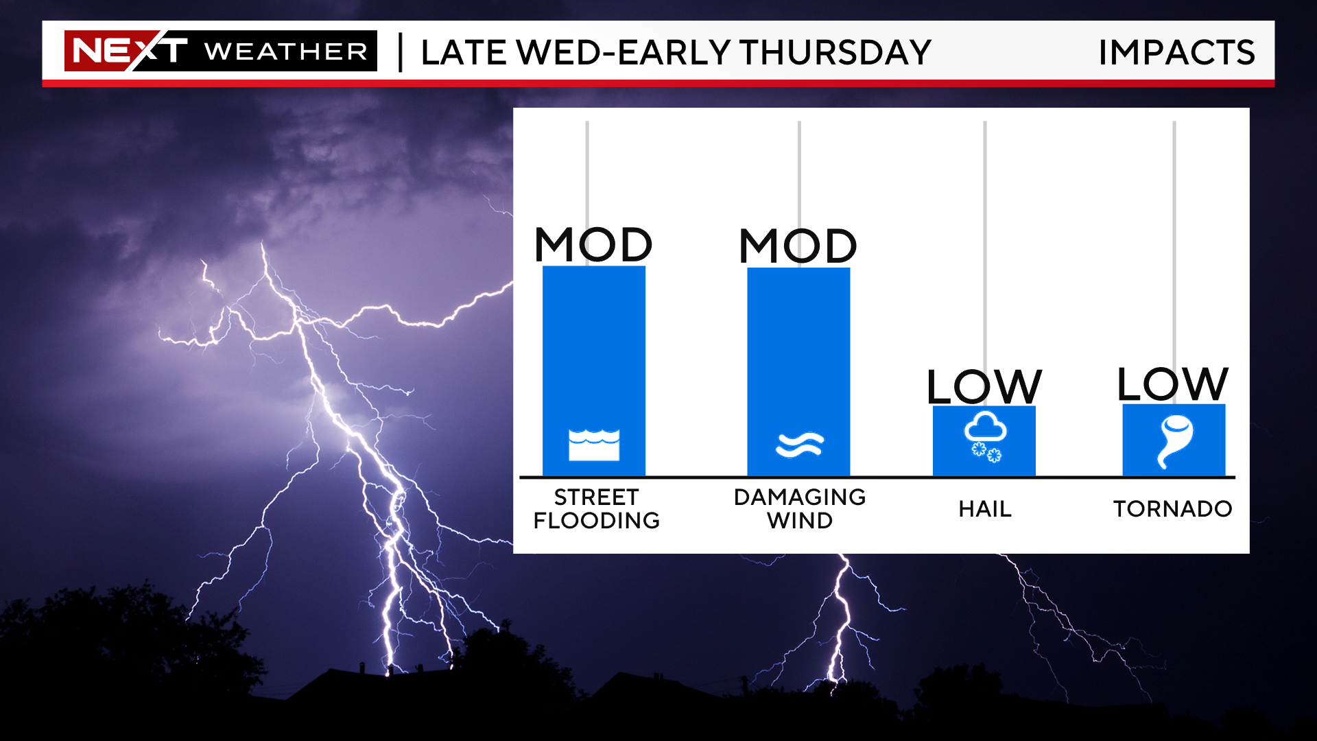
TIMELINE:
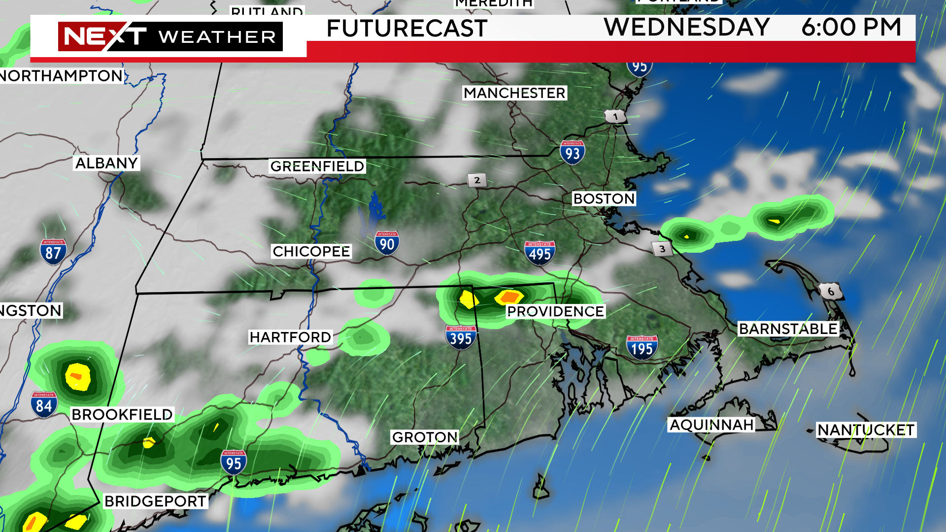
Most of the day on Wednesday will remain rain-free. There will be some building clouds in the afternoon, and we may see a few scattered downpours popping up after 5pm.
Most models are focused on areas near or just south of the Mass Pike for the first round of showers.
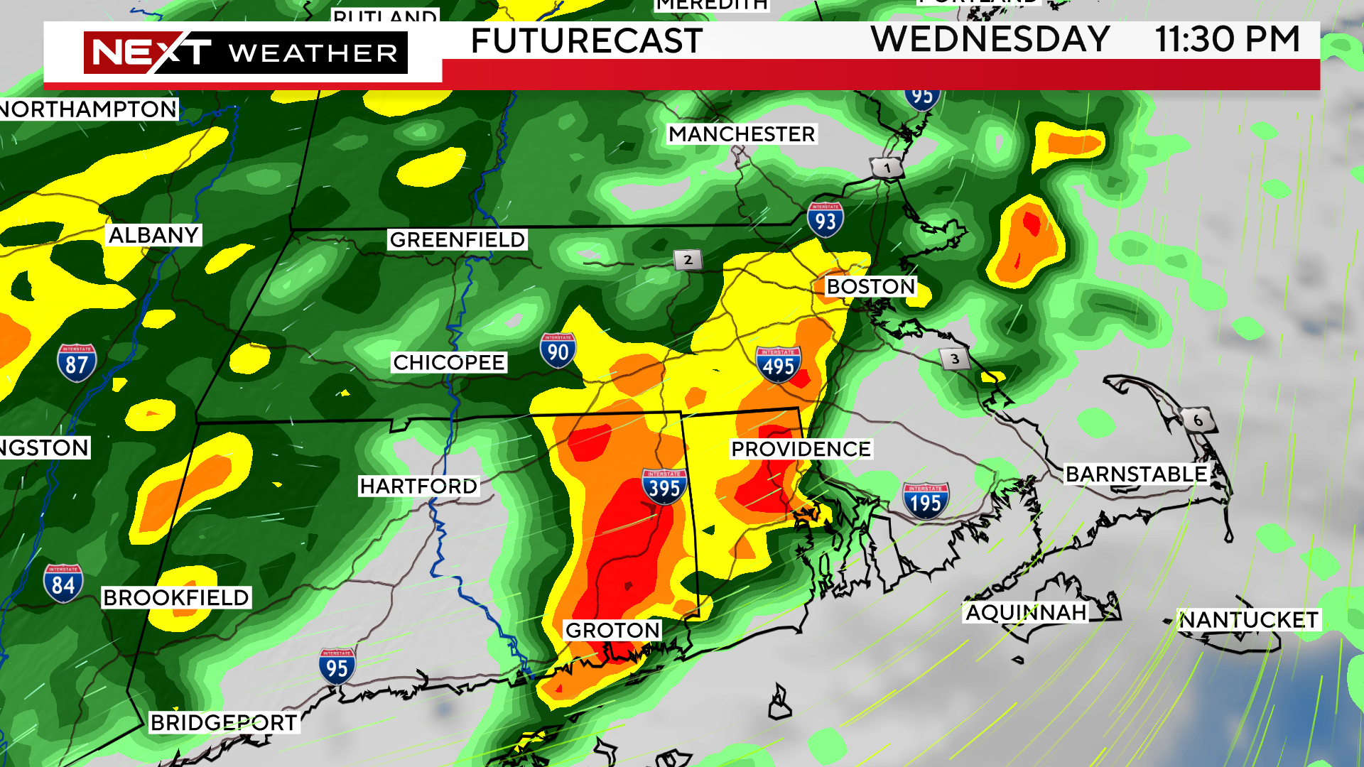
After sunset, the downpours will become widespread, and rain will be falling in most of southern New England by midnight.
We expect some embedded thunderstorms as well.
The Storms Prediction Center has placed portions of the area in a “marginal” risk for severe weather (green shading).
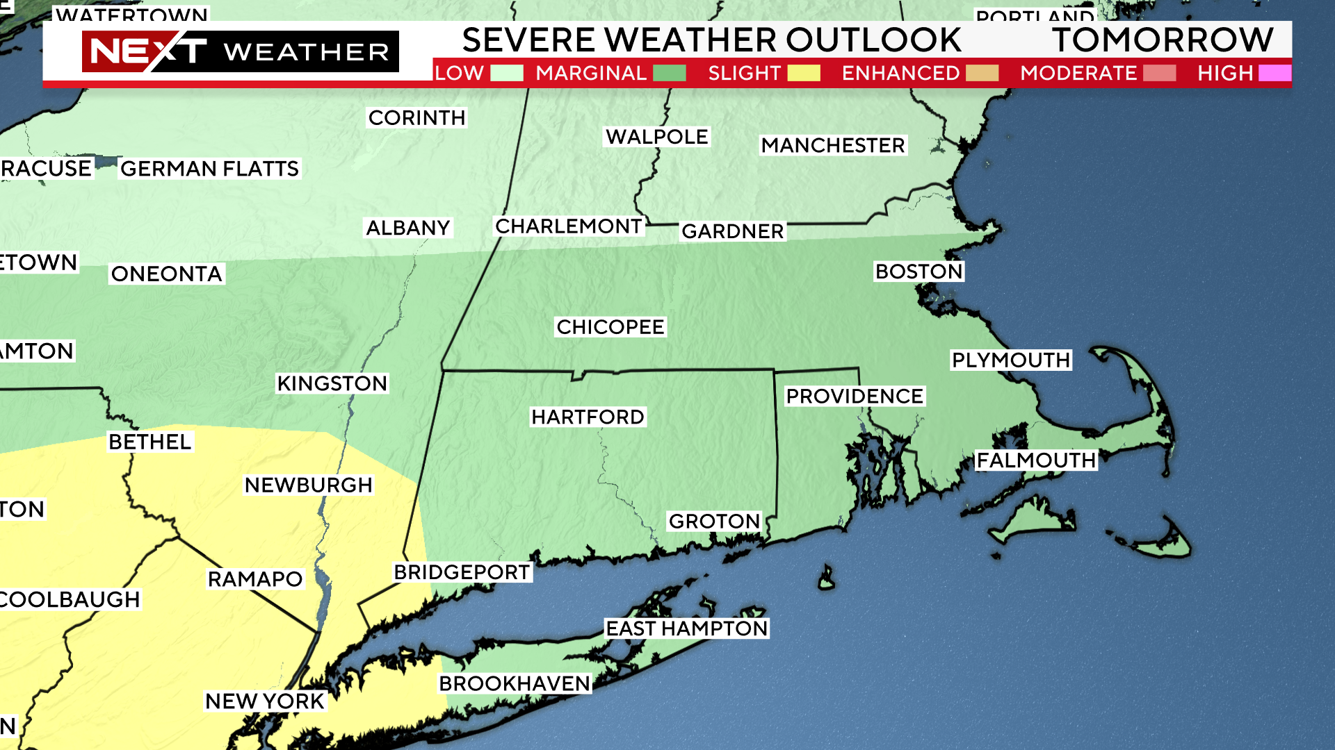
Main concerns with any potential severe thunderstorms will be heavy downpours (leading to localized flooding) and damaging wind gusts.
There will be periods of heavy rain and thunderstorms overnight.
The heaviest rain will exit the Coastline between 4-7am Thursday.
We will then see clearing skies and dropping humidity for the remainder of the day on Thursday.

Click here for Westford snow storm data and past totals or select “Winter Snowfall“ under “Pages” on the left hand side.
For more up to date forecast information follow me on Twitter (@terrywbz) or follow the WBZ weather team on Facebook, search WBZWeather
Reader Comments