


Welcome to the first full week of summer!
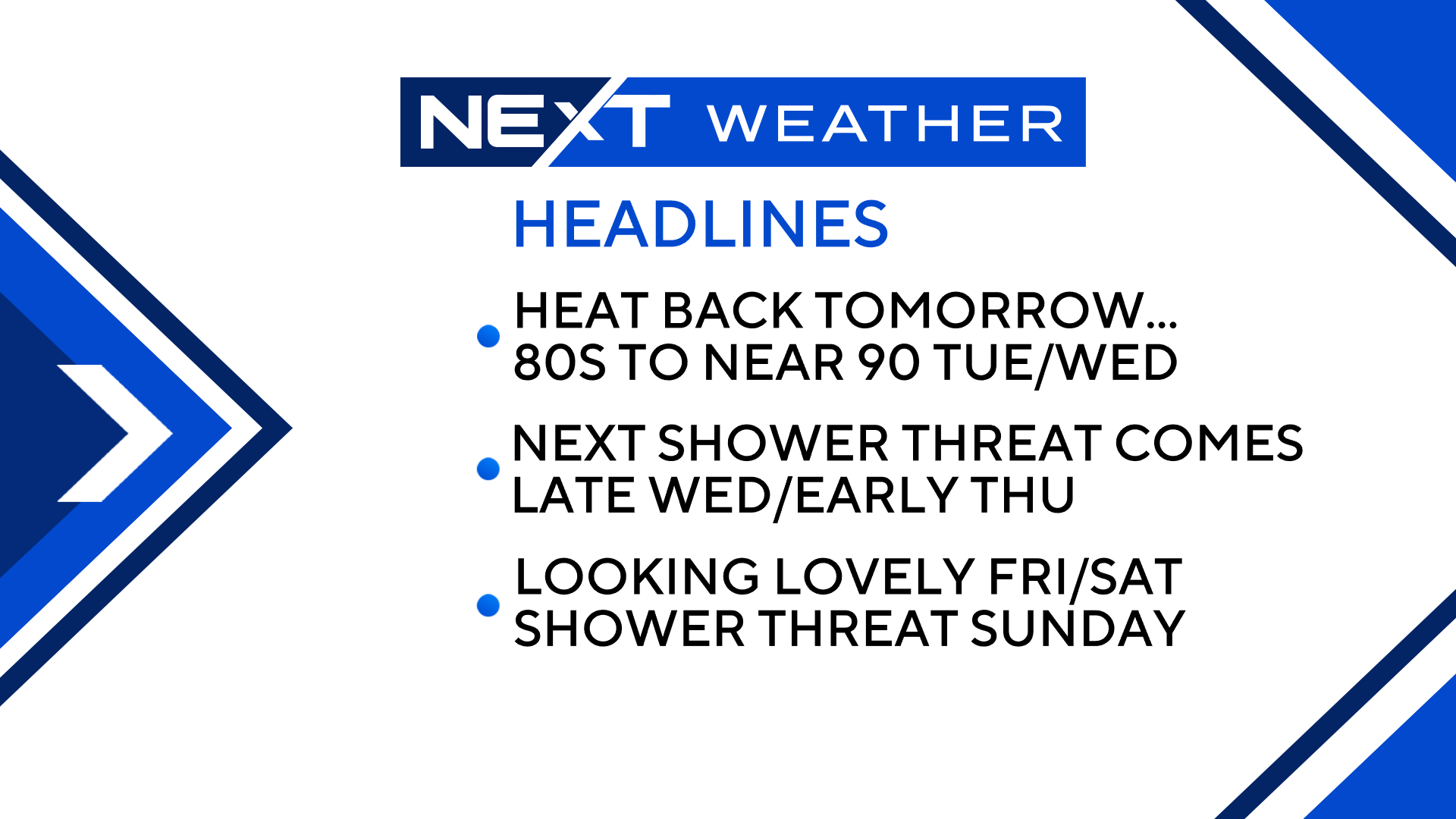
Featured this week…
More periods of heat and humidity
One significant risk of showers and thunderstorms
And a very nice finish!
TODAY:
Some building clouds this afternoon and a very slight risk of a pop-up shower. Nothing severe or impactful expected.
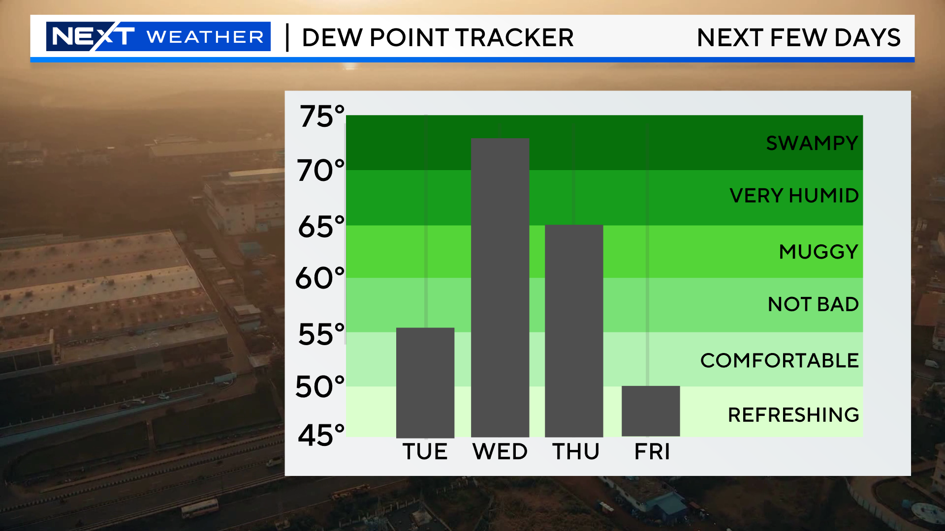
And, most importantly, DECREASING humidity!
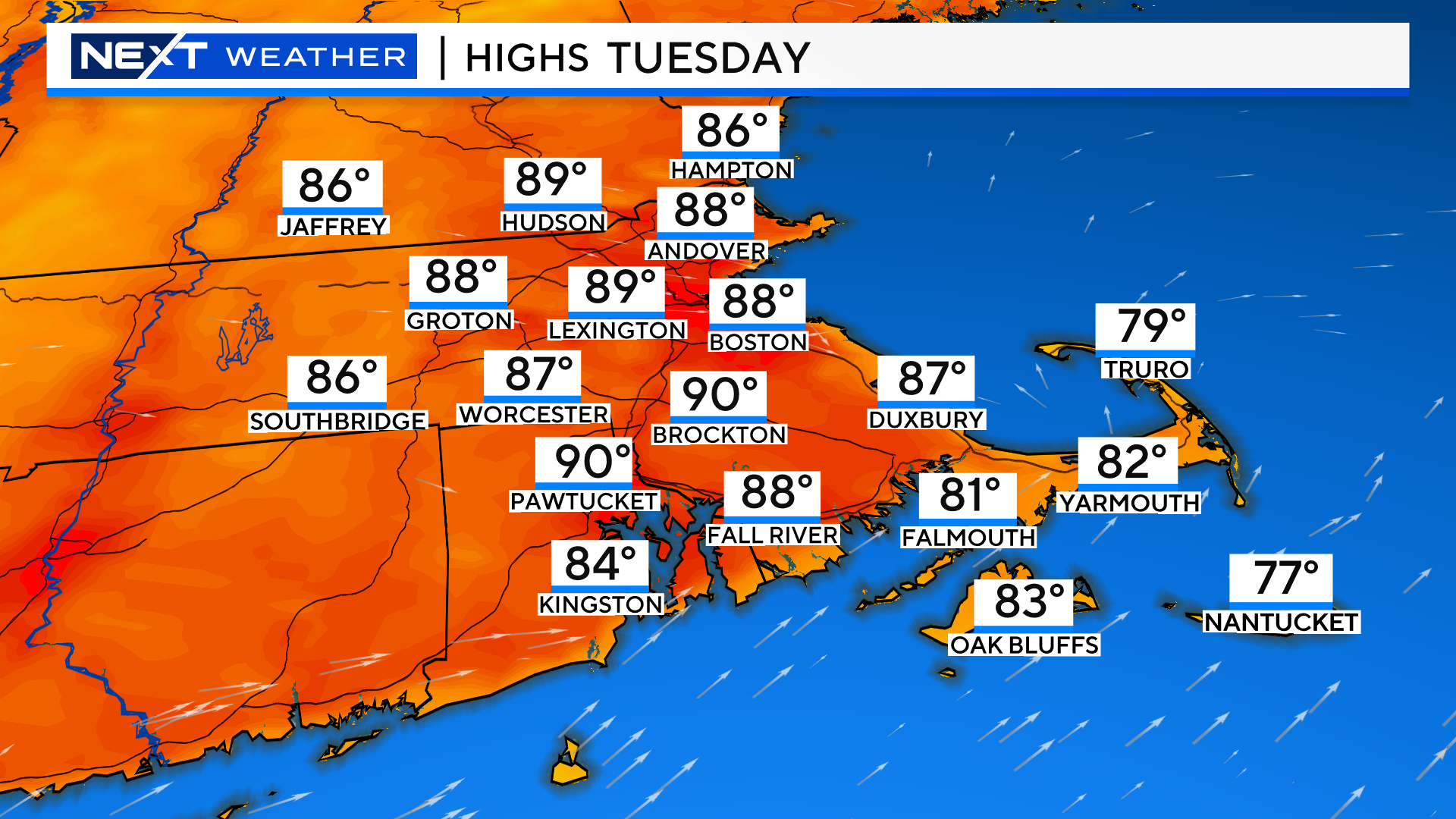
TUESDAY:
A summer beauty!
Fairly hot but with very low humidity.
Highs 85-90
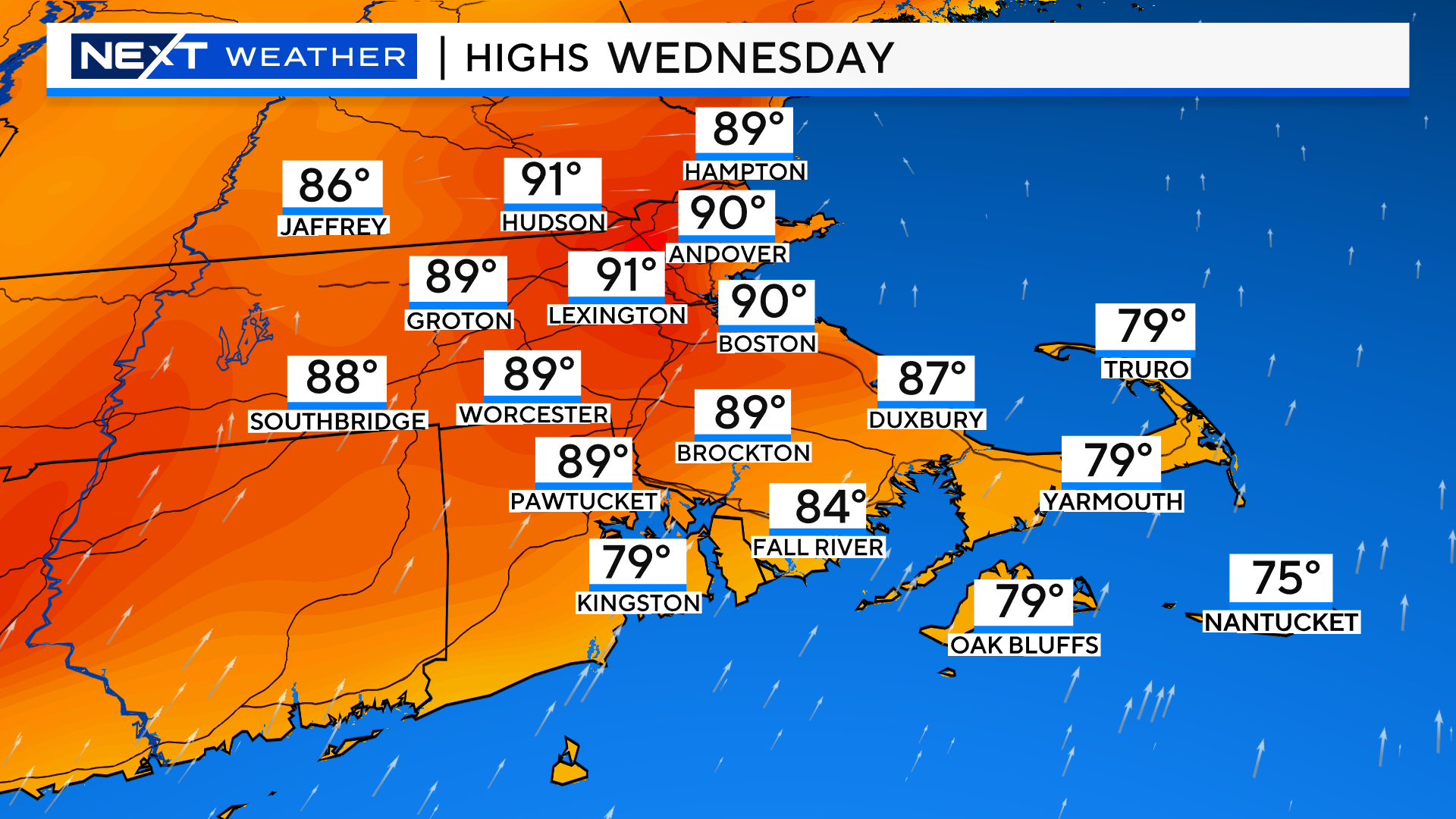
WEDNESDAY:
The hottest and most humid day of the week.
Highs near 90 with oppressive humidity. Feels-like temperatures between 95-100.
Clouds will build in the afternoon and evening and there may be a few scattered downpours and thunderstorms, slight chance of severe.
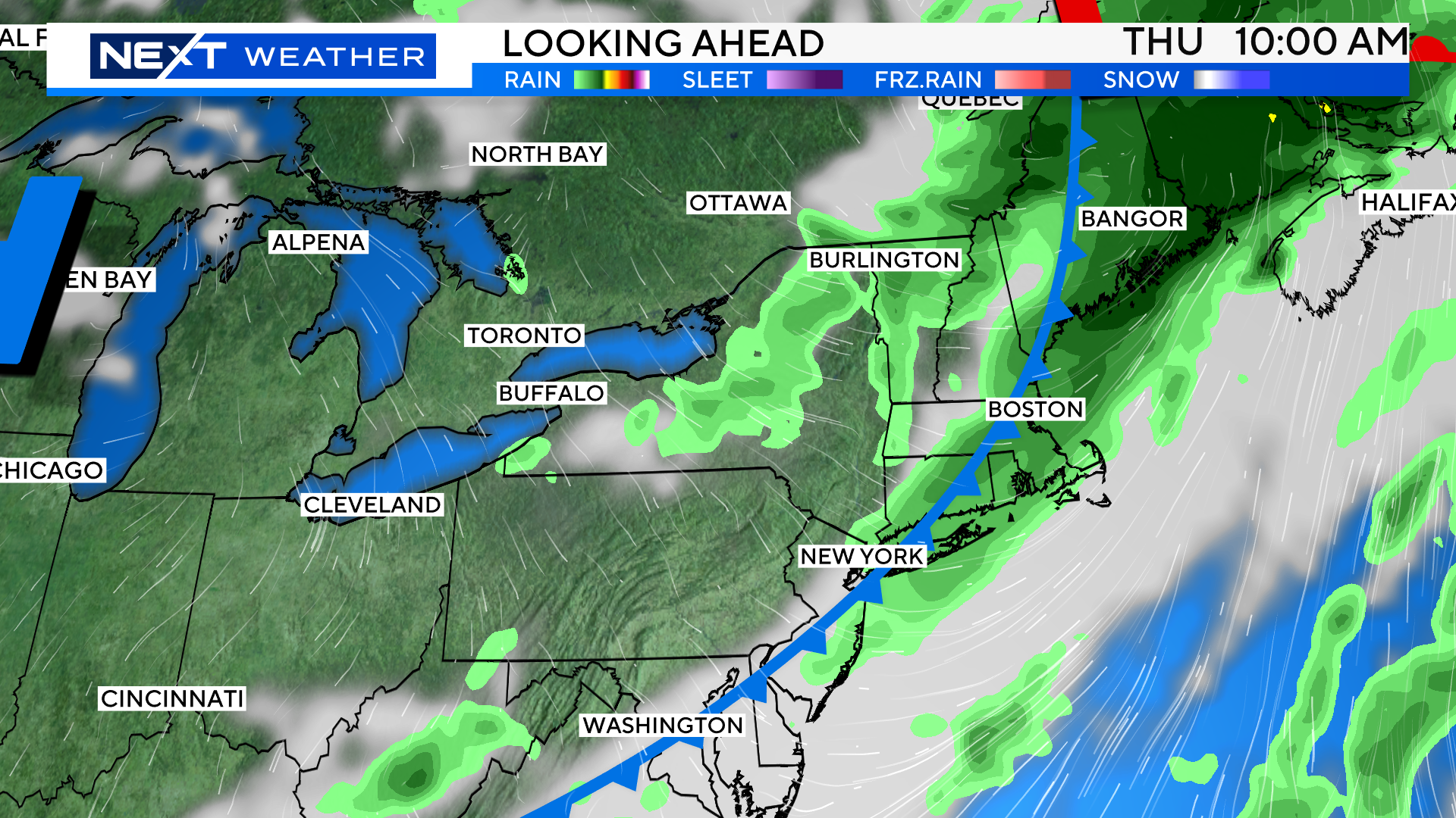
THURSDAY:
The cold front pushes through very early Thursday morning so there will be some lingering clouds and showers to start the day.
However, we expect the sunshine to return by midday/afternoon and humidity levels to drop once again. Highs in the low 80s.
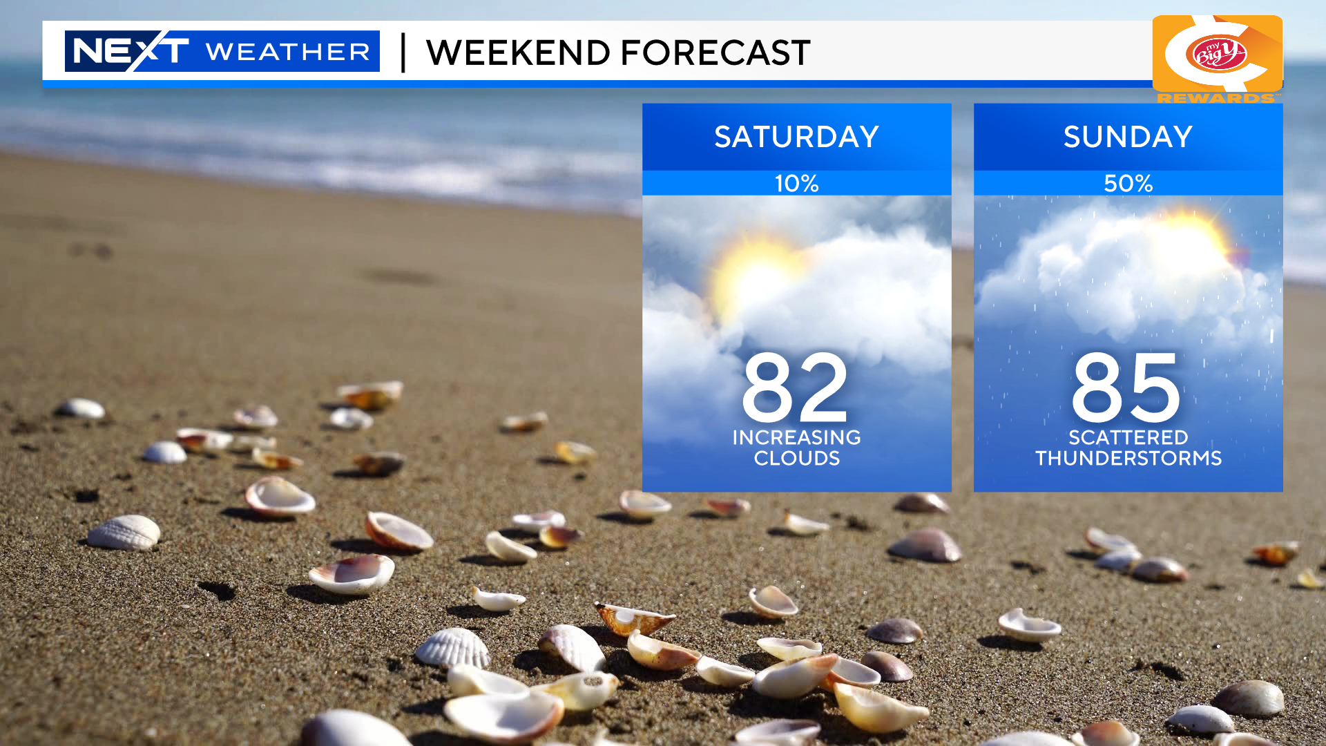
FRIDAY and the WEEKEND
Friday looks to be the pick of the week! Temperatures between 75-80 with very low humidity…yes please!
Clouds will begin to increase during the day on Saturday and we expect some scattered showers around late in the day.
Sunday carries the highest risk of scattered showers and storms this weekend…more on this to come in the days ahead.
Click here for Westford snow storm data and past totals or select “Winter Snowfall“ under “Pages” on the left hand side.
For more up to date forecast information follow me on Twitter (@terrywbz) or follow the WBZ weather team on Facebook, search WBZWeather
Reader Comments