


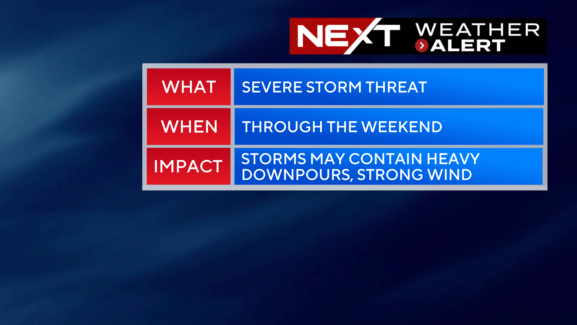
The NEXT Weather Alert continues through Sunday for the risk of severe storms.
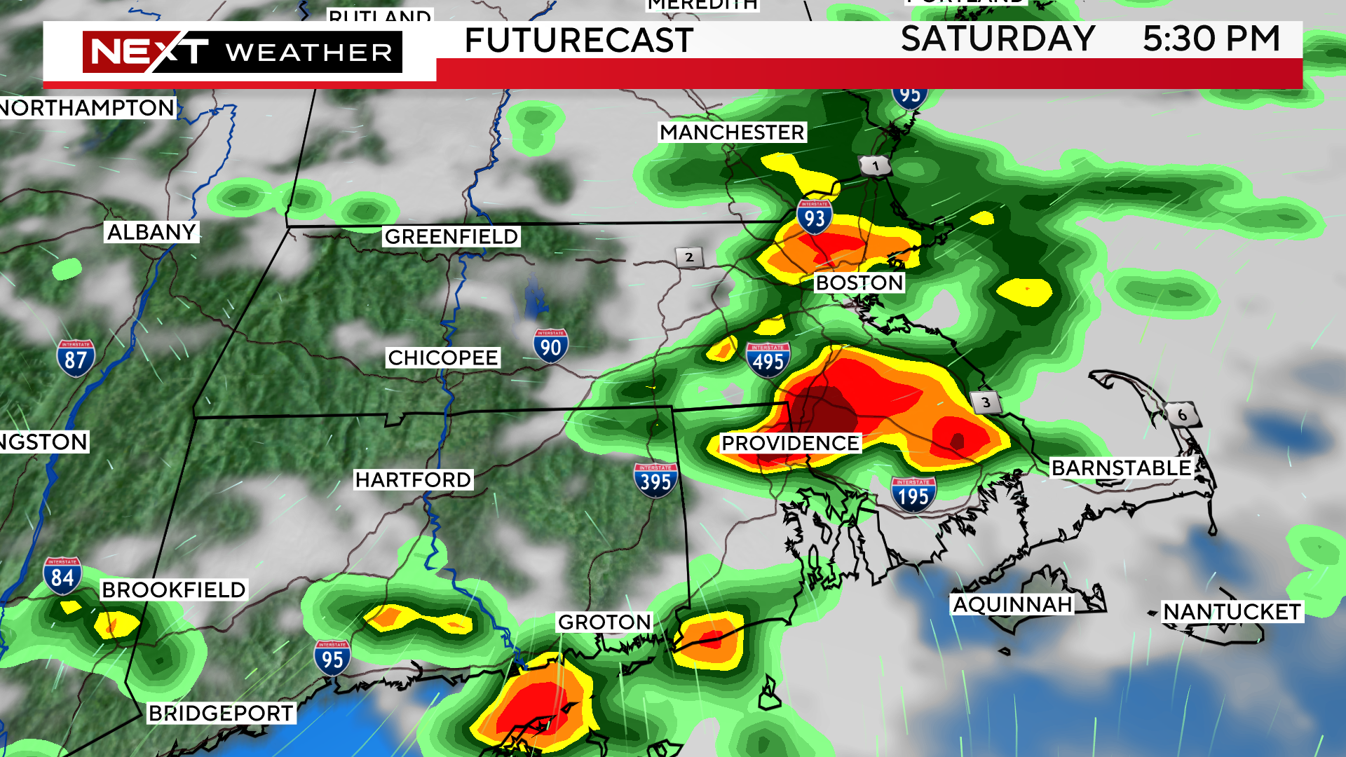
SATURDAY:
With very little sunshine to provide a trigger for severe weather, we believe that the highest risk is for heavy downpours and localized flooding later Saturday afternoon and evening. There is a smaller risk of wind damage and small hail. We cannot rule out an isolated tornado, but the risk remains quite low.
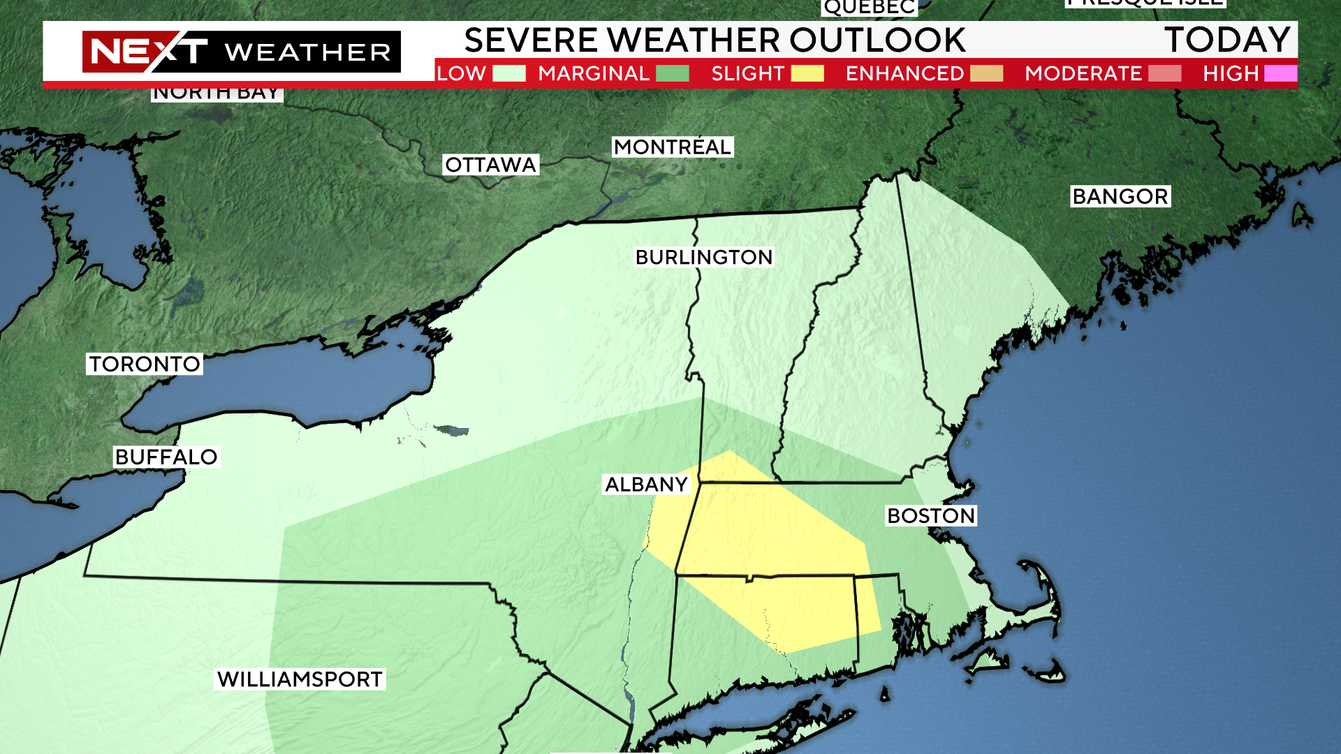
The Storms Prediction Center has placed parts of New England (southwest where there is more sunshine) in a “marginal” risk for severe weather on Saturday.
The highest risk of downpours and storms on Saturday comes between 1pm and 7pm.
SUNDAY:
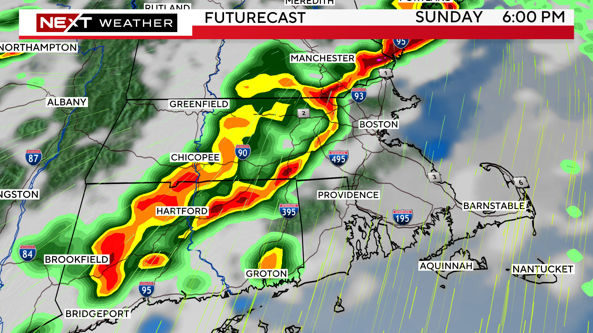
There will be two rounds of storms on Sunday.
The first comes very early in the morning between 2a-8a.
The second and most volatile round will be in parts of central and northern New England between Noon and 5pm and in southern New England between 4-8pm.
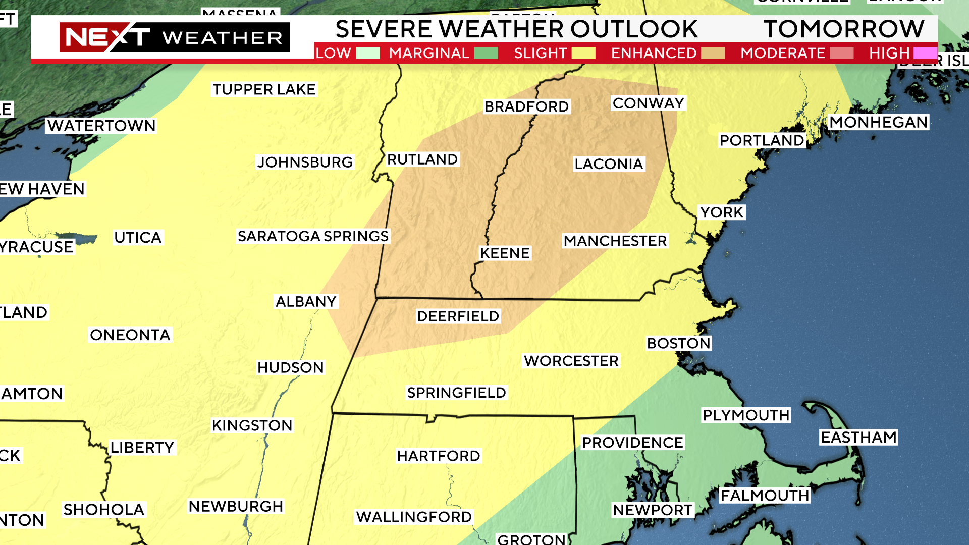
The Storms Prediction Center has placed a much larger area in the “marginal” risk (yellow shading) for severe weather on Sunday extending from Boston all the way through northern New England.
In addition, they added an “enhanced” area (orange shading), level 3 of 5, in parts of the Berkshires, southern and central Vermont and through the Lakes Region in New Hampshire.
New England rarely sees this level of severe thunderstorms risk, perhaps a few times per year if that.
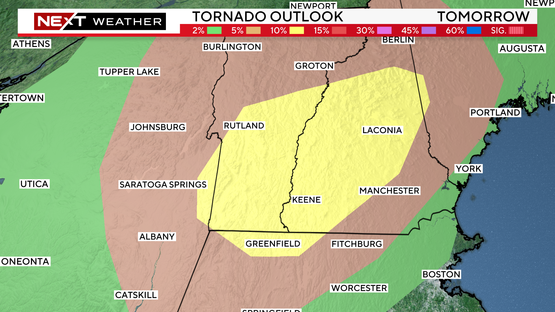
Even more unusual is the SPC’s tornado risk assessment. The 2% (greed shading) extends from Boston through Northern New England. There is a 5% risk (brown shading) north and west of Fitchburg. Finally, they have issued a 10% tornado risk (yellow shading) in parts of southern and central Vermont through the Lakes Region of New Hampshire.
This is incredibly rare and concerning for this area.
A few quotes from the Saturday afternoon SPC discussion…
“Scattered damaging winds and a few tornadoes are likely across parts of the Northeast, mainly during Sunday afternoon”
“The most favorable parameter space appears centered on parts of the Hudson River Valley through the central portion of New England…This may yield a few discrete supercells with a risk for tornadoes and damaging winds.”
WHAT DOES A 10% TORNADO RISK MEAN?
“Reaching the 10% threshold indicates a notable increase in the tornado threat. These forecasts are often associated with enhanced or moderate risk days when several tornadoes are possible and the potential for a stronger tornado, (EF2 or greater) increases.
A 10% tornado probability means that within 25 miles of any point in the highlighted area, there is a 10% chance of a tornado occurring. This is extremely significant and again, very rare for this area.
Clearly, Sunday will be a day to keep an eye on radar. We urge that you stay tuned to WBZ-TV, WBZ.com and CBS News Boston as we will have you covered all weekend long.
Click here for Westford snow storm data and past totals or select “Winter Snowfall“ under “Pages” on the left hand side.
For more up to date forecast information follow me on Twitter (@terrywbz) or follow the WBZ weather team on Facebook, search WBZWeather
Reader Comments