The NEXT Weather Alert continues through Sunday for the risk of severe storms.

SATURDAY:
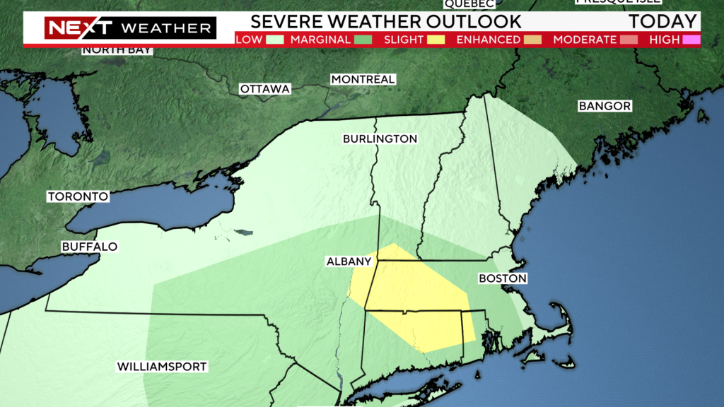
With very little sunshine to provide a trigger for severe weather, we believe that the highest risk is for heavy downpours and localized flooding later Saturday afternoon and evening. There is a smaller risk of wind damage and small hail. We cannot rule out an isolated tornado, but the risk remains quite low.
The Storms Prediction Center has placed parts of New England (southwest where there is more sunshine) in a “marginal” risk for severe weather on Saturday.

The highest risk of downpours and storms on Saturday comes between 1pm and 7pm.

SUNDAY:
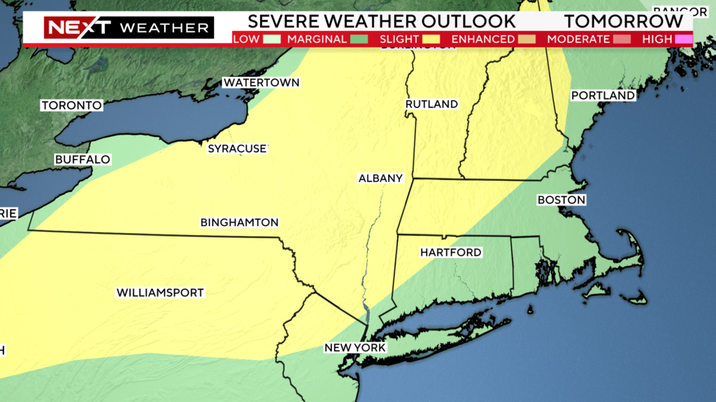
There will be two rounds of storms on Sunday.
The first comes very early in the morning between 2a-8a.
The second round has the highest risk of severe weather and will occur between 4p-9p.

The Storms Prediction Center has placed a much larger area in the “marginal” risk for severe weather on Sunday. This time areas at highest risk are north and west of Boston, including much of New Hampshire and Vermont.

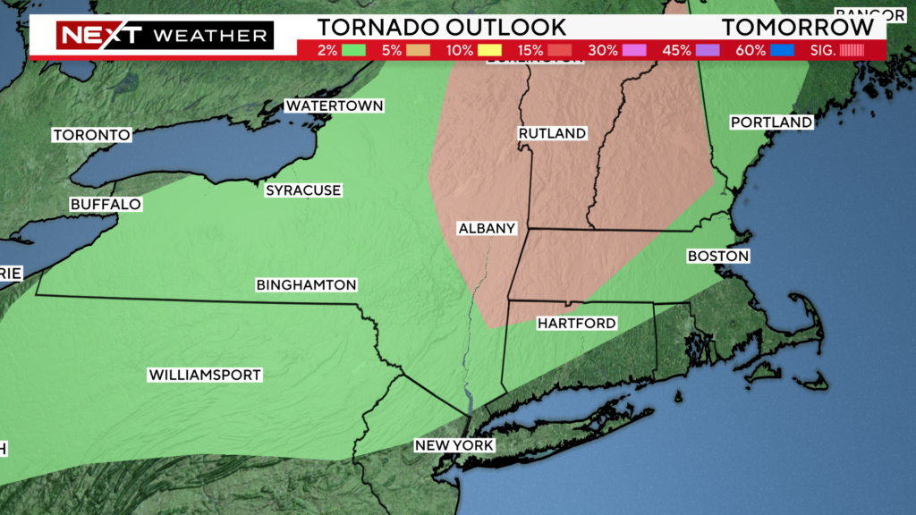
There is also a 5% tornado risk (brown shaded area) north and west of Boston on Sunday afternoon and evening with a slightly lower (2% risk) in the green shaded area.
This is somewhat unusual for New England but certainly not unheard of. It essentially means that certain parameters are in place in the atmosphere that could lead to some rotation of storms. Tornadoes are far from a guarantee but we urge that you heed any warnings that may occur.

Clearly, Sunday will be a day to keep an eye on radar. We urge that you stay tuned to WBZ-TV, WBZ.com and CBS News Boston as we will have you covered all weekend long.
Click here for Westford snow storm data and past totals or select “Winter Snowfall“ under “Pages” on the left hand side.
For more up to date forecast information follow me on Twitter (@terrywbz) or follow the WBZ weather team on Facebook, search WBZWeather


Reader Comments