


THURSDAY (DAY 3):
High temperatures will be similar to Wednesday. If the cloud cover stays minimal, we would rise a few degrees higher, nearing 100 degrees in some areas.
This is dependent on the timing of a cold front that will be sliding southward from northern New England. If it moves a bit quicker, some cloud cover and a shower threat could hold temperatures back a bit in southern New Hampshire and northern MA.

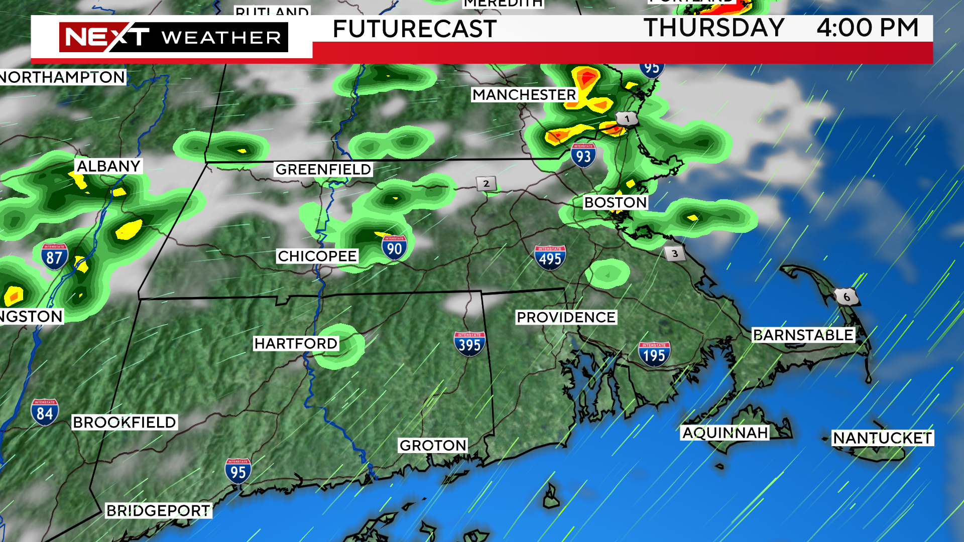
The main difference on Thursday will be to introduce the threat of thunderstorms in the afternoon and evening, particularly in southern New Hampshire and northern Massachusetts.
The Storms Prediction Center has placed parts of our area in a “marginal” threat for severe weather.
Main concerns with any cells that form would be very heavy downpours, localized flooding and the chance of some wind damage and small hail.
FRIDAY (Day 4):
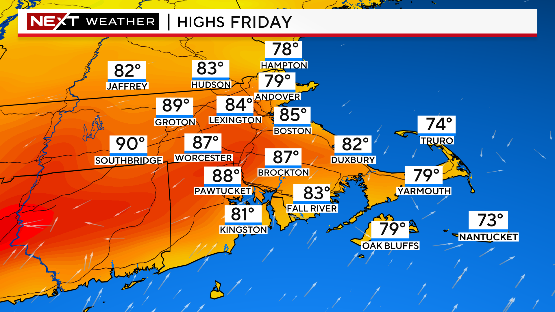
The cold front will be very slowly moving from north to south through Southern New England during the day on Friday. Therefore, the hottest temperatures will be in the morning hours. We could reach as high as 85-90 in the morning on Friday before the winds shift to the east-northeast with the passage of the front.
Once that front comes through, temperatures will fall back into the 70s and 80s.
Locations farther south and west of Boston will see the hottest temperatures given that the front will take longer to reach them. So, places like southern Worcester county and Connecticut should easily top 90 degrees for the 4th day in a row.
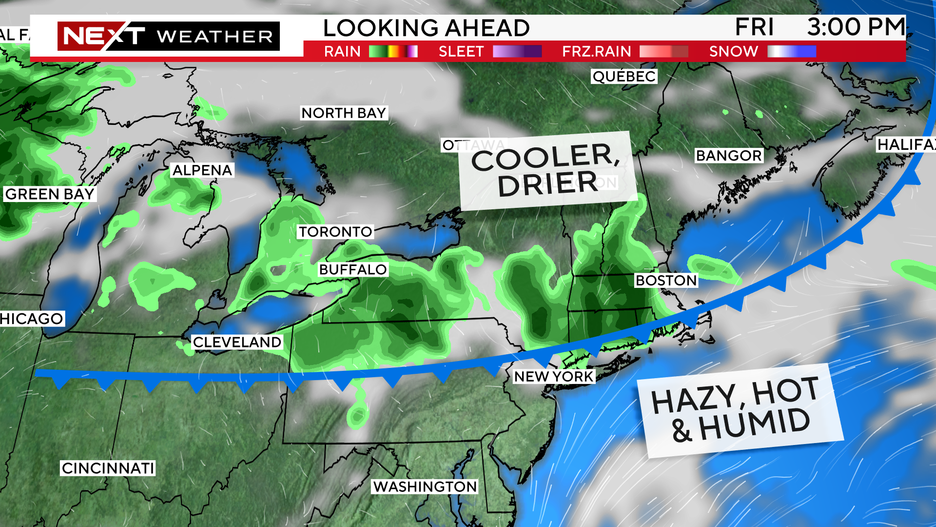
There will also be additional showers and thunderstorm popping up along the frontal boundary during the day Friday.
This forecast COULD work out to be ideal for the Celtics parade.
Ultimately this will come down to the timing and location of that cold front, but as of this writing we expect the front will be through Boston by 11am and temperatures will be cooling off.
We cannot rule out a shower or storm, although there is a much higher risk to the west of Boston assuming the front has already passed through.

Click here for Westford snow storm data and past totals or select “Winter Snowfall“ under “Pages” on the left hand side.
For more up to date forecast information follow me on Twitter (@terrywbz) or follow the WBZ weather team on Facebook, search WBZWeather
Reader Comments