


Welcome to heatwave day 1.
The WBZ Weather Team is continuing the NEXT Weather Alert for the next several days. The combination of high heat and humidity will make it feel like 100+ in many southern New England towns.
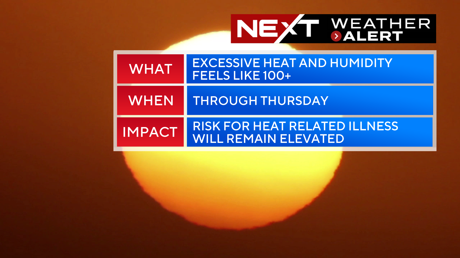
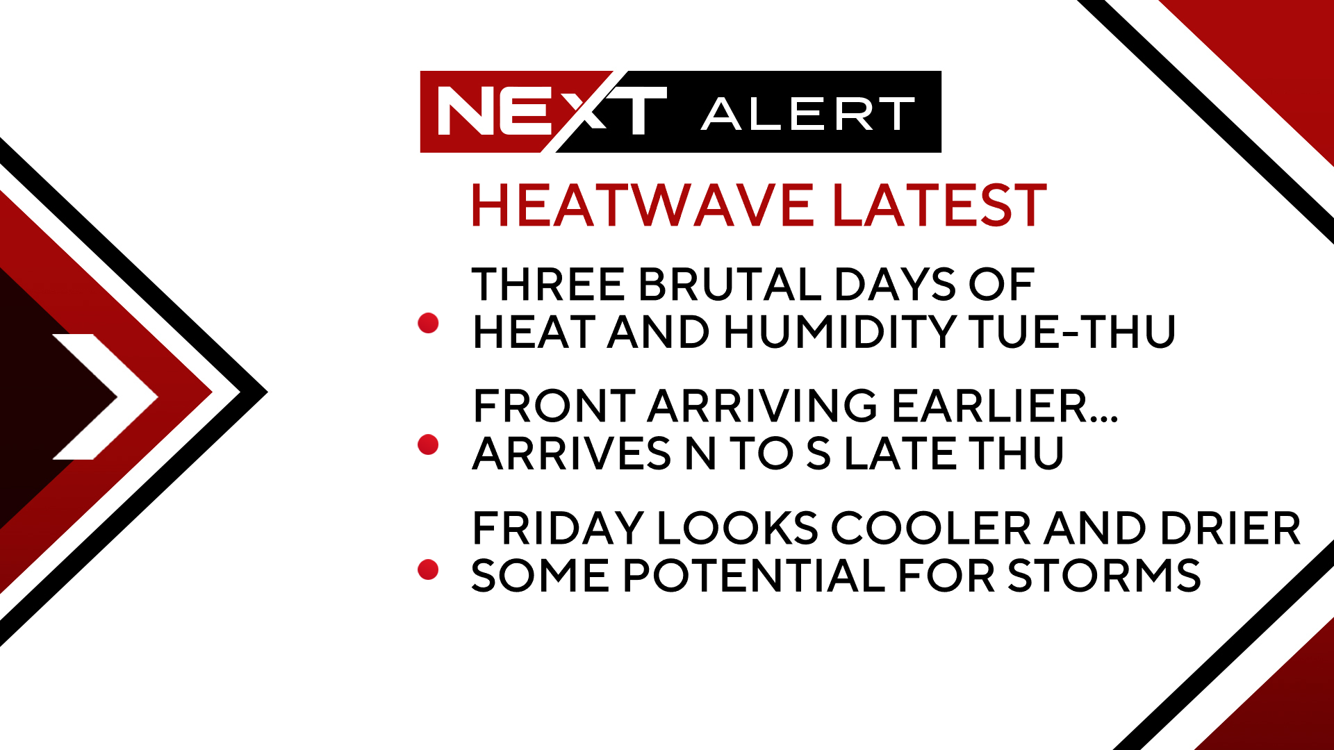
There are some important changes to the forecast today. Models have trended earlier with a cold front later this week which would mean an earlier end to the excessive heat than was forecasted yesterday.
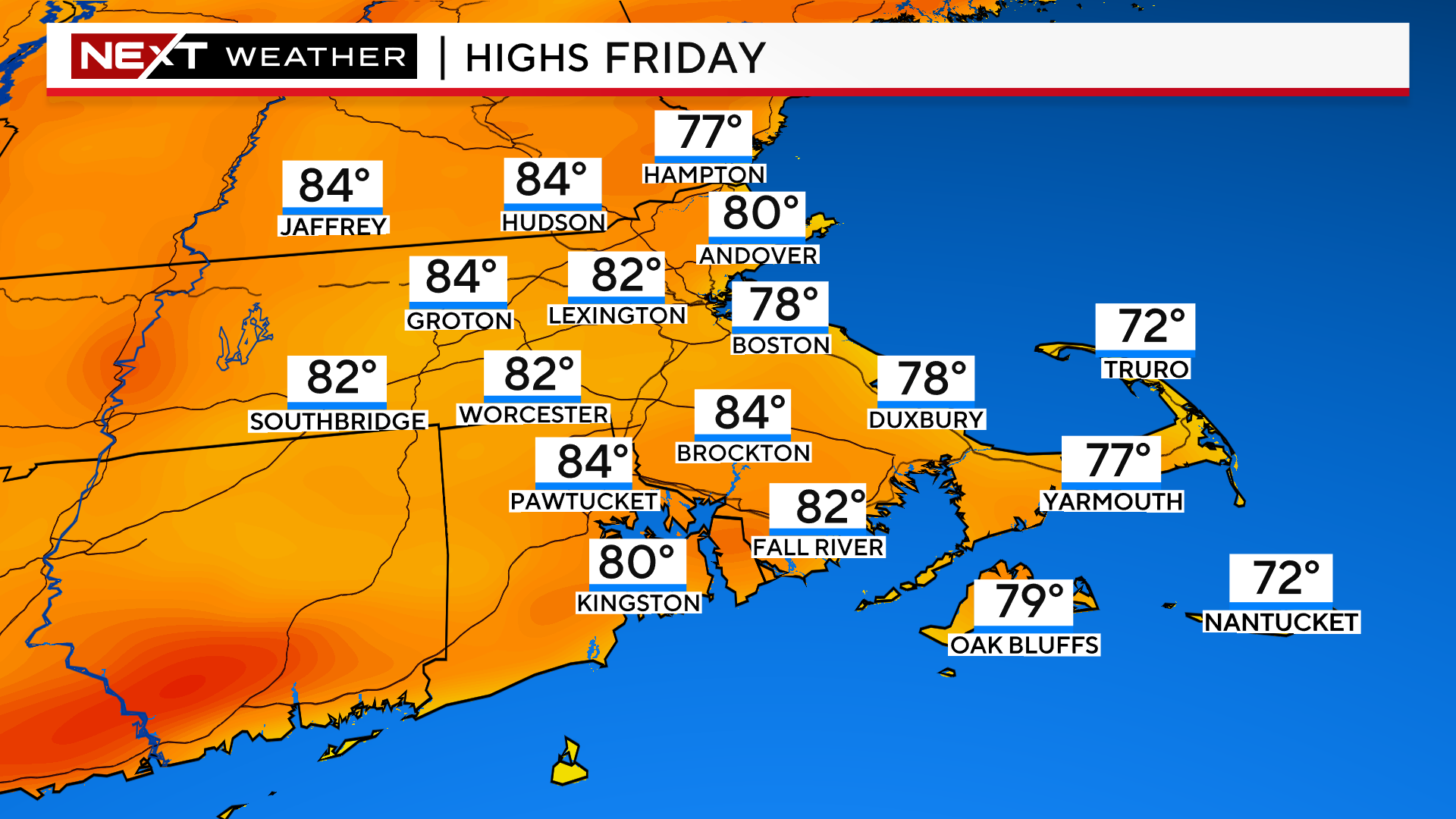
In short, we may now be looking at a 3-day heatwave instead of 4 as Friday may be quite a bit cooler.
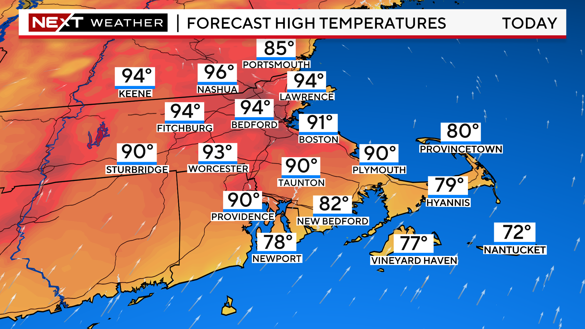
TODAY (Day 1):
The first 90-degree day of the year in Boston. The hottest temperatures will be just to the north and west of the City, peaking in the mid 90s in the Merrimack Valley.
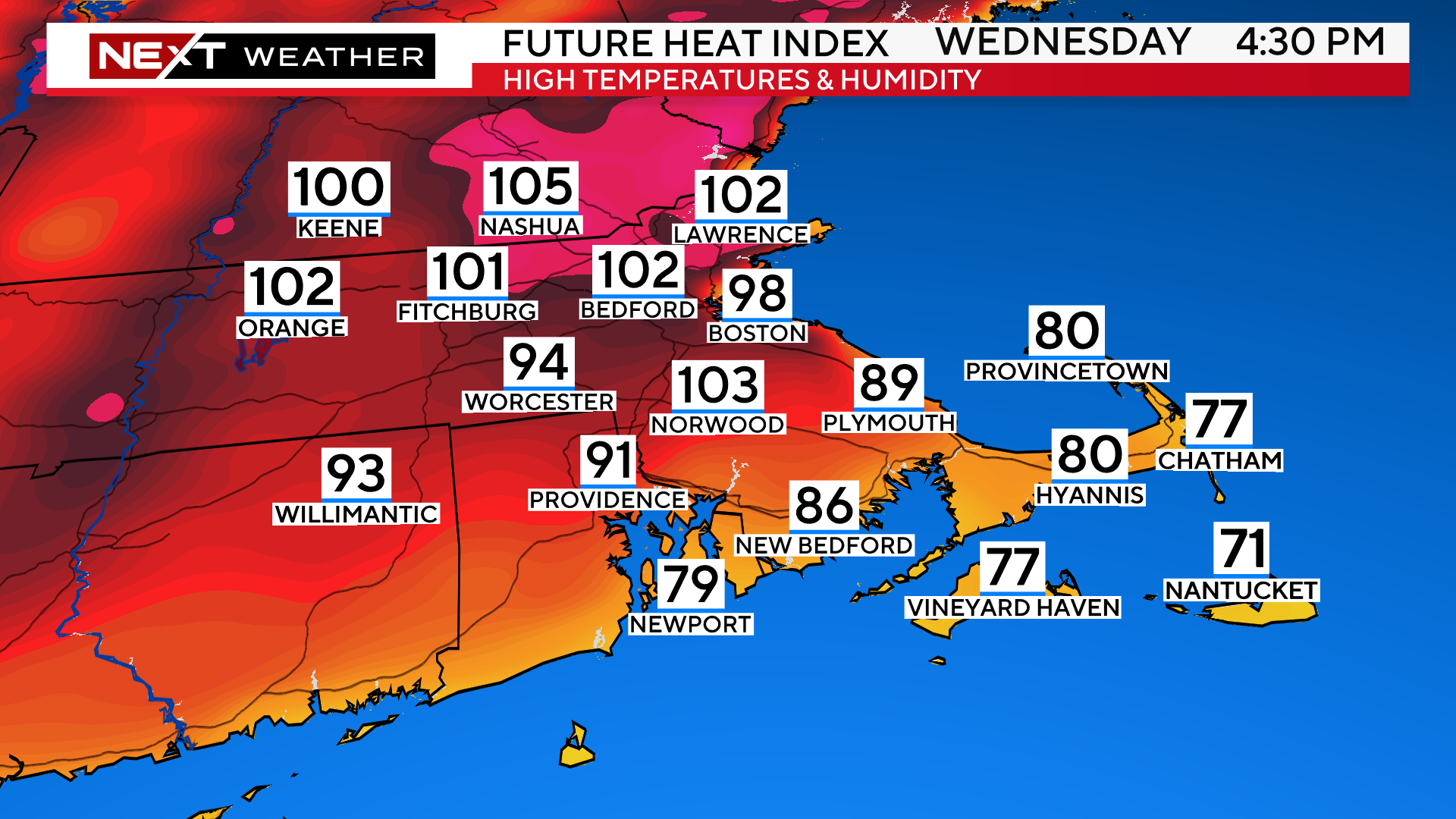
WEDNESDAY (DAY 2):
On average a few degrees hotter than Tuesday with several towns soaring to 95-100 degrees.
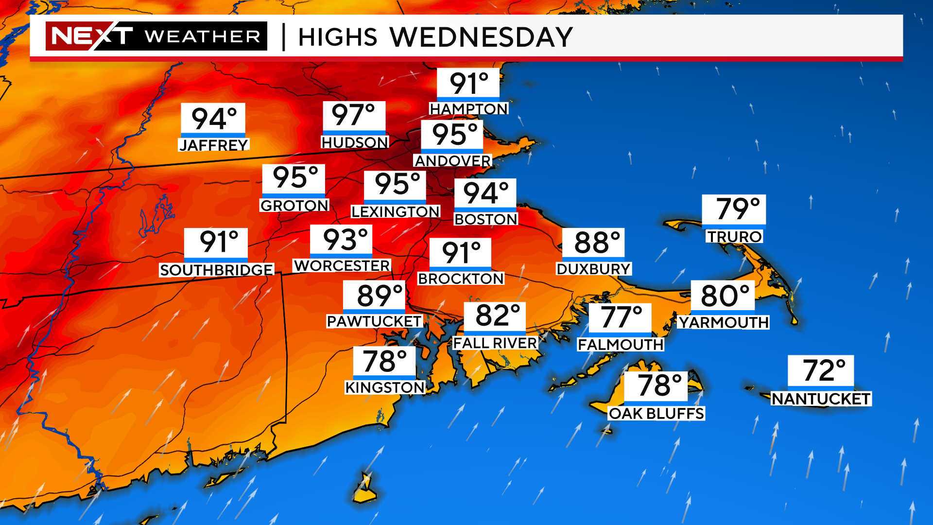
Combine that with very high dewpoints and you get “feels-like” temperatures between 100-105 north and west of Boston.
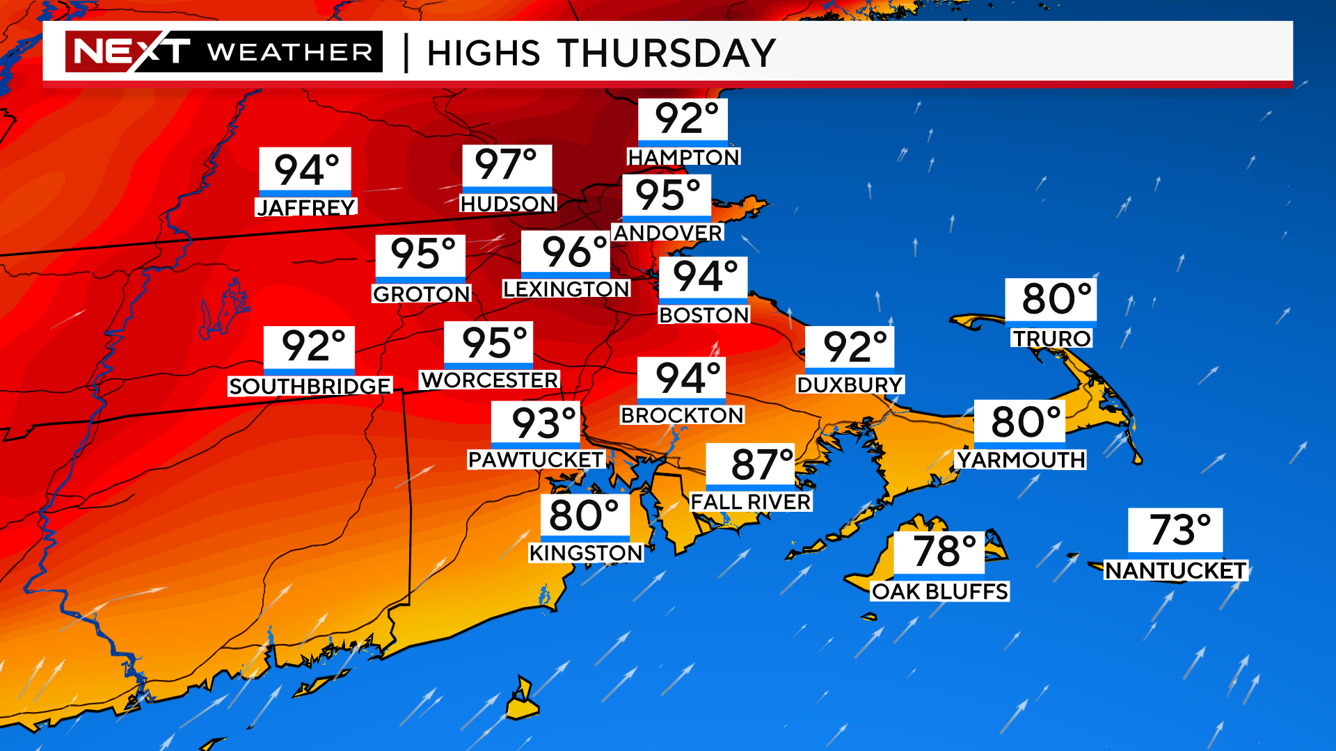
THURSDAY (DAY 3):
High temperatures will be similar to Wednesday. If the cloud cover stays minimal, we would rise a few degrees higher, nearing 100 degrees in some areas.
This is dependent on the timing of a cold front that will be sliding southward from northern New England. If it moves a bit quicker, some cloud cover and a shower threat could hold temperatures back a bit in southern New Hampshire and northern MA.
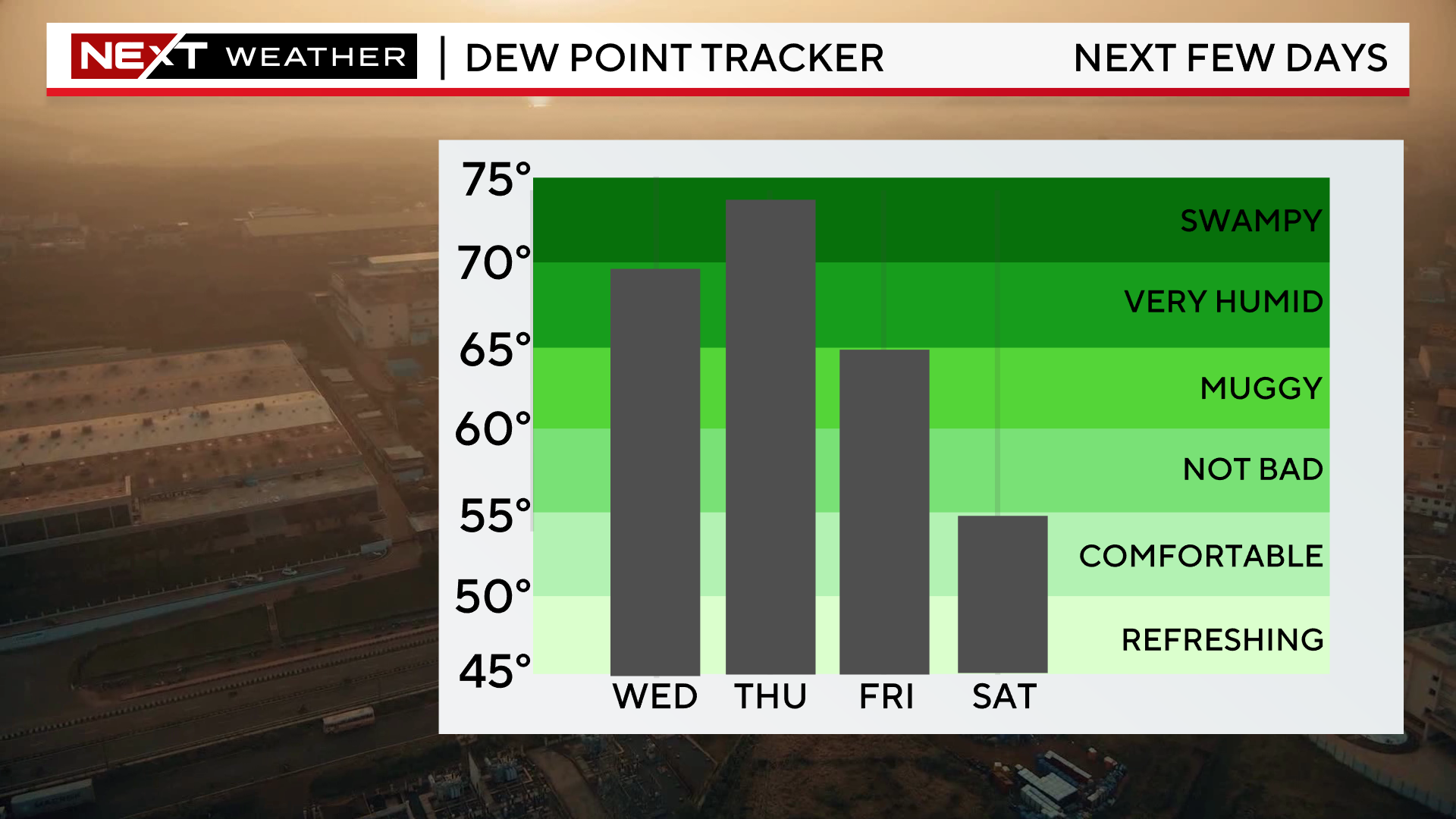
Dewpoints will peak on Thursday topping out in the mid 70s, something rarely seen here in our area.
The air outside will feel like pea soup.
The biggest change in the forecast today is the acceleration of a cold front moving southward Thursday night and Friday morning.
It now appears that most, if not all, of our area will be on the north side of the front during the day Friday (cooler side). Winds will shift from southwest to east-northeast, off the water.
This would also introduce a threat of showers and thunderstorms on Friday in our area.
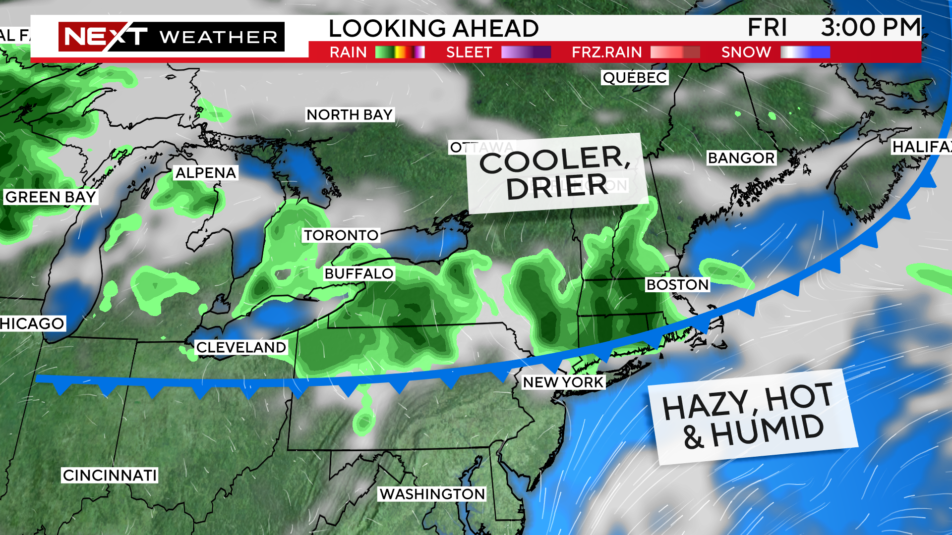
In this case, temperatures would be 10-20 degrees cooler on Friday, likely stuck in the 70s in most of eastern MA.
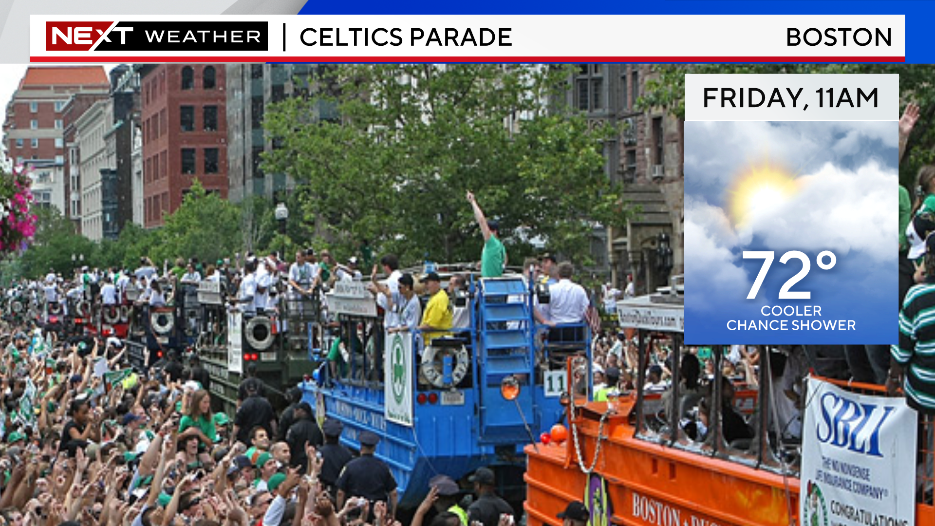
This change in the forecast COULD work out to be ideal for the Celtics parade.
Ultimately this will come down to the timing and location of that cold front, something we are still working out details on…stay tuned to updates in the next 24 hours.
Click here for Westford snow storm data and past totals or select “Winter Snowfall“ under “Pages” on the left hand side.
For more up to date forecast information follow me on Twitter (@terrywbz) or follow the WBZ weather team on Facebook, search WBZWeather
Reader Comments