


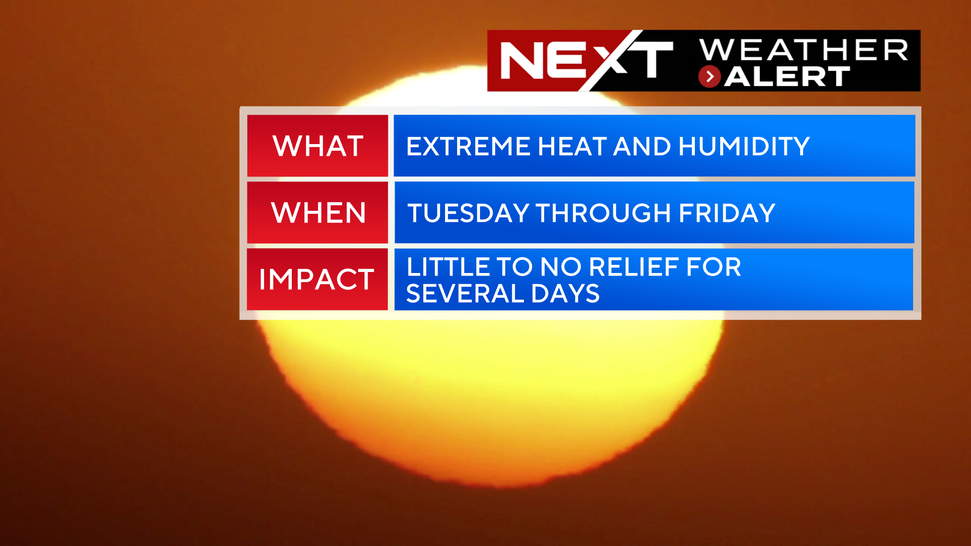
The WBZ Weather Team has issued a NEXT Weather Alert for the entire week ahead.
There is potential for this to be one of the hottest weeks in years and for several records to be shattered.
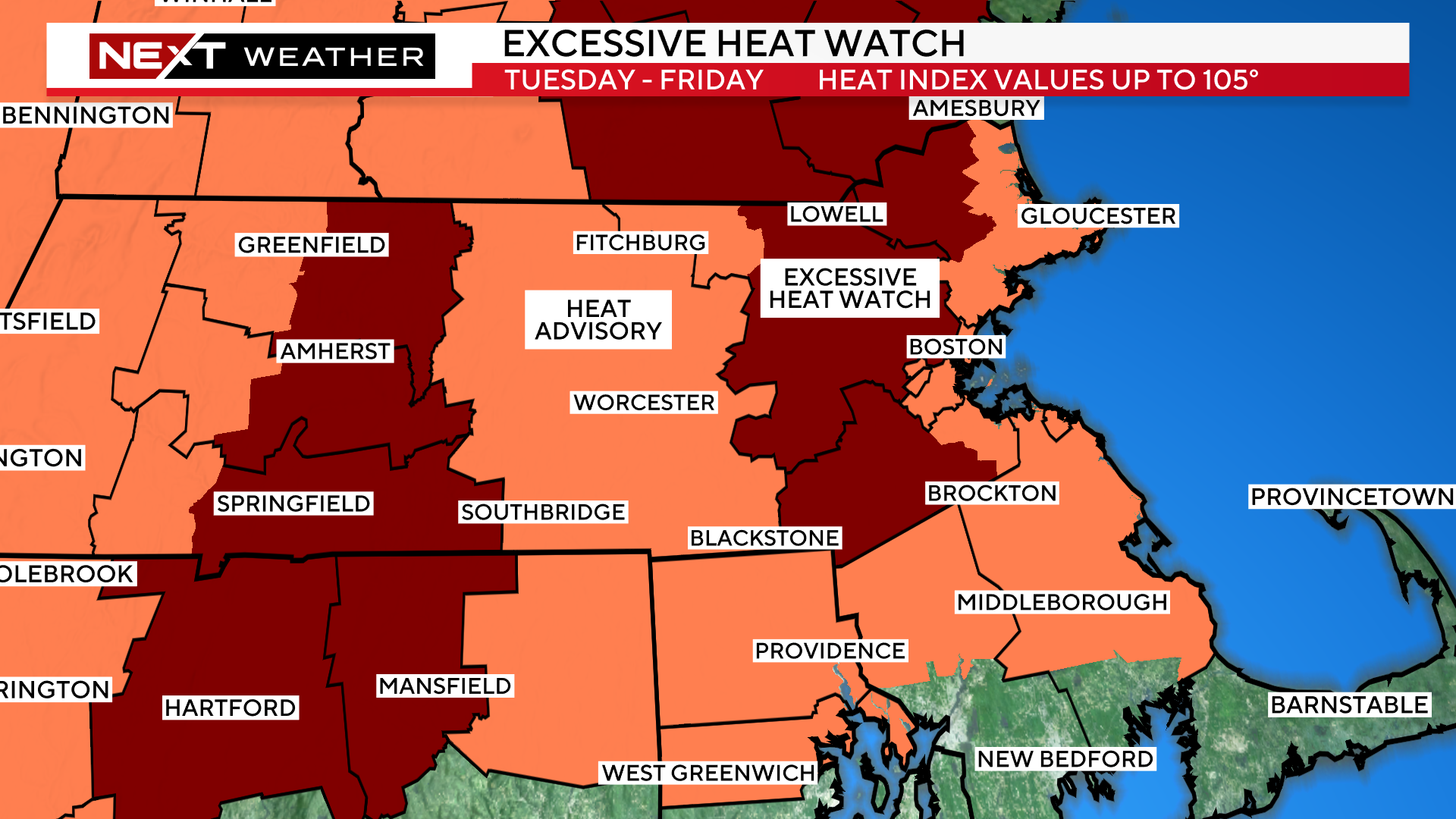
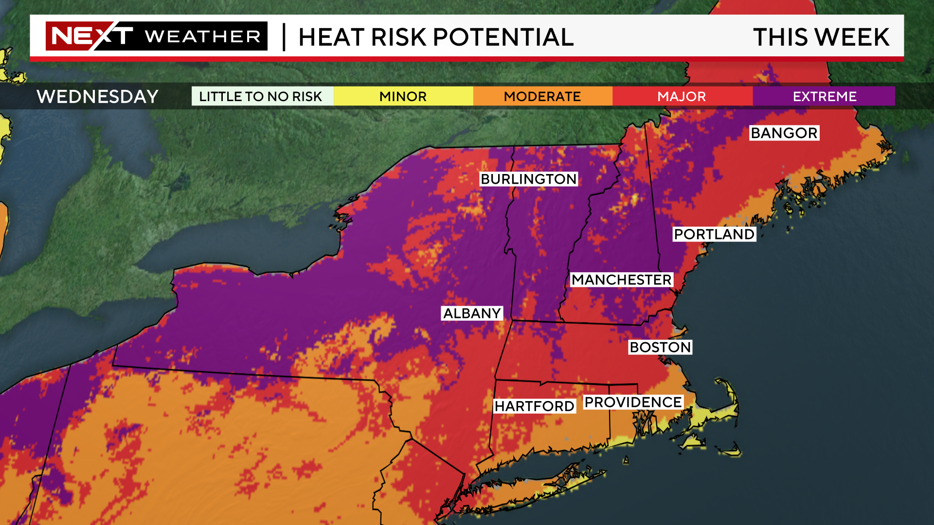
The National Weather Service has issued an Excessive Heat Watch for areas just to the west of Boston including most of Middlesex county and southern New Hampshire.
These are the areas where the heat is expected to be at its absolute peak. Temperatures will be well into the 90s Tuesday through Friday, and it will feel like 105 degrees or higher at times.
This certainly isn’t to say it won’t be very hot and humid outside of those areas.
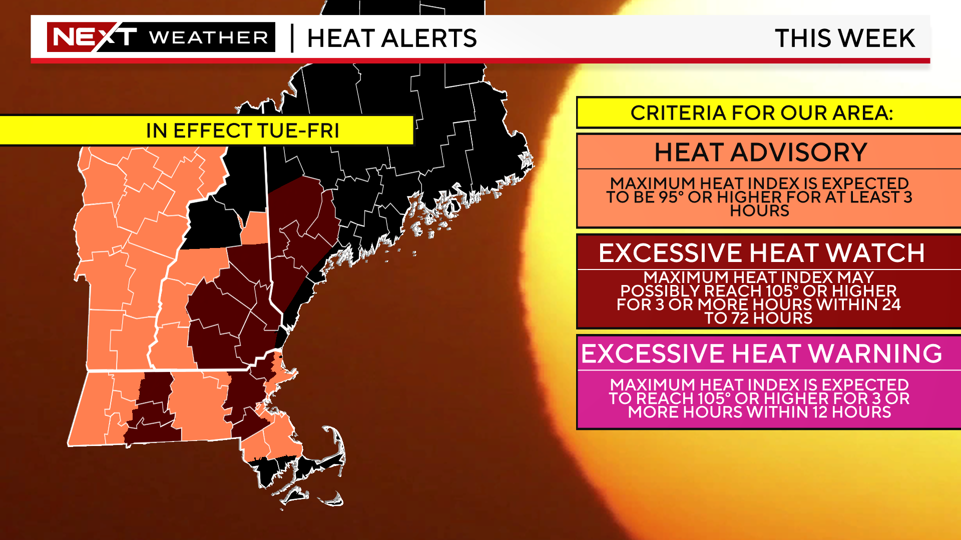
Temperatures will be in the 90s with heat indices near or over 100 in most of southern New England Tuesday through Friday.
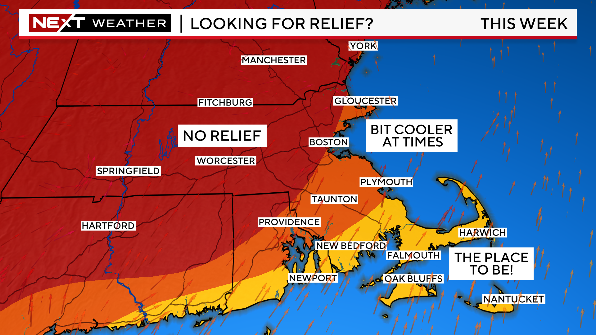
The only relief will be found along the South Coast, Cape and Islands where a persistent, south-southwest wind will bring in some natural air conditioning.
There may be some occasional cooling over Cape Ann and other Coastal areas with intermittent sea breezes.
NOAA’s heat risk outlook has highlighted parts of New England with an “extreme” risk. This is highly rare for our area.
It is defined as “the level of rare and/or long-duration extreme heat with little to no overnight relief…affects anyone without effective cooling and/or adequate hydration. Impacts likely in most health systems, heat-sensitive industries and infrastructure.”
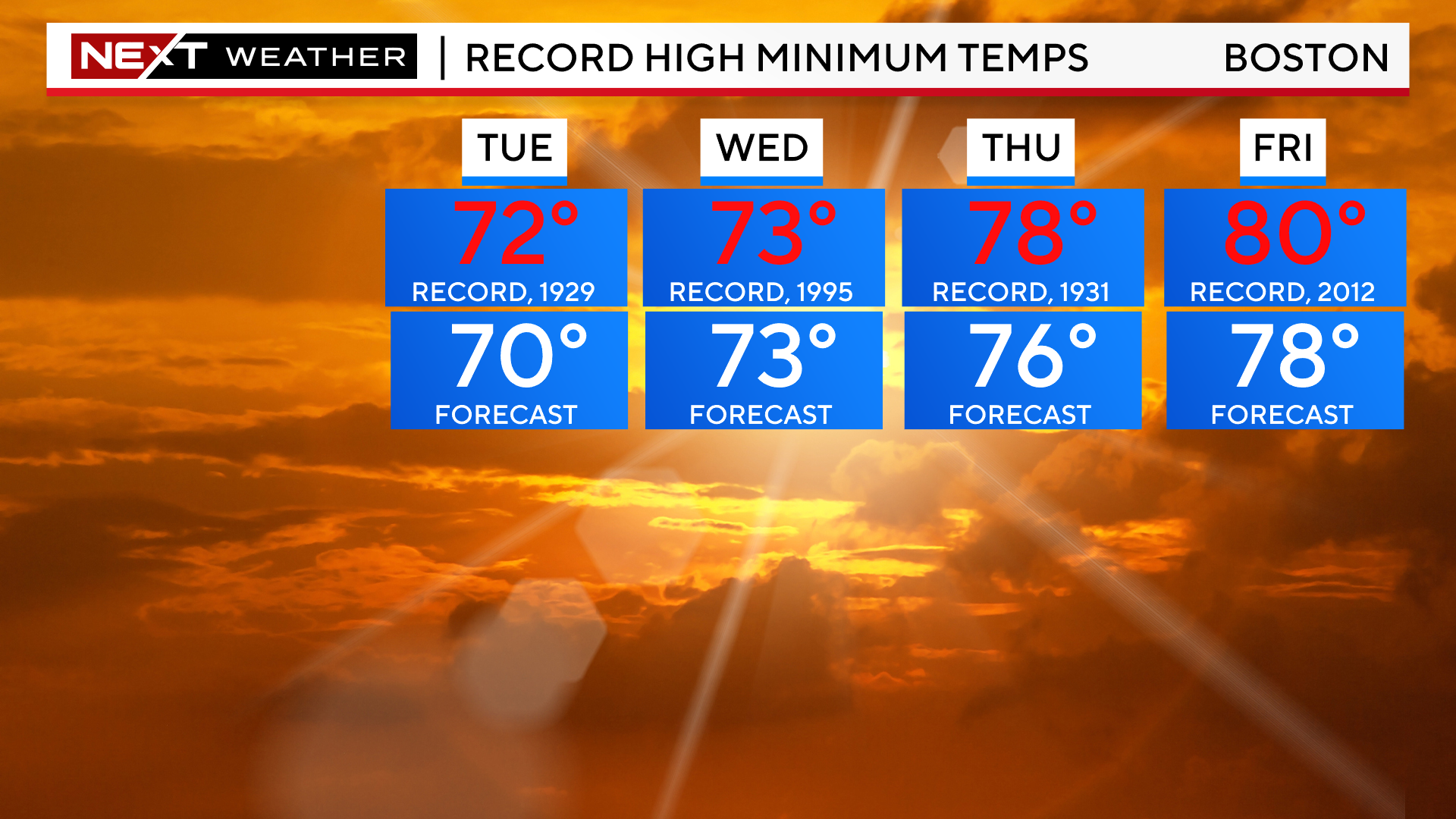
During this heatwave, temperatures will remain quite warm during the overnights, thus not allowing much relief at all.
In the City of Boston, where heat typically remains trapped more readily, overnight lows will remain in the mid to upper 70s for several days, nearing record high mins.
Speaking of records, Boston will also be near several high temperature marks this week. I certainly would not rule out hitting the century mark in and around the City and specifically in the Merrimack Valley and western suburbs.
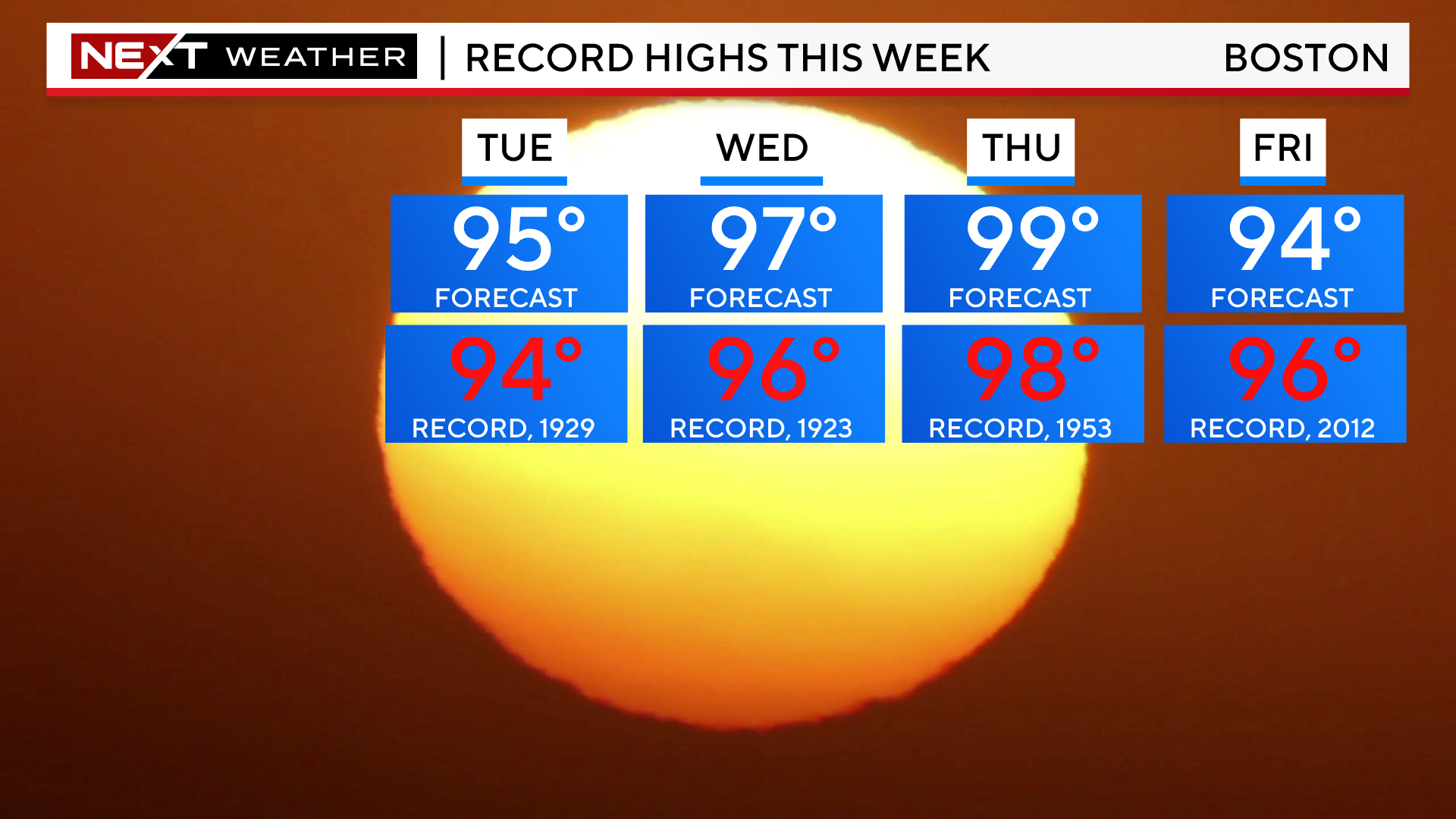
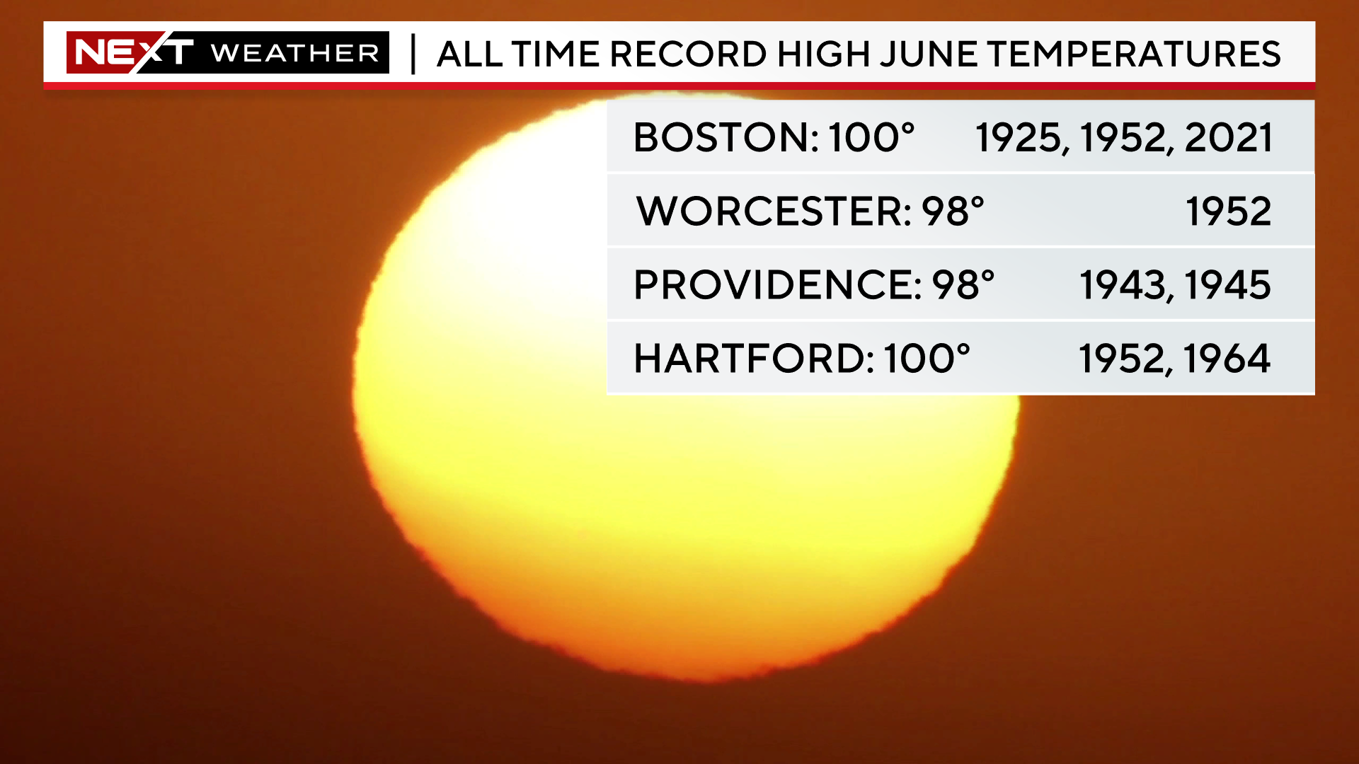
We will challenge some all-time June record highs in the major southern New England cities.
The highest temperature ever recorded in Boston in June is 100 degrees, on three occasions including in 2021.
The most uncomfortable days will be Wednesday and Thursday. It will feel like 100-110 degrees in most of the area during those afternoons.
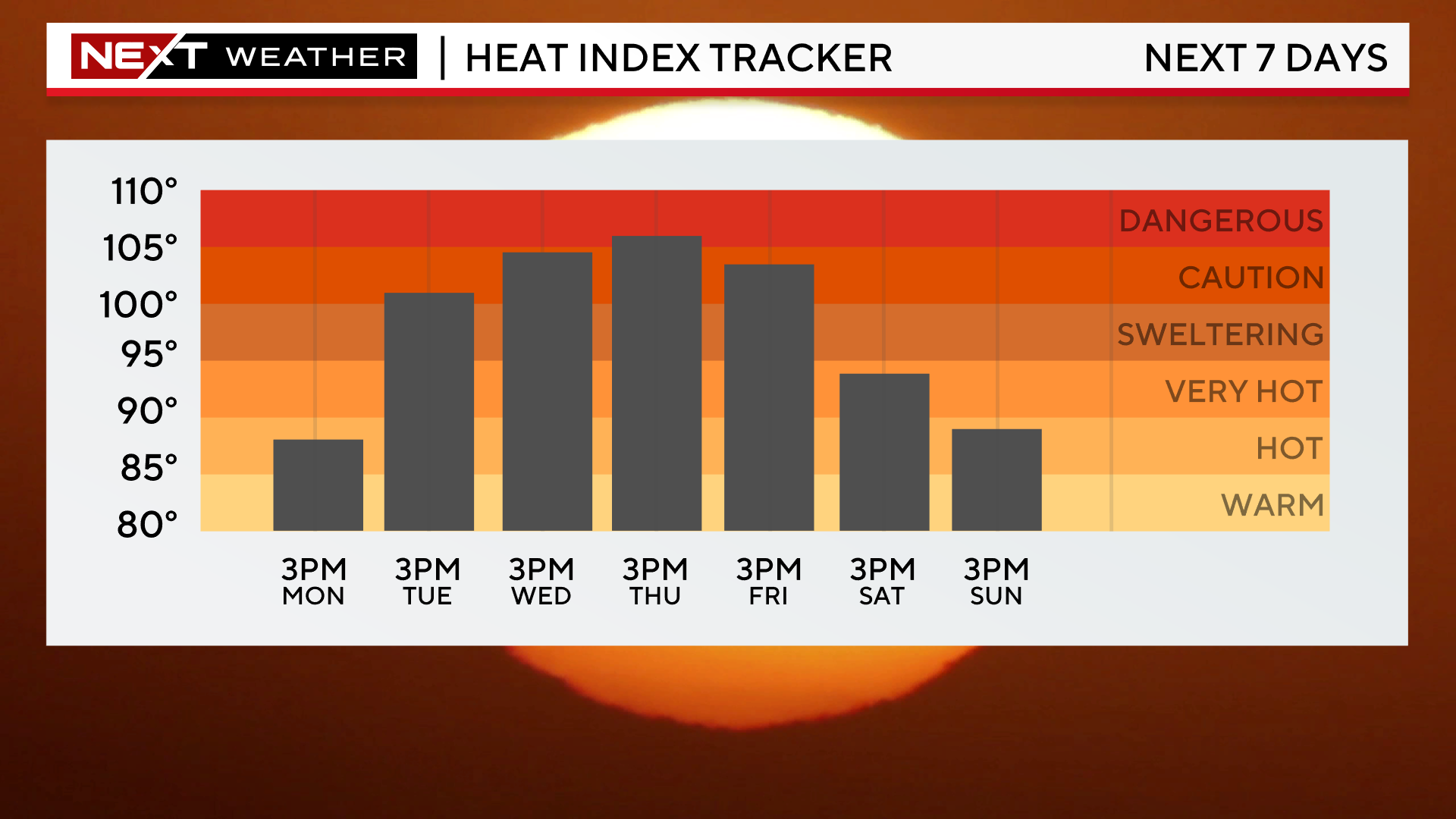
This is just about as hot and extreme as it gets here.
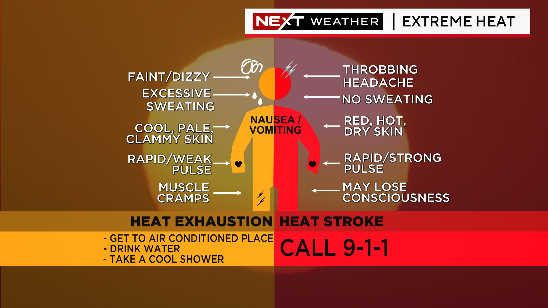
It will be vitally important that those without adequate cooling are monitored for signs of heat exhaustion and heat stroke.
During the peak heat and humidity this week, everyone should try to limit their time spent outdoors, especially in full sunshine.
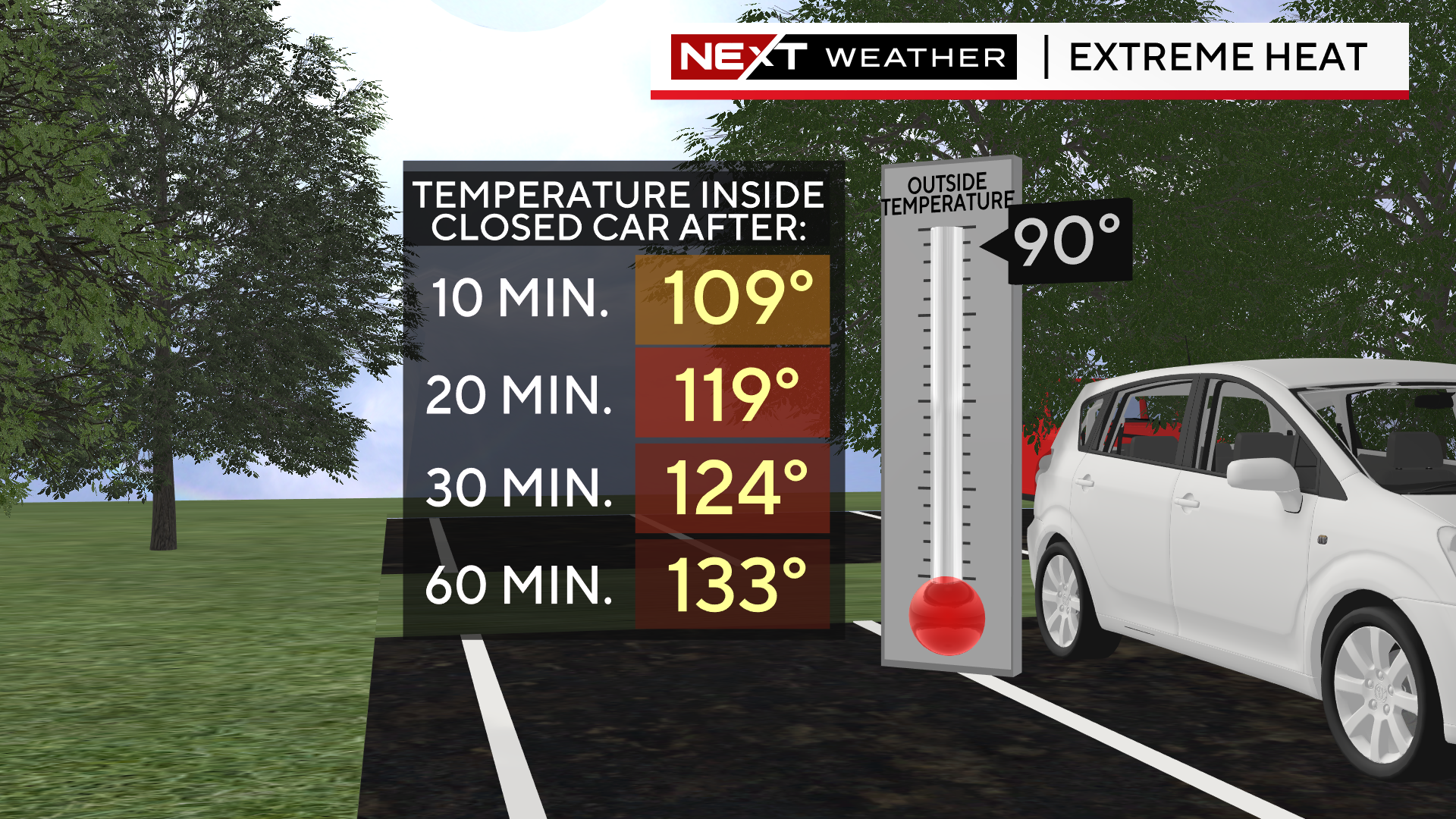
And, of course, don’t forget your pets! Certainly, do not leave them in the car. With an outdoor temperature of 90 degrees, temperatures inside the car rise very rapidly.
Nowadays, any time we have a particularly rare or noteworthy weather event, it seems that we feel the need to label it with a fancy weather term.
You certainly recall some of the most infamous from recent years…
Bombogenesis…
Polar Vortex…
Snowmageddon…
I can remember back in the day when “El Nino” first exploded into the public vernacular. Over the last few decades, you have learned all sorts of wacky, buzz-worthy meteorological terms.
Well, time for one more…The weather term of the week is “heat dome”.
You won’t find this one in the National Weather Service glossary. Honestly, I don’t really know who was the first to coin the phrase and at this point it doesn’t matter. The beast has been unleashed.
Typically, this is a term most used/heard in the southwestern United States during some of their more excessive heat waves. This week, the heat dome has moved to the East Coast.
So, what is a heat dome?
This one is pretty simple.
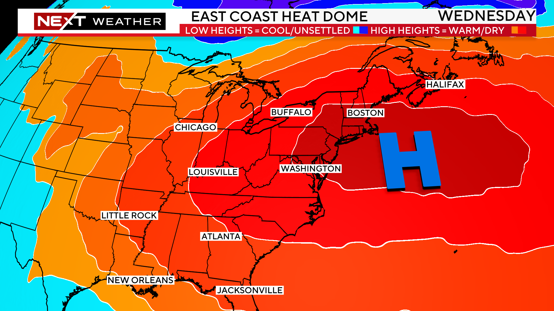
Essentially, all you need is a large area of high pressure (that big, blue H on the weather map) that is semi-stationary over several days during the warm season.
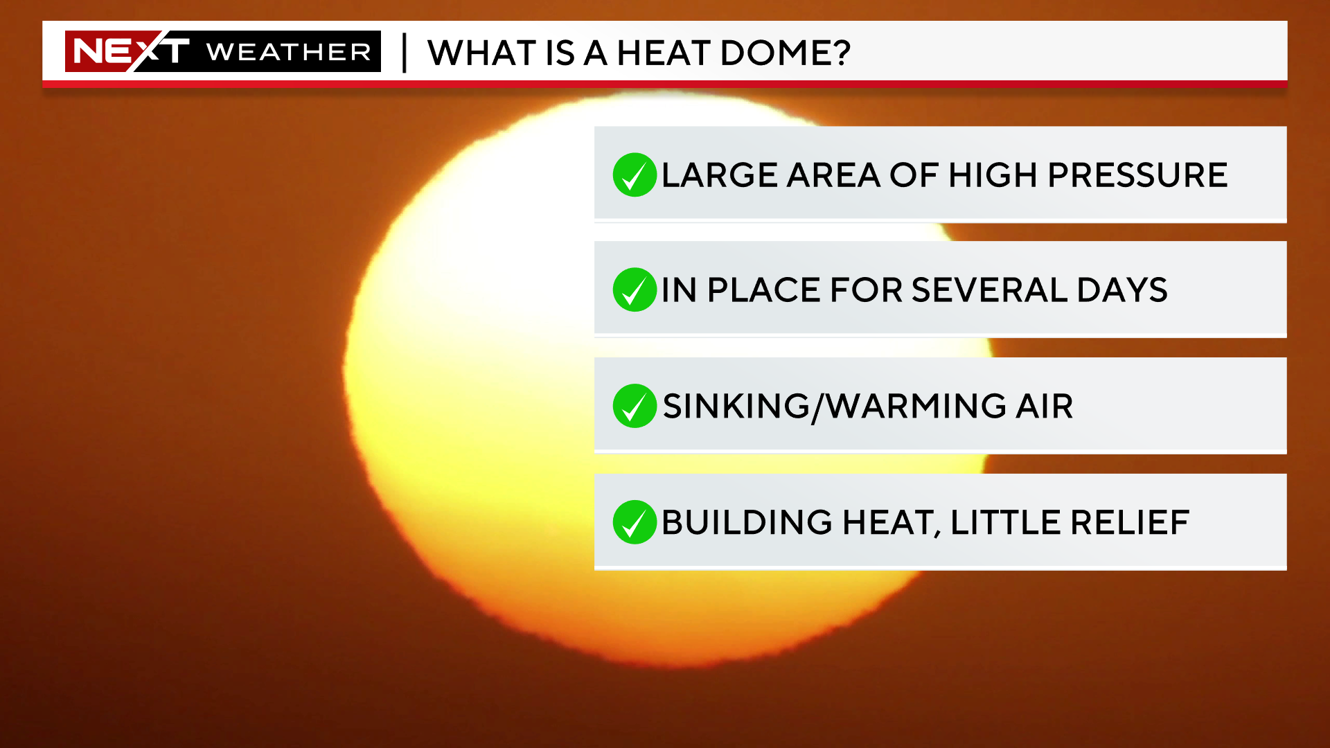
Picture a large dome in the atmosphere above the northeastern United States. It isn’t something you can see, but the pressures at upper levels are much higher than what is typical or average.
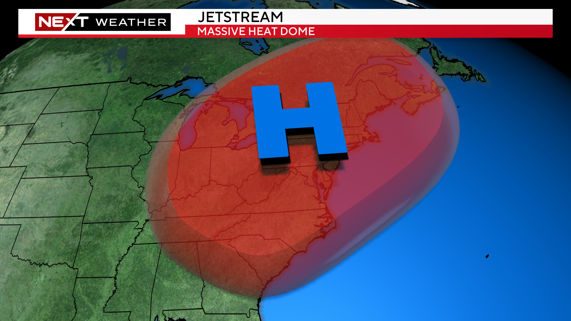
Underneath this high-pressure dome (where we live), air is sinking from up above to the ground level. When air sinks, a few things occur.
-It creates a very stable atmosphere, meaning very few clouds and rain showers
-It also compresses as it sinks, making it warmer and warmer…warm air naturally rises, and as it rises, it hits the “dome” and then is forced downward again, further warming it
-The airmass also often becomes very stagnant, thereby worsening air quality
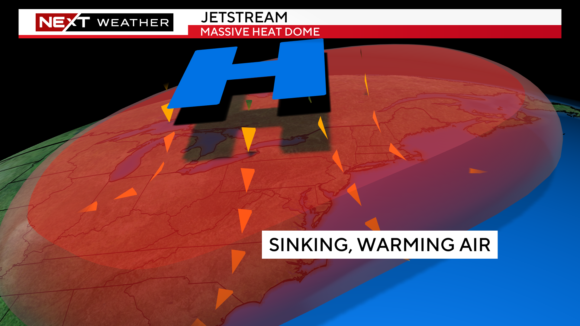
This will be our pattern for the next several days. The center and placement of this heat dome will be in the perfect location for some of the most excessive heat to be in the northeast, right over New England.
Peak conditions will occur Wednesday and Thursday.
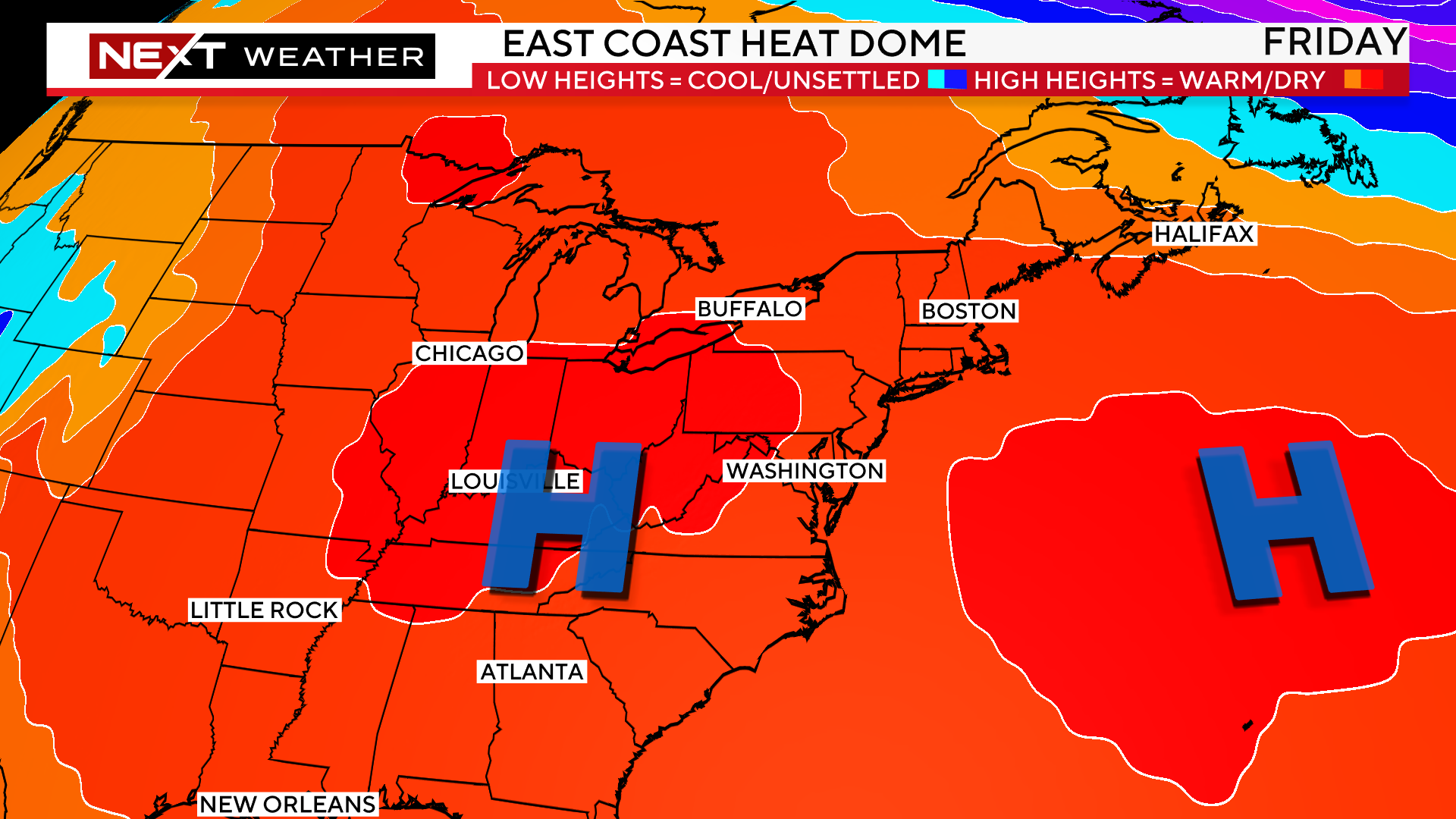
By Friday, the dome-pattern will begin to break down, splitting into two separate high-pressure centers.
This will be the beginning of the end of our heat wave, bringing some “cooler” temperatures and a risk of storms by Friday night and the Weekend.
Click here for Westford snow storm data and past totals or select “Winter Snowfall“ under “Pages” on the left hand side.
For more up to date forecast information follow me on Twitter (@terrywbz) or follow the WBZ weather team on Facebook, search WBZWeather
Reader Comments