


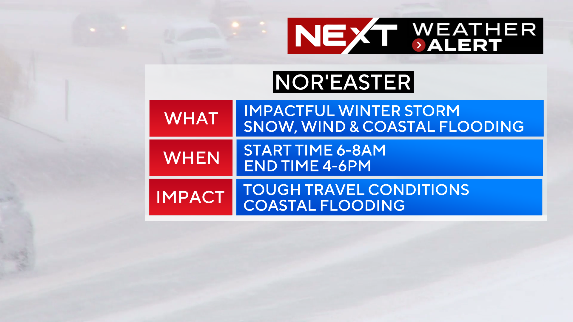
A messy Tuesday on the way…quick hitting nor’easter will bring widespread, plowable snowfall and significant coastal flooding.
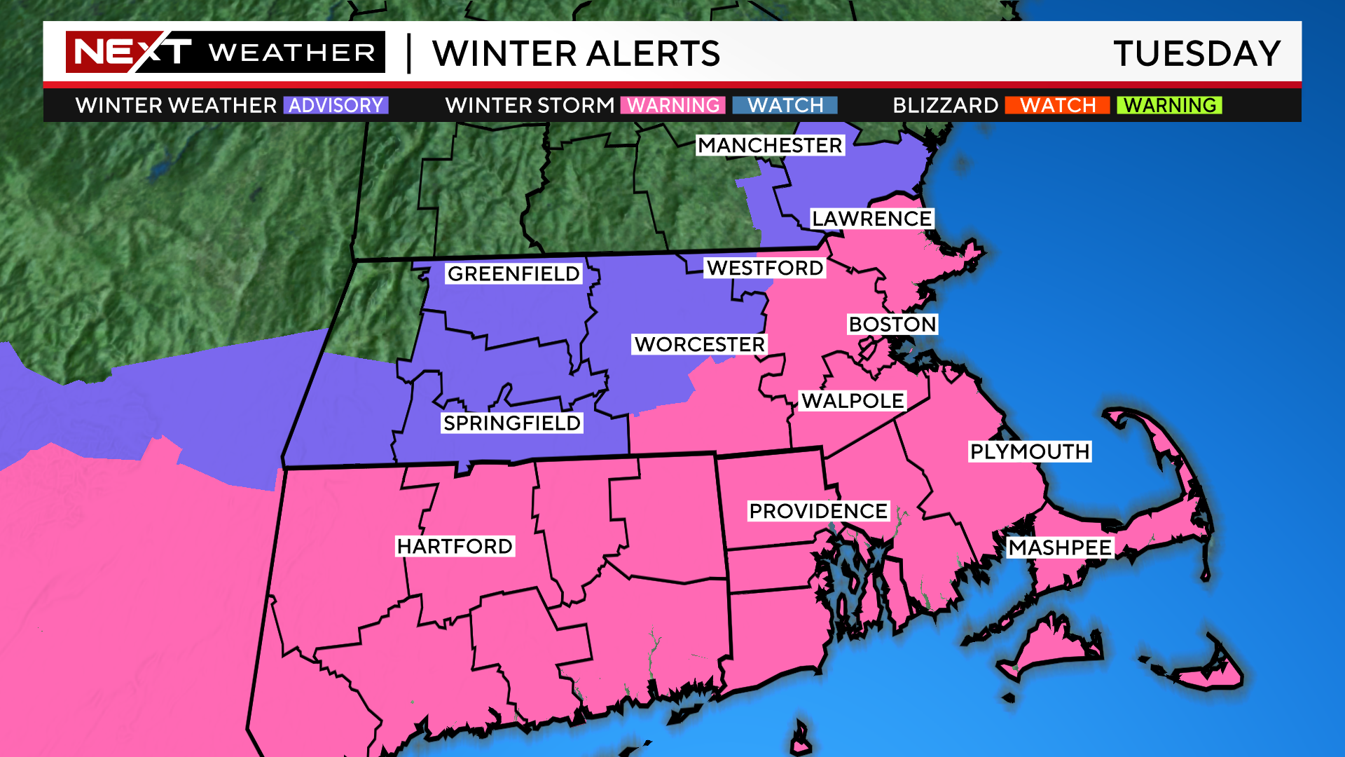
The heaviest snowfall potential has shifted slightly south over the last 24 hours. This has prompted the National Weather Service to extend the Winter Storm Warnings southward to include Bristol and Plymouth counties in southeastern Massachusetts.
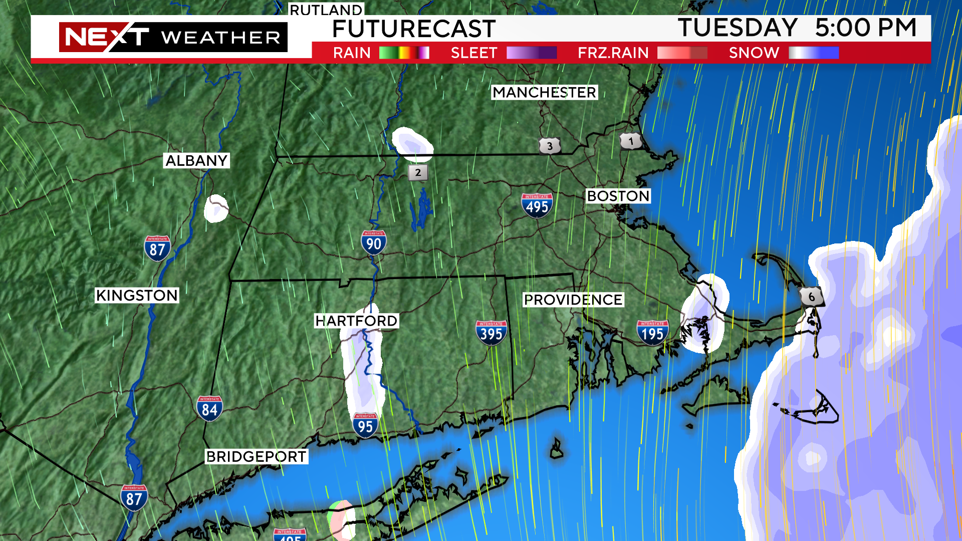
TIMELINE:
Another significant change has been for the snow to start a bit later than originally thought.
Expected start times:
South of the Pike: 5-7am
Boston area: 6-8am
North of Pike, through MA/NH border: 7-9am
It will likely start as a brief period of rain across eastern MA and then change to snow as the intensity increases (within the first few hours).
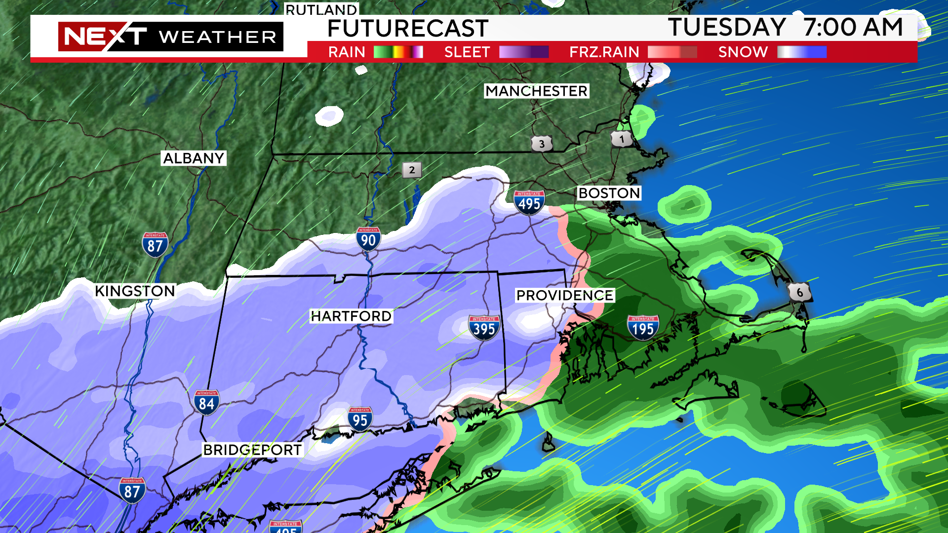
The storm will be a very fast mover.
The heaviest snow will fall between 9am-3pm.
It will come down very heavily during this timeframe, with as much as 1-3″ per hour in some of the heavier bands over southeastern MA.
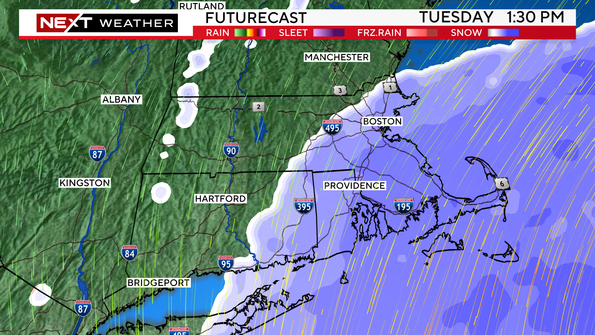
Final Flakes:
Western/Central MA: 1-3pm
Eastern MA, including Boston: 3-5pm
Cape Cod: 5-7pm
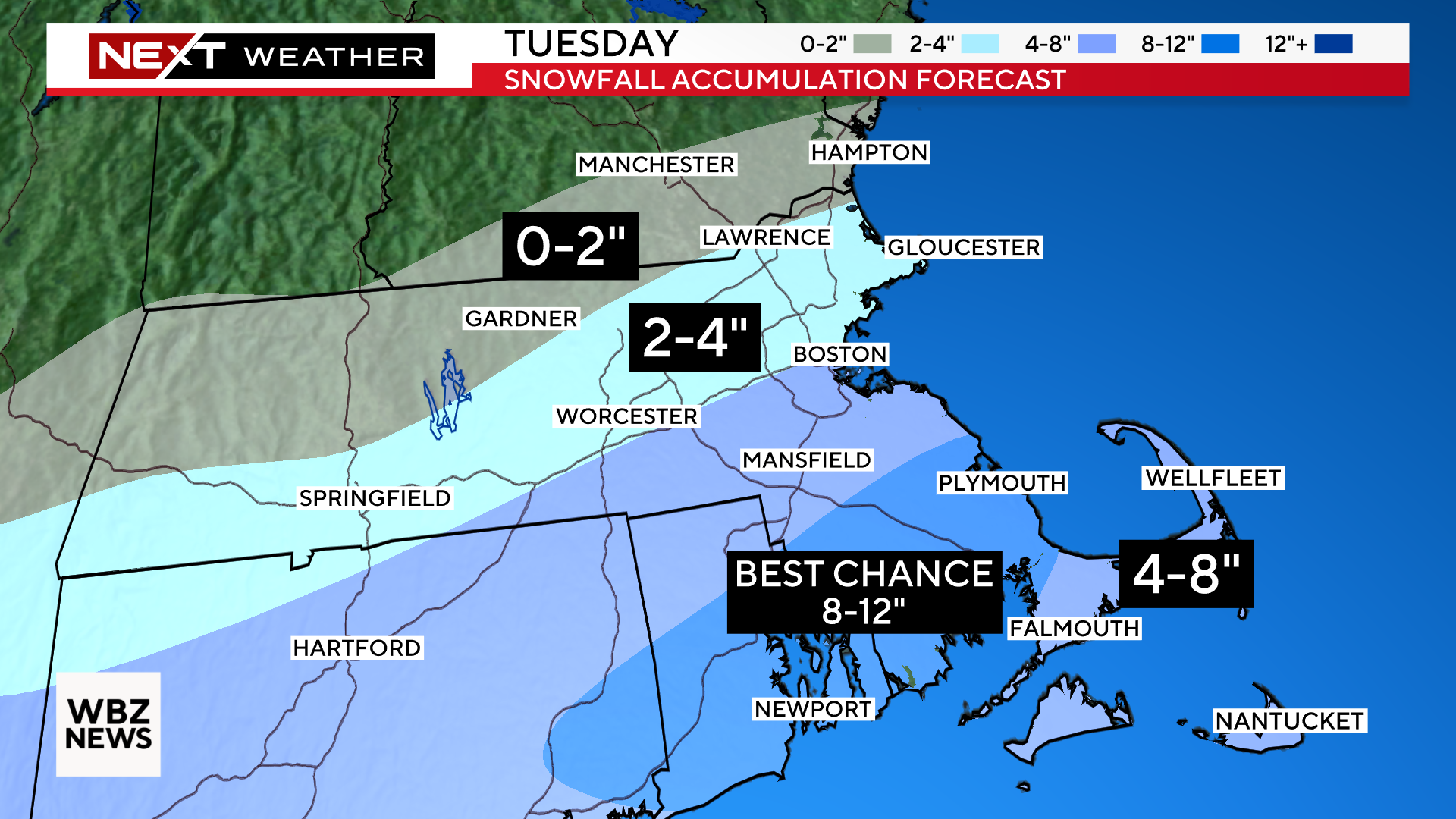
HOW MUCH?
Snowfall totals have also shifted south today…
4-8″ From Boston, Worcester and the Mass Pike southward through Cape Cod and the Islands. This includes all of southeastern MA.
2-4″ Just north of the Pike up through 495 including northern Middlesex county and Essex county.
0-2″ Near the MA/NH border, northern Worcester county and western MA.
The best chance for more than 8″ will be from Plymouth to Providence and areas south to the South Coast and Upper Cape. This is where the most intense bands of snow will be during the day Tuesday.
WIND:
Highest wind gusts will be over the Cape and Islands on Tuesday. In these areas, northeast to northerly winds will gust as high as 45-55mph.
Along the rest of the Coastline, we anticipate gusts peaking between 30-45mph.
Inland areas will have less wind with gusts 20-30mph.
Not expecting widespread power outages however, with the weight of the wet snow combined with the strong winds, there may be some scattered loss of power in eastern MA.
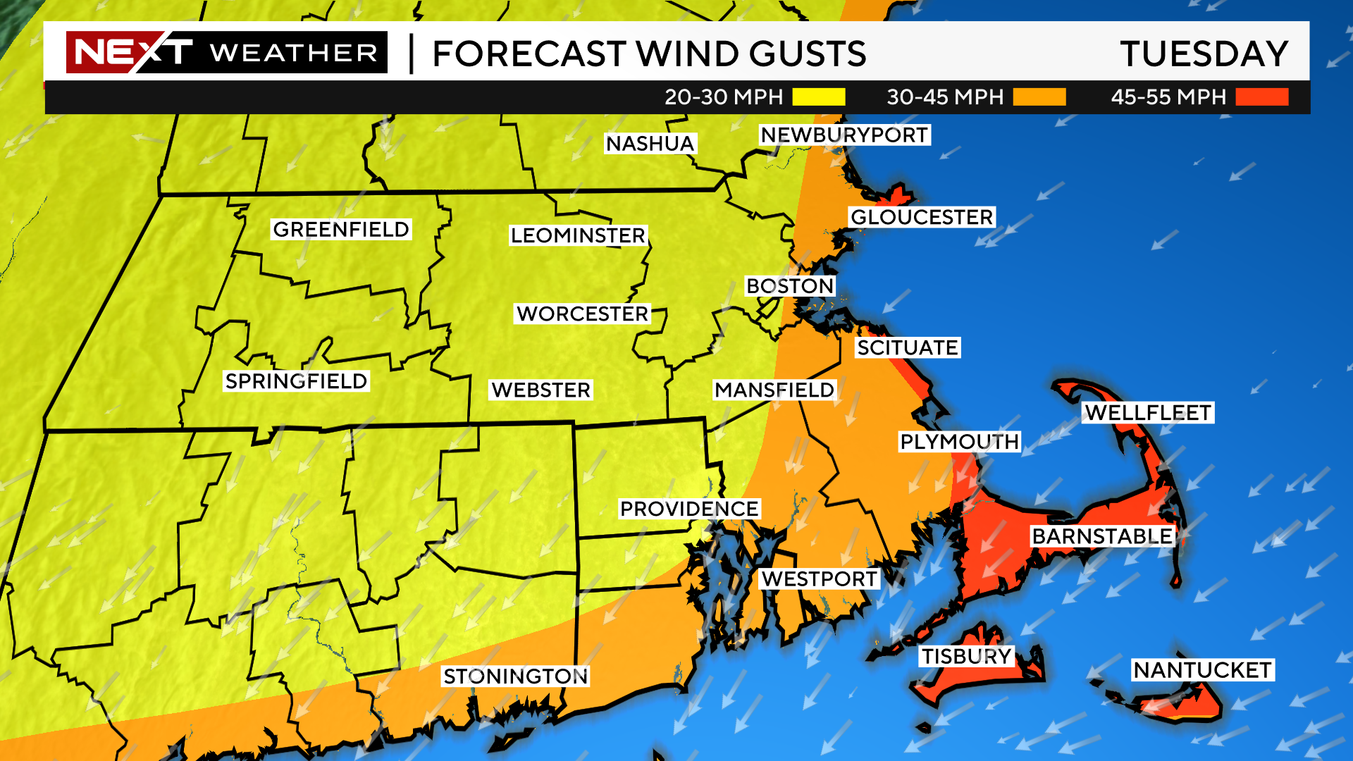
The winds will peak from about midday through evening on Tuesday. There will be a gradual tapering Tuesday night however, the winds will remain busy/gusty right through Wednesday.
FLASH FREEZE
During Tuesday afternoon, the winds will turn more northerly, thus drawing down colder air across eastern MA. Temperatures will drop 5-10 degrees in a short period of time.
Coastal areas that had been above freezing Tuesday morning will drop below freezing causing any untreated surfaces to ice up.
This will occur from north to south…early afternoon along the North Shore and through Boston and late afternoon/evening along the South Shore and through the Cape.
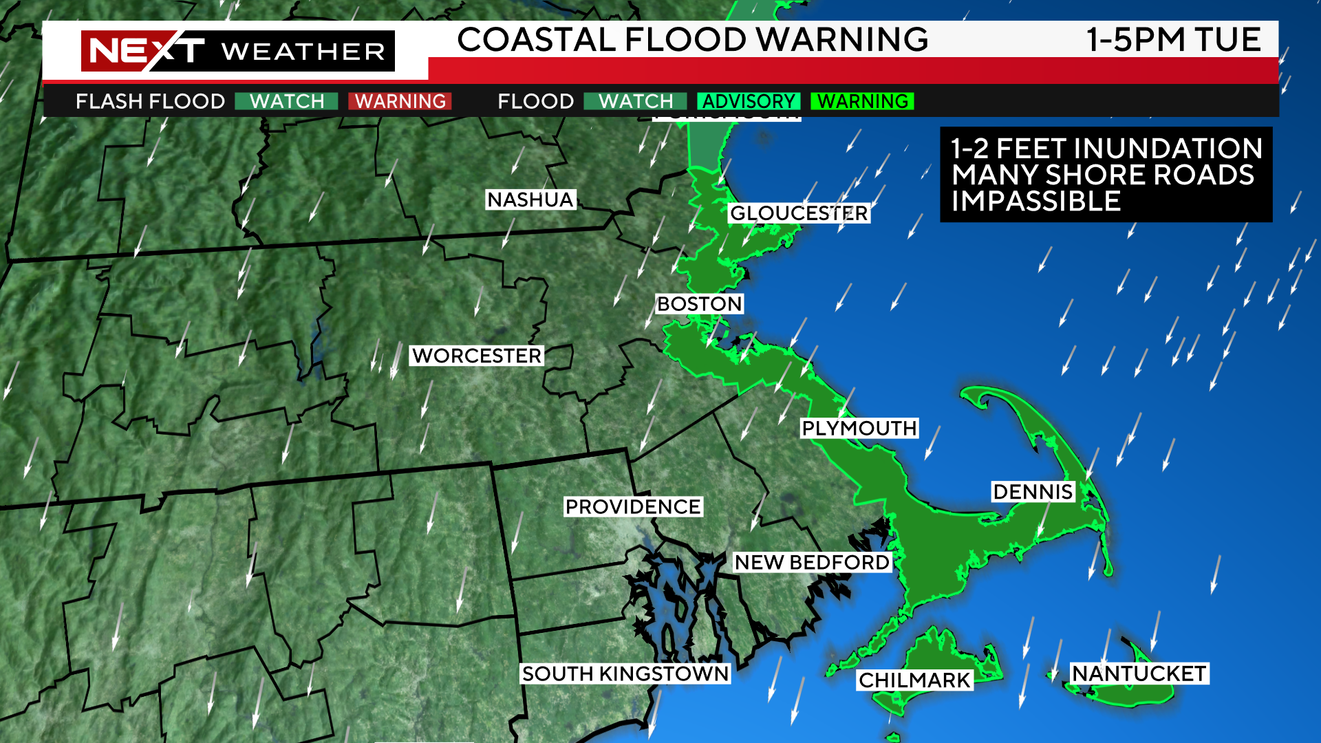
COASTAL FLOODING
There is a coastal flood warning posted for the Tuesday afternoon high tide cycle.
We are currently in one of the highest tide cycles for 2024. They will be coming off their peak levels on Tuesday but, still will be quite high.
Combine this fact with a strong northeast wind on Tuesday and we expect widespread minor to moderate coastal flooding.
There will likely be 1-2 feet of inundation over all the typical, flood prone coastal roadways.
This flooding will peak between Noon and 4pm Tuesday.
Finally, we expect some additional coastal flooding again during the early morning high tide on Wednesday (between 1-4am). The winds will have shifted offshore by then so, much of the flooding Wednesday should be minor.
WHAT’S NEXT
Looks like winter is here to stay a while.
Temperatures will be below average for the remainder of the week.
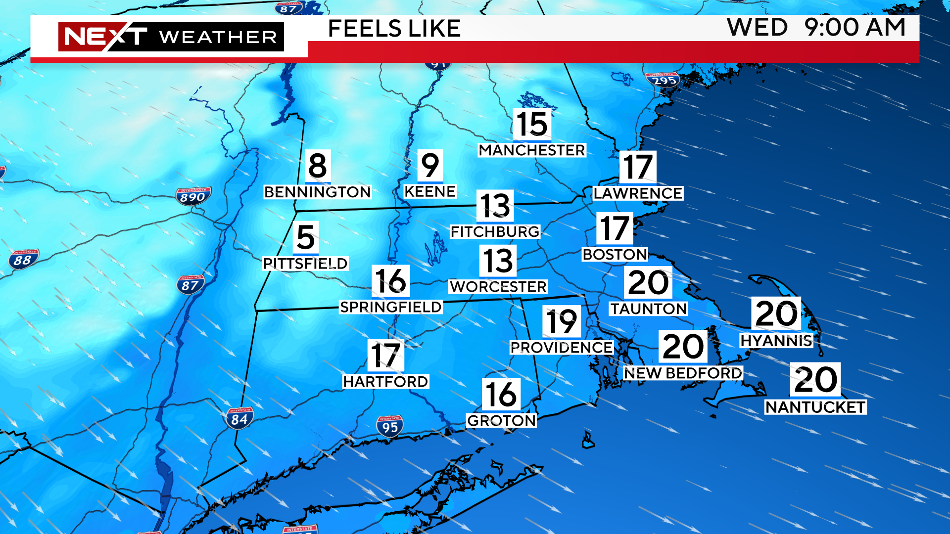
Wind chills will be in the single digits and teens Wednesday morning and air temperatures will struggle to bet back to the freezing mark Wednesday and Thursday afternoons.
There may be some additional light snow Thursday night.
Right now, this does not look like a major storm but something to keep an eye on over the next few days.
Click here for Westford snow storm data and past totals or select “Winter Snowfall“ under “Pages” on the left hand side.
For more up to date forecast information follow me on Twitter (@terrywbz) or follow the WBZ weather team on Facebook, search WBZWeather
Reader Comments