


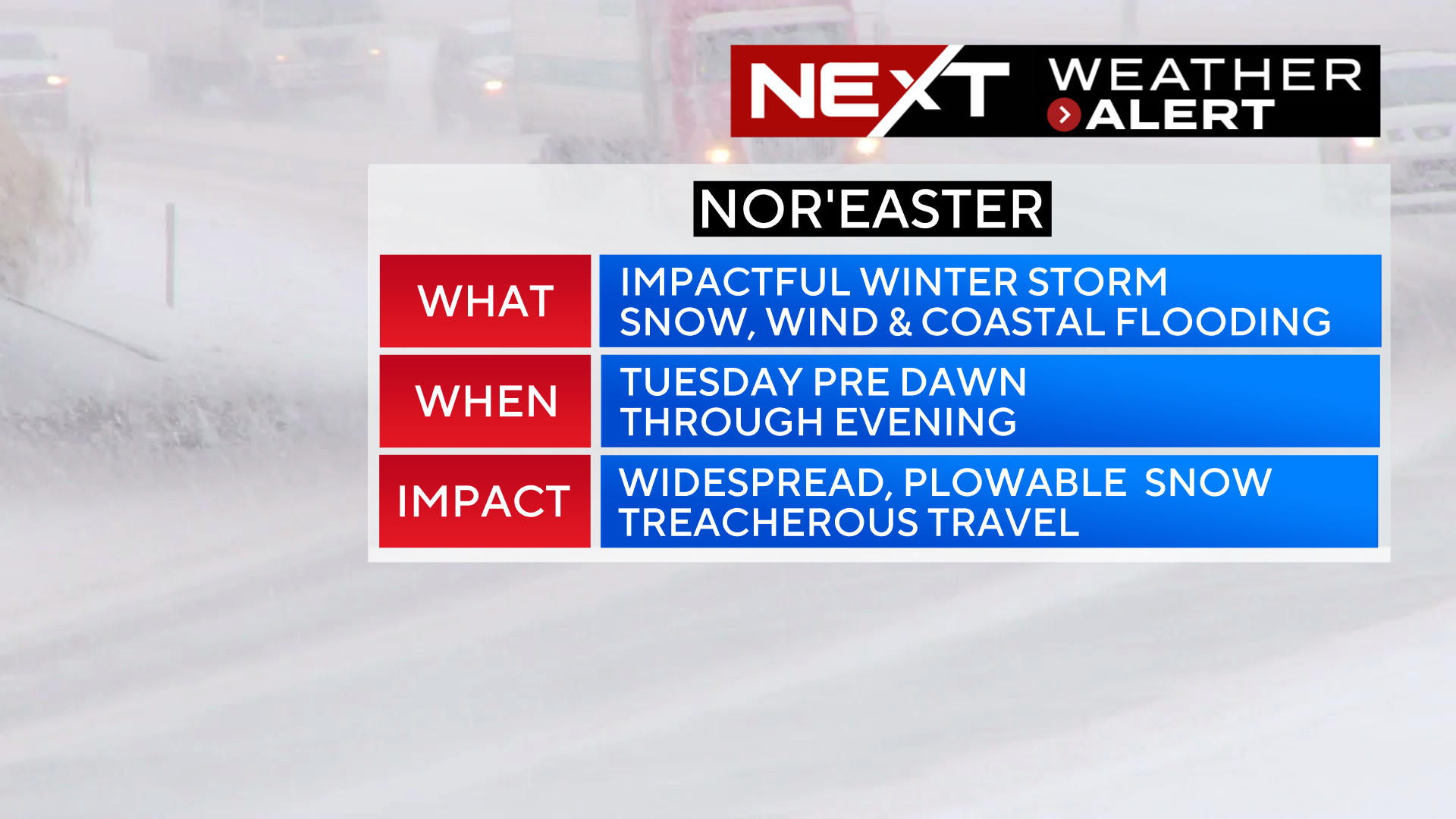
The WBZ Weather Team has issued a NEXT Weather Alert for a highly impactful nor’easter headed our way on Tuesday.
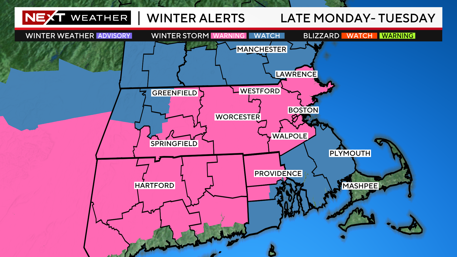
The National Weather Service has also issued winter storm warnings for most of interior Massachusetts.
Winter is about to make a serious comeback. After a record-breaking warm weekend and a rampant spread of spring fever, we now turn our attention to an approaching winter storm.
TIMELINE:
The precipitation arrives after midnight on Monday. Surface temperatures will initially be rather mild so, it will likely start as rain across far eastern and southeastern MA. By 5am, it will be snowing across most of southern New England with rain gradually changing to wet snow along the immediate Coastline.

Once the rain changes to snow it will come down very heavily on Tuesday morning. The brunt of the storm and majority of the snow accumulation will occur between 7am-4pm Tuesday. Snowfall rates of 1-2″ per hour are likely in some of the heavier bands that develop. Highways will quickly become snow-covered, and travel will be quite slippery/treacherous during both the Tuesday AM and PM commutes.
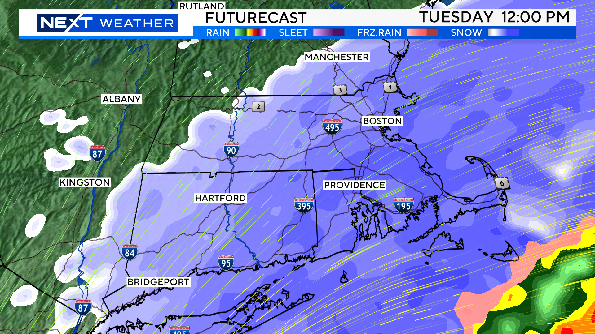
The snow will taper off from west to east late Tuesday afternoon and evening. Final flakes in western and Central MA fall between 1-4pm.
Across eastern MA, the snow will taper off between 4-7p.
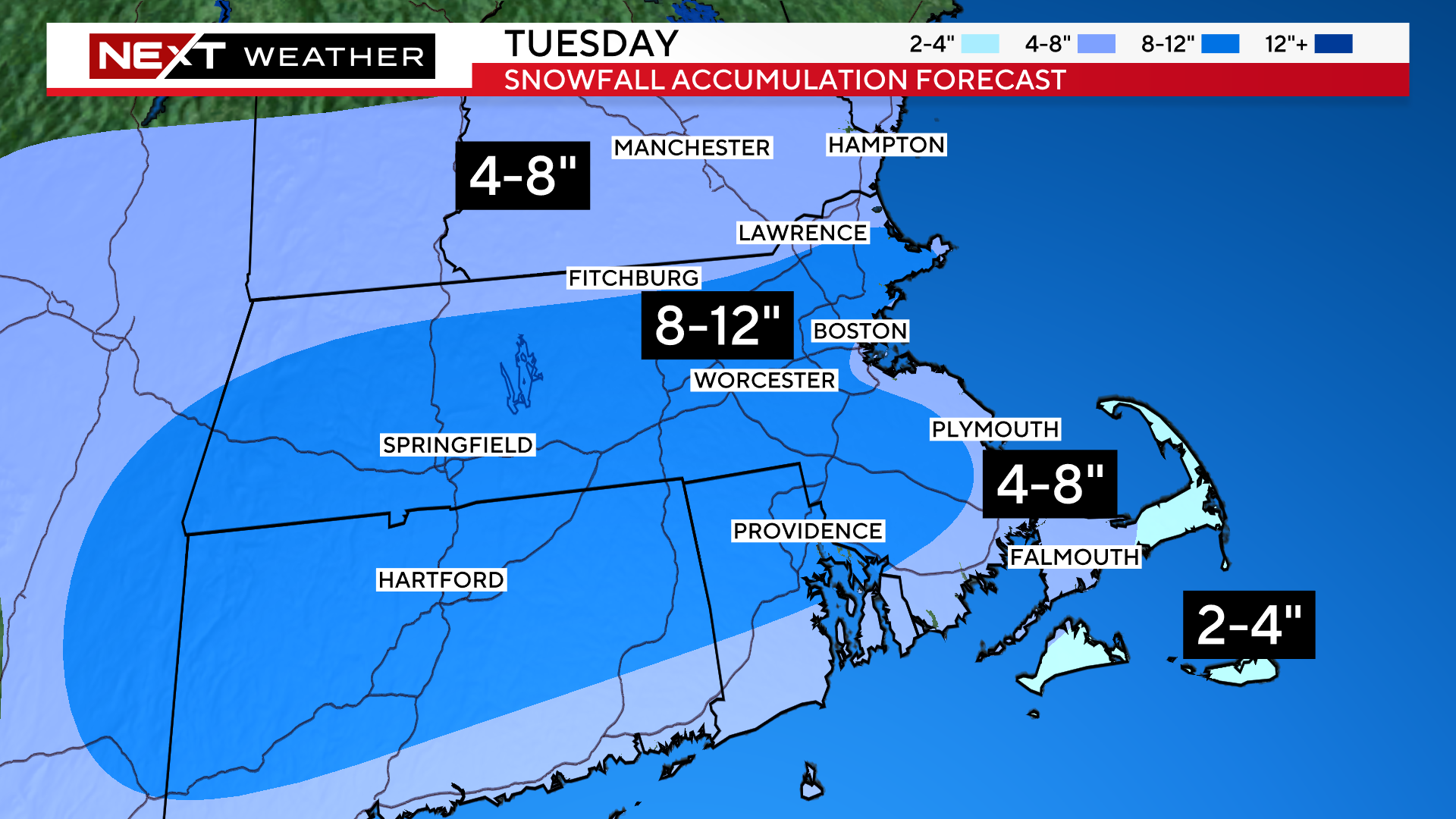
HOW MUCH?
8-12″ Along and west of I95, most of interior Massachusetts…The farther north and west you live, the lighter/fluffier the snow (Worcester county specifically)
4-8″ Immediate Coastline from Boston down through coastal Plymouth county to the Upper Cape and South Coast. Temperatures will be around or just above freezing in these areas for most of the first half of the storm, therefore it will not accumulate as readily.
4-8″ Also up in southern New Hampshire, southern Vermont and Southern Maine…these areas will be too far away from the center of the storm to get more than 8″
2-4″ Mid to Outer Cape Cod and the Islands. Lots of mixing/rain early on and higher temperatures makes it tough to accumulate snow until very late in the storm
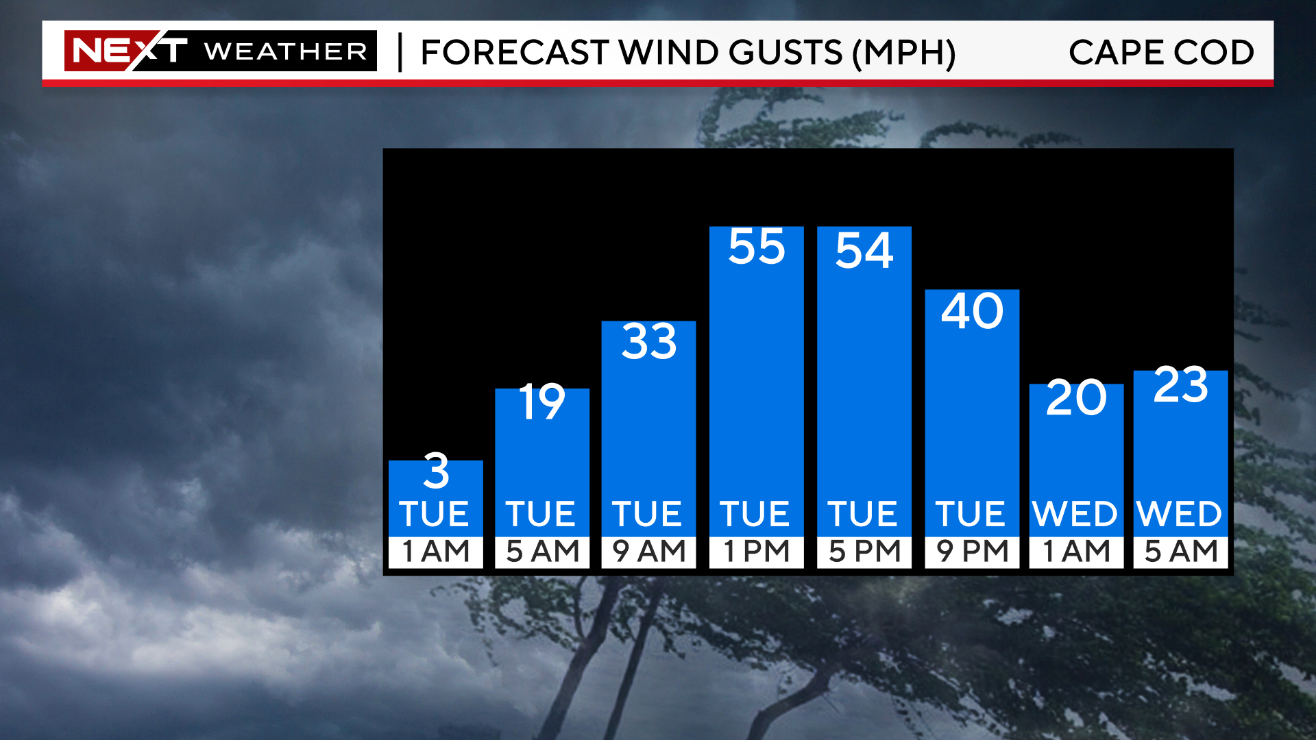
WIND:
Highest wind gusts will be over the Cape and Islands on Tuesday. In these areas, northeast to northerly winds will gust as high as 45-60mph.
Along the rest of the Coastline, we anticipate gusts peaking between 30-45mph.
Inland areas will have less wind with gusts 20-30mph.
Not expecting widespread power outages however, with the weight of the wet snow combined with the strong winds, there may be some scattered loss of power in eastern MA.

The winds will peak from about midday through evening on Tuesday. There will be a gradual tapering Tuesday night however, the winds will remain busy/gusty right through Wednesday.
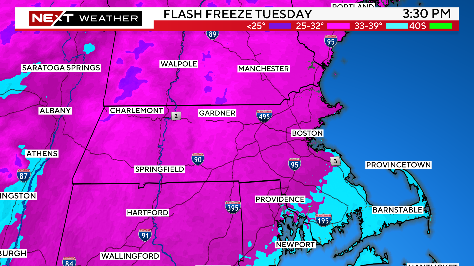
FLASH FREEZE
During Tuesday afternoon, the winds will turn more northerly, thus drawing down colder air across eastern MA. Temperatures will drop 5-10 degrees in a short period of time.
Coastal areas that had been above freezing Tuesday morning will drop below freezing causing any untreated surfaces to ice up.
This will occur from north to south…early afternon along the North Shore and through Boston and late afternoon/evening along the South Shore and through the Cape.
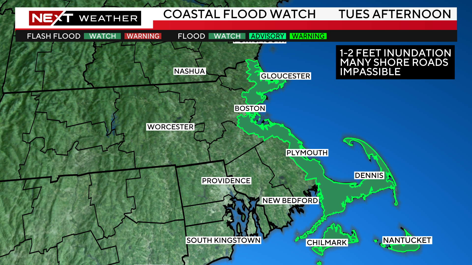
COASTAL FLOODING
There is a coastal flood watch posted for the Tuesday afternoon high tide cycle.
We are currently in one of the highest tide cycles for 2024. They will be coming off their peak levels on Tuesday but, still will be quite high.
Combine this fact with a strong northeast wind on Tuesday and we expect widespread minor to moderate coastal flooding.
There will likely be 1-2 feet of inundation over all the typical, flood prone coastal roadways.
This flooding will peak between Noon and 4pm Tuesday.
Finally, we expect some additional coastal flooding again during the early morning high tide on Wednesday (between 1-4am). The winds will have shifted offshore by then so, much of the flooding Wednesday should be minor.
WHAT’S NEXT
Looks like winter is here to stay a while.
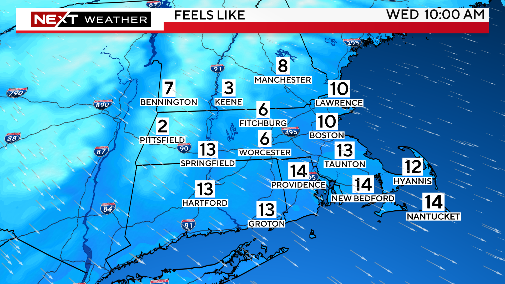
Temperatures will be below average for the remainder of the week.
Wind chills will be in the single digits Wednesday morning and air temperatures will stay below freezing through the day in most areas.
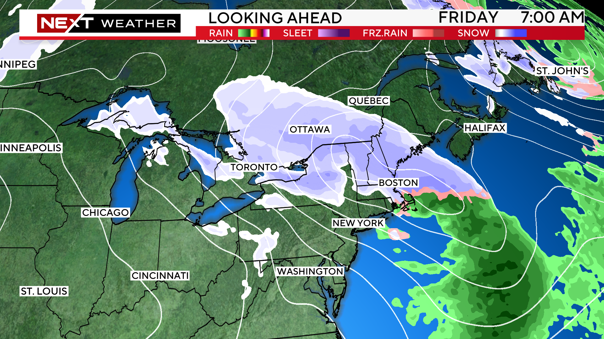
There may be some additional snowfall later Thursday or Friday.
Right now, this does not look like a major storm but something to keep an eye on over the next few days.
Click here for Westford snow storm data and past totals or select “Winter Snowfall“ under “Pages” on the left hand side.
For more up to date forecast information follow me on Twitter (@terrywbz) or follow the WBZ weather team on Facebook, search WBZWeather
Reader Comments