


The WBZ Weather Team is continuing the NEXT Weather Alert through midday Wednesday.
Judging by the traffic this morning, it seems as though a lot of folks have chosen to travel or get their last-minute errands done today. Smart move! My guess if that the traffic this evening will be just as bad, if not worse, given the forecast.
Speaking of which, the forecast hasn’t changed much at all in the last 24 hours.
TIMELINE:
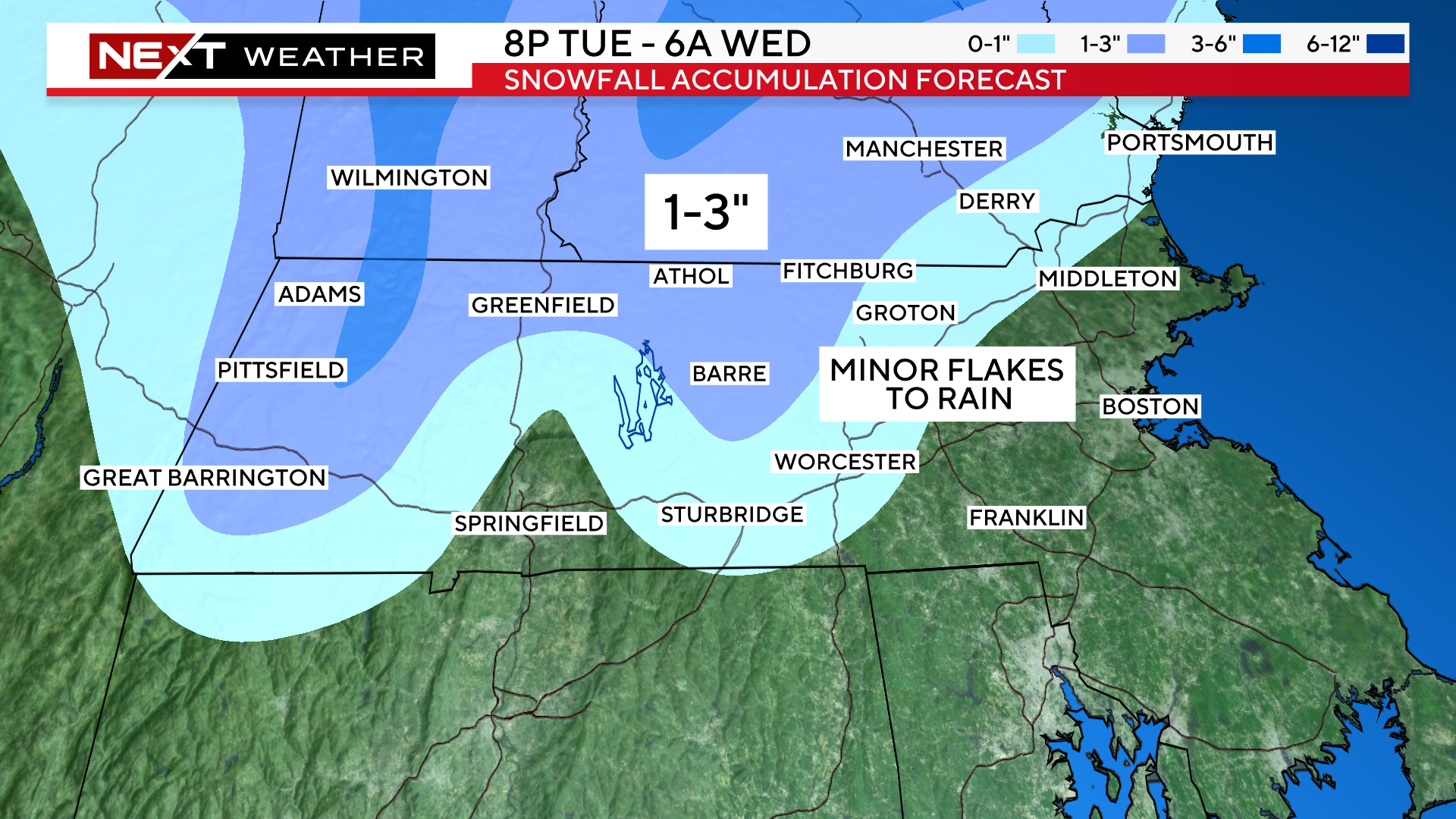
Mix of rain and snow arrives in central MA around 8pm tonight and into Boston by 11pm.
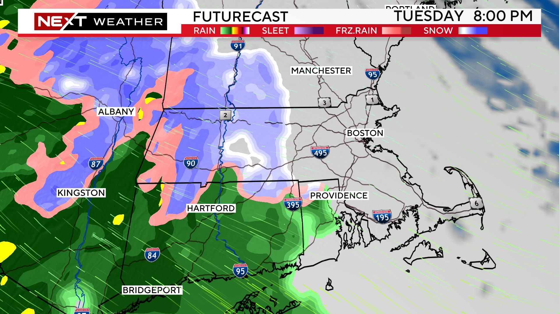
Overnight, milder air will work in on strong southeast winds, changing any snow in southern New England over to rain. By dawn (or even a few hours before) there will not be any frozen precipitation left in our area.
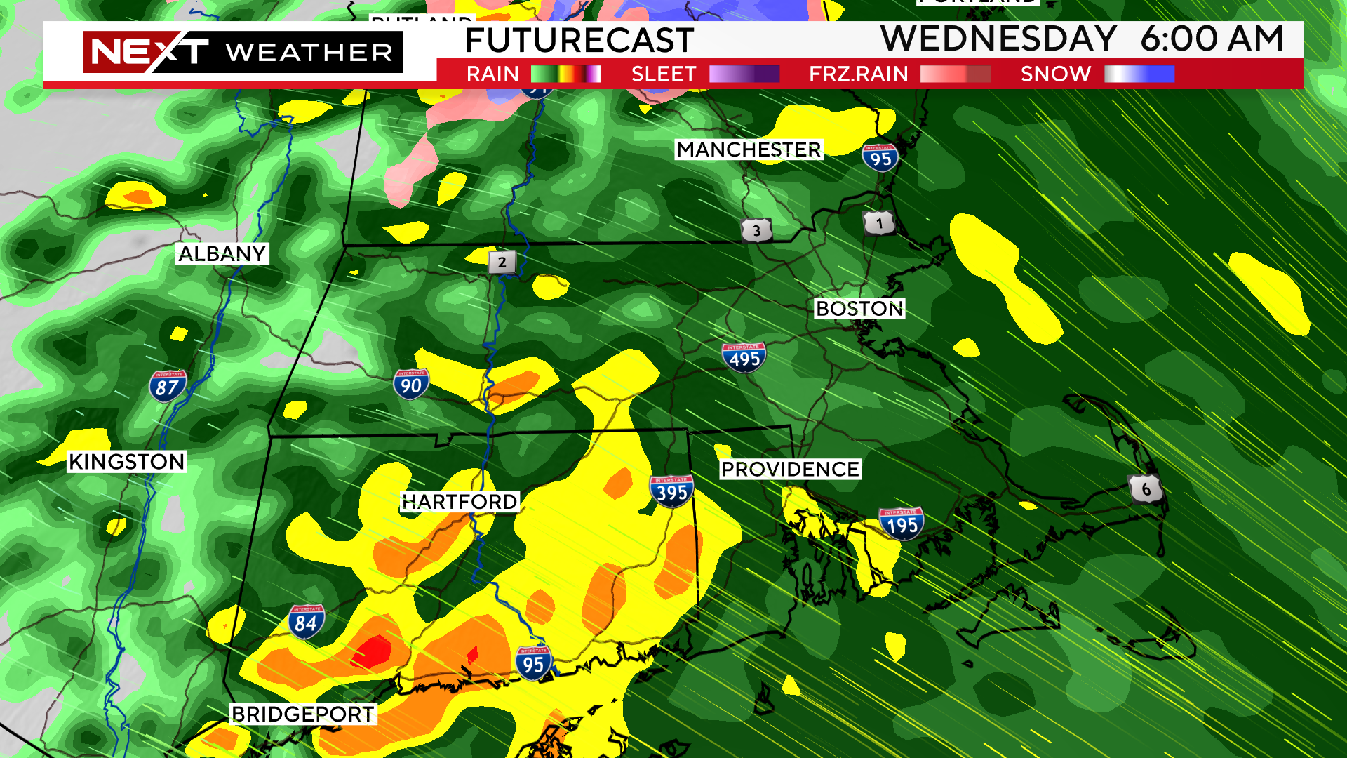
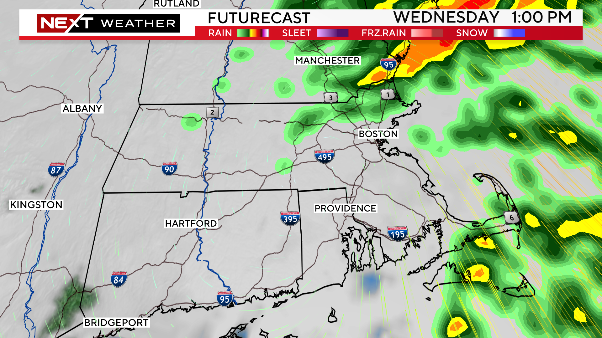
The rain will continue, heavy at times, through about midday on Wednesday before tapering off to a few leftover showers.
Expect about .5″-1.5″ of water…enough to cause some ponding on roadways in the AM, but no significant flooding is expected.
Total snowfall amounts will be pretty meager, only 1-3″ in the higher elevations of northern Worcester county, the Berkshires and southwestern New Hampshire. Most of this snow will be severely compacted or washed away by the rainfall.
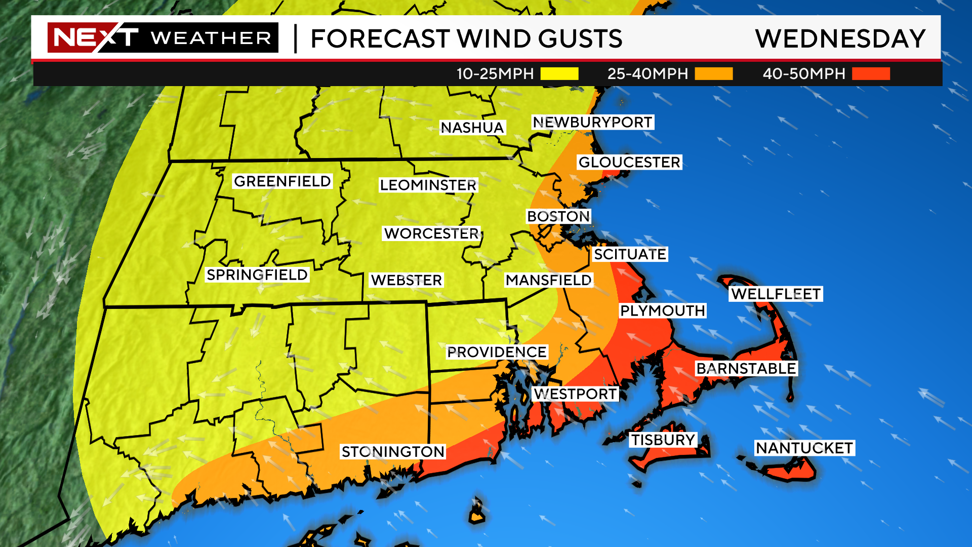
The winds will also be a concern with this storm but, mainly along the Coastline.
The strongest winds will occur between about dawn and mid-afternoon on Wednesday.
Peak Gusts:
40-50mph over extreme southeastern MA, the South Coast, Cape Cod and the Islands
25-40mph over the rest of the Coastline including Boston and most of the North Shore
Wind gusts are not much of a concern inland of I95.
Wednesday evening will be much quieter, just a bit of a gusty northwest wind.
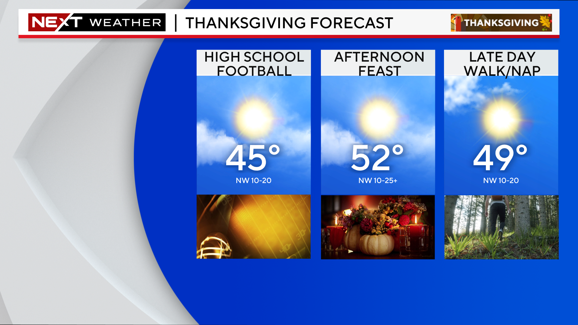
Thanksgiving Day looks rather pleasant. Expect highs in the 40s for the morning football games and low 50s during the afternoon.
Winds will remain busy, gusting 15-25mph at times.
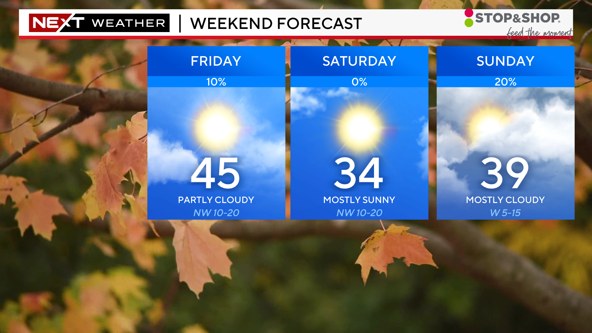
The rest of the holiday weekend is quiet and chilly. Highs on Black Friday will reach the mid 40s but, by the weekend, we will be stuck in the 30s.
Next chance of any precipitation (likely rain) comes Sunday night and Monday.
Click here for Westford snow storm data and past totals or select “Winter Snowfall“ under “Pages” on the left hand side.
For more up to date forecast information follow me on Twitter (@terrywbz) or follow the WBZ weather team on Facebook, search WBZWeather
Reader Comments