


The WBZ Weather Team has issued a NEXT Weather Alert for the rather untimely storm system on the way Tuesday night and Wednesday.

It’s been a while since we had a significant storm in New England and, wouldn’t you know it, we have snow, rain and wind on the way as we enter the busiest travel week of the year.
Currently, the storm is taking shape in the middle of the Country, bringing rain from Minneapolis to Houston. Not expecting much in the way of travel troubles today.
By Tuesday, the storm will be expanding and strengthening as it travels through the Ohio Valley and towards the Mid-Atlantic. Thankfully, not much snow or ice during the day on Tuesday, but plenty of rain from Detroit to Nashville and down through the Gulf Coast.

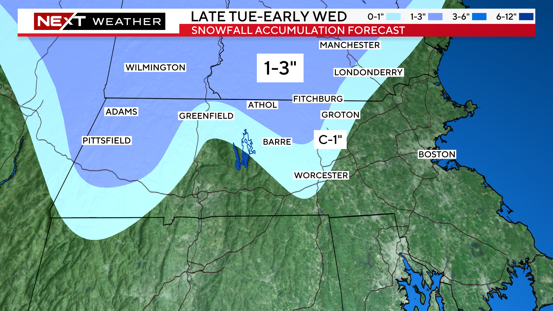
By Tuesday night, as the storm arrives in the Northeast, the air will be just cold enough in the elevated areas for some snow to fall.
We expect that between 7pm and midnight, some wet snow will begin to lightly accumulate in the Berkshires and eventually as far east as the Worcester Hills.

By dawn on Wednesday, the snow will have changed to rain in just about all of southern New England.
The rain will come down heavy at times Wednesday morning through about midday.
There may be some brief, localized flooding and ponding on the roads during this time.

By Wednesday afternoon, the storm will be pulling away and the rain will taper to a few scattered, lighter showers.
The commute home will be MUCH improved from the prior morning drive.

Snowfall amounts will be light and confined to the higher elevated areas.
Much of this will be washed away by the change to rain on Wednesday.
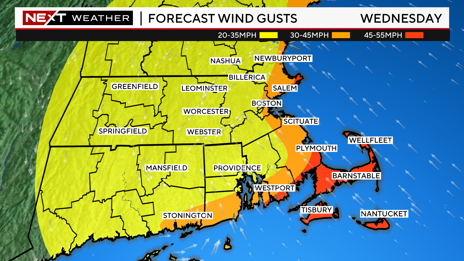
Over southeast MA, it will be all rain, however, the winds will be quite gusty.
Southeast winds could gust over 50mph along the South Coast, Cape Cod and the Islands Wednesday morning and Afternoon.
Farther north, along the immediate Coastline from Plymouth to Boston and through the North Shore, gusts will top out mainly between 30-40mph.
By Wednesday evening, the winds will shift to the northwest and peak gusts will drop to between 20-30mph across most of the area.
Thanksgiving will be a much quieter day.
Expect partly sunny skies in the morning for all the football games with temperatures in the low 40s.
Highs will reach the mid to upper 40s in the afternoon, but winds will be busy, gusting 25-35mph.

Enjoy the Holiday! Safe Travels!
Click here for Westford snow storm data and past totals or select “Winter Snowfall“ under “Pages” on the left hand side.
For more up to date forecast information follow me on Twitter (@terrywbz) or follow the WBZ weather team on Facebook, search WBZWeather
Reader Comments