


We made it! Happy Friday!
With Thanksgiving week on our doorstep, no doubt everyone will be looking a bit closer at the weather forecast in the coming days. And wouldn’t you know it, there will be a sizeable storm system chugging across the Country early next week. More on that in a moment…
Today will be a marvelous finish to the week and perhaps our warmest day for the rest of the month!
Highs will reach well into the 60s across southern New England. Not bad considering the average high for today is 51!
Clouds will thicken tonight, and we will see a few rain showers Saturday morning though midday.
Warmest temperatures on Saturday will be in the morning with a precipitous drop in the afternoon and evening. The sunshine will return just before sunset along with a very gusty, cold wind.
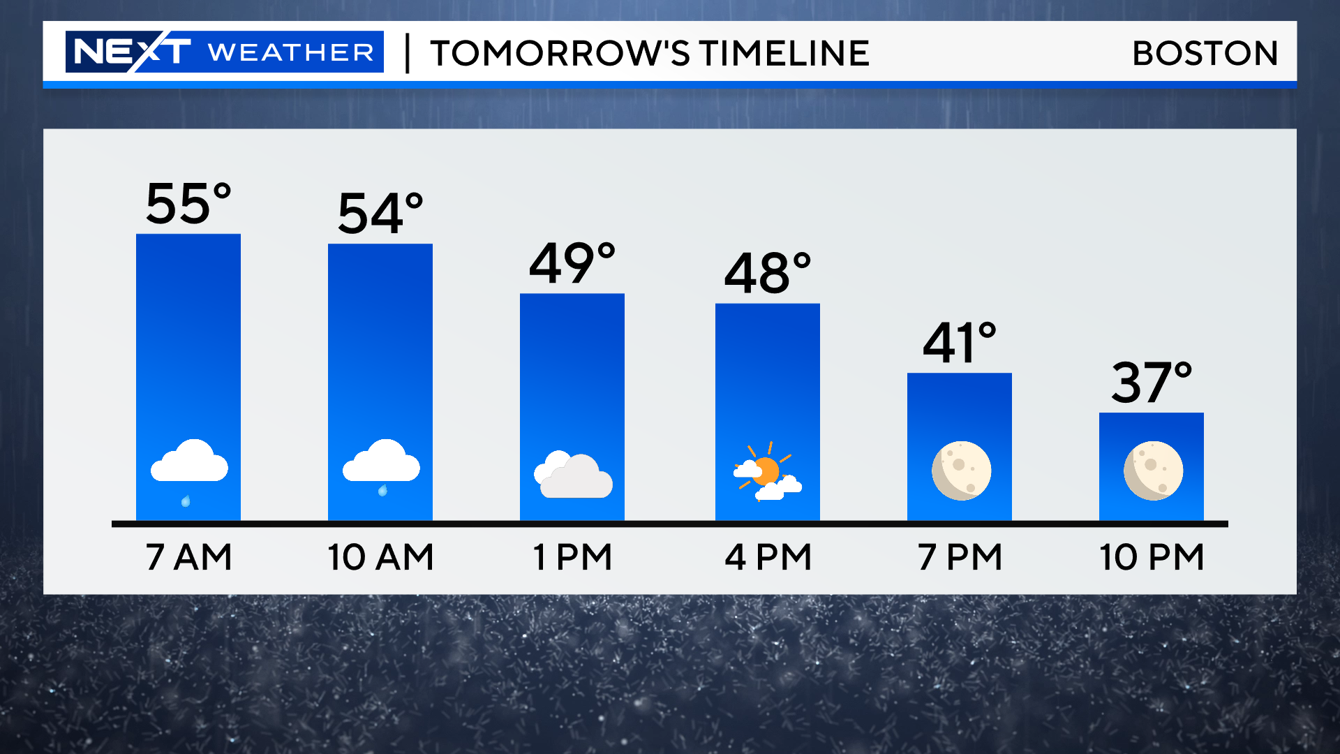
Sunday will be a rather brisk day with periods of sun and clouds and a few scattered sprinkles or flurries. Decent enough for you to go out and get the yard work done, but the leaves may be blown around a bit.
Then we get to Thanksgiving (Travel) Week…
Let’s take you day-by-day
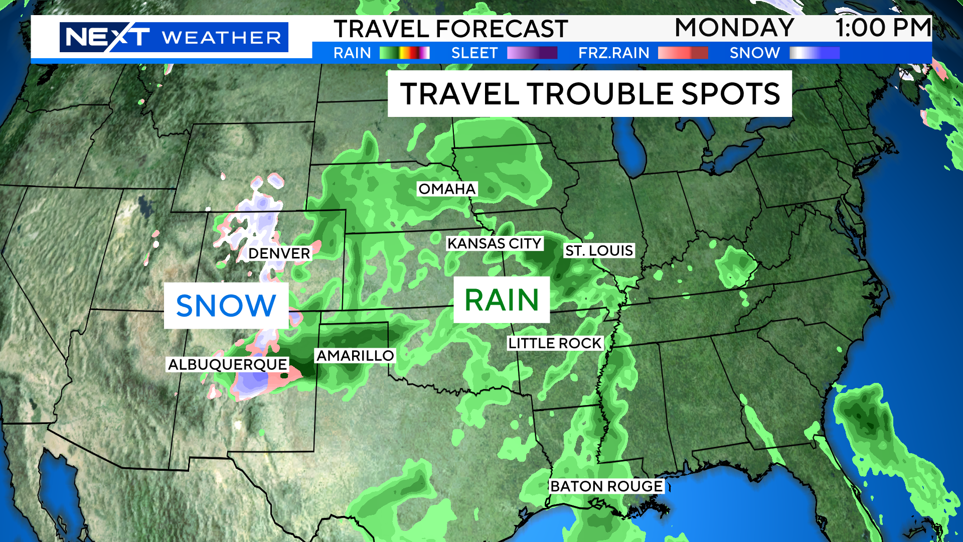
Monday:
A storm system gathers strength in the central part of the Country, near the panhandle of Texas. Expect rain showers from Omaha to Amarillo to Baton Rouge. Some snow will fall on the backside of the system in the Denver and Albuquerque area.
New England is quiet and chilly.
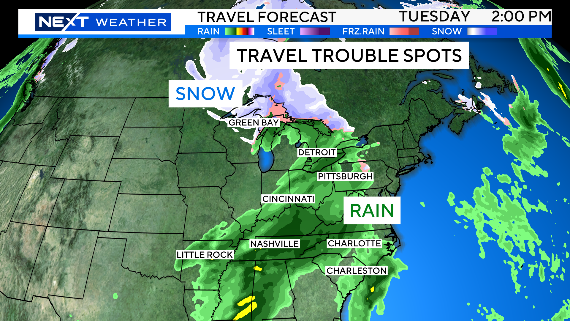
Tuesday:
The storm, now a bit stronger, arrives in the Ohio Valley and Upper Midwest. Expect periods of heavy rain from Detroit to Nashville and down through the Gulf Coast.
The snow will be limited to the upper reaches of the Great Lakes, mainly in Canada.
New England remains quiet during the day, highs in the 40s.
Wednesday:
Our turn…The storm may actually arrive late Tuesday night here in the Northeast. It may start as some wet snow in parts of our area, the highest risk being in the elevated areas of Worcester county and the Berkshires. It is likely that by dawn, most of the precipitation will have changed to rain. Expect periods of heavy rain Wednesday morning through at least midday. Travel could certainly be impacted by a windswept, heavy rainfall.

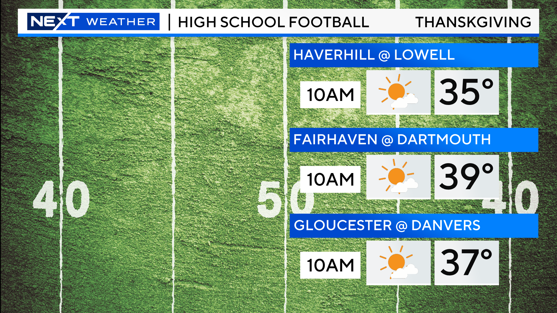
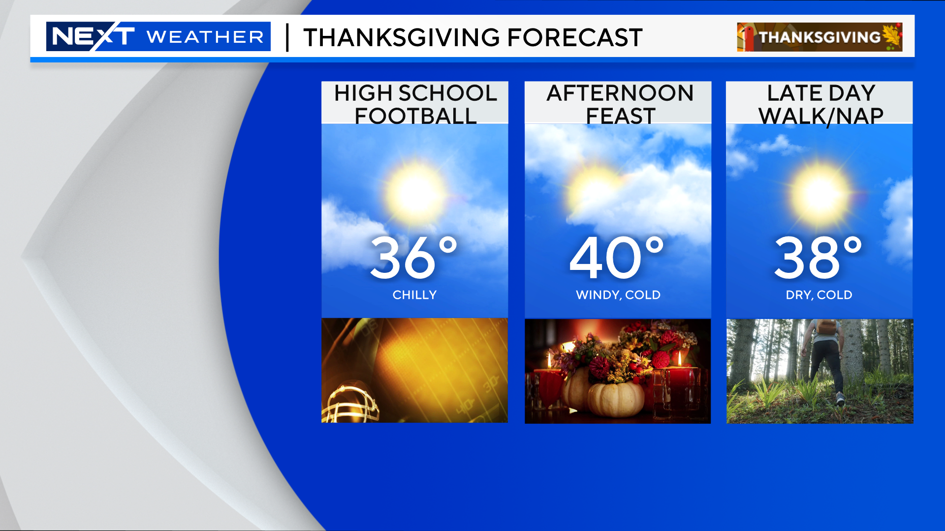
Thanksgiving!
Looks like a cold and windy morning for all the high school football games. Temperatures in the mid to upper 30s, feeling 5-10 degrees colder with the wind.
As you head out to grandma’s house for the feast, high temperatures will only top out around 40 degrees. Again, a gusty wind will add an extra bite to the cold.
After that, it looks quiet and cool for a few days. Our next storm chance may come sometime around Sunday.
Safe Travels!
Click here for Westford snow storm data and past totals or select “Winter Snowfall“ under “Pages” on the left hand side.
For more up to date forecast information follow me on Twitter (@terrywbz) or follow the WBZ weather team on Facebook, search WBZWeather
Reader Comments