


Happy Thursday!
After a foggy start today, most areas are now beginning to clear. The fog will continue to gradually burn off and we expect mainly sunny skies for the rest of the day. High temperatures will be in the 70s today, still 5-10 degrees above the average.
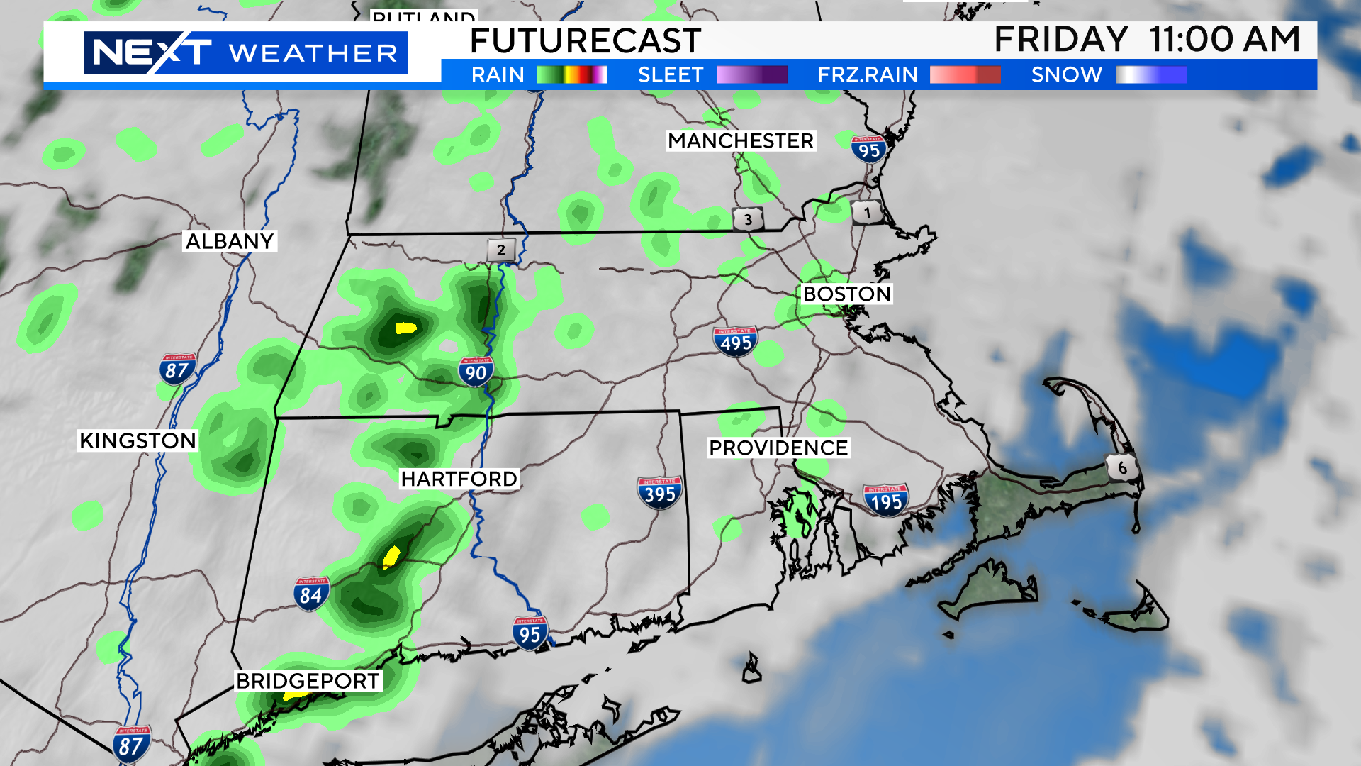
Friday will once again start foggy, and we will see increasing clouds throughout the day. There is a slight chance of a shower and temperatures will be a bit cooler, topping out around 70.
Then we come to the weekend.
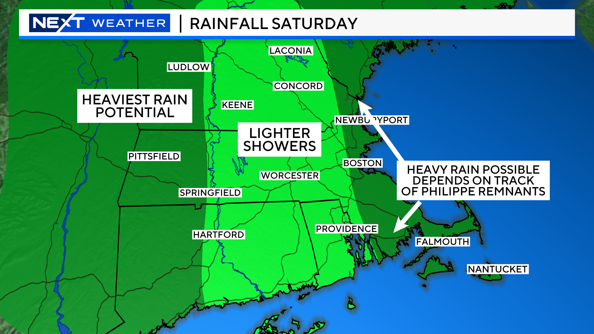
The forecast remains a bit tricky as southern New England will be sandwiched between two storm systems.
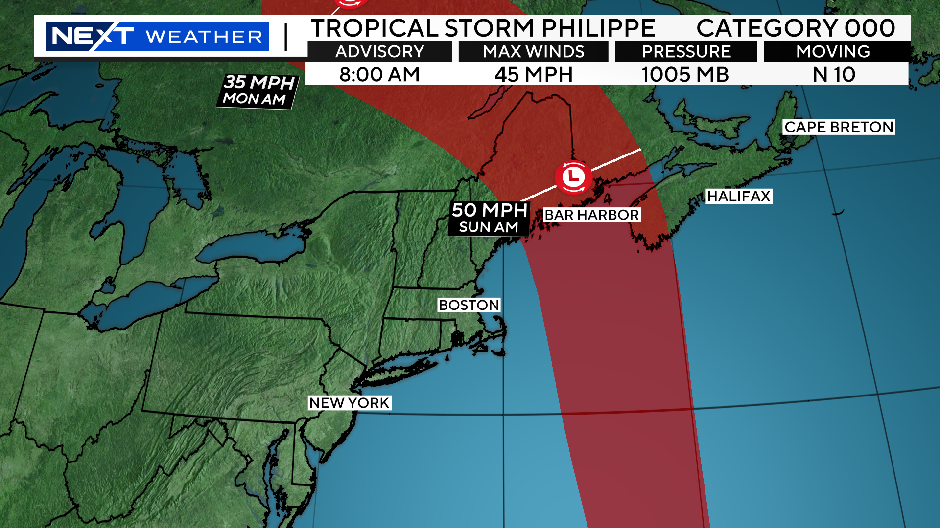
There will be a cold front approaching from the west and the remnants of Philippe to the east.
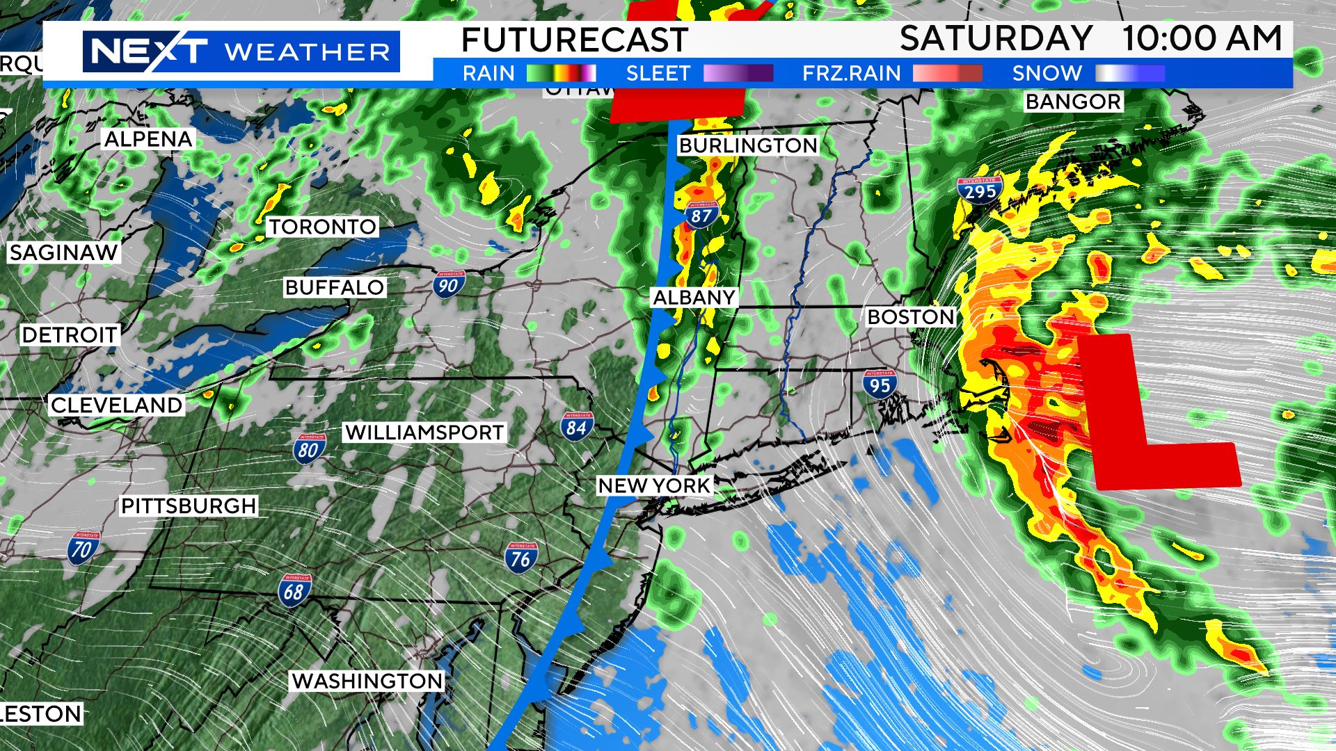
The highest risk of steady/heavy rainfall on Saturday will be across western MA (from the cold front) and over eastern MA (from Philippe).
The areas in between may not see much rainfall at all…just a cloudy day with a few light/spotty showers.
The biggest question is, how close does Philippe’s rain shield come to our Coastline?
At this point, the scenarios range from a complete miss to a couple inches of rainfall. A very tight shave!
More on this to come as we digest model data this afternoon…
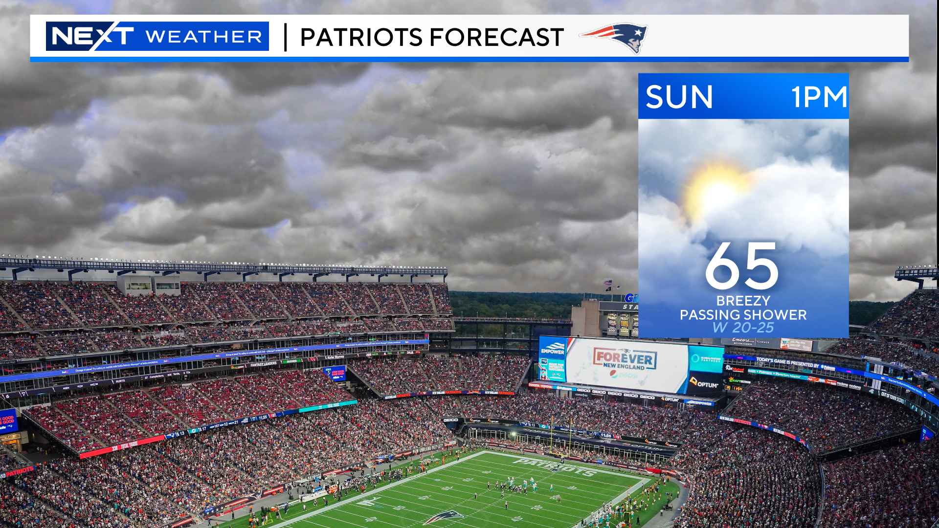
The main axis of rain will shift into northern New England Sunday. We will be left with lots of clouds, a few scattered showers and a gusty, westerly wind.
Should be mainly dry at Gillette for the Pats game at 1pm. There will be a strong wind blowing across the field, gusting 20-30mph.
Click here for Westford snow storm data and past totals or select “Winter Snowfall“ under “Pages” on the left hand side.
For more up to date forecast information follow me on Twitter (@terrywbz) or follow the WBZ weather team on Facebook, search WBZWeather
Reader Comments