


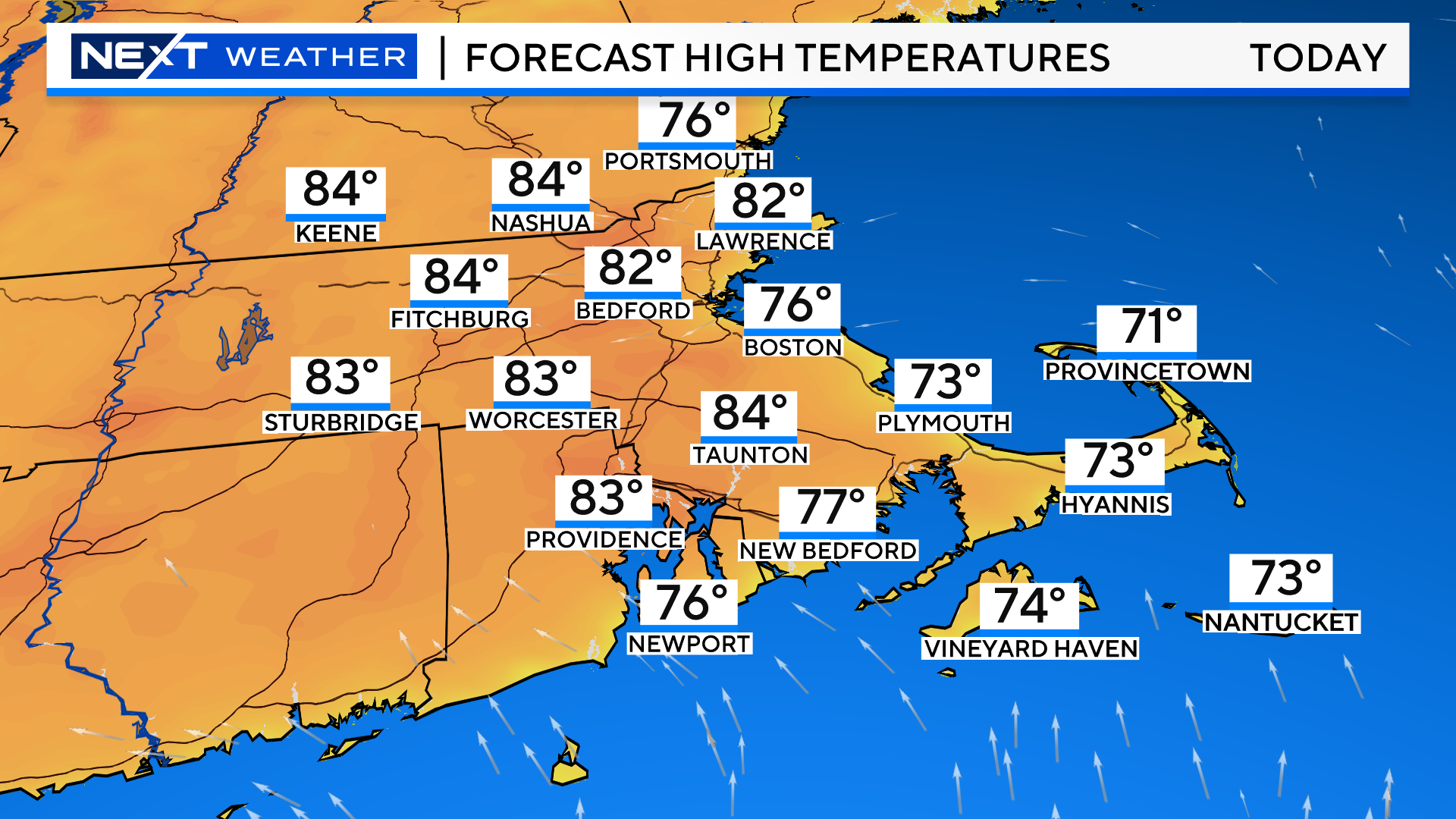
Another lovely summer-like day on tap for today. High’s 80-85 away from the Coastline and in the 70s right at the water.
Worcester will likely fall a few degrees shy of a record high temperature. Boston, thanks to an onshore breeze, will be well shy.
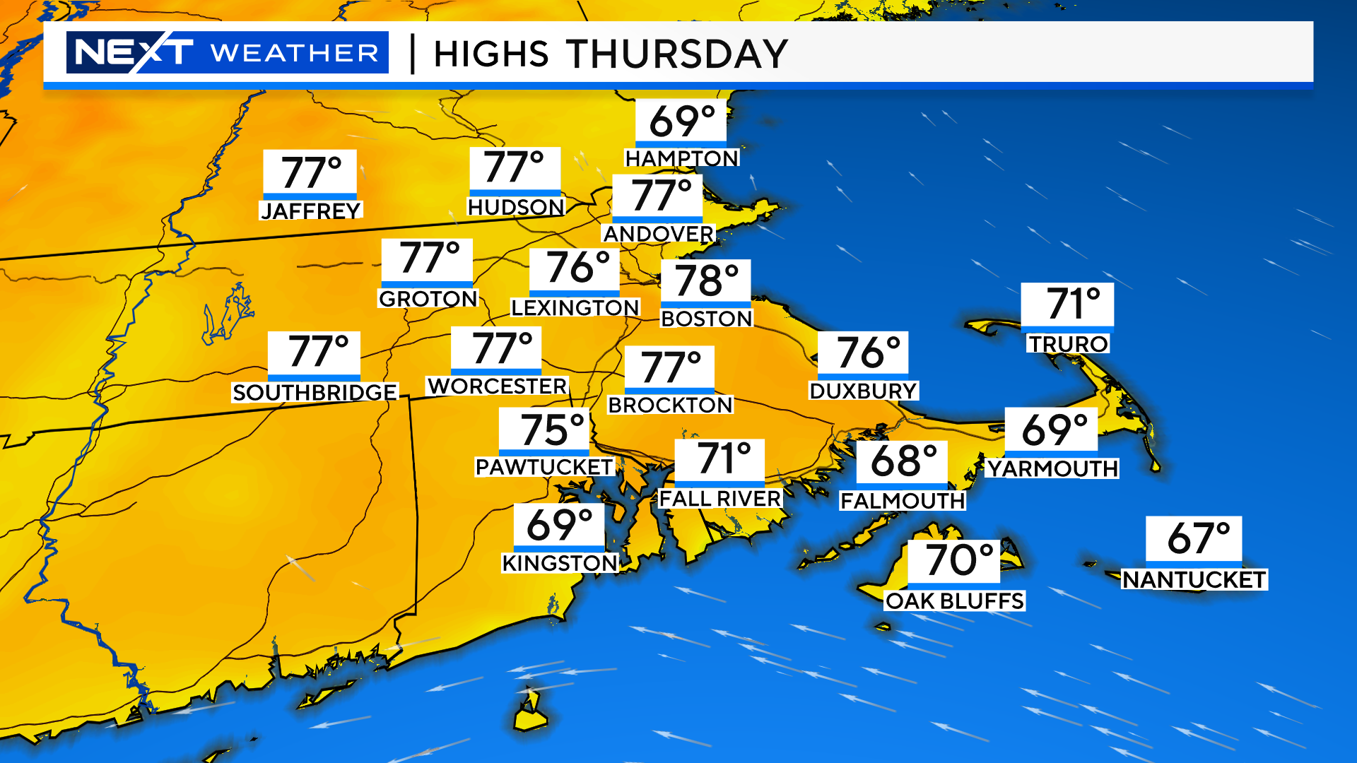
There will be a few more clouds around tomorrow and temperatures will be about 5 degrees cooler inland.
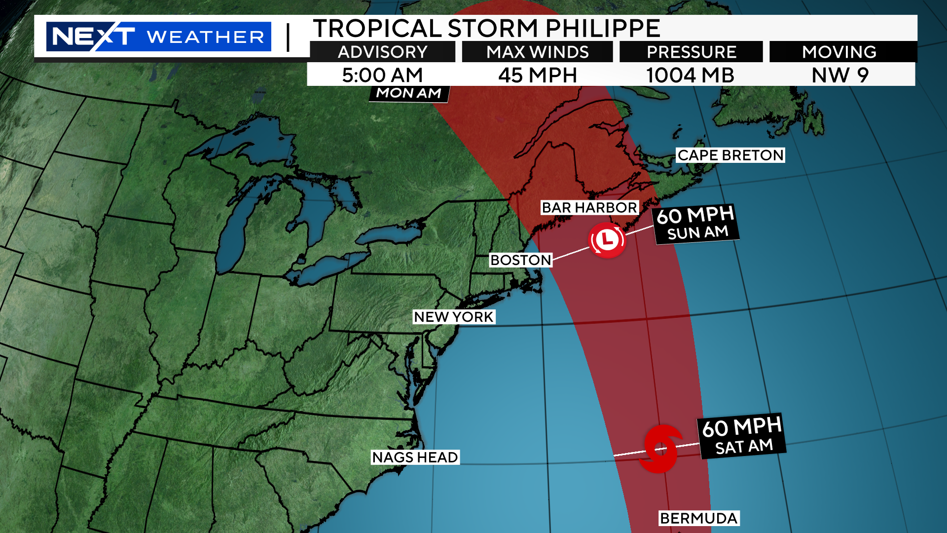
From there, our attention will turn to two weather systems…a frontal boundary to our west and tropical storm Phillipe to our east.
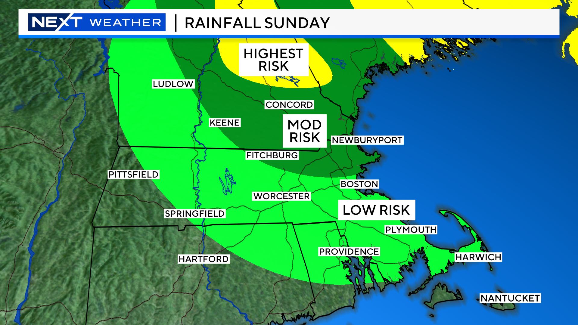
The latest forecast track for Phillipe has the center passing a few hundred miles east of our area early on Sunday. This should be far enough offshore to keep the main shield of rain and wind away from southern New England. Nova Scotia and Downeast Maine will bear the brunt of the impacts locally on Sunday.
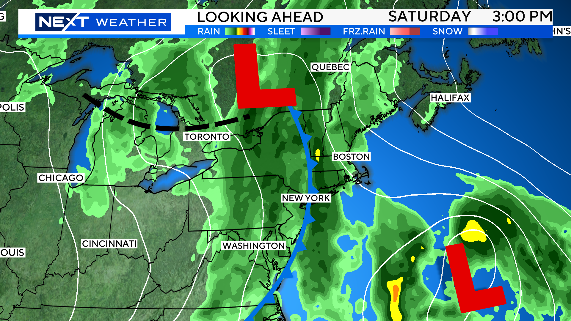
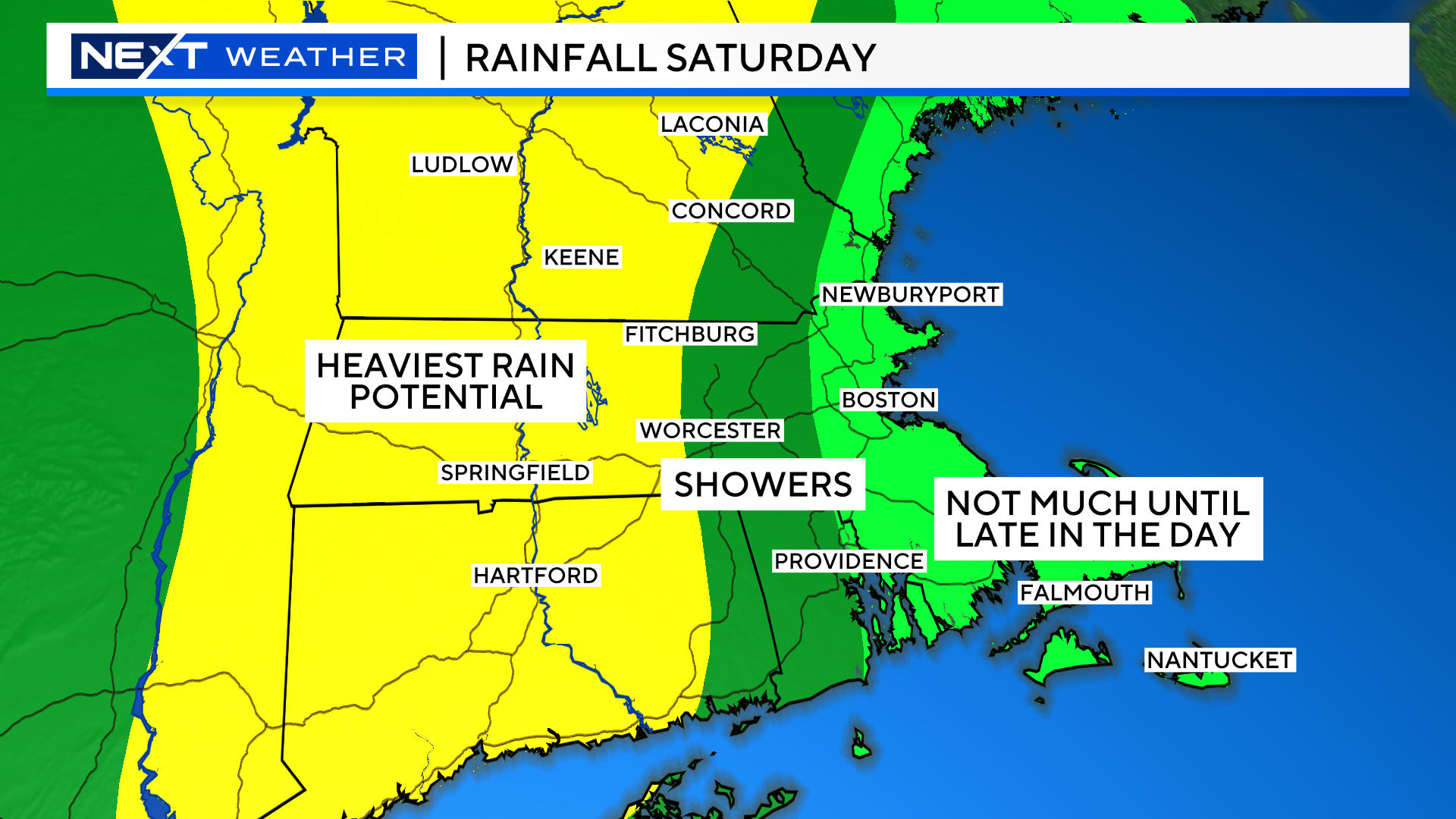
While we are likely to escape the rainfall from Philippe, our streak of rainy Saturday’s will unfortunately continue. The heaviest rainfall will be across central and western MA during the day. Farther to the east, much of the day should stay fairly dry.
On Sunday morning, there will be a few remaining showers, mainly across northeast MA, New Hampshire and Maine.
Southern New England will dry out and see some sunshine by the midday/afternoon. Northern New England will remain mostly cloudy with some scattered showers.
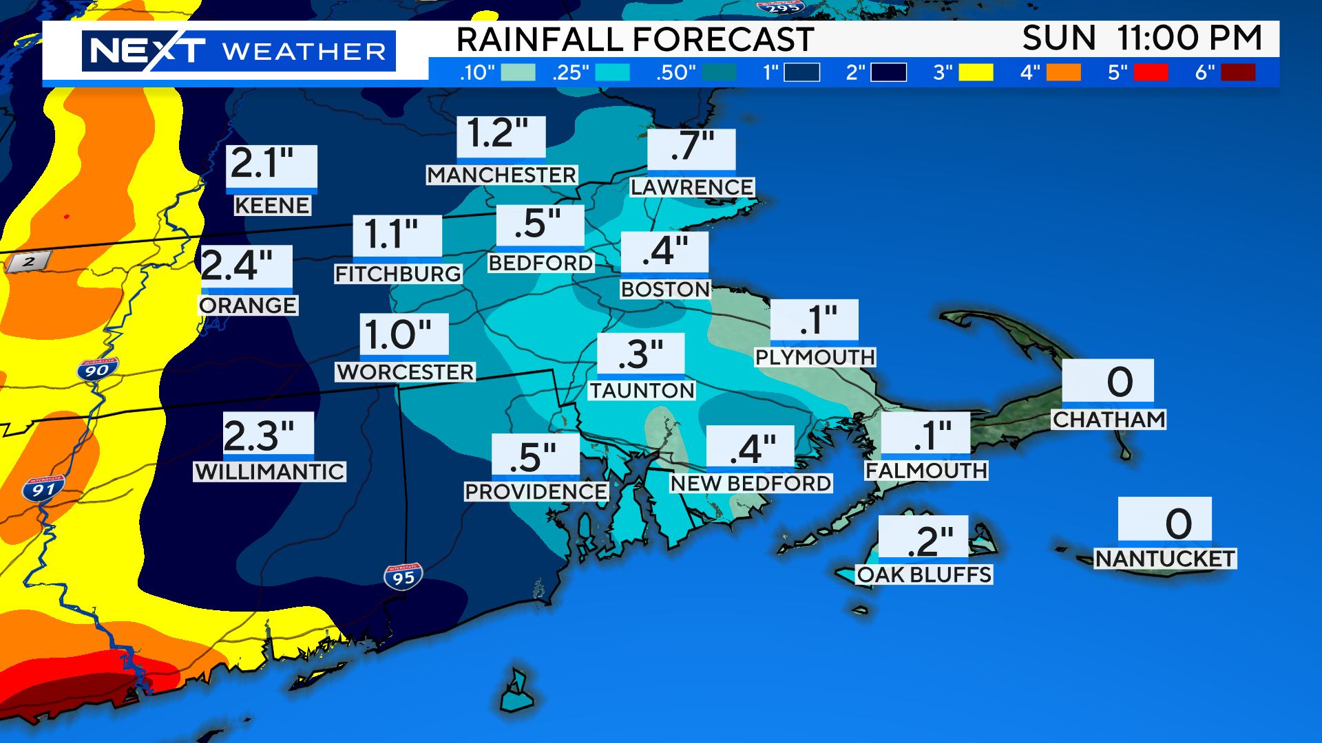
You can see the heaviest rainfall totals are clearly to the west, most of this falling during the daytime on Saturday.
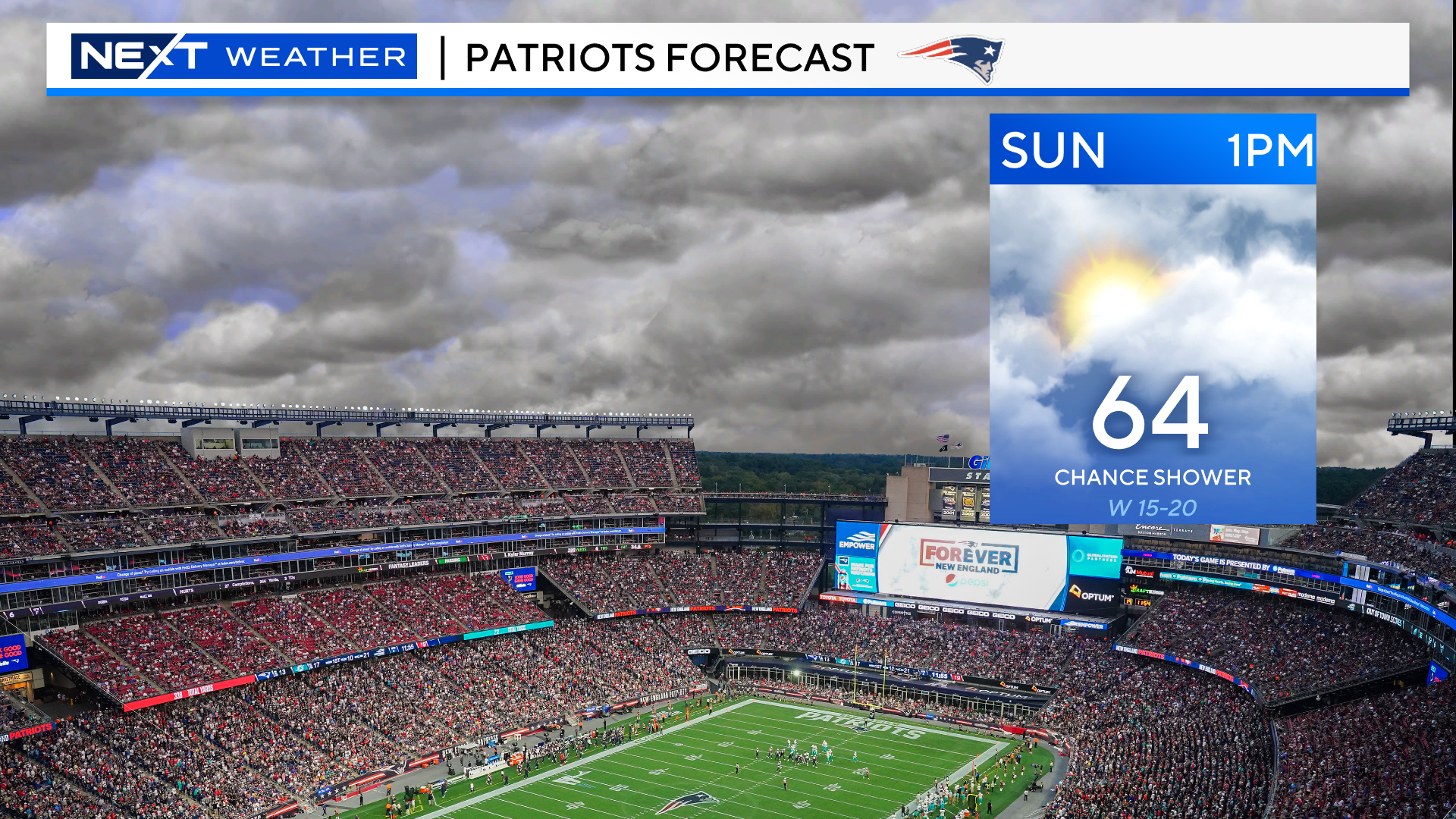
Lastly, for the Pats game at Gillette…sun and clouds, very low risk of a brief shower, and a gusty westerly wind.
Click here for Westford snow storm data and past totals or select “Winter Snowfall“ under “Pages” on the left hand side.
For more up to date forecast information follow me on Twitter (@terrywbz) or follow the WBZ weather team on Facebook, search WBZWeather
Reader Comments