


Happy Monday!
Hope you all got to enjoy some sunshine on Sunday!
This week will have all the fall feels. Each day will feature a mix of sun and clouds, very dry/crisp air and highs in the low to mid 60s.
The overnights will be chilly with temperatures dropping into the 40s and some upper 30s in the distant suburbs.
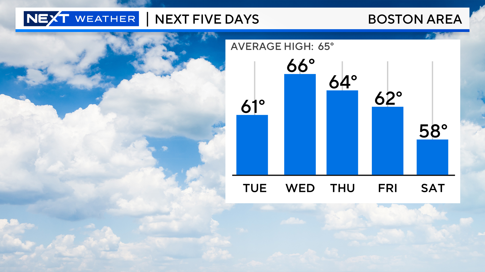
Other than an isolated sprinkle, we will stay dry through Friday.
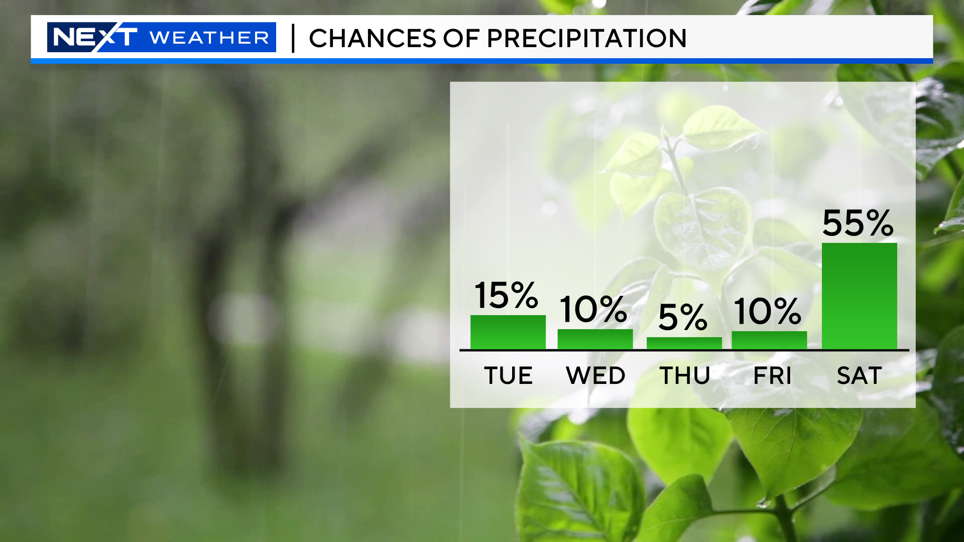
Then, we come to the weekend, and an all-too familiar story.
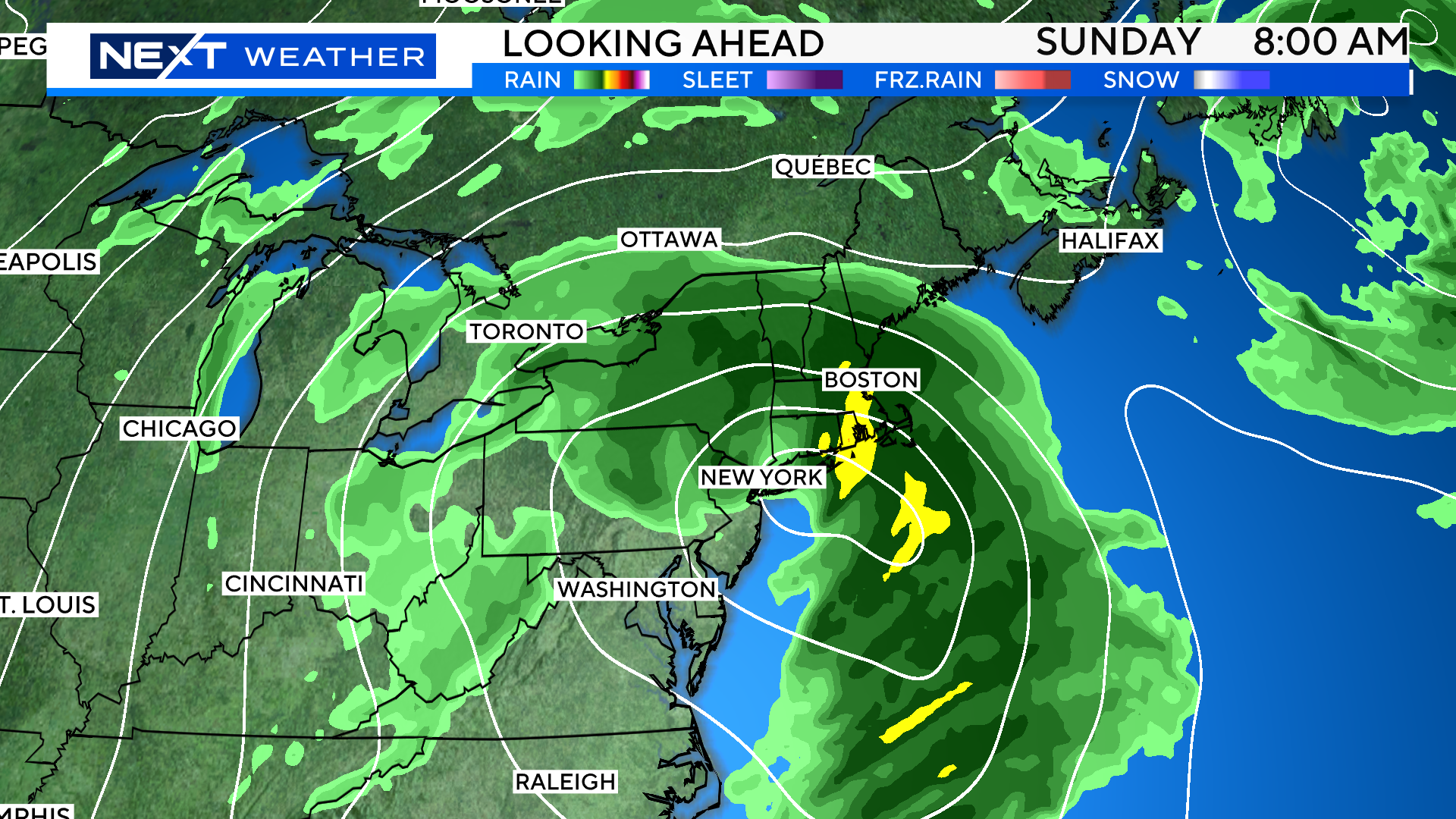
There will be a fairly robust storm system coming out of the Midwest later this week that seems destined for New England.
It is still too early to pin down the exact arrival time but the odds of some rainfall both Saturday and Sunday are fairly high at this time.
There are also some indications that this system will be very slow to depart our region and could linger for several days. If that were the case, there would be some inland and coastal flooding concerns. Again, details to be worked out over the next several days.
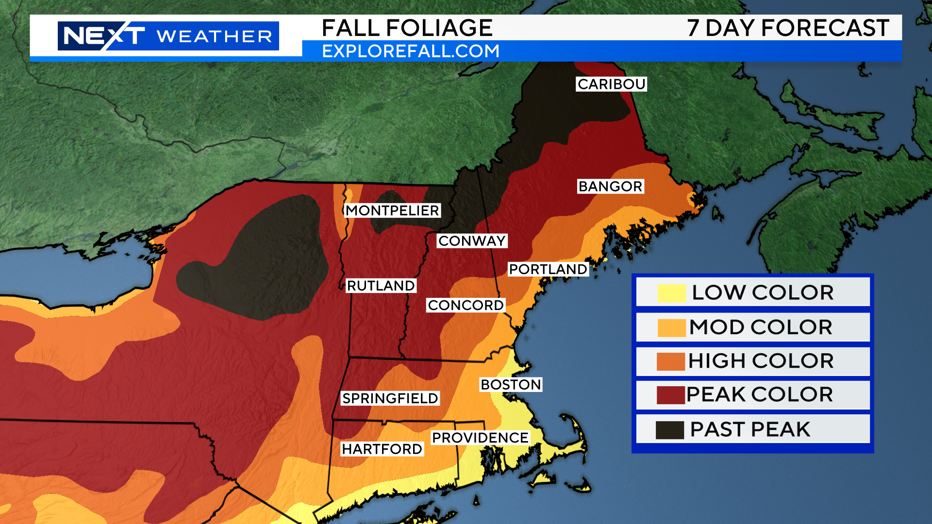
The fall weather this week is going to have a major impact of the foliage throughout New England.
If you were out and about this weekend, you likely noticed bursts of color here and there, even throughout southern New England.
I would classify the foliage to date as highly variable and spotty. Driving down route 119 yesterday from Groton to Ashby, I noticed some very colorful spots but also some areas where the leaves seemed to go straight from green to brown.
Peak color is now happening across most of northern New England including the highest elevations of the Green and White Mountains.
There is “moderate color” now in the Lakes Region near Winnipesaukee.
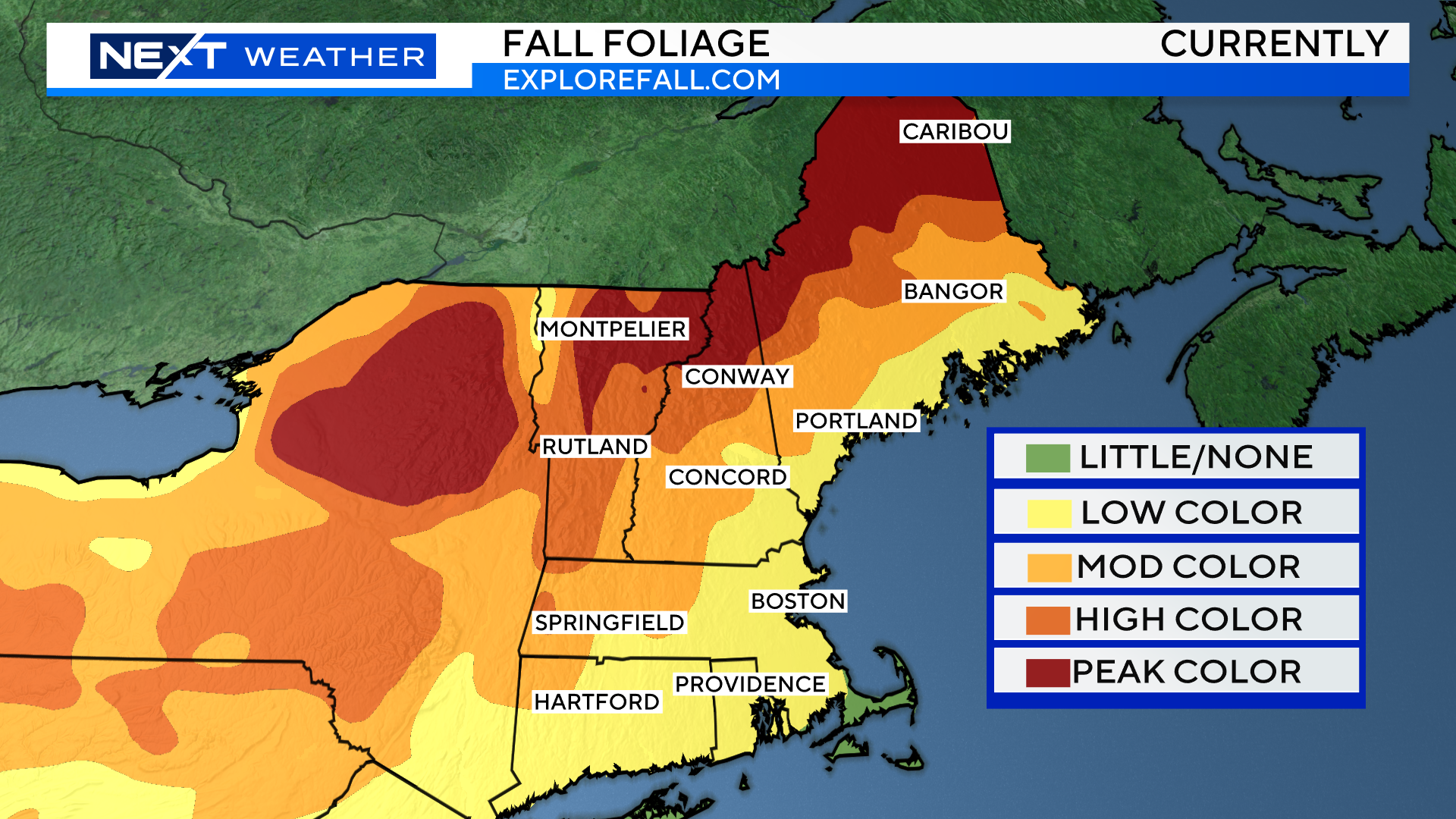
We expect that by next weekend, the peak color will have moved south into central New England including parts of northern Worcester county and the Berkshires. Far northern New England will be past peak with some leaf drop occurring.
If the forecast holds and we get several days of rain/wind next weekend, that could lead to a quick and unfortunate end to the peak color season for many areas north and west of Boston.
Bottom line, the next several days may be your last chance to catch the best that fall has to offer this year.
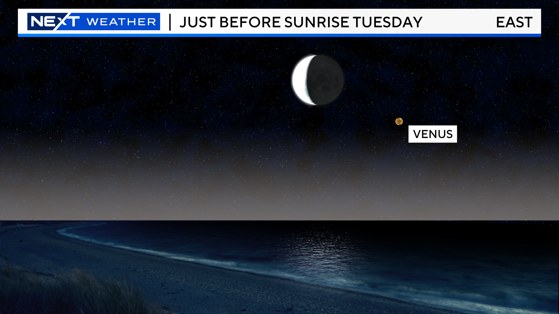
Lastly, there are a few interesting astronomical events going on this week…
Over the next few mornings, the Moon will be very close to Venus in the eastern sky before sunrise.
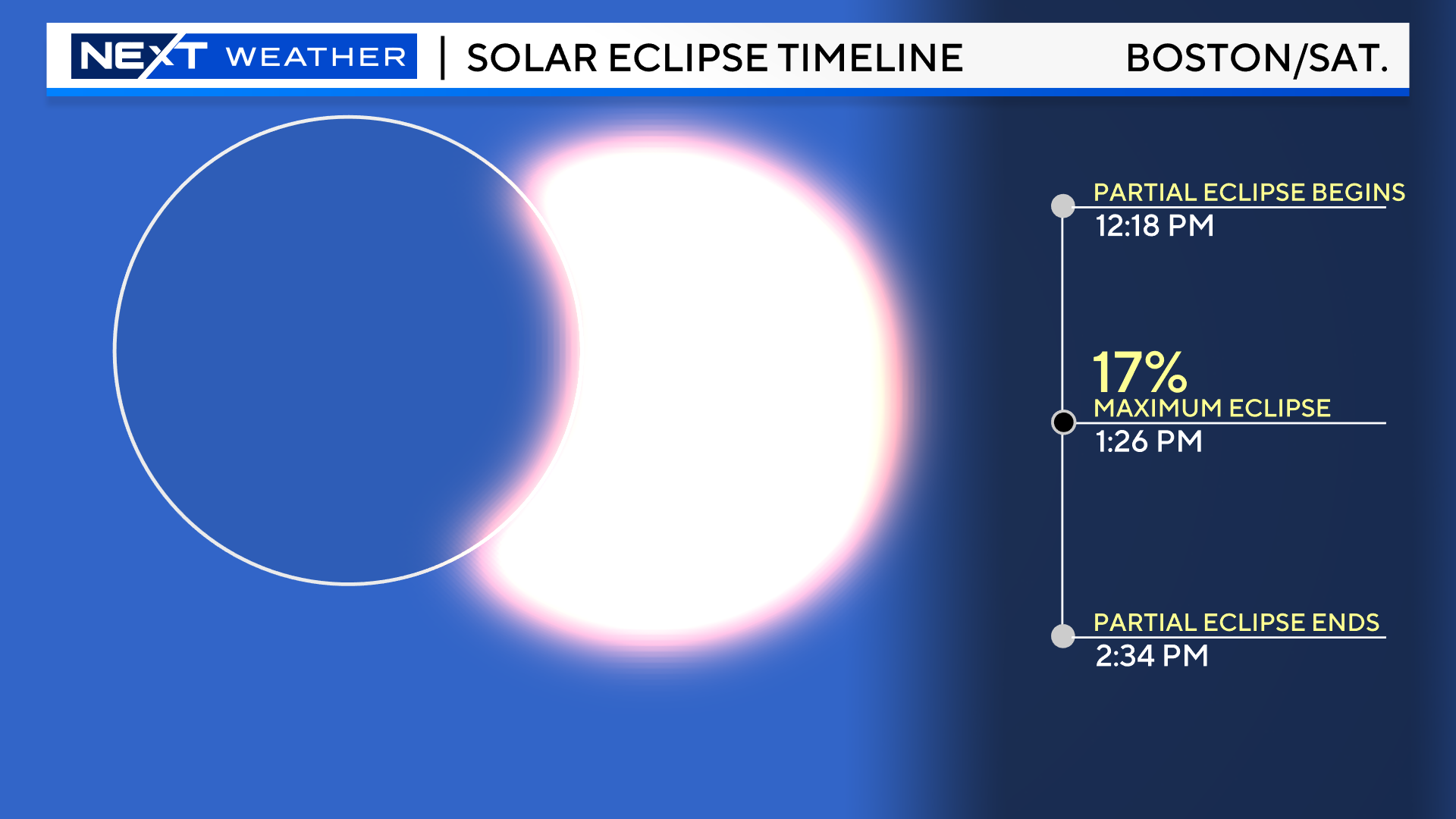
This Saturday we have a very exciting event known as an annular solar eclipse. This is slightly different than a total solar eclipse in that the Moon does not completely cover the entire disk of the sun. An annular solar eclipse, also known as a “ring of fire eclipse” occurs when the new Moon moves directly in line, in-between the Earth and the Sun. Unlike a total solar eclipse, the Moon is farther away from the Earth in its orbit during an annular eclipse, so it appears smaller in our sky. On Saturday, the Moon will cover 91% of the sun, leaving a “ring of fire” around the edges. This will only occur along a very narrow path known as the “path of annularity”.
For this particular event, that path is over parts of the western United States, stretching from Oregon to western Texas.
We will be on the eastern edge of this event on Saturday here in New England. In Boston, the Moon will cover a maximum of only 17% of the sun at 1:26pm.
The entire partial eclipse here takes place from 12:18pm to 2:34pm.
We will have more on this to come later this week. At this point, given the weather forecast for the weekend, it appears unlikely that any of this will be visible in our area.
Click here for Westford snow storm data and past totals or select “Winter Snowfall“ under “Pages” on the left hand side.
For more up to date forecast information follow me on Twitter (@terrywbz) or follow the WBZ weather team on Facebook, search WBZWeather
Reader Comments