


Happy Tuesday!
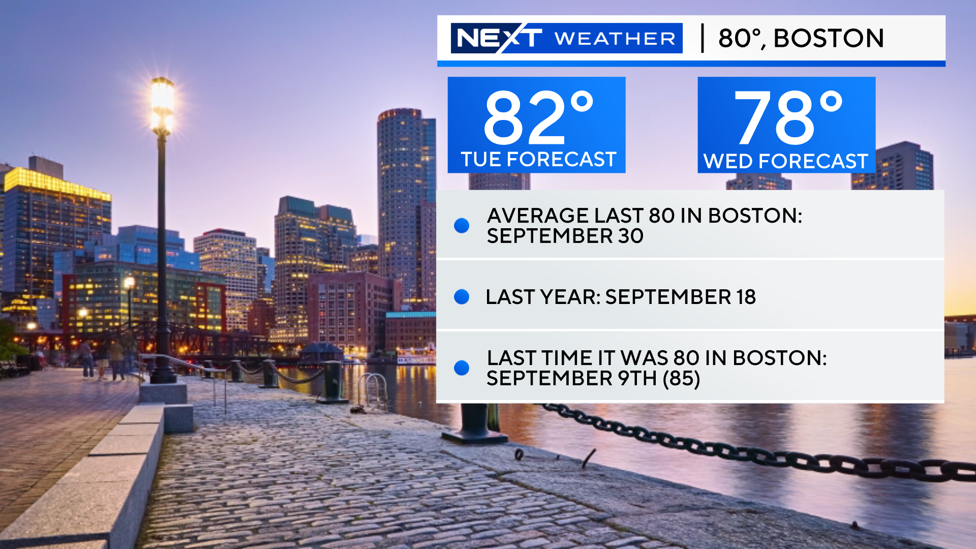
Does it get better than this? I think we can count on one hand the number of days recently with clear, blue skies, no rain and no wildfire smoke. Add to that, a high temperature today in the low 80s (our average for this date is 67), and you get the perfect recipe for a LONG lunch break.
Hard to believe, it has been nearly a month since Boston hit 80 degrees (thanks for nothing September).
And, you never know if this could be the last time we hit 80 for many months. Some inland locations will do it again tomorrow but, after that, we may have to wait until next spring. Our average last 80 degree day comes around the end of September.
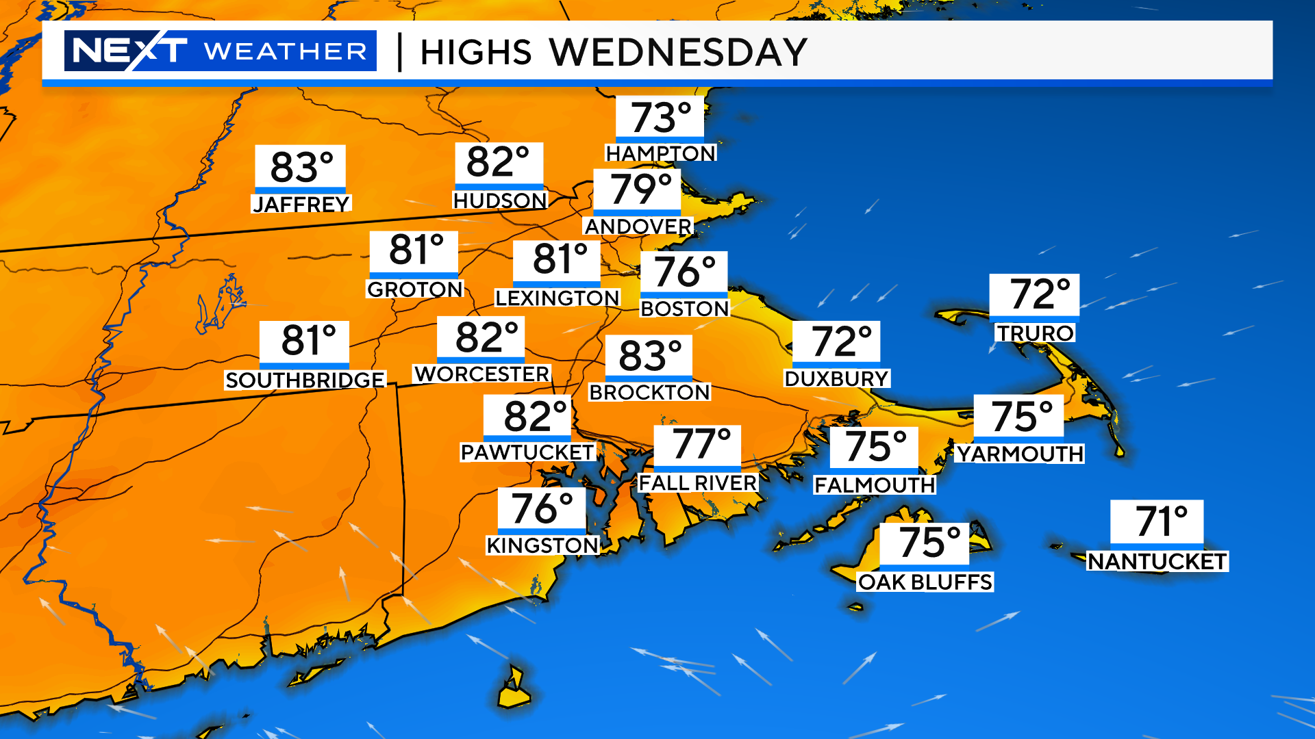
There will be a bit of an onshore breeze Wednesday, so the Coastline will stay in the 70s while inland locations soar to 80-85 once again.
Thursday will be another beauty, albeit a few degrees cooler and with a little more cloud cover.
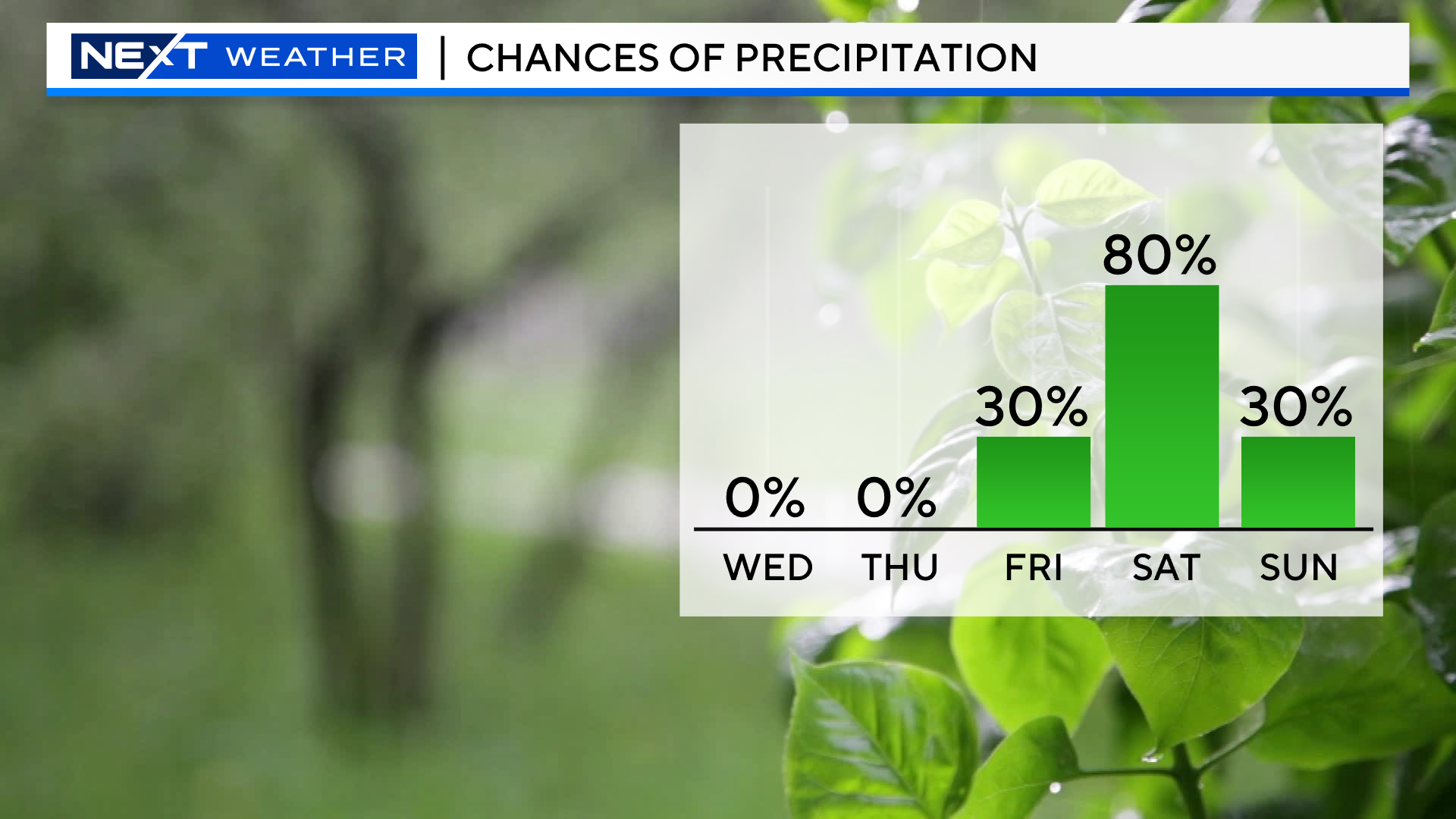
And then, an all-too familiar story, rain coming for the Weekend.
If you go back to June 1, we have had 18 wet weekends including 9 soggy Saturdays, 9 soaking Sundays and 5 weekends with rain on both days.
Some rain has fallen in Boston on 7 of the last 8 weekend days going back to the beginning of September.
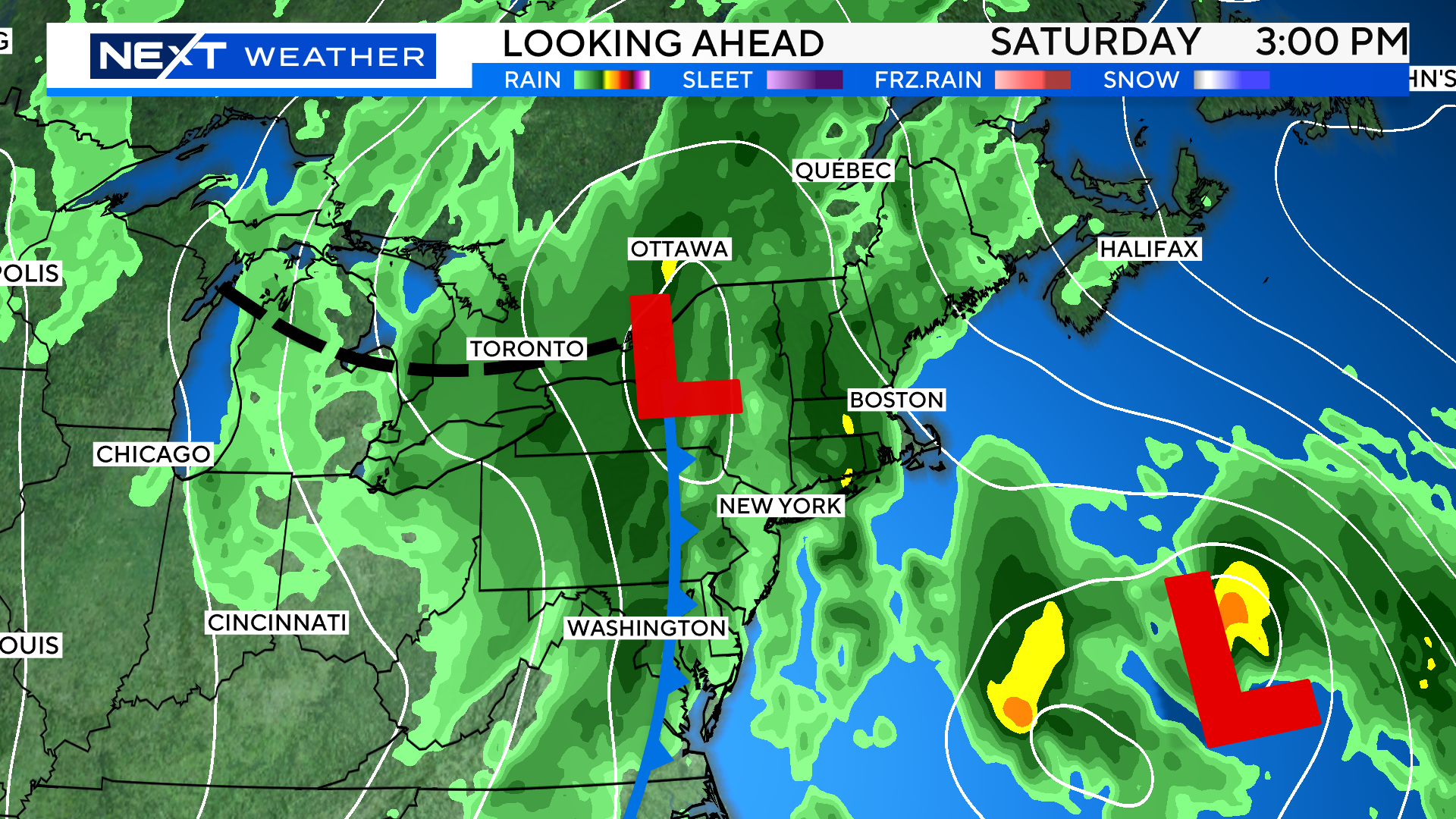
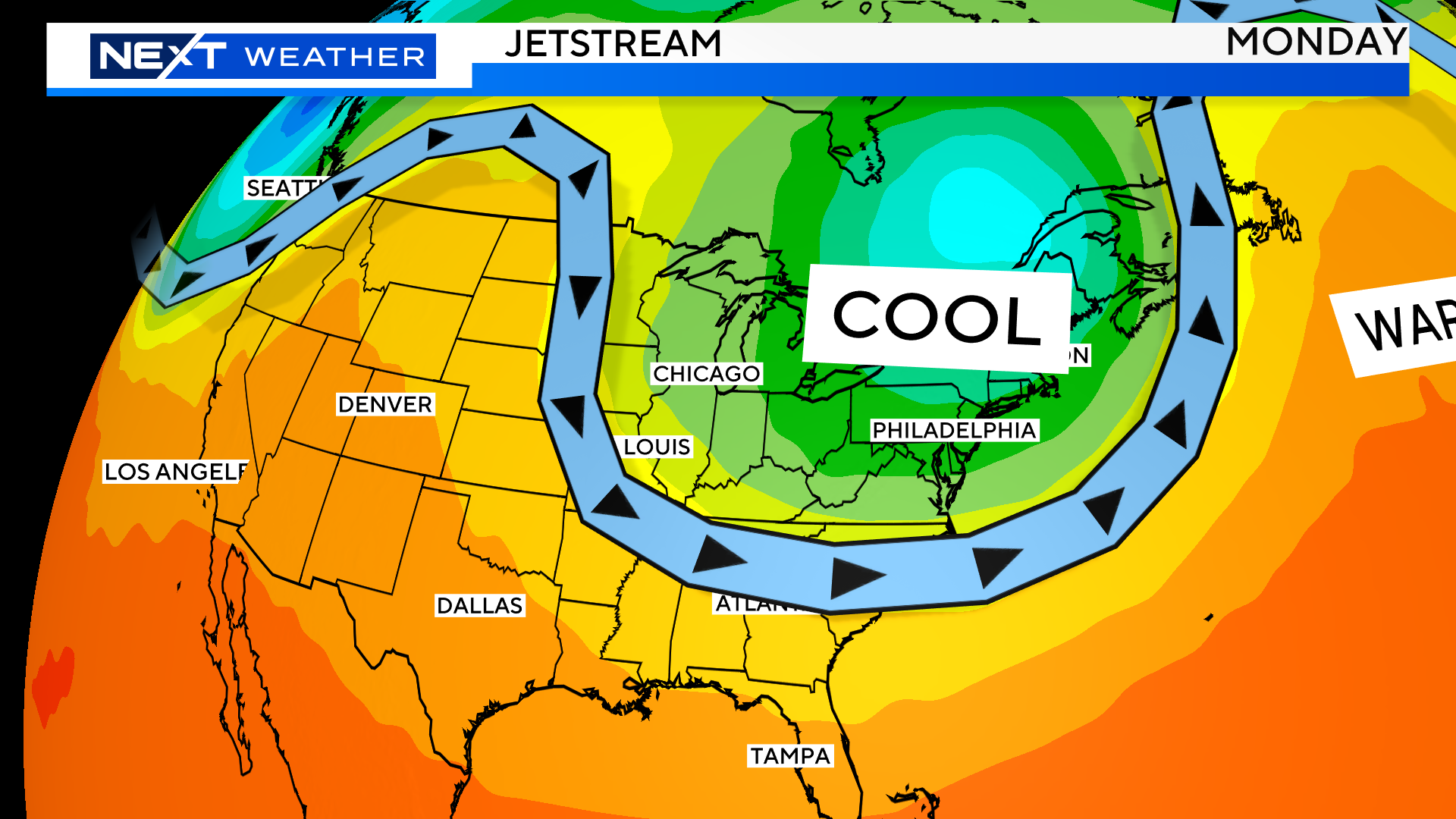
This weekend we will have a front approaching from the west and Tropical Storm Phillipe off to our east.
The heaviest rainfall will come during Saturday from that frontal system, while Philippe heads up into Nova Scotia and Downeast Maine.
While Sunday will be a drier day, we cannot rule out a pop-up shower, same for Monday.
Essentially, the remnants of Philippe are expected to head into eastern Canada and stall out for several days, causing a trough to set up in the northeast.
This means a stretch of cooler than average days along with a somewhat unsettled pattern. Not expecting a lot of rain after Saturday, but we will be in and out of the clouds with a few showers here and there. Bye-bye 80 degrees!
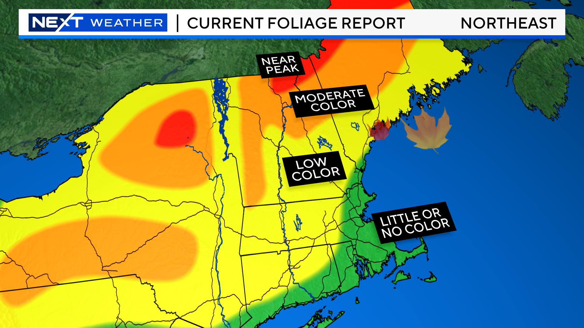
Columbus Weekend is typically the best and most popular weekend of the year for leaf peeping in central and northern New England. In an “typical” year, the foliage is just about at its peak in most of that area, perhaps just past its peak in the higher elevations of the White Mountains.
This year has been anything but typical.
You have to drive a significant distance from Boston to see any decent color.
The good news is that just in the last couple of days we have seen a major burst of color in the Green and White Mountains. In the highest elevations, foliage is now well on its way to peak color. And, despite the slow start, reports from that region are quite good!
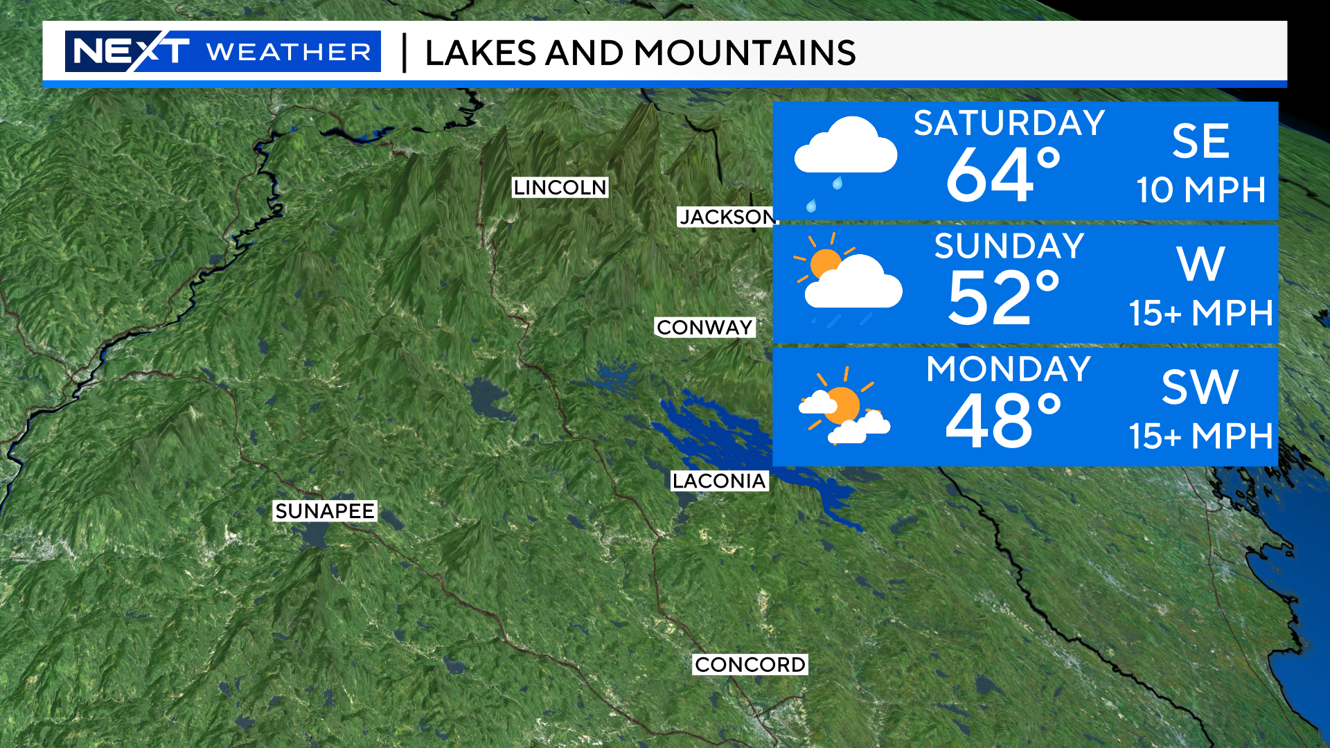
Now for the bad news…the forecast this weekend for the Mountains is not ideal.
Saturday is trending towards a washout.
Sunday is likely to be mostly cloudy with some scattered showers. A much drier day than Saturday but also windier and cooler.
Monday, more of the same. Lots of clouds, a few pop-up showers, windy and chilly…stuck in the upper 40s in northernmost areas.
Click here for Westford snow storm data and past totals or select “Winter Snowfall“ under “Pages” on the left hand side.
For more up to date forecast information follow me on Twitter (@terrywbz) or follow the WBZ weather team on Facebook, search WBZWeather
Reader Comments