


It’s another gorgeous day today! If only we could bottle this up and save it for the weekend…
Today will, once again, feature mainly sunny skies and highs in the mid 70s, near perfection.
Tomorrow will be a tad cooler and we will start to see come high clouds moving in. Still, not a bad day…

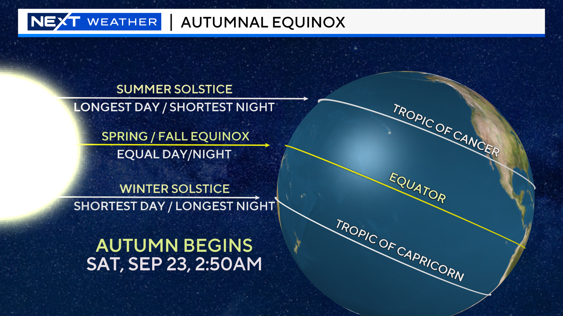
Saturday is the first day of Fall! The Autumnal Equinox occurs at 2:50am Saturday morning.
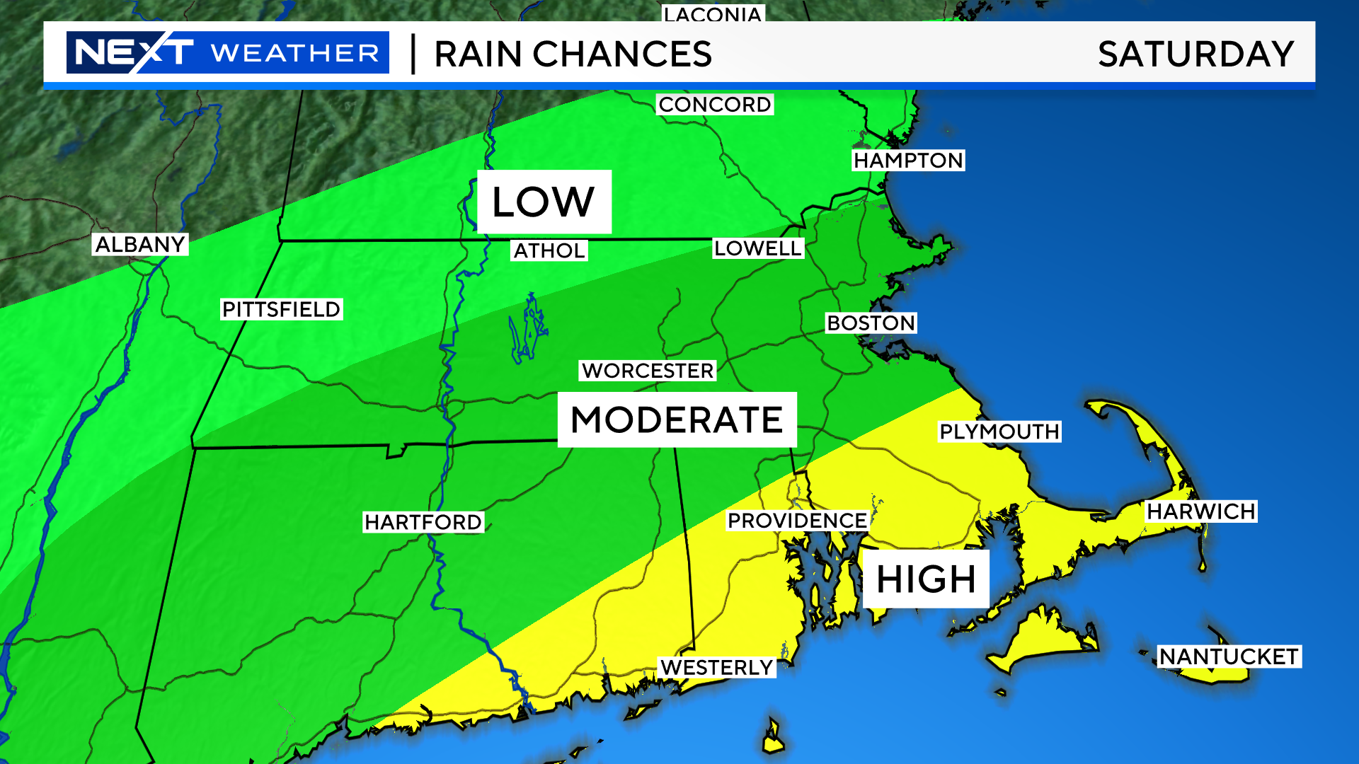
New season, same result…looks like periods of rain this weekend.
Models have trended a bit wetter for Saturday, many showing a near washout.
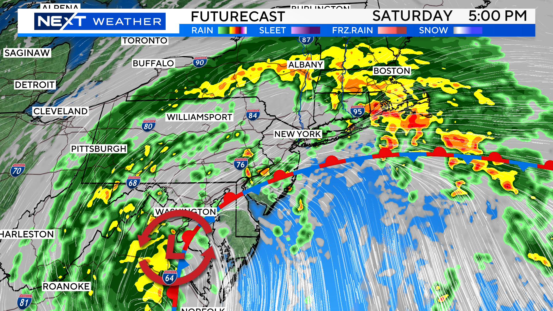
I am still holding out hope that parts of our area COULD remain dry Saturday and the majority of the rain will be held to the south, but those chances seem to be dwindling by the hour. The highest washout potential is over southeastern MA…the farther north and west you go, the better chance of some dry weather.
We may get a bit of a break from the rain early on Sunday, but it is likely to return late Sunday into Monday…I wouldn’t count on seeing much, if any, sunshine either day this weekend.
After getting a bit of a jump start this week, the fall foliage season is likely to go back on hold with the wet weather coming this weekend…for more on that, you can read by blog here:
https://www.cbsnews.com/boston/news/foliage-season-new-england-start-leaves-changing-colors-weather/
Bottom line, it is off to a historically slow start.

Here we go again…For the second weekend in a row we will be talking about a Tropical system near the East Coast.
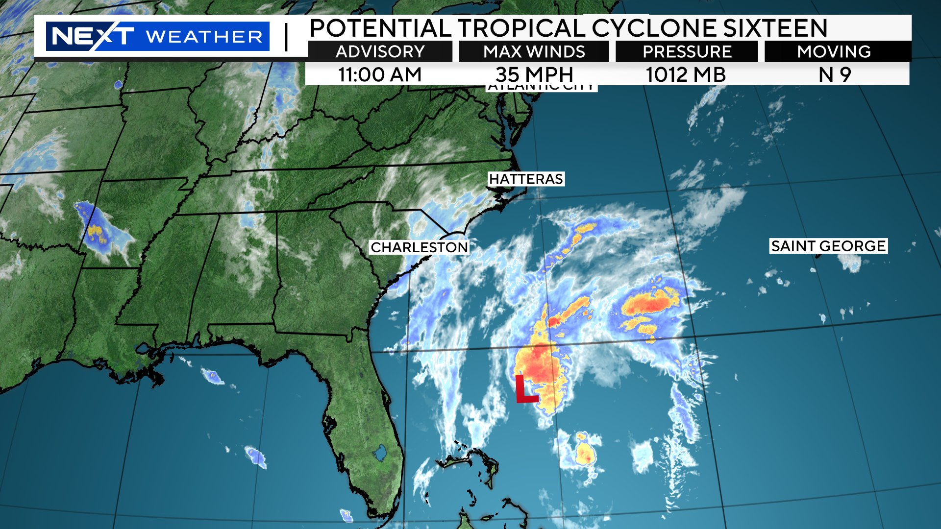
As of 11am Thursday, the National Hurricane Center began issuing advisories on “Potential Tropical Storm 16”
This is for an area of disturbed weather off the southeast Coastline, which currently has a 50% chance of becoming tropical.
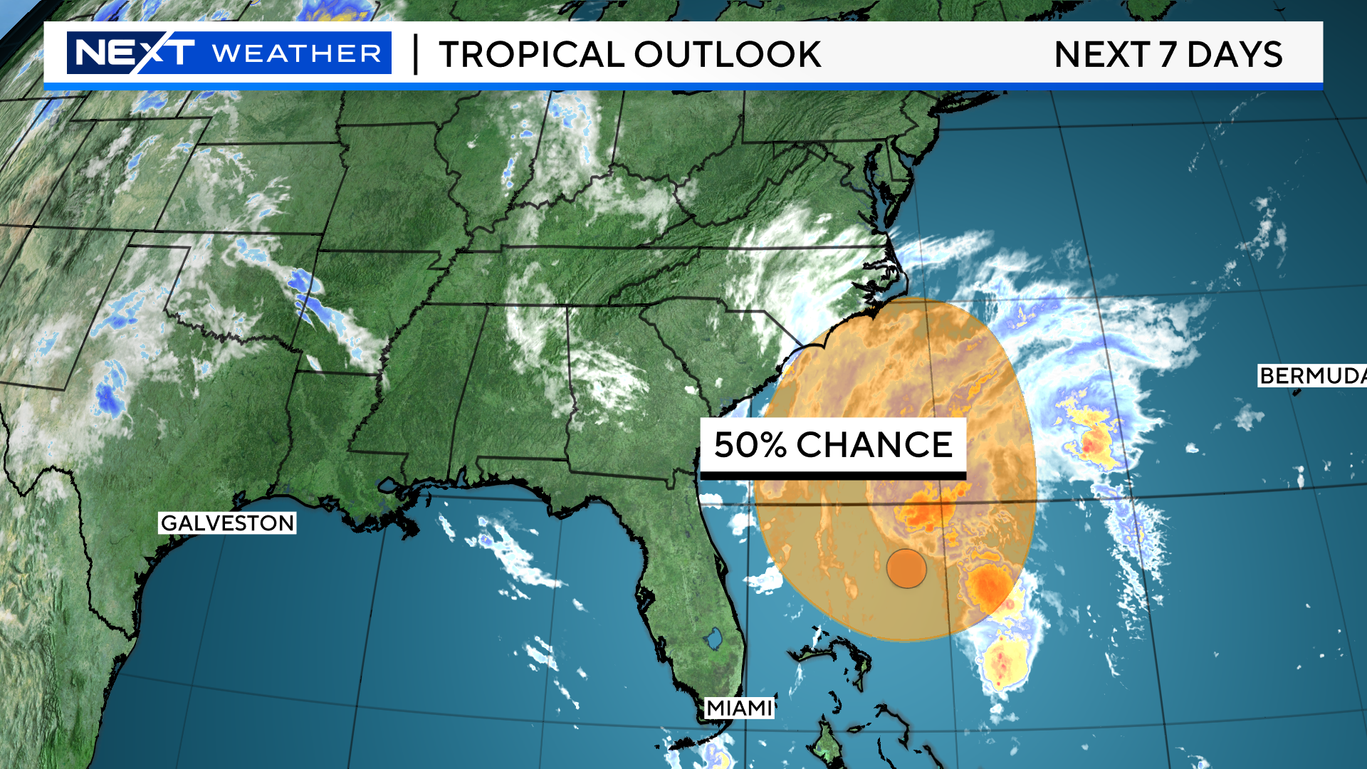
The center of this developing storm system is about 370 miles southeast of Charleston, South Carolina and has maximum sustained winds of 35mph.
It is currently drifting northward at about 10 mph.
The official National Hurricane Center forecast is for this to become a Tropical Storm (Ophelia) by Friday morning and continue to strengthen through the day Friday. It then makes landfall in coastal North Carolina early on Saturday.
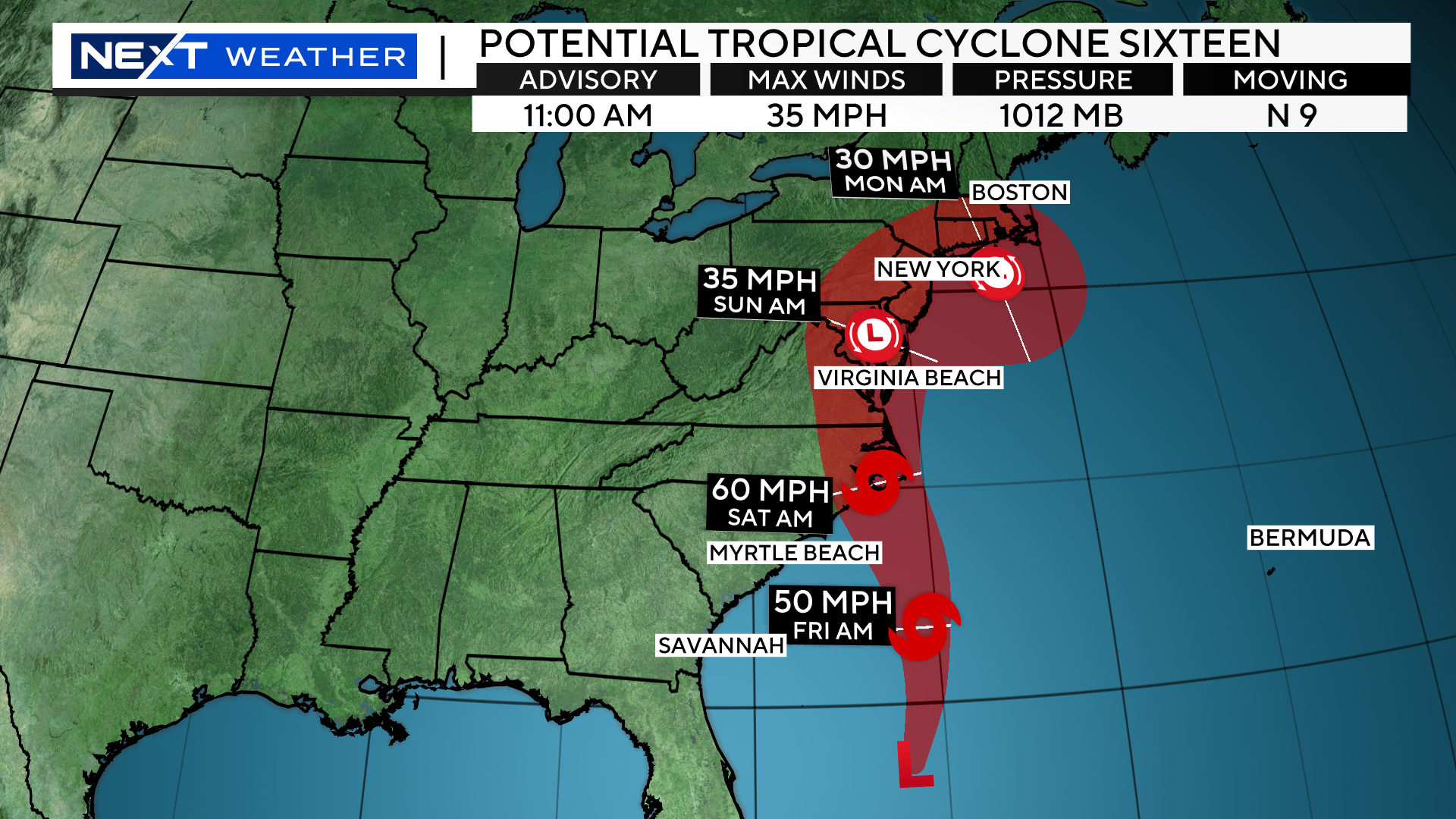
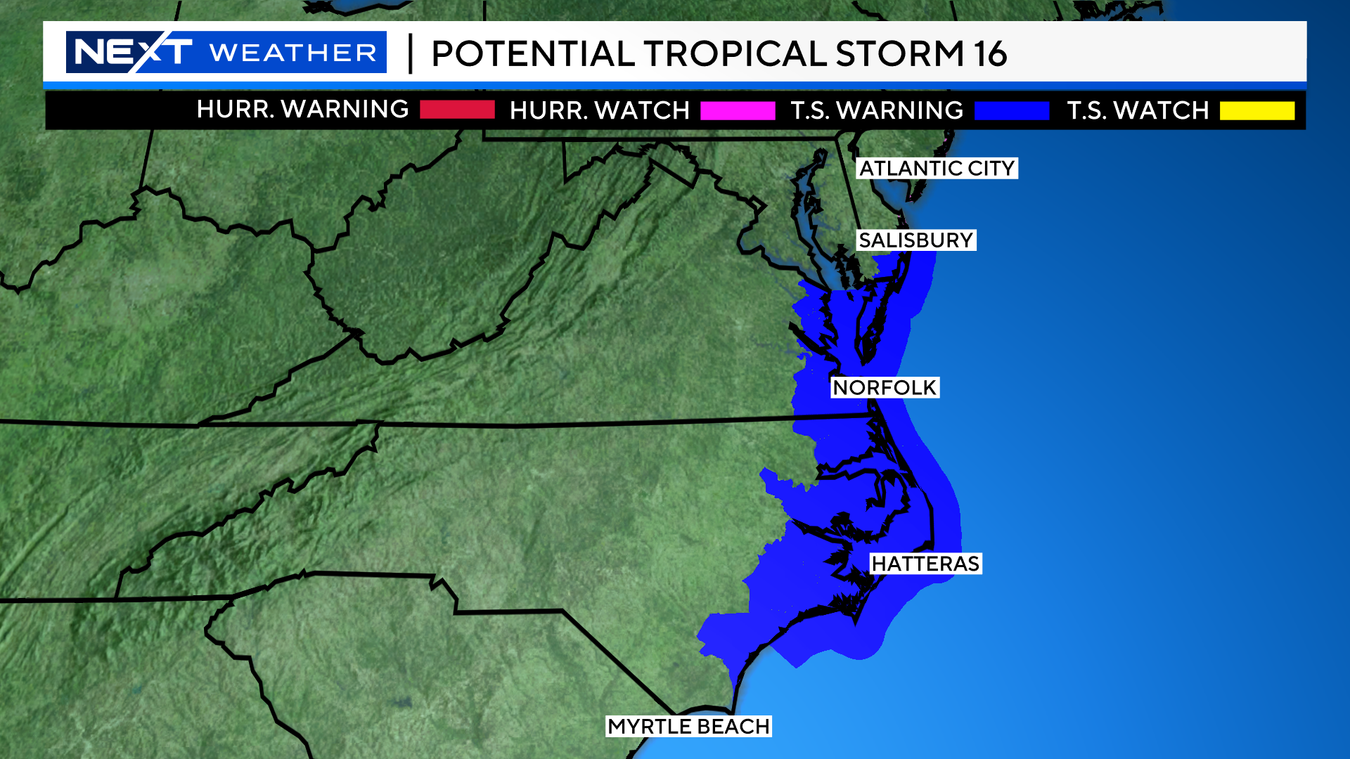
There are currently Tropical Storm Warnings in effect from Cape Fear, NC to Fenwick Island, DE. Among the concerns in this area are a 2-4 foot storm surge, as well as coastal and inland flooding.
Current forecasts are for at least 2-4″ of rain in many areas between North Carolina and the Mid Atlantic. Farther north into New England, there is still some model discrepancy as to how much we are impacted. More on that to come in the next 24 hours.
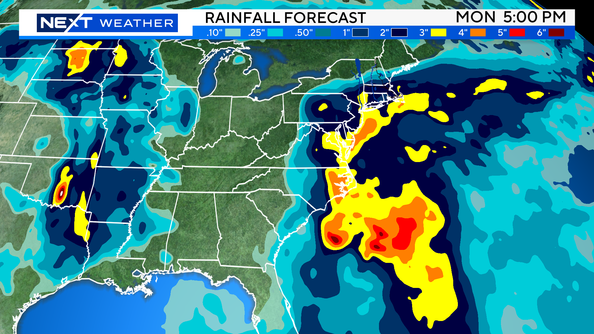
Needless to say, it is imperative that you stay tuned to update forecasts in the next 24 to 48 hours. While we do not anticipate any sort of tropical landfall in New England, there is certainly a risk of some periods of heavy rain this weekend…something we can not afford given how wet it has been.
Click here for Westford snow storm data and past totals or select “Winter Snowfall“ under “Pages” on the left hand side.
For more up to date forecast information follow me on Twitter (@terrywbz) or follow the WBZ weather team on Facebook, search WBZWeather
Reader Comments