


If you’ve come here looking for good news, perhaps a sudden change in the weekend forecast, you’ve sadly come to the wrong place. I will do my best to guide you to the “drier” times this weekend. I am stopping short of calling the entire weekend a washout as there will be some variability from place to place. Let’s dig in…
I think it is important to note that we do not expect there to be any widespread flooding issues or severe weather. This weekend is more of a grind. There will be periods of rain over a 72 hour stretch (into Monday), which, in the end, will add up to about 1-3″ of water for most of southern New England. Consider, that most of the storms we have experienced lately have dropped at least that much in just a few hours…So, the story this time is less of a severe or sudden flooding situation and more of a prolonged cloudy, damp and dreary stretch.
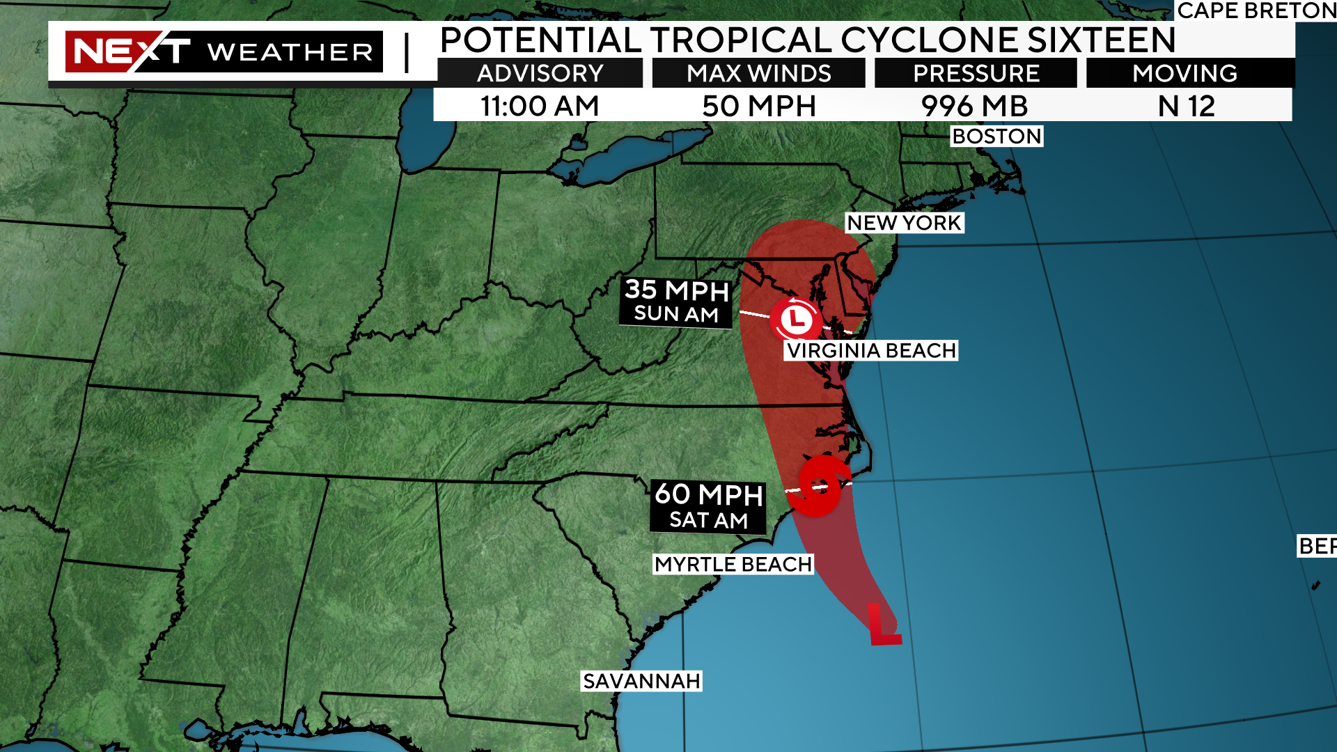
I realize that the potential tropical storm is attracting most of the headlines, however, for us here in New England it is really irrelevant whether it gets a name or not.
Whatever it is, it will make landfall in North Carolina this weekend and we will be getting wet either way.
Rain Timeline:
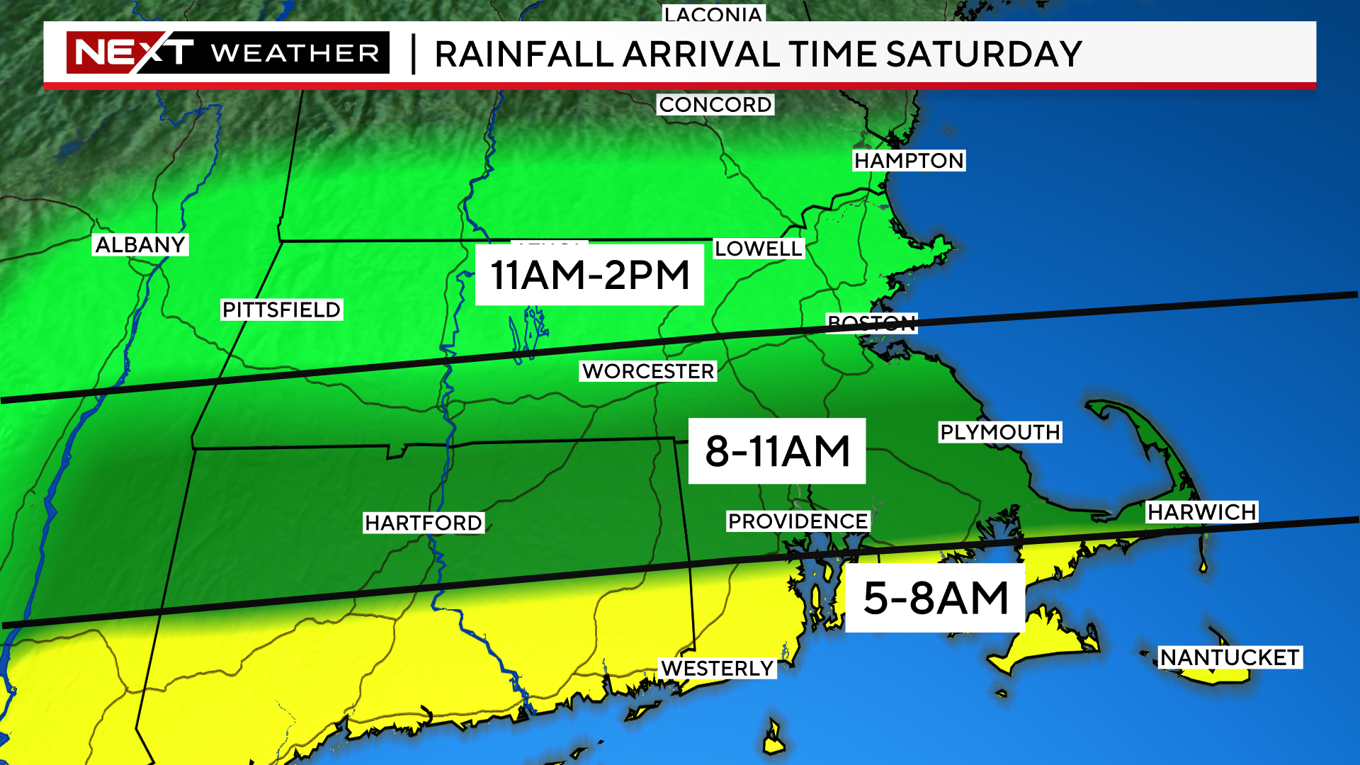
There will be a solid shield of moderate rainfall moving northward into southern New England Saturday morning.
Plan on steady rain arriving first along the South Coast around dawn.
It should get to the Mass Pike and Boston/Worcester between 8-11am.
It will take a little longer to reach the MA/NH border, perhaps not arriving until lunchtime.
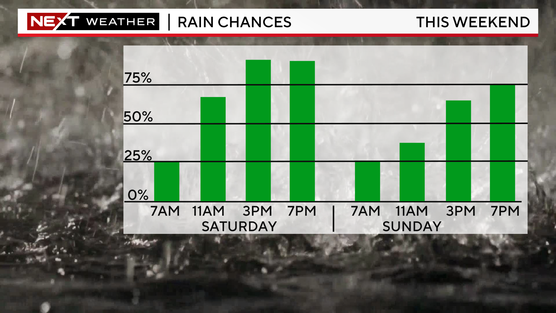
Once it arrives, it will generally be steady, light to moderate rainfall for the remainder of the day and through the evening hours. There could be some pockets of downpours here and there.
We expect there to be a break from the steady rainfall on Sunday morning/midday. There will still be pockets of drizzle here and there (no prize), before another round of steady rain moves in later Sunday afternoon lasting into Monday.
When all is said and done (by Monday night), we expect a general 1-3″ of rain for the entire area. Amounts on the higher end south of the Pike and near the South Coast and on the lower end farther north towards New Hampshire.
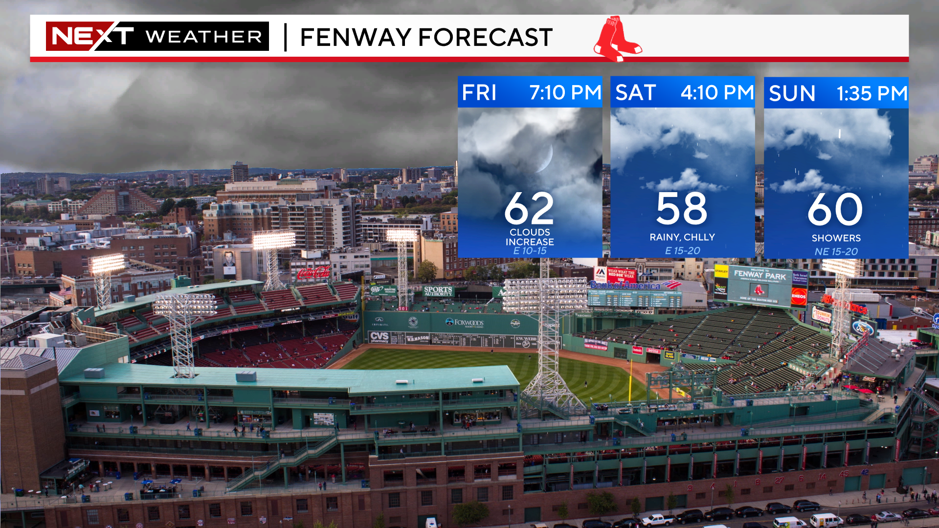
If you have tickets to Billy Joel Saturday night at Gillette or the Sox on Saturday or Sunday, bundle up and bring your rain gear.

If you are willing to take a drive this weekend, the best weather will be in far northern New England.
There could be some sunny breaks up in the northern Greens and Whites and temperatures will be 5-10 degrees milder with a very low risk of any rainfall.

Click here for Westford snow storm data and past totals or select “Winter Snowfall“ under “Pages” on the left hand side.
For more up to date forecast information follow me on Twitter (@terrywbz) or follow the WBZ weather team on Facebook, search WBZWeather
Reader Comments