


Hurricane Lee
Category 1
5 p.m. Update
Coordinates/Location:
37.9N 66.7W
290 miles SE of Nantucket
Maximum Sustained Winds:
80 mph
Movement:
N at 18 mph
Minimum Central Pressure:
965mb or 28.50″
We now have high confidence that Lee will pass about 200 miles east of southern New England Saturday morning.
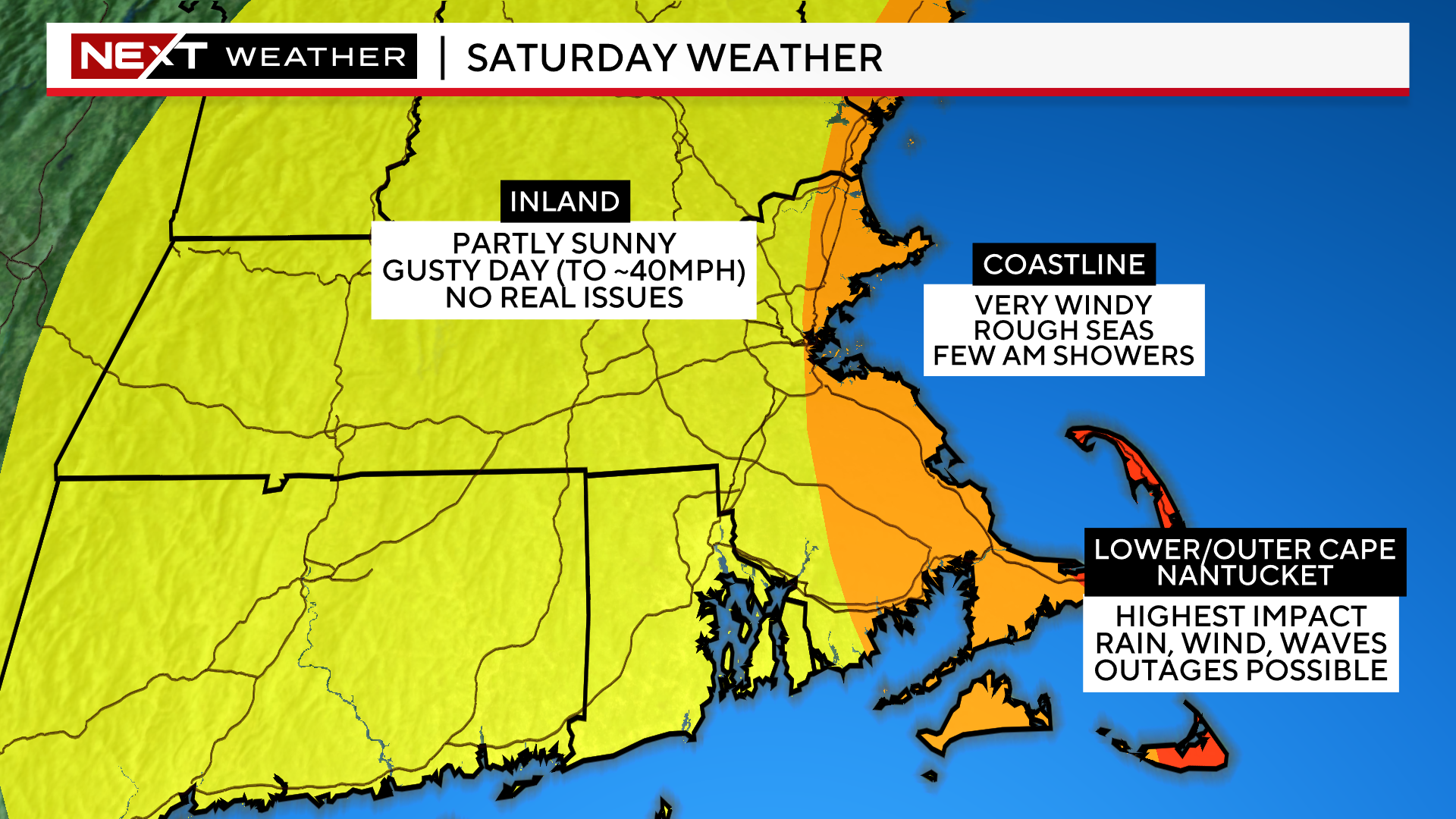
With a track this far offshore, impacts will be minimal for most of our area.
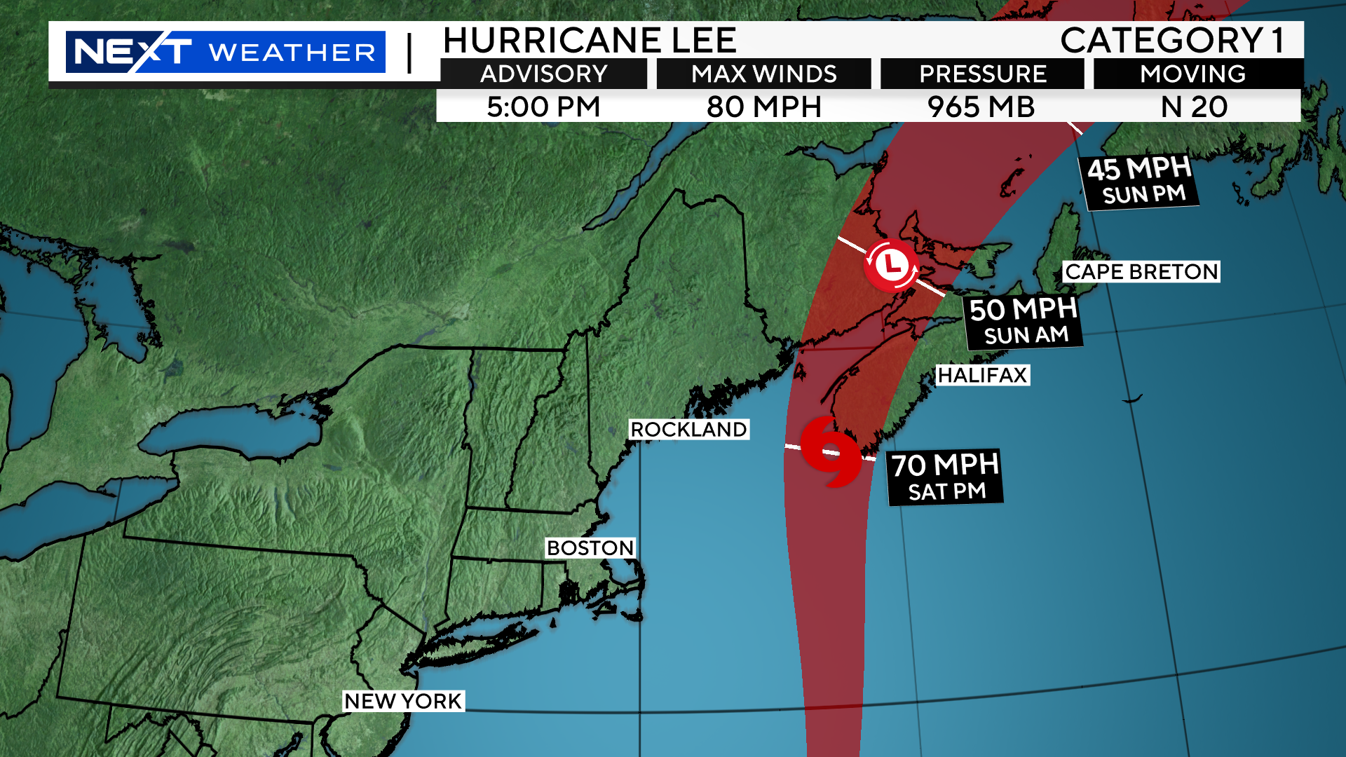
The greatest impact will be felt on the Lower and Outer Cape and on Nantucket. In those areas, we anticipate frequent tropical storm force winds, some bands of rain and also the possibility of some power outages.
West of there, Lee won’t amount to much. A few AM showers are possible along the rest of the Coastline. West of I95, we don’t expect any rainfall at all. In fact, many inland locations will see some sunshine during the day on Saturday.
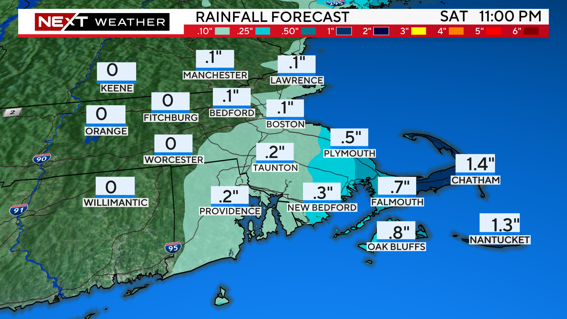
RAIN TIMELINE:
The first rain bands could creep up on the Islands and Cape Cod just after sunset on Tonight. Overnight, the rain shield will push westward to just about the Cape Cod Canal, perhaps bringing some light showers along the immediate Coastline up through Boston and the North Shore.
By late Saturday morning, as Lee passes our latitude, the rain will begin to pull northeastward, off the Cape.
Rain amounts will be meager outside of extreme southeastern MA.
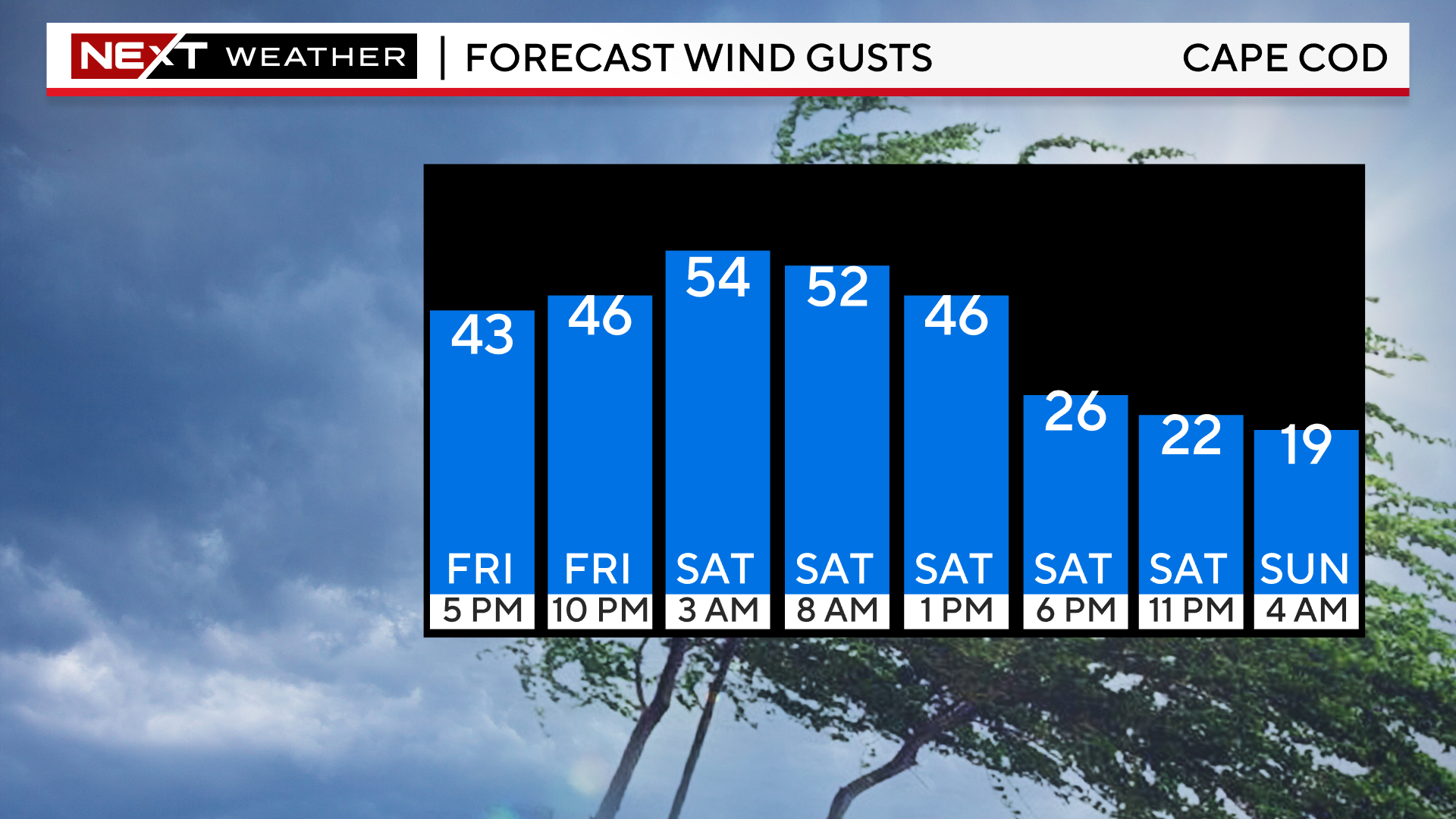
WIND TIMELINE:
The winds have already begun to ramp up over southeastern MA and will continue to do so for the remainder of Friday.
Peak winds will come overnight tonight through about 7am Saturday.
During this time, we expect gusts between 50-65mph on the Outer Cape and Nantucket.
For the rest of the Coastline, peak gusts will range between 40-50mph.
Farther inland, west of I95, gusts should top out between 25-40mph.
Later Saturday morning and throughout the afternoon and evening, the peak wind speeds/gusts will slowly decrease hour by hour.
By sunset on Saturday, gusts should be no higher than 20-30mph even on Cape Cod.
COAST:
The greatest impact from Lee will clearly be felt in our coastal waters and right at the Shoreline. We anticipate 10-20 foot waves and some coastal erosion. Thankfully, our tides are astronomically low right now and it also appears that the peak of Lee’s impact and wind will come during the low tide on Saturday morning.
There is a coastal flood advisory in effect for both high tide cycles, around 1am tonight and 1pm Saturday.
No doubt about it, we are dodging a MAJOR bullet with Lee. This one was way too close for comfort and many folks will never know how lucky we were that Lee didn’t take a closer track or make a direct hit on southern New England.
A minor wobble to the west and the story would have been much different.
Most of us will go about our day on Saturday with very little impact or disruption to our lives.
The next time we may not be so lucky. It could be a month from now, a year from now or 20 years from now, but sooner or later it will be our turn.
Click here for Westford snow storm data and past totals or select “Winter Snowfall“ under “Pages” on the left hand side.
For more up to date forecast information follow me on Twitter (@terrywbz) or follow the WBZ weather team on Facebook, search WBZWeather
Reader Comments