


Post-Tropical Cyclone Lee
5 a.m. Update
Coordinates/Location:
41.8N 66.0W
230 miles SSW of Halifax
Maximum Sustained Winds:
80 mph
Movement:
N at 25 mph
Minimum Central Pressure:
965mb or 28.50″
The center of Lee has wobbled a bit farther east overnight and is now passing about 250 miles east of Boston.
Lee has officially become “post-tropical” on Saturday morning. This essentially means it is taking on the shape and characteristics of a typical mid-latitude storm.
With a track this far offshore, impacts will be minimal for most of our area and felt most acutely along the immediate coastline.
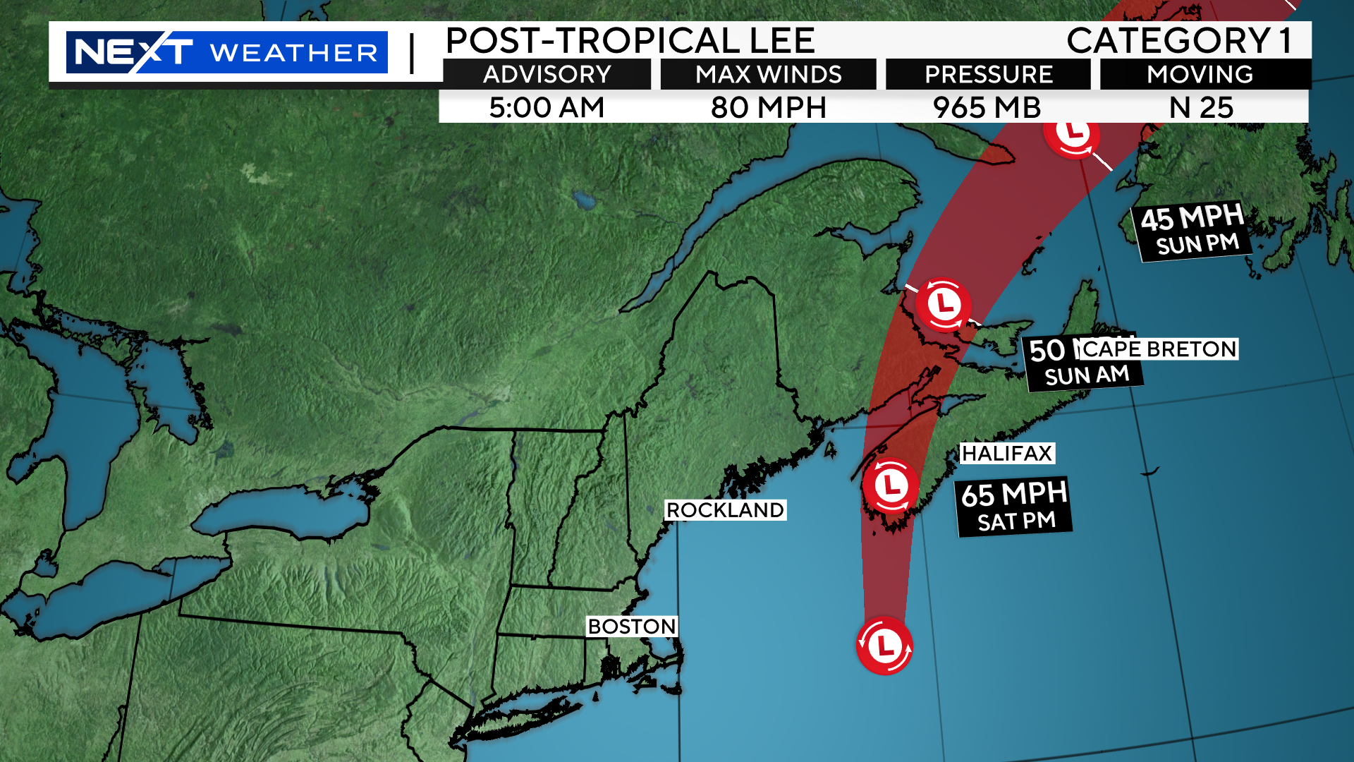
The greatest impact will be felt on the Lower and Outer Cape and on Nantucket. That is where some bands of rain and wind gusts over 50mph will occur through the morning.
West of there, Lee won’t amount to much. A few AM showers along the rest of the Coastline. West of I95, we don’t expect any rainfall at all. In fact, most inland locations will see some sunshine during the day on Saturday.
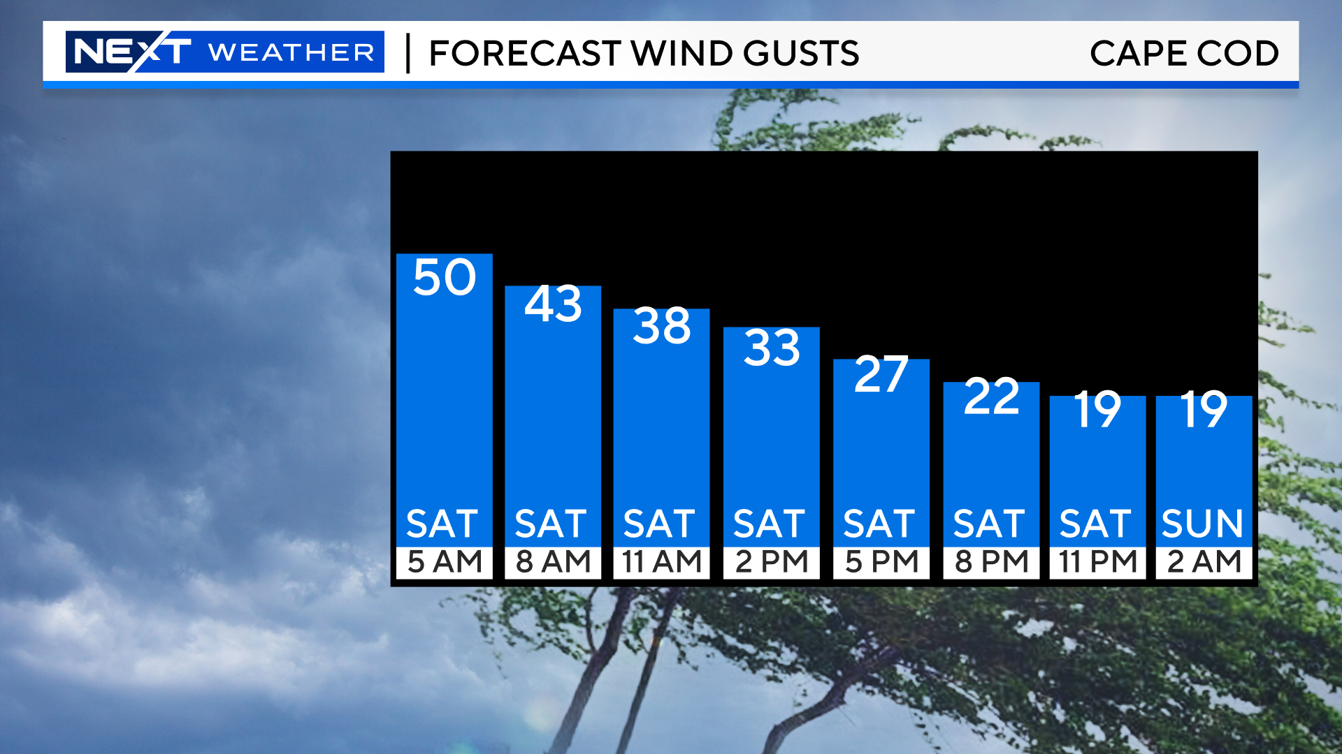
WIND TIMELINE:
Peak winds overnight and early on Saturday topped out between 45-55mph with a few isolated higher gusts.
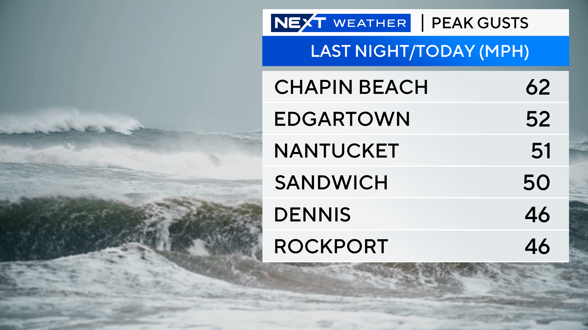
The wind speeds will gradually decrease hour-by-hour through the rest of the day today.
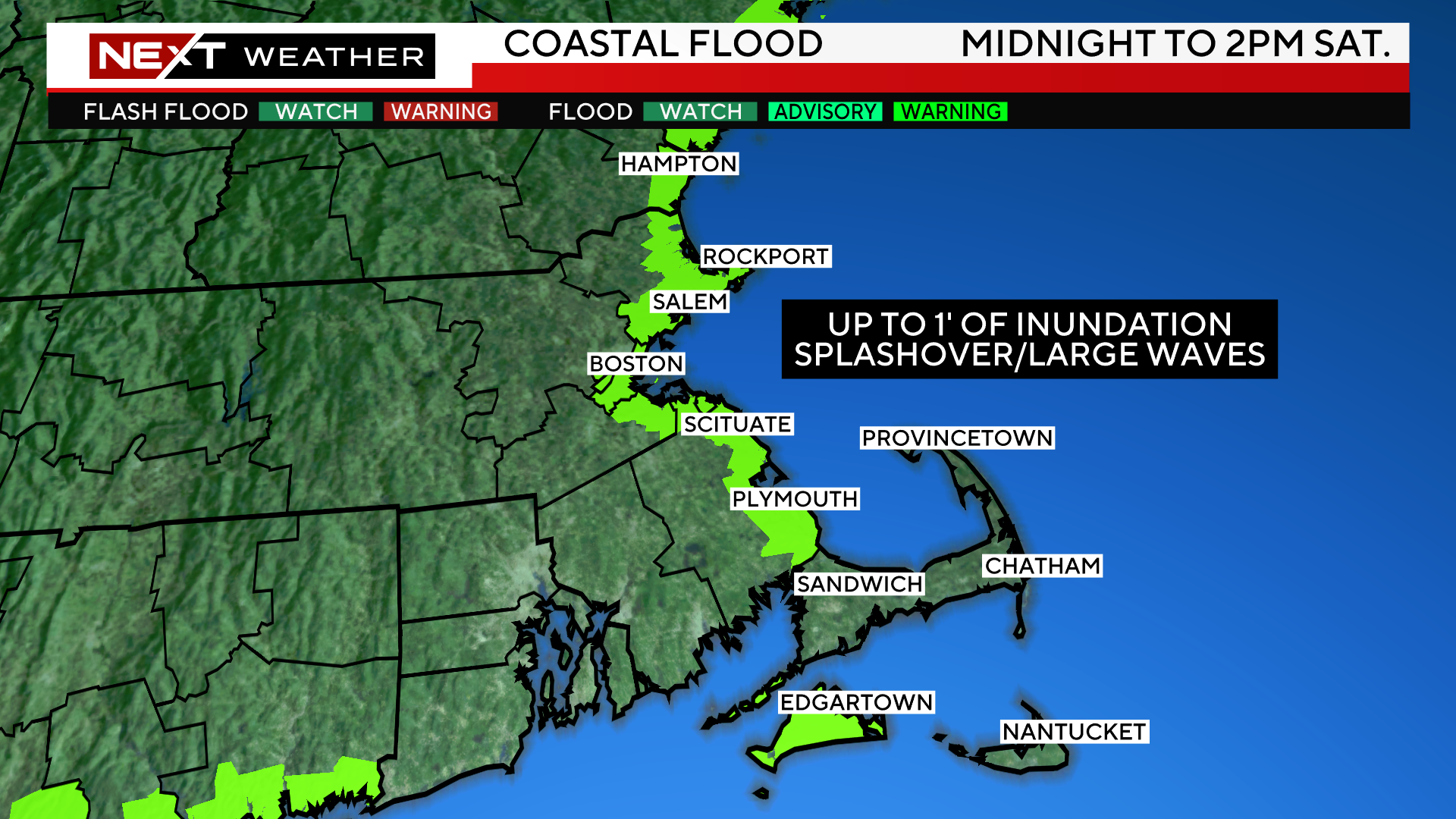
COAST:
The greatest impact from Lee will clearly be felt in our coastal waters and right at the Shoreline. We anticipate 8-18 foot waves and some coastal erosion.
There is a coastal flood advisory in effect for the midday/early afternoon high tide on Saturday, but we only anticipate minor flooding.
The remnants of Lee will rapidly pull away from our region Saturday, making landfall in Nove Scotia. Any rainfall will exit by this afternoon and skies will become partly cloudy for a nice finish to the day.
We certainly dodged a MAJOR bullet with Lee. This one was way too close for comfort and many folks will never know how lucky we were that Lee didn’t take a closer track or make a direct hit on southern New England.
Just a few hundred miles to the west and we would have been talking about disastrous flooding and widespread wind damage and power outages.
Thankful that for now, New England has once again been spared from a major tropical hit.
Click here for Westford snow storm data and past totals or select “Winter Snowfall“ under “Pages” on the left hand side.
For more up to date forecast information follow me on Twitter (@terrywbz) or follow the WBZ weather team on Facebook, search WBZWeather
Reader Comments