


Hurricane Lee
Category 1
5 p.m. Update
Coordinates/Location:
31.7N 68.3W
665 miles S of Nantucket
Maximum Sustained Winds:
85 mph
Movement:
N at 15 mph
Minimum Central Pressure:
957mb or 28.26″
There is a Tropical Storm Warning now posted for the entire coastline of Rhode Island, Massachusetts, New Hampshire and Maine. There is still a hurricane watch for the far northeastern coastline of Maine.
Lee is a category 1 hurricane and is forecast to continue to slowly weaken from here on out. Lee is now headed due north and also beginning to accelerate its forward speed.
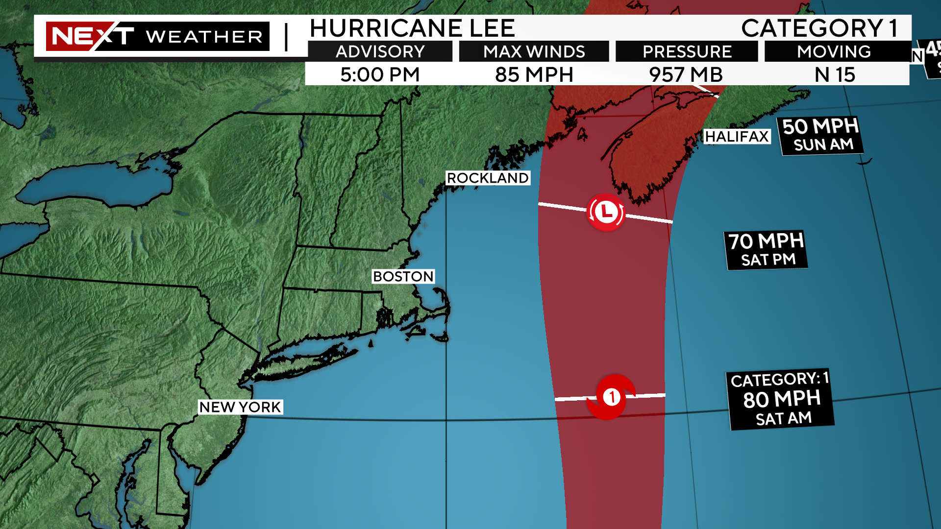
Lee will make it closest approach to New Engand on Saturday morning, likely as a minimal category 1 hurricane, transitioning to an extra-tropical, nor’easter-type storm.
Current projected landfall is in the Bay of Fundy area late Saturday night
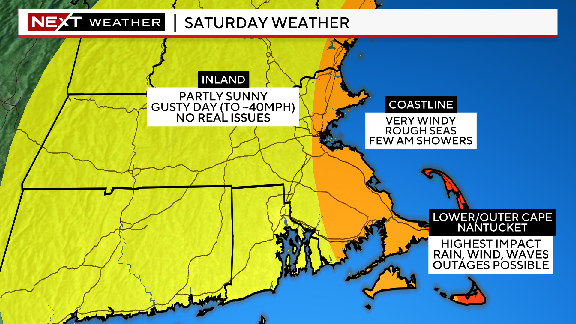
Forecast confidence has increased greatly today with regards to the final track and impacts of Hurricane Lee. The current forecast is for the center of Lee to pass about 150 miles east of the Outer Cape on Saturday morning.
Given this track, the majority of the impacts will be felt over Cape Cod and Nantucket and in particular the Outer Cape.
If you live inland, away from the Coastline, you will see very little rain and just a little gusty wind.
TIMELINE:
The first rain bands could creep up on the Islands and Cape Cod around sunset on Friday.
The peak of the rain and wind will come as the center of the storm is making its closest pass. This occurs very late Friday night through about midday on Saturday.
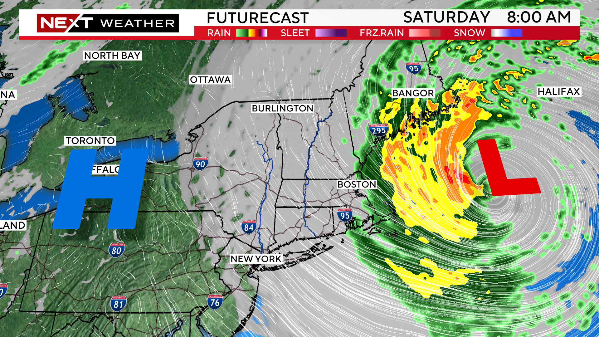
Lee will be accelerating as it passes our latitude and by nightfall, be nearing the Bay of Fundy and Canada.
Therefore, the rain and wind will quickly taper during the afternoon hours, moving into parts of northern New England (Maine).
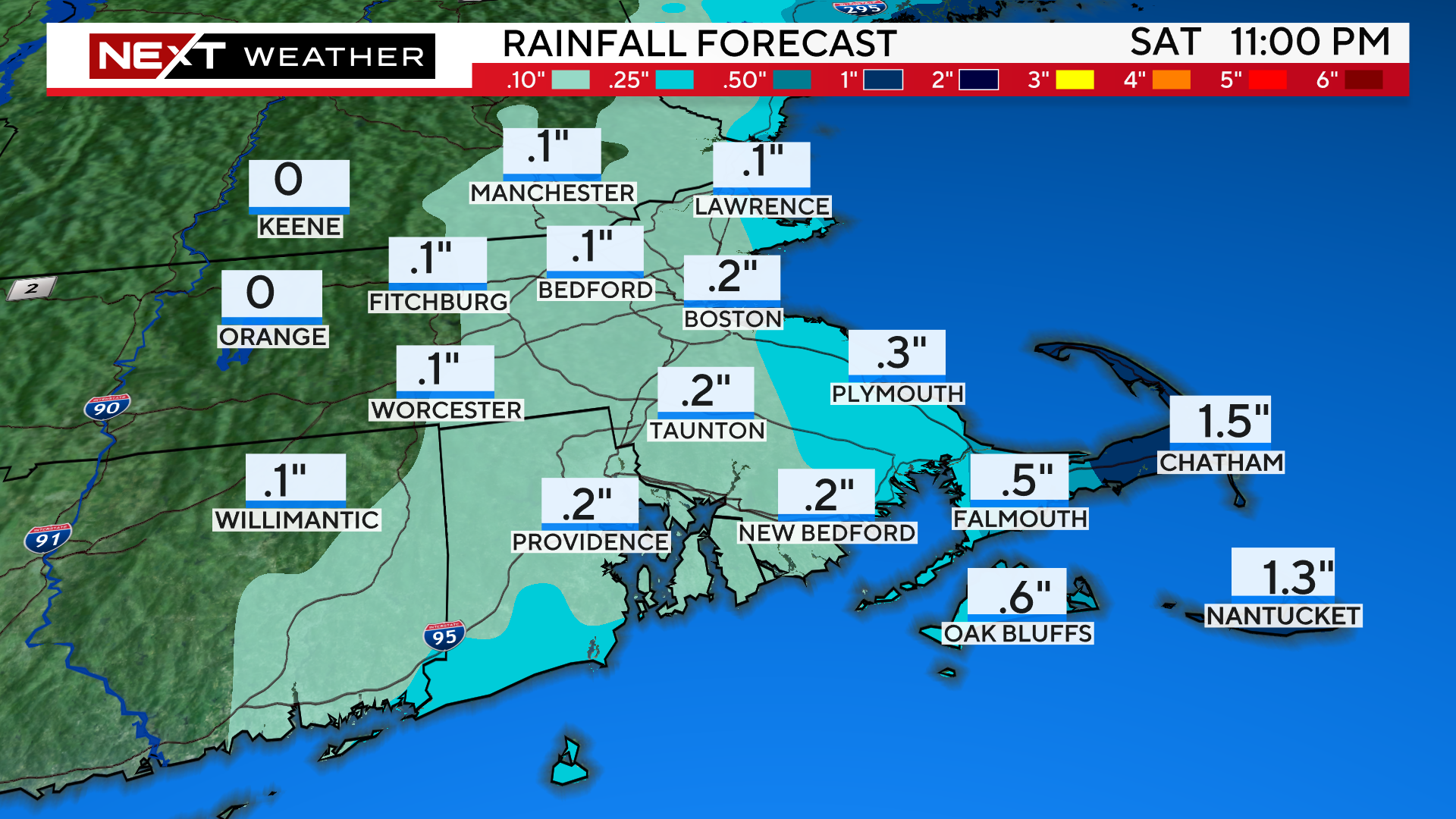
RAIN:
The heaviest rainfall will be in areas closest to the center of the storm, far eastern MA and Cape Cod. In fact, inland areas may see very little, if any rainfall on Saturday.
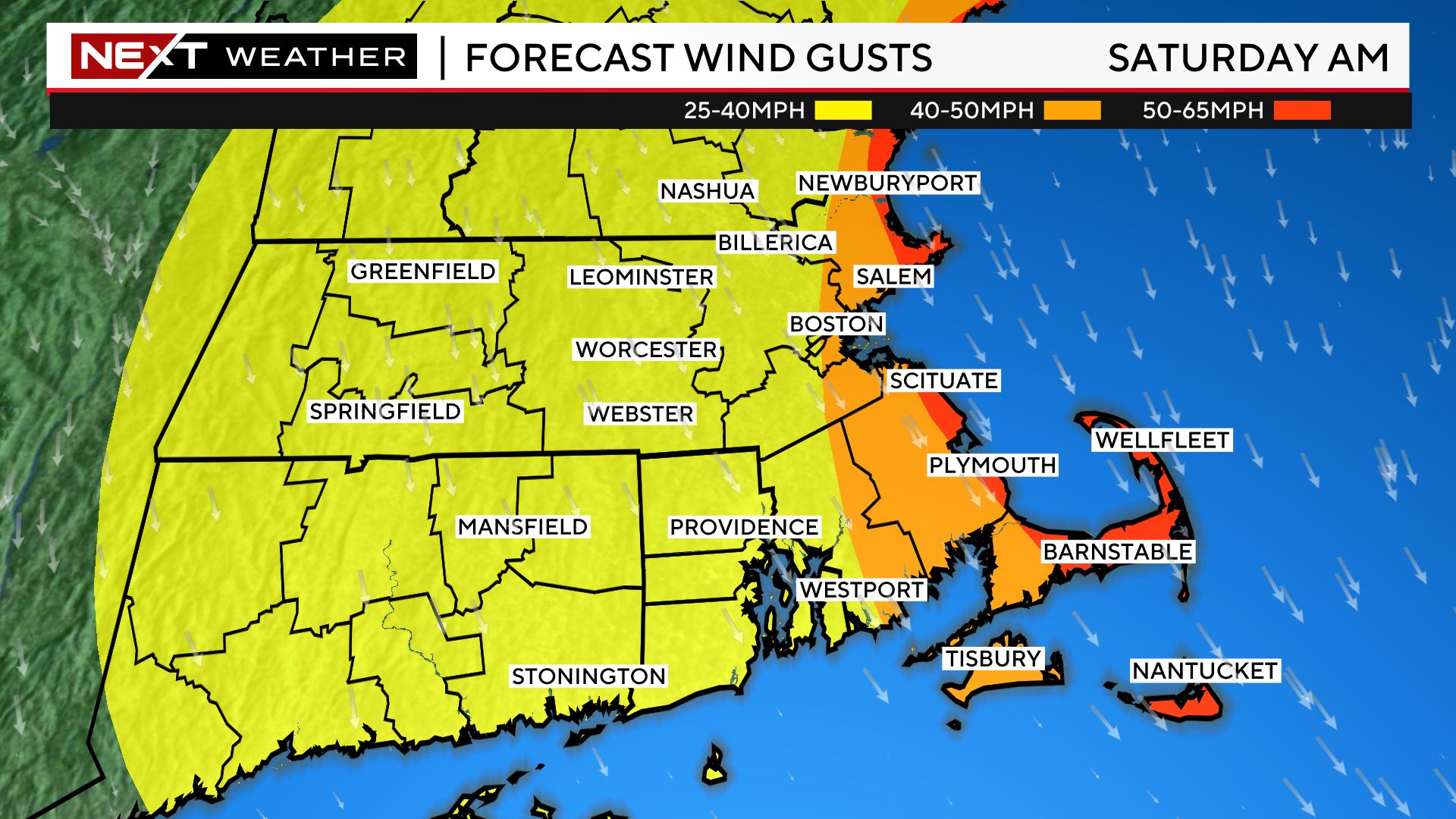
WIND:
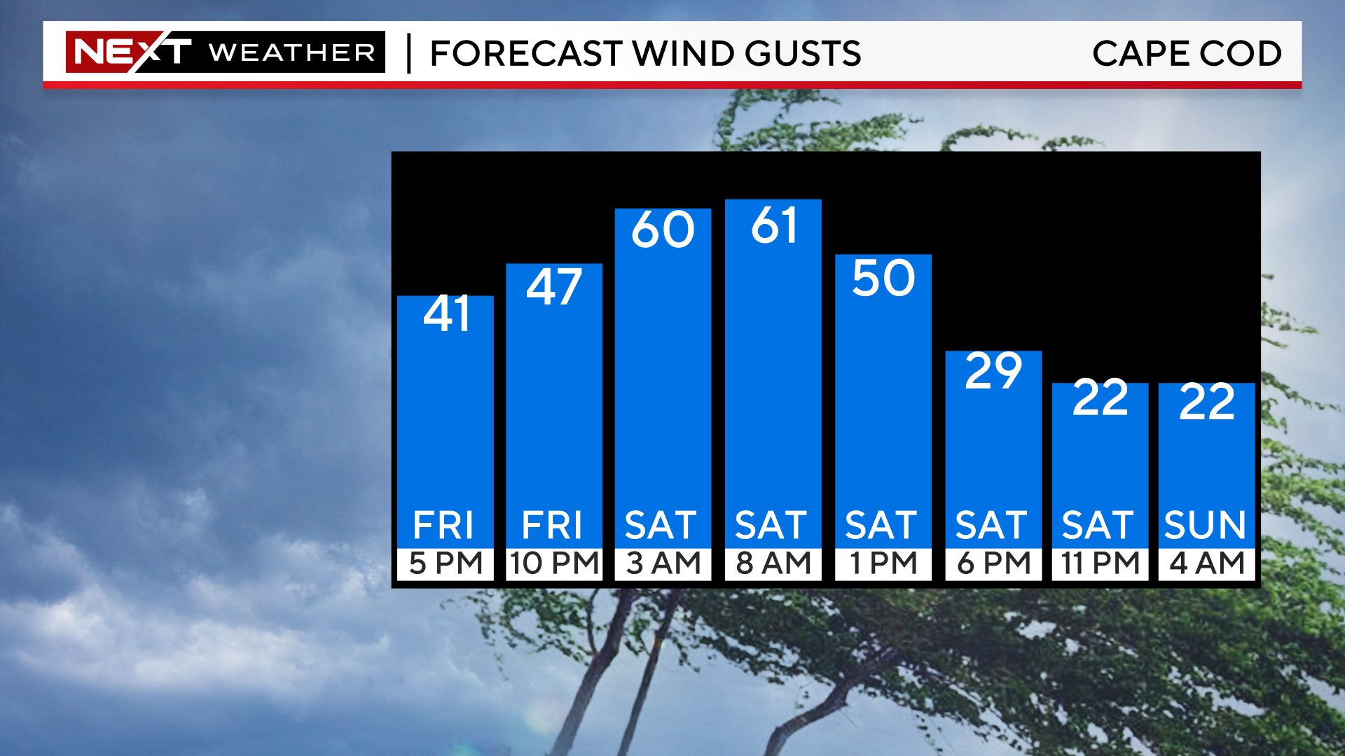
Similarly, the strongest winds will also occur in easternmost southern New England, mainly over the Outer Cape. We expect gusts between 50-65mph there during Saturday morning.
For the rest of the Coastline, peak gusts will range between 40-50mph.
Farther inland, west of I95, gusts should top out between 25-40mph.
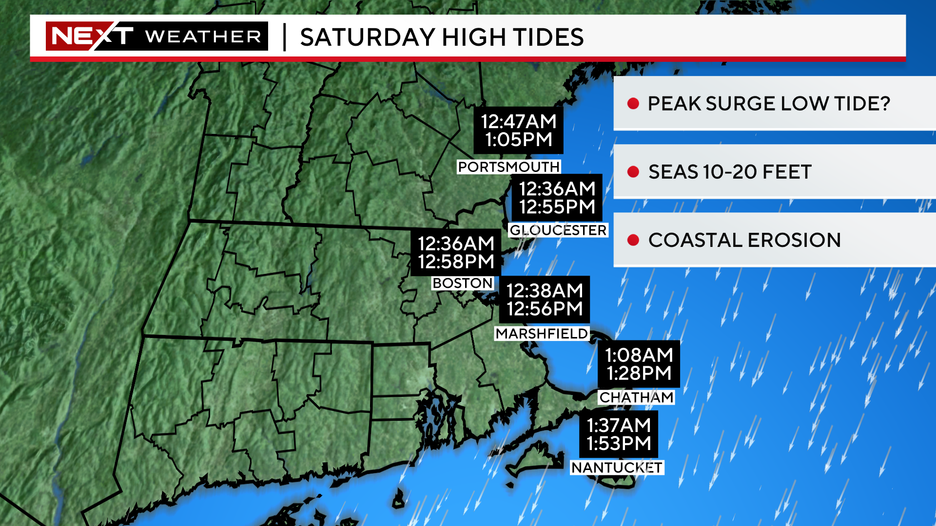
COAST:
The greatest impact from Lee will clearly be felt in our coastal waters and right at the Shoreline. We anticipate 10-20 foot waves and some coastal erosion. We also expect a fairly minor, 1-3 foot storm surge on Saturday. Thankfully, our tides are astronomically low right now and it also appears that the peak of Lee’s impact and wind will come during the low tide on Saturday morning.
We will continue to provide frequent updates before and during the storm on WBZ-TV, WBZ.com and CBS News Boston…we got you covered!
Click here for Westford snow storm data and past totals or select “Winter Snowfall“ under “Pages” on the left hand side.
For more up to date forecast information follow me on Twitter (@terrywbz) or follow the WBZ weather team on Facebook, search WBZWeather
Reader Comments