


The National Hurricane Center has issued a Tropical Storm Watch for the entire coastlines of Rhode Island, Massachusetts, New Hampshire and much of Maine. A Hurricane Watch has been issued for the coastline in far northern (Downeast) Maine.
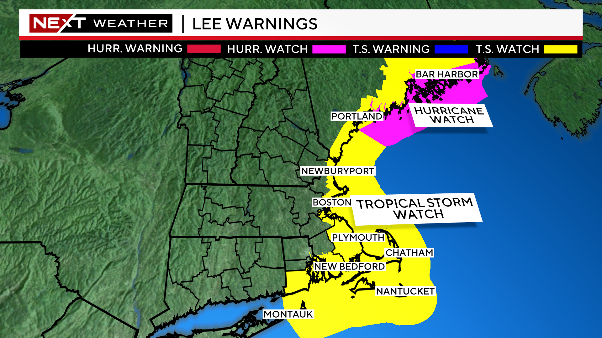
There is also a storm surge watch for Barnstable and Nantucket counties.
Lee is now a category 2 hurricane and is forecast to continue to slowly weaken from here on out. Lee is starting to make its northward turn and also beginning to accelerate its forward speed.
The latest forecast track has Lee as a category two for most of the day tomorrow and then a category one on Friday.
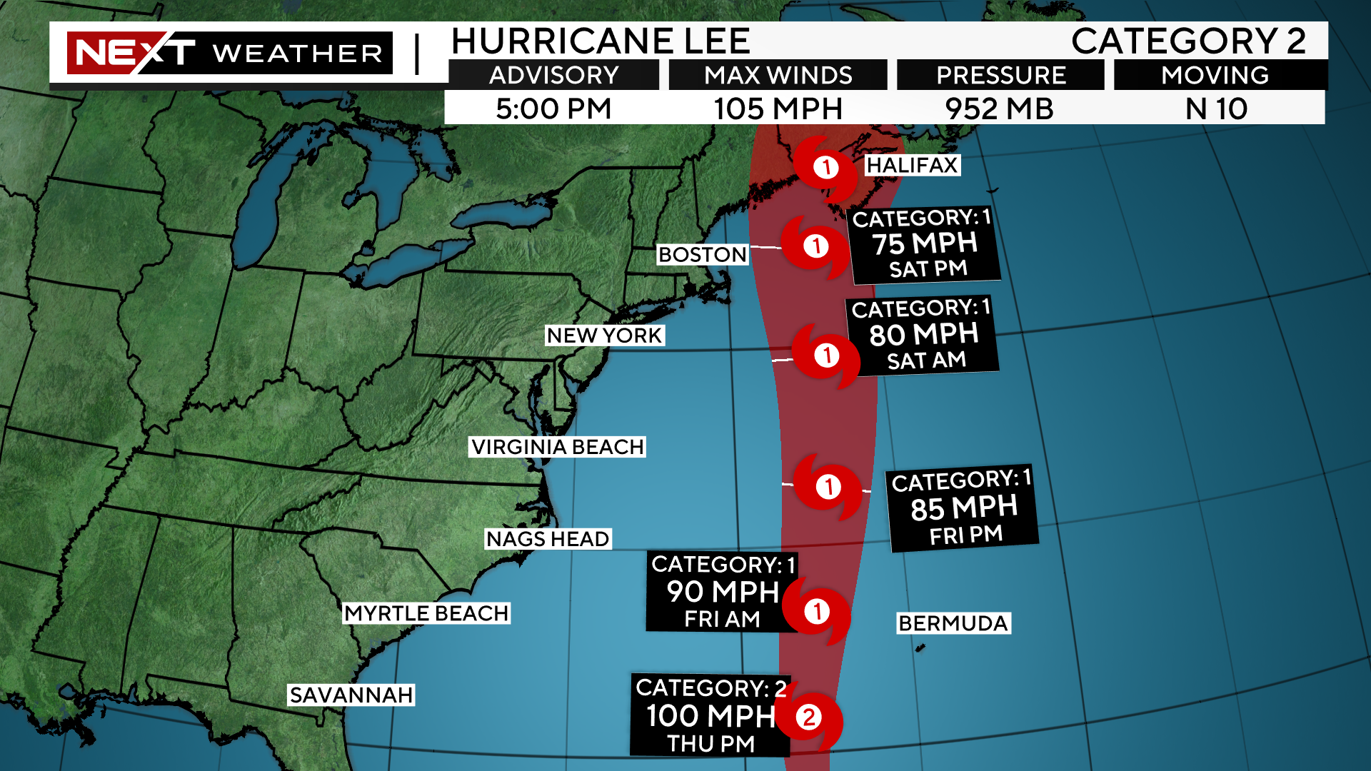
Lee will make it closest approach to New Engand on Saturday morning, likely as a minimal category 1 hurricane, transitioning to an extra-tropical, nor’easter-type storm.
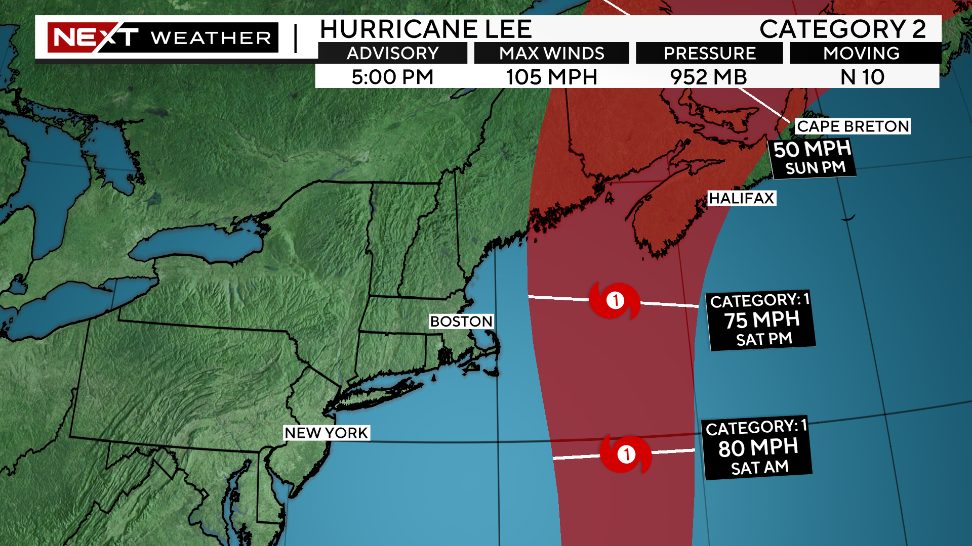
Current projected landfall is in far eastern Maine, Bay of Fundy area late Saturday night
Forecast confidence has increased greatly today with regards to the final track and impacts of Hurricane Lee. The current forecast is for the center of Lee to pass between 100-150 miles east of the Outer Cape on Saturday morning. While this is certainly much preferred over a landfall in southern New England, it will still lead to some very impactful weather for parts of our area.
TIMELINE:
The first rain bands could creep up on the Islands and Cape Cod around sunset on Friday.
Overnight the rain and wind will continue to push north and east and increase in intensity.
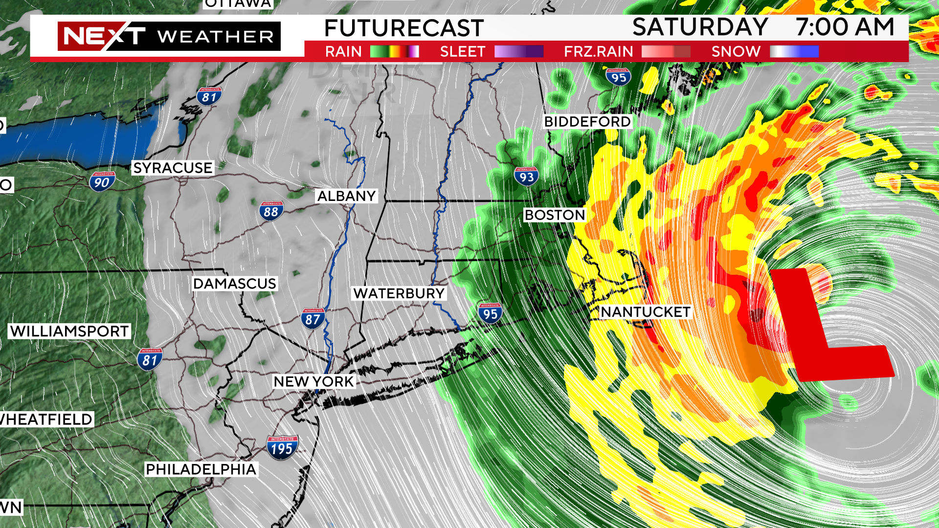
The peak of the rain and wind will come as the center of the storm is making its closest pass. This will be between 5am and 1pm on Saturday.
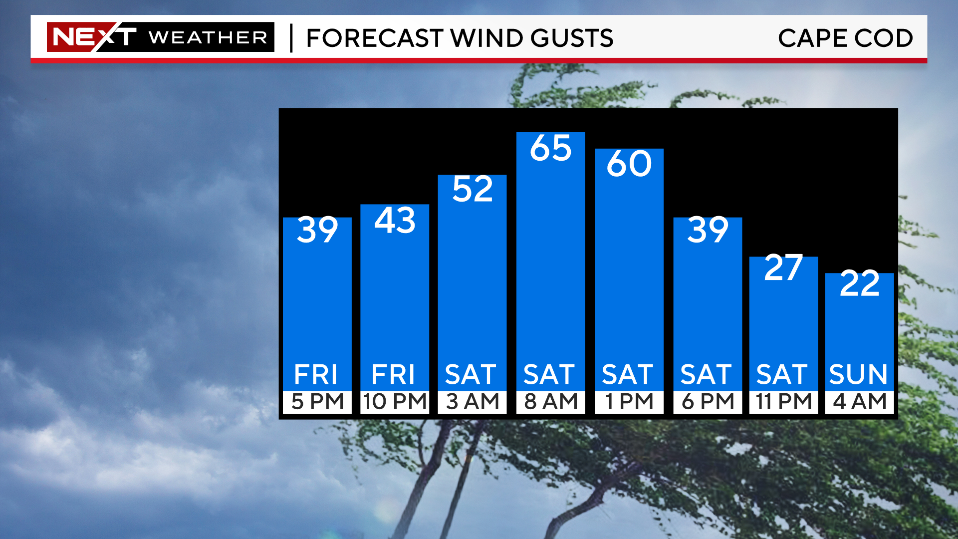
Lee will be accelerating as it passes our latitude and by nightfall, be nearing the Bay of Fundy and Canada.
Therefore, the rain and wind will quickly taper during the afternoon hours, moving into parts of northern New England (Maine).
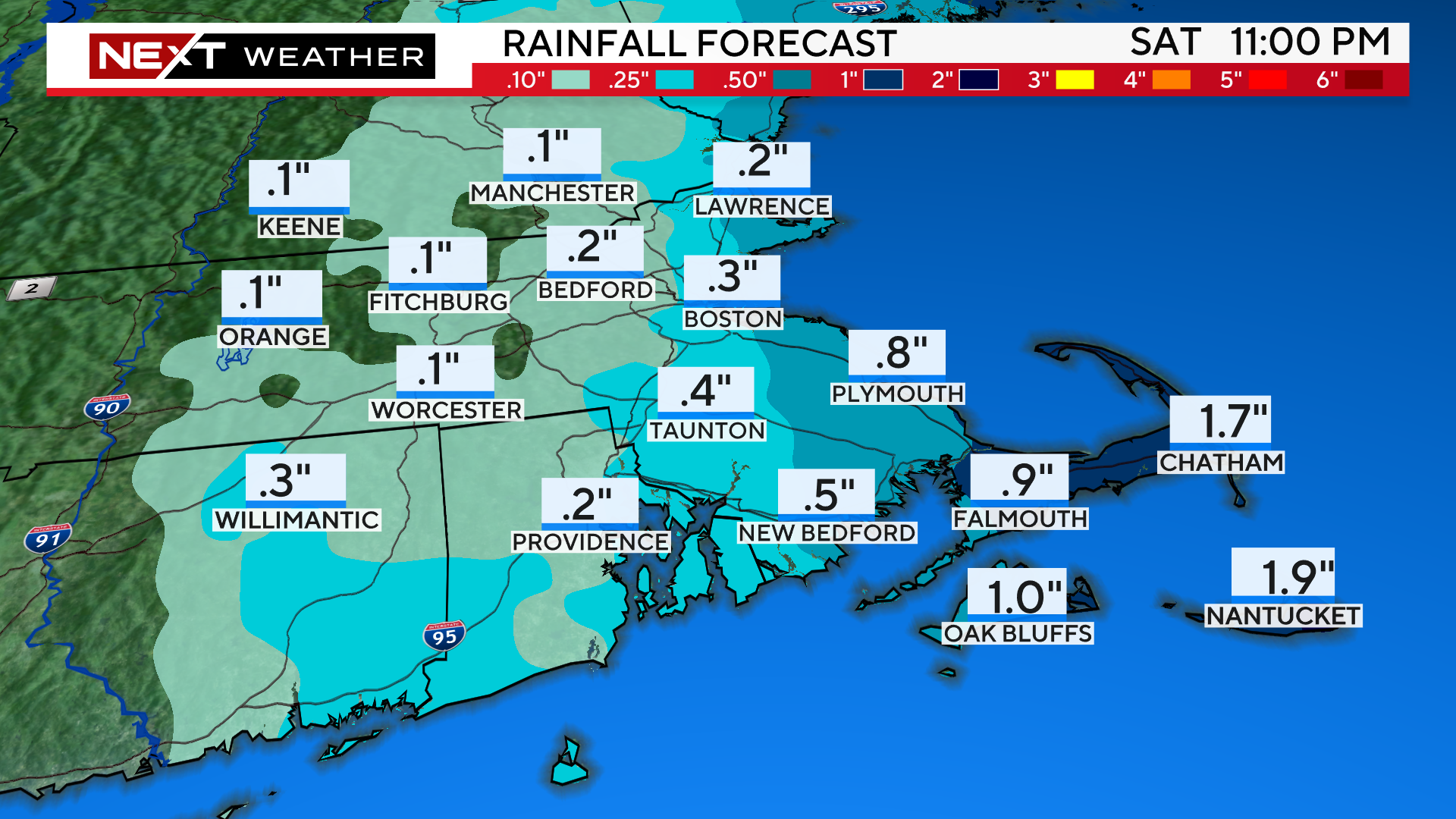
RAIN:
The heaviest rainfall will be in areas closest to the center of the storm, far eastern MA and Cape Cod.
If Lee were to track a bit closer to our coast, these rainfall projections could easily double or triple.
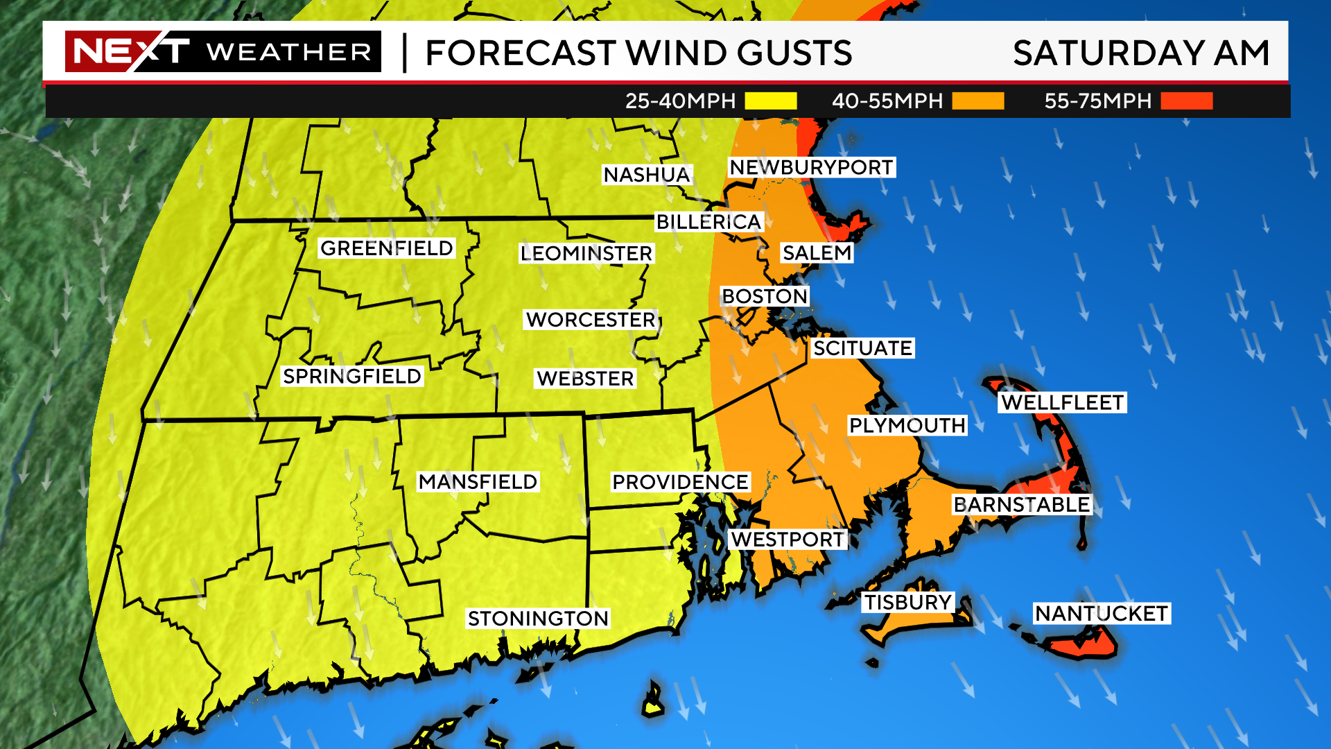
WIND:
Similarly, the strongest winds will also occur in easternmost southern New England, mainly over the Outer Cape. We expect gusts between 55-75mph there during Saturday morning.
For the rest of the Coastline, peak gusts will range between 40-55mph.
Farther inland, west of I95, gusts should top out between 25-40mph.
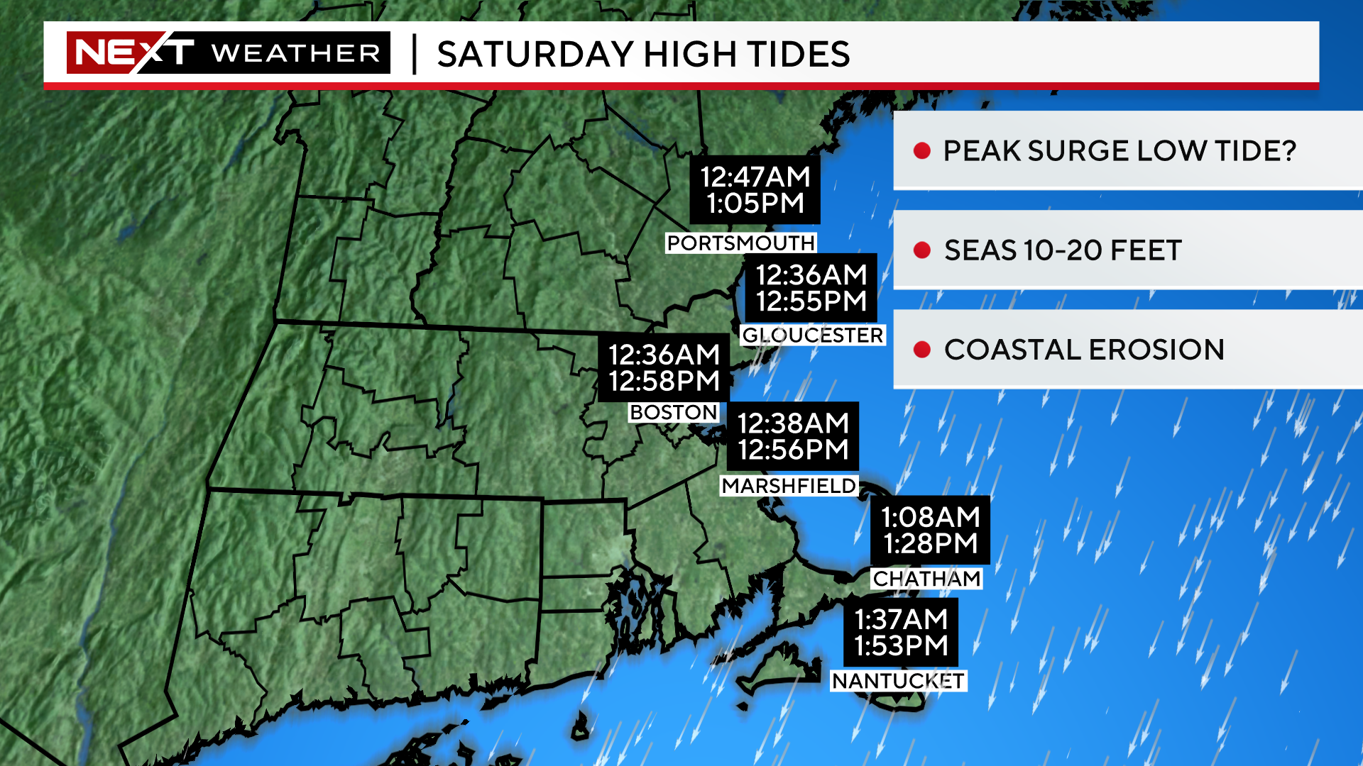
COAST:
The greatest impact from Lee will clearly be felt in our coastal waters and right at the Shoreline. We anticipate 10-20 foot waves and some coastal erosion as well. Thankfully, our tides are astronomically low right now and it also appears that the peak of Lee’s impact and wind will come during the low tide on Saturday morning. Still, anyone with boats in the water or Coastal interests should heed all warnings and prepare for the worst.
We are still a few days away from Lee’s closest pass and therefore, some forecast changes may occur. We urge that you stay tuned to all of our updates on WBZ-TV, WBZ.com and CBS News Boston in the coming days. We’ve got you covered!
Click here for Westford snow storm data and past totals or select “Winter Snowfall“ under “Pages” on the left hand side.
For more up to date forecast information follow me on Twitter (@terrywbz) or follow the WBZ weather team on Facebook, search WBZWeather
Reader Comments