


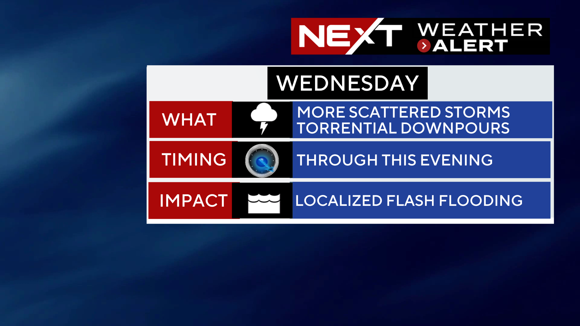
The WBZ Weather Team has issued a NEXT Weather Alert through this evening for the risk of scattered downpours and thunderstorms along with the possibility of some localized flooding.
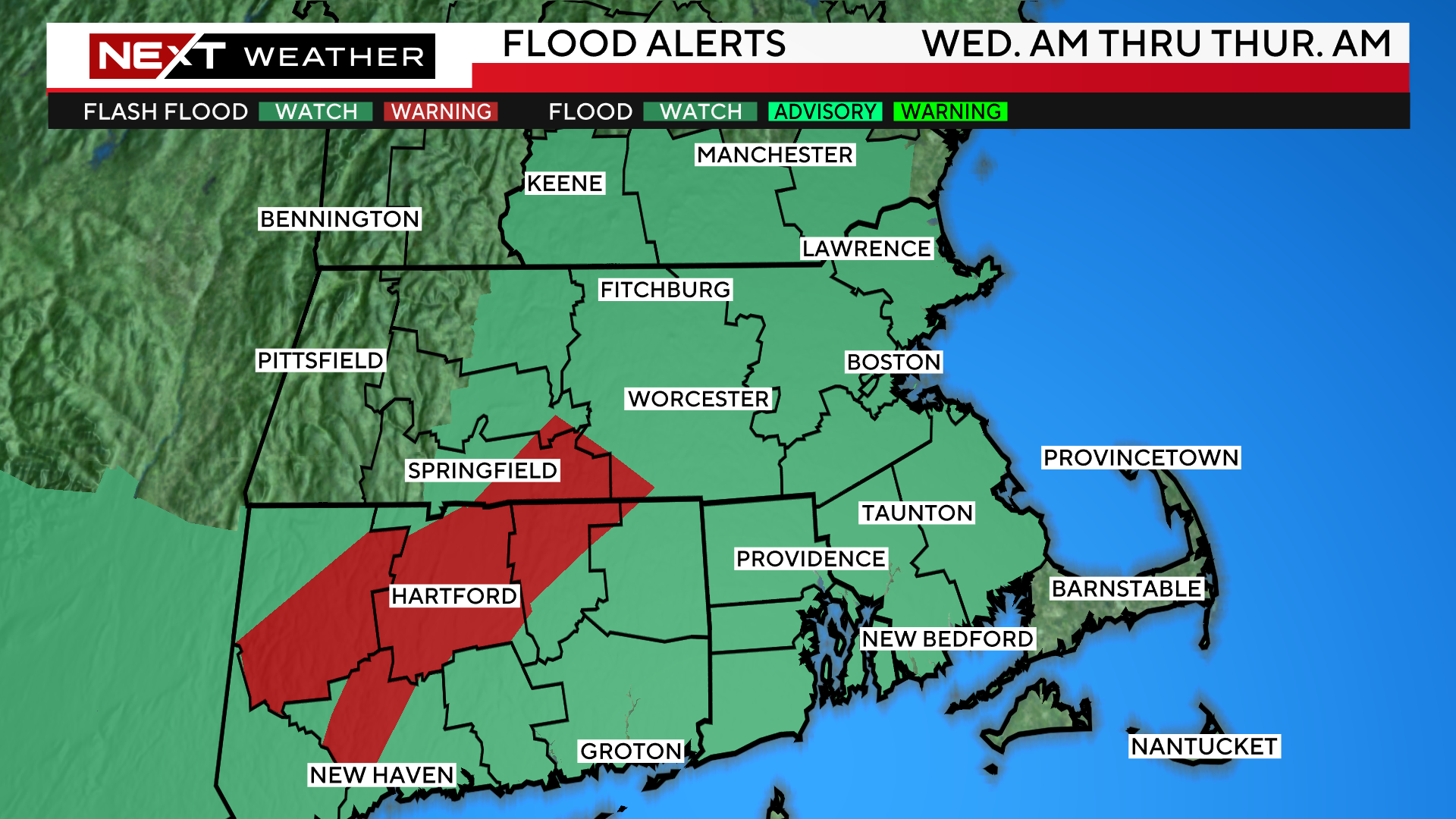
The National Weather Service has also issued a flood watch through early Thursday for most of Southern New England.
Just what we don’t need…another active day on the Doppler.
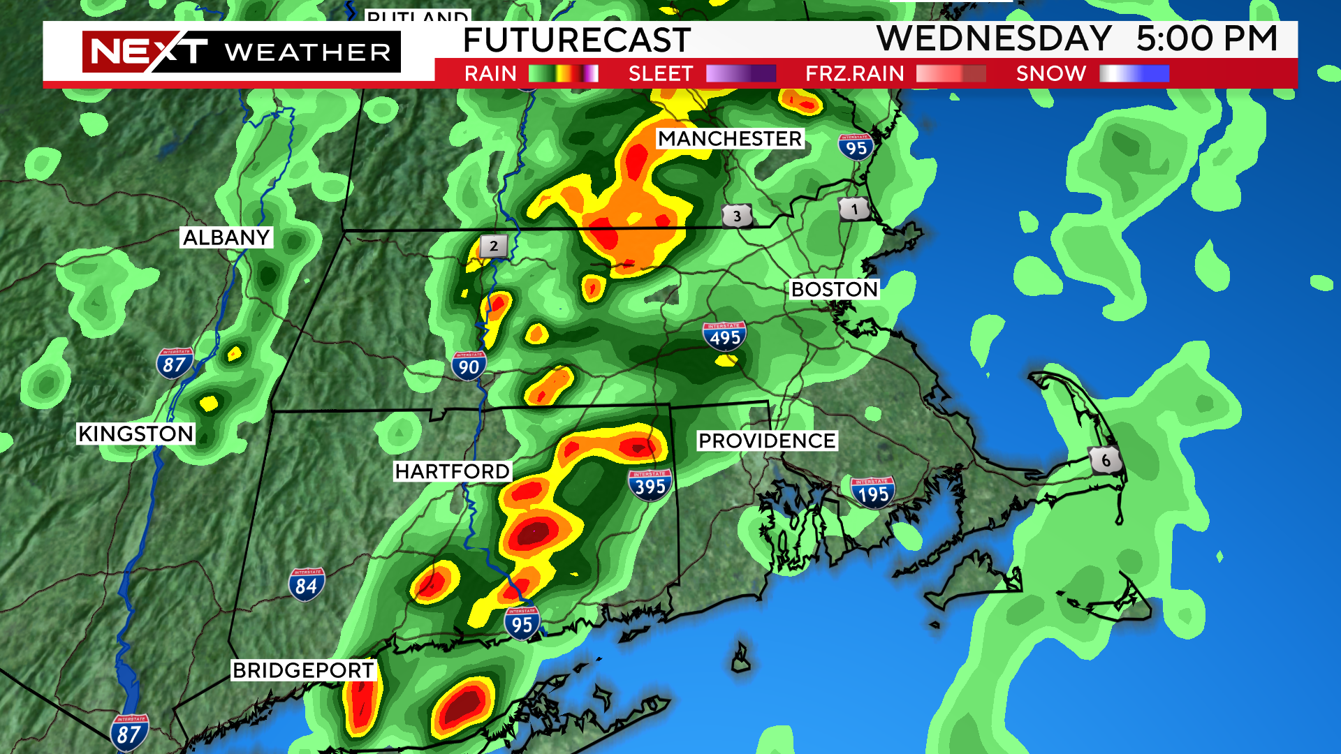
We are expecting multiple rounds of downpours/storms during the day today.
The first round comes late Wednesday morning and that will be followed up by additional downpours this afternoon and evening.
There is the potential for a brief, spin up tornado, particularly with the morning batch of storms south of the Pike. Otherwise, the main concern today is for renewed flash flooding, especially in those areas that have recently been inundated with water.
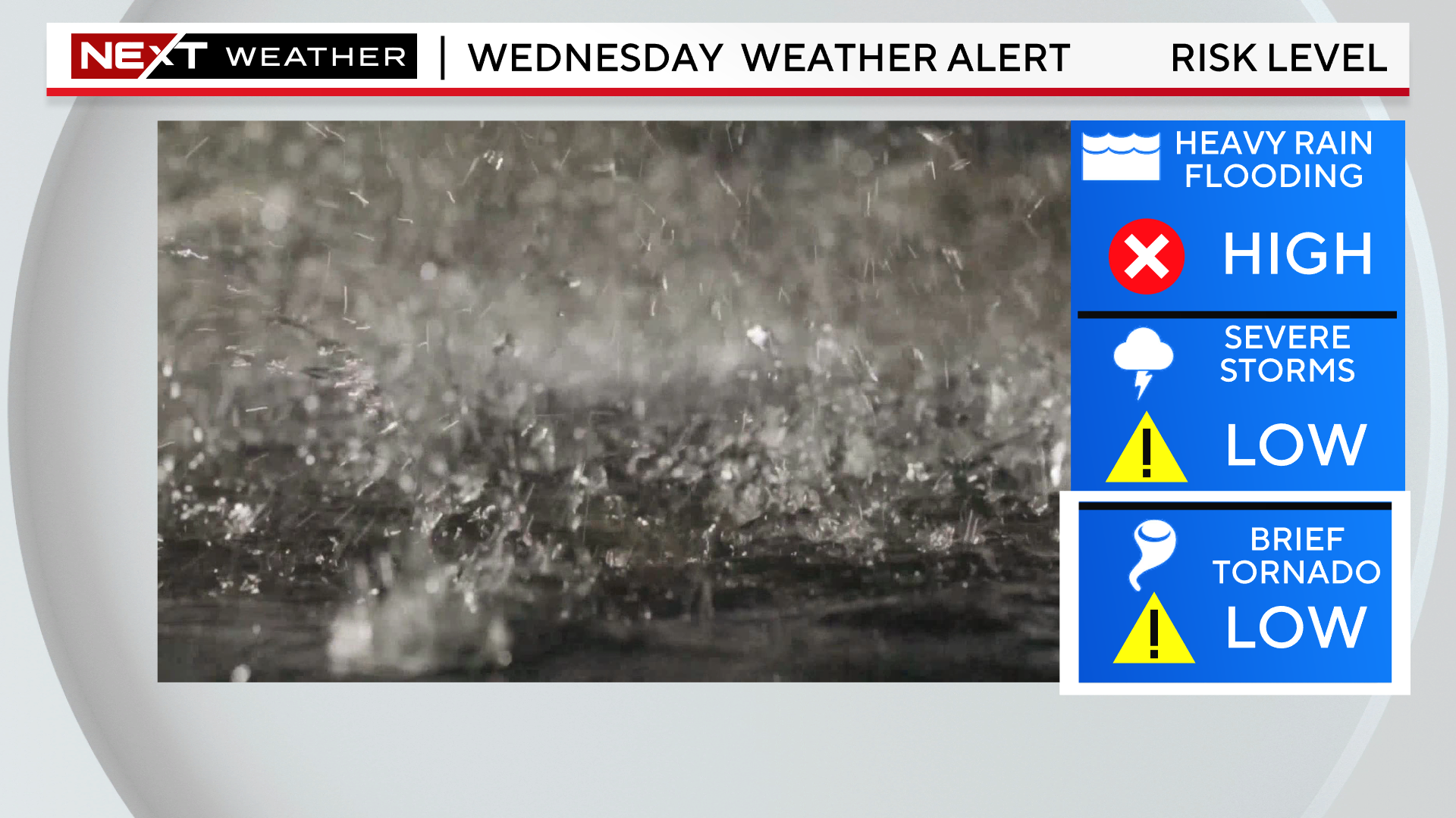
Unlike the storms on Monday that were nearly stationary, today’s cells will be moving along. This should preclude any one area from getting anything close to the excessive rainfall amounts we experienced on Monday. However, there is a chance for a couple inches of water today in a short period of time. Given how high our water table is already, that would certainly be enough to cause another round of flash flooding.
The storm action will die down after sunset tonight, leaving just a few showers across eastern MA overnight.
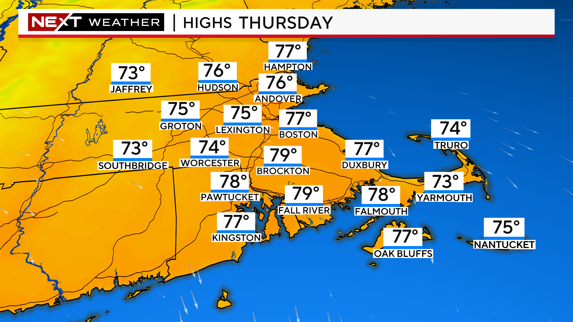
After a murky start at the Coast on Thursday, the sunshine will emerge and, more importantly, the dewpoints will drop significantly. Thursday will feel quite refreshing, a nice break from the soupy airmass that has hung over us for nearly a week now.
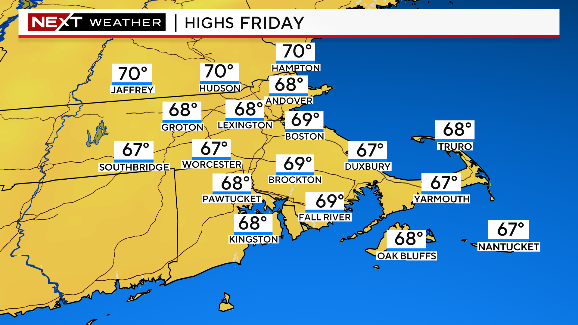
Friday will be another dry, comfy, coolish day, albeit with some increasing high clouds from the approaching Hurricane Lee. More on that to come…
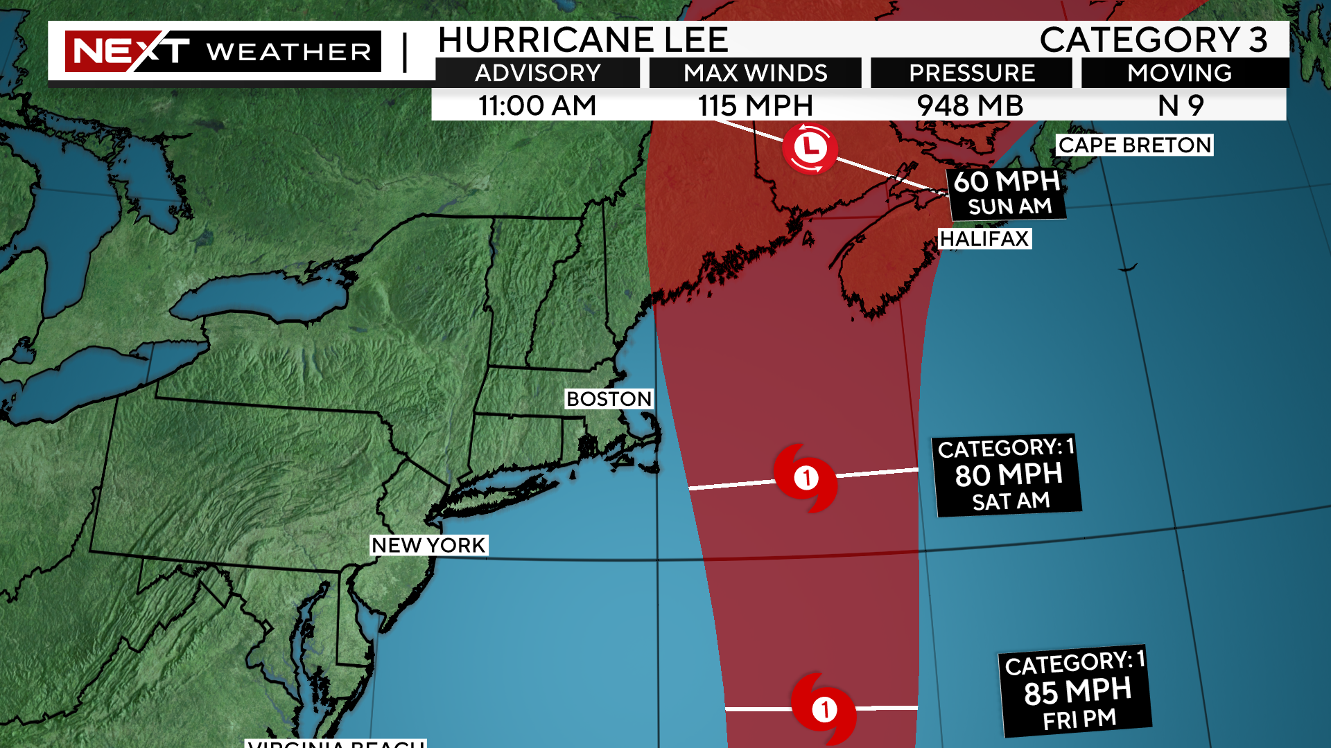
Hurricane Lee
Category 3
11 a.m. Update
Wednesday September 13
Coordinates/Location:
26.4N 67.2W
1035 miles S of Nantucket
Maximum Sustained Winds:
115 mph
Movement:
WNW at 9 mph
Minimum Central Pressure:
948mb or 28.00″
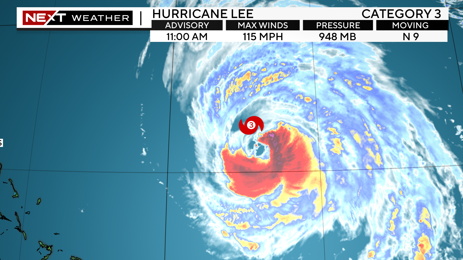
Very little has changed with Lee’s status in the last 24 hours. Lee remains a category 3 hurricane and is forecast to begin to slowly weaken from here on out. Lee is starting to make its northward turn and also beginning to accelerate its forward speed.
The latest forecast track has Lee as a category two for most of the day tomorrow and then a category one on Friday.
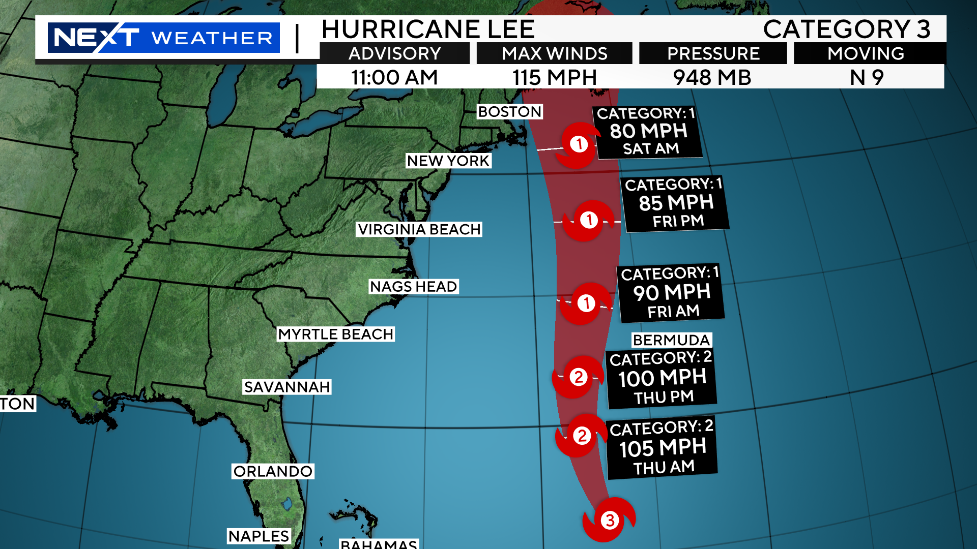
Lee will make it closest approach to New Engand on Saturday morning, likely as a minimal category 1 hurricane, transitioning to an extra-tropical, nor’easter-type storm.
Current projected landfall is in far eastern Maine late Saturday night.
There is still much to be determined with regards to Lee’s impact here in New England. The greatest impacts will be felt very late Friday night and more so, during the day on Saturday.
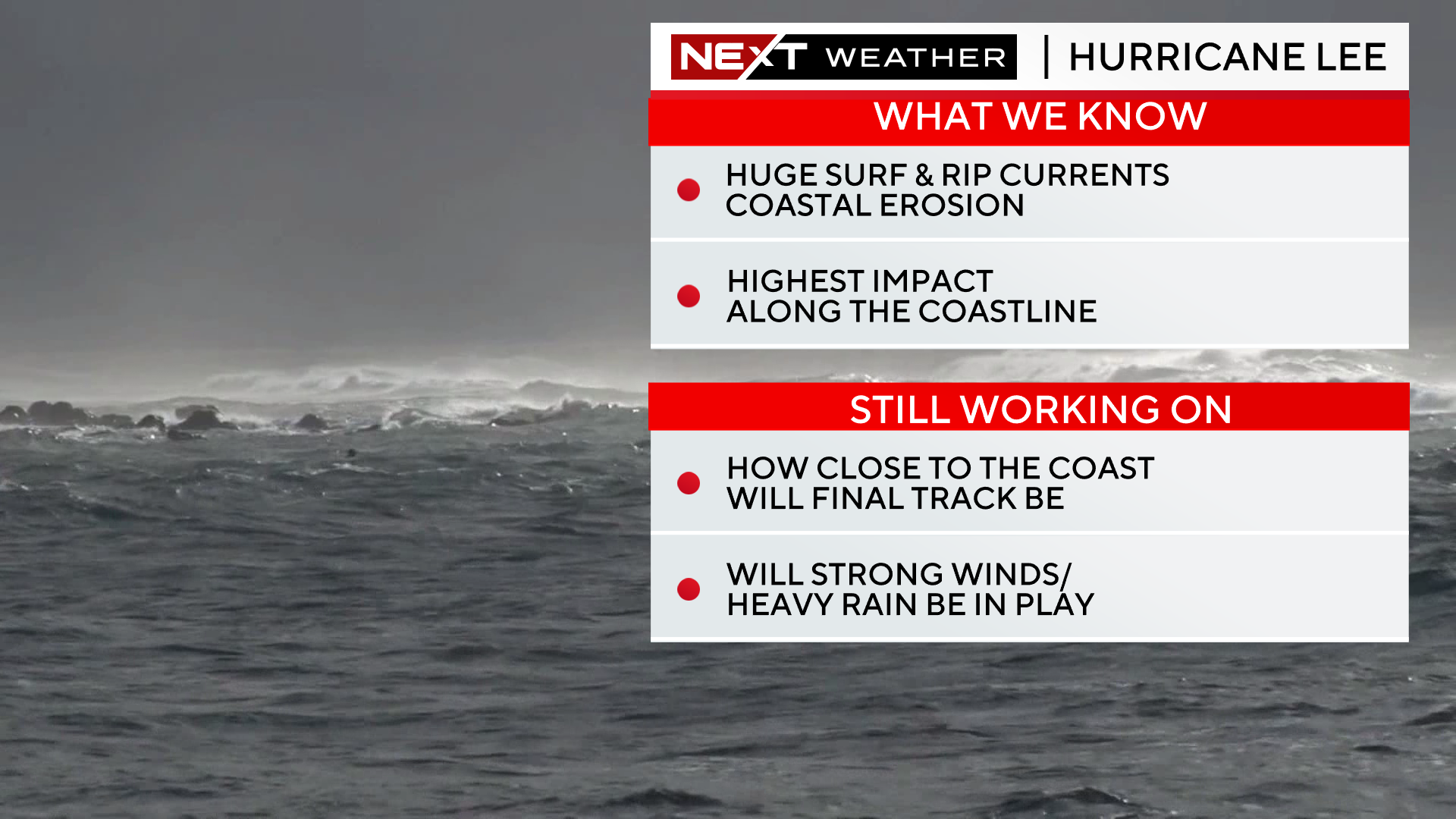
While the forecast track hasn’t changed all that much in the last few days, there is still enough wiggle room to leave some uncertainty in the forecast for New England. Some models are showing a westward wobble in the track just as Lee is nearing our area.
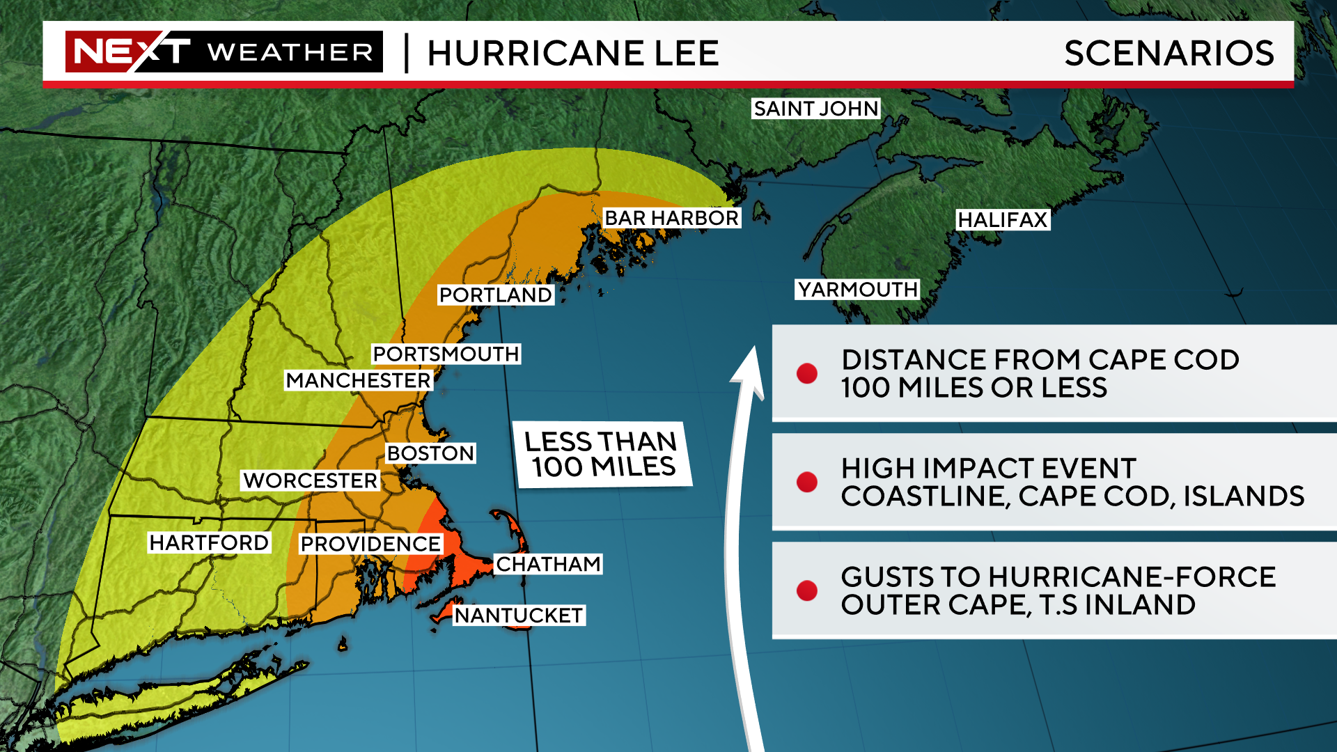
A track within 100 miles of the Outer Cape would certainly bring tropical-storm force winds to easternmost areas, with potentially some gusts to hurricane-strength especially over the Outer Cape. This scenario is becoming more and more likely as we have seen a bit of an eastward trend on models in the last 24 hours.
A track between 100-200 miles offshore, would mean some rain bands and tropical storm force winds along the immediate Coastline and the Cape, impacts similar to a quick moving nor’easter.
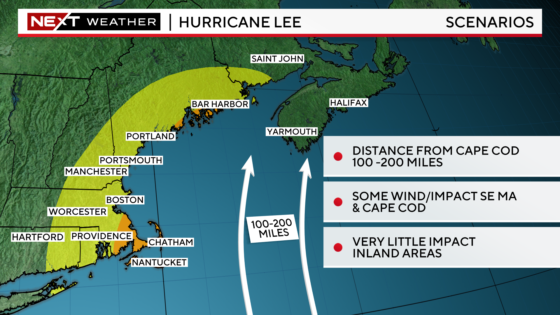
A track of 200 miles east of the Cape or more would likely mean very little, if any, wind and rain for our area.
Unfortunately, this scenario now appears the least likely of the bunch,
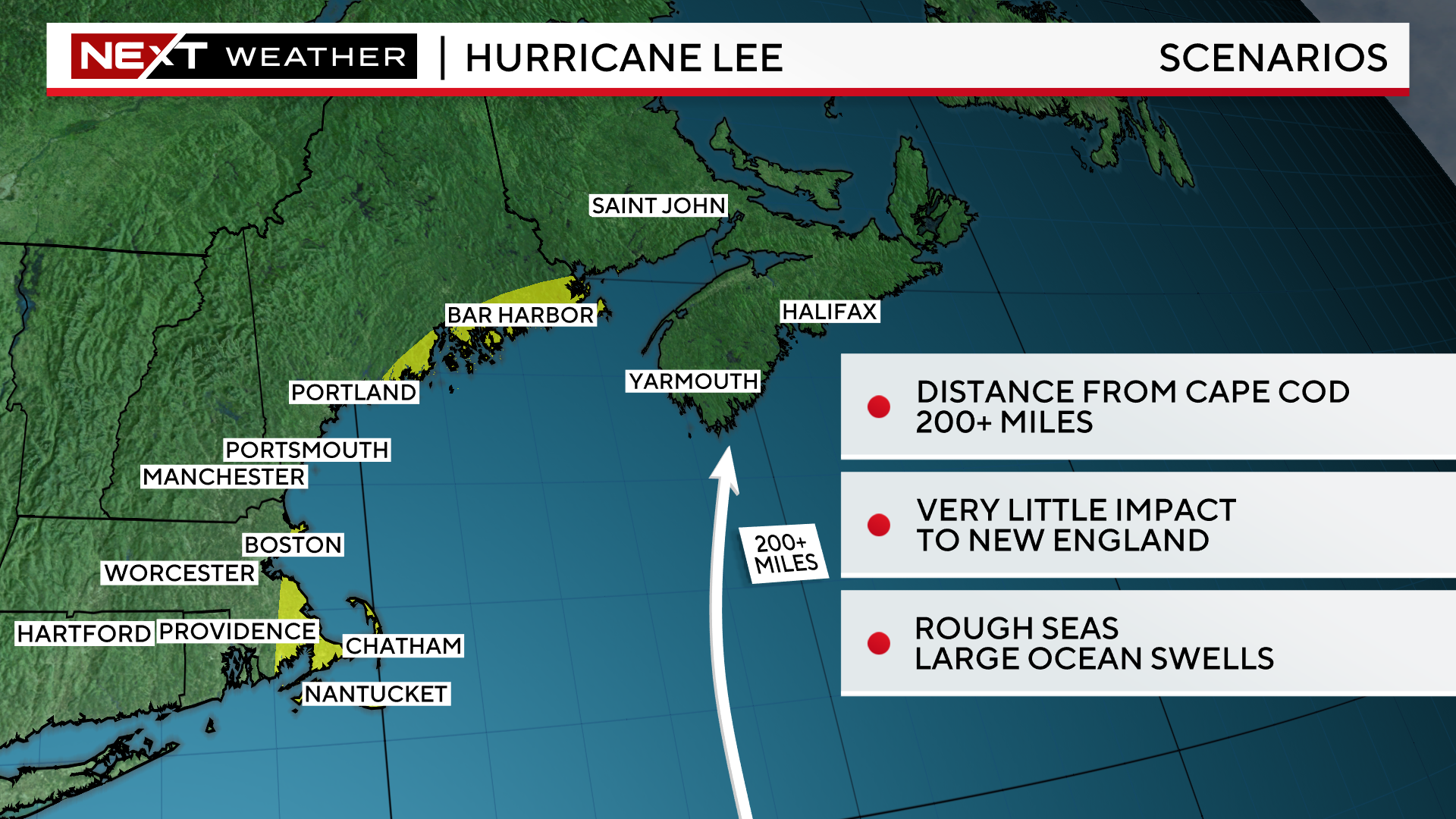
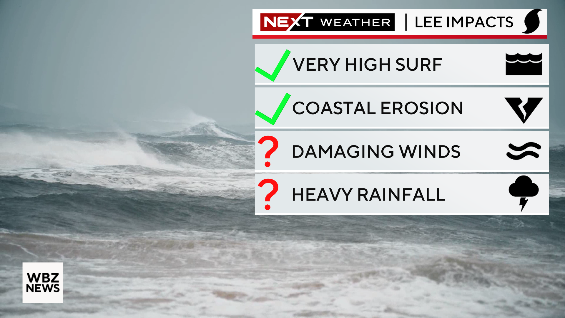
Regardless of the final track, the seas will be extremely rough in the days leading up to and during Lee’s pass by New England. We will see swells of 10-20 feet at our east-facing beaches, absolutely treacherous conditions to be near or out on the water.
The high surf and coastal erosion are sure bets, the rain and wind impacts still need to be determined.
We will continue to monitor the trends and hone in on the final forecast in the next few days.
It is imperative that you stay tuned to updated forecasts on WBZ-TV, WBZ.com and CBS News Boston all week long. Our NEXT Weather team has you covered!
Click here for Westford snow storm data and past totals or select “Winter Snowfall“ under “Pages” on the left hand side.
For more up to date forecast information follow me on Twitter (@terrywbz) or follow the WBZ weather team on Facebook, search WBZWeather
Reader Comments