


After 4 straight days of stormy weather, we get a respite today but it won’t last long.
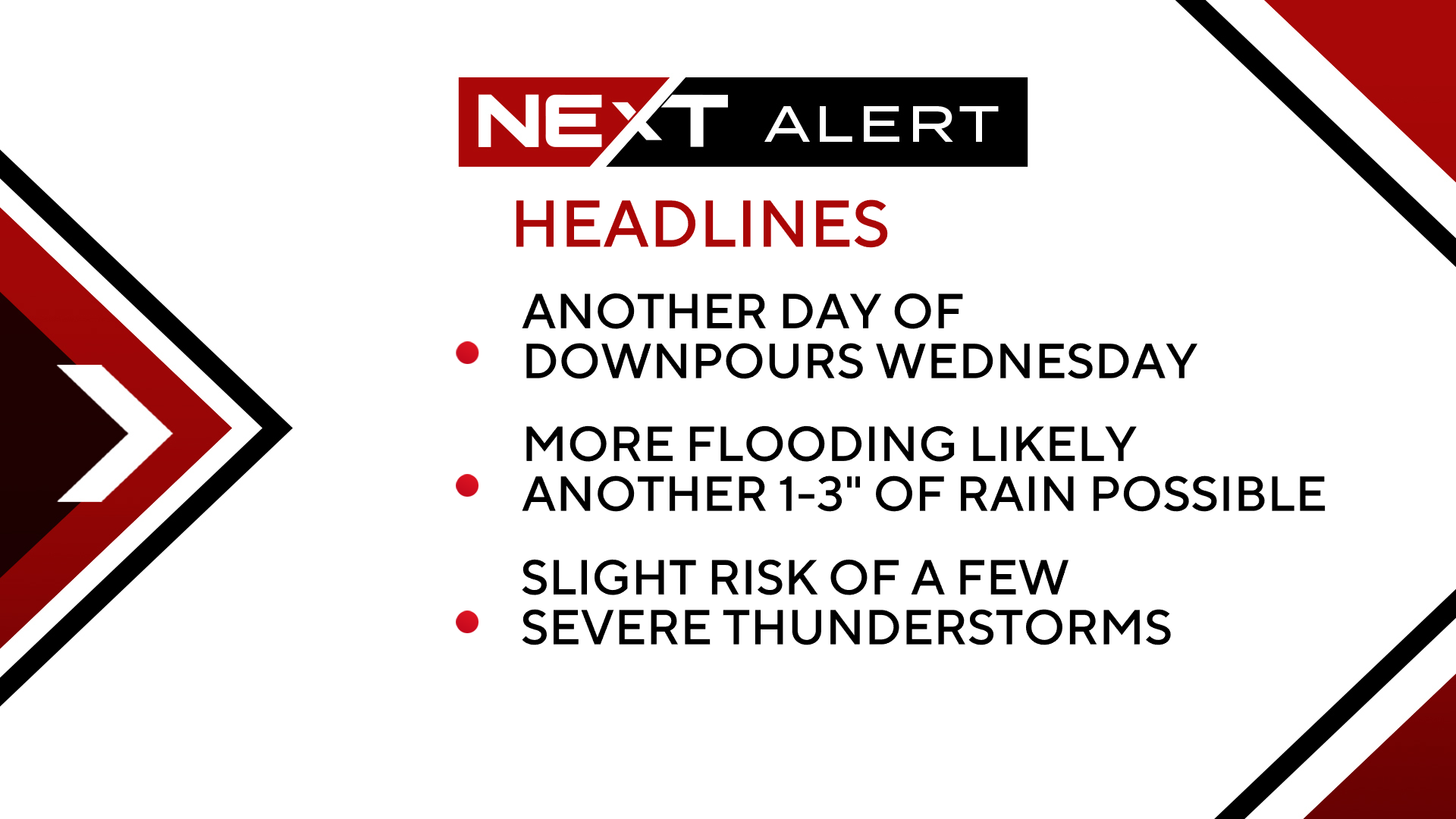
We are expecting another busy afternoon and evening on Wednesday.
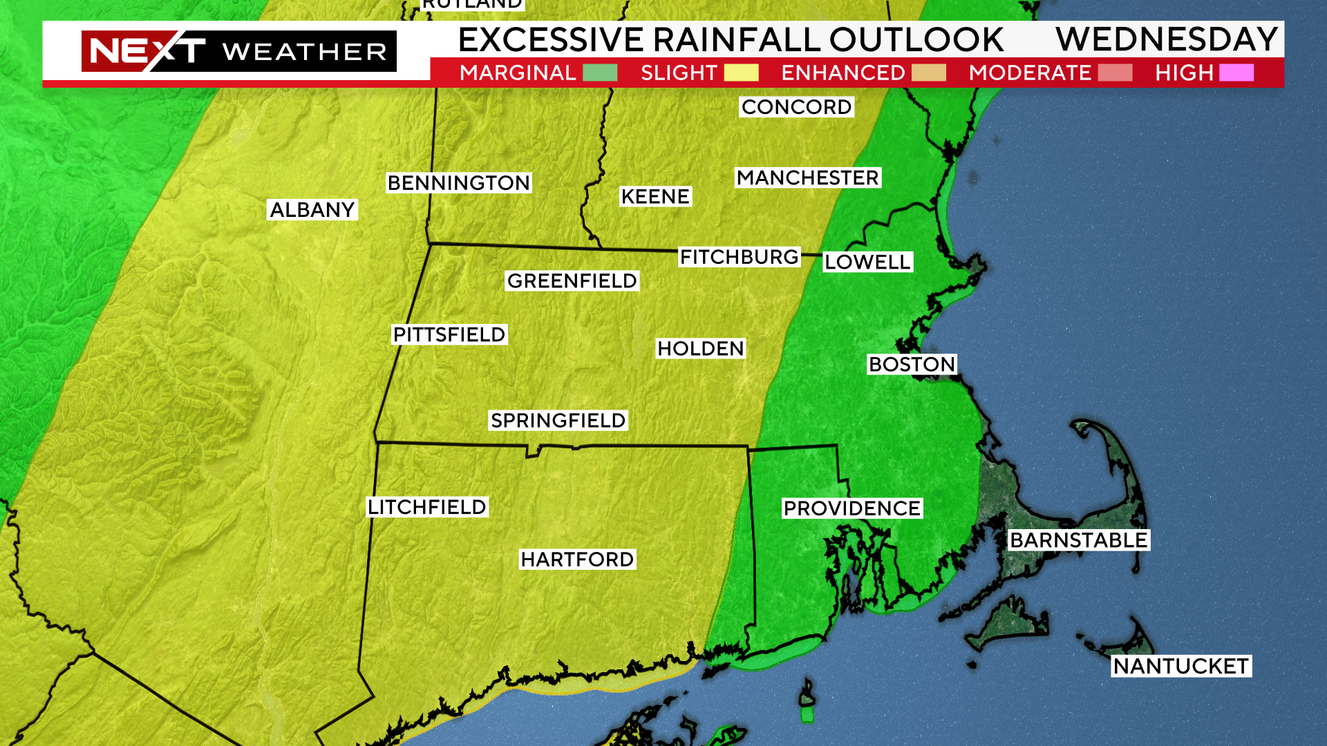
The Weather Prediction Center has placed parts of our area (including the Leominster area) in a slight risk for excessive rainfall Wednesday.
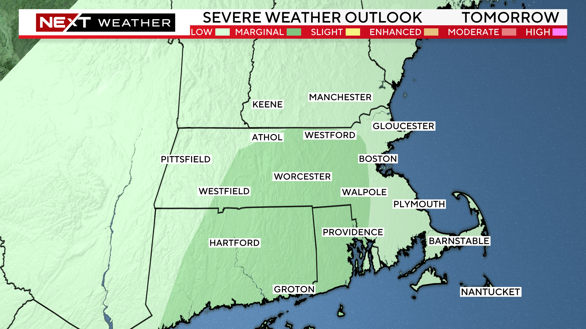
Also, the Storms Prediction Center has placed parts of our area in a marginal risk for severe storms Wednesday.
We will be under the gun anytime between noon and 8pm for scattered showers, thunderstorms and downpours. There could be several rounds during the PM on Wednesday.

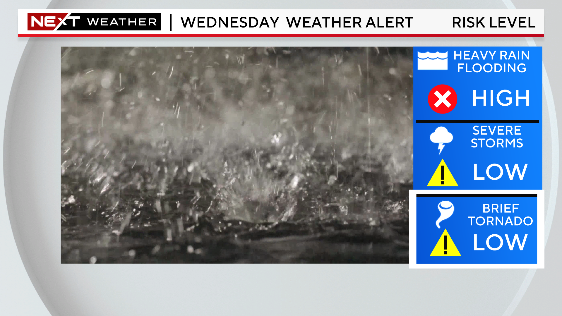
By far, the greatest concern and biggest potential impact is heavy rain leading to additional flooding.
There is a relatively low risk for a few severe thunderstorms and even an isolated tornado.
The main difference between yesterday’s storms and Wednesday’s will be the speed at which they are moving. The storms on Monday were nearly stationary, hence the ridiculous rainfall totals in some isolated areas.
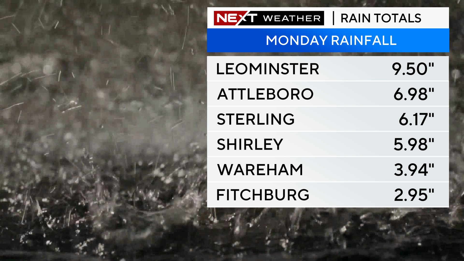
On Wednesday, we expect that the storms will be moving along, therefore lowering the likelihood of any more than 1-3″ of rain in one area.
The problem is, we have had so much rain lately, the threshold for flooding is now very low. Typically, it would take several inches of water in a short period of time to lead to any significant flooding in our area. With the water table so high right now, many locations will see flooding with an inch of rain or less.
Thankfully, we expect the showers to clear out early Thursday morning. We will get a couple of dry, refreshing days to finish the week.
We then turn our attention to Hurricane Lee for the Weekend. The stakes would obviously be high with any tropical system making a close pass to our area. However, given the antecedent conditions, there is an extra level of concern with regards to the wind and rain forecast this weekend.
We will keep you updated with the very latest on Wednesday’s rain and Lee’s track on WBZ-TV, WBZ.com and CBS News Boston throughout the rest of the week.
Hurricane Lee
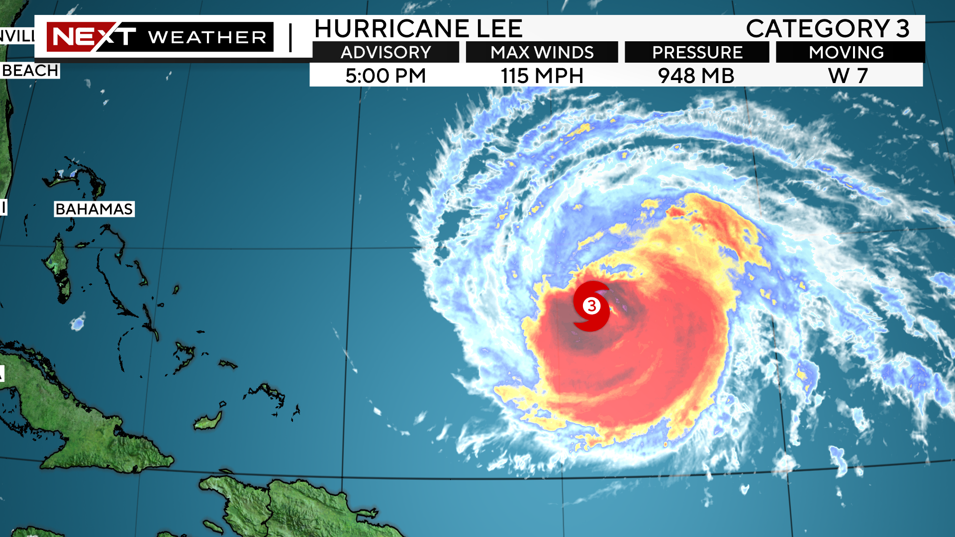
The official National Hurricane Center forecast is for Lee to maintain category 3 status for the next few days before it starts to weaken later this week. It will also begin to take a right-hand turn, to the north in the next 24-48 hours.
Beyond that, Lee is the expected to move generally north-northwestward…west of Bermuda on Thursday.
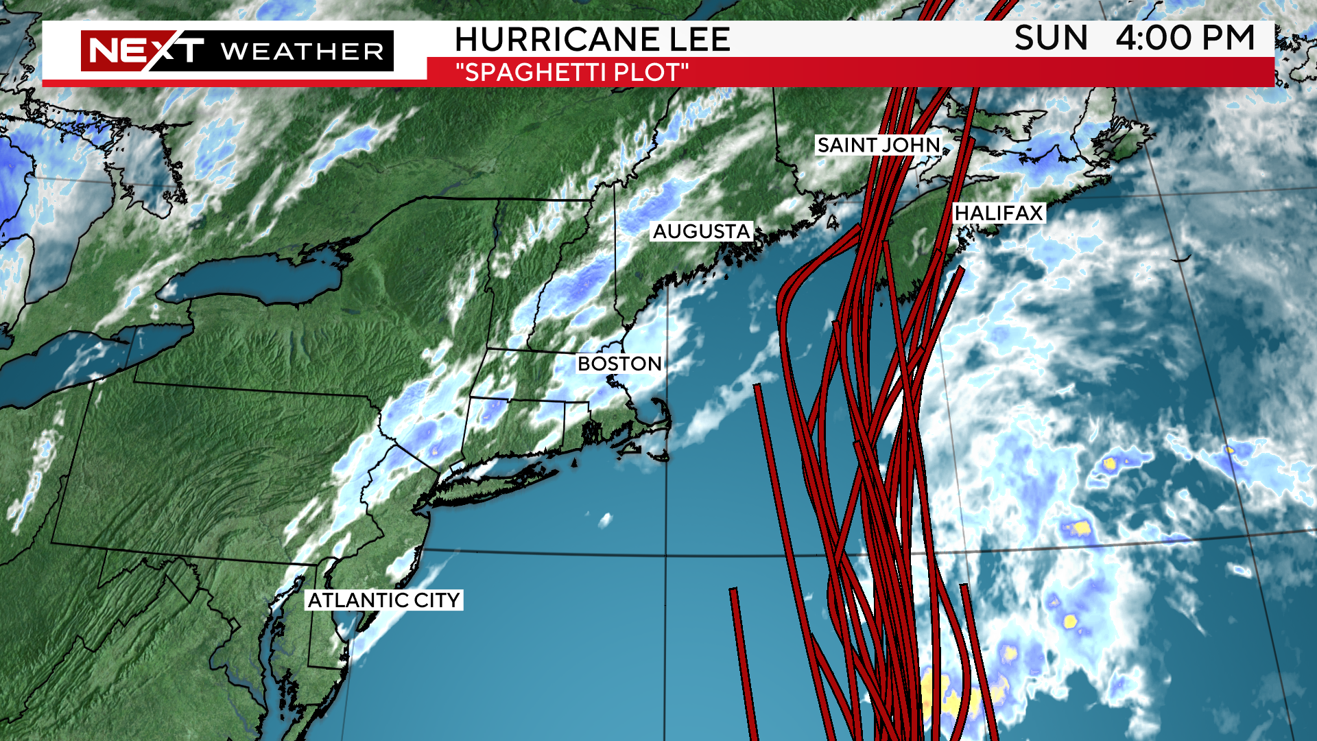
You can see that parts of eastern MA are now on the western edge of the “cone of uncertainty”.
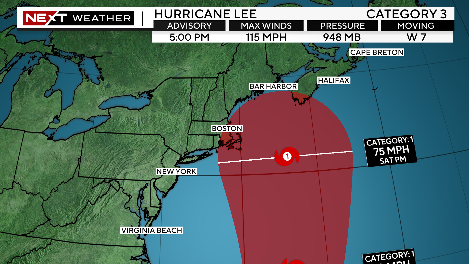
The model consensus keeps the center of Lee offshore of New England as it makes it closest approach around Saturday of this Weekend.
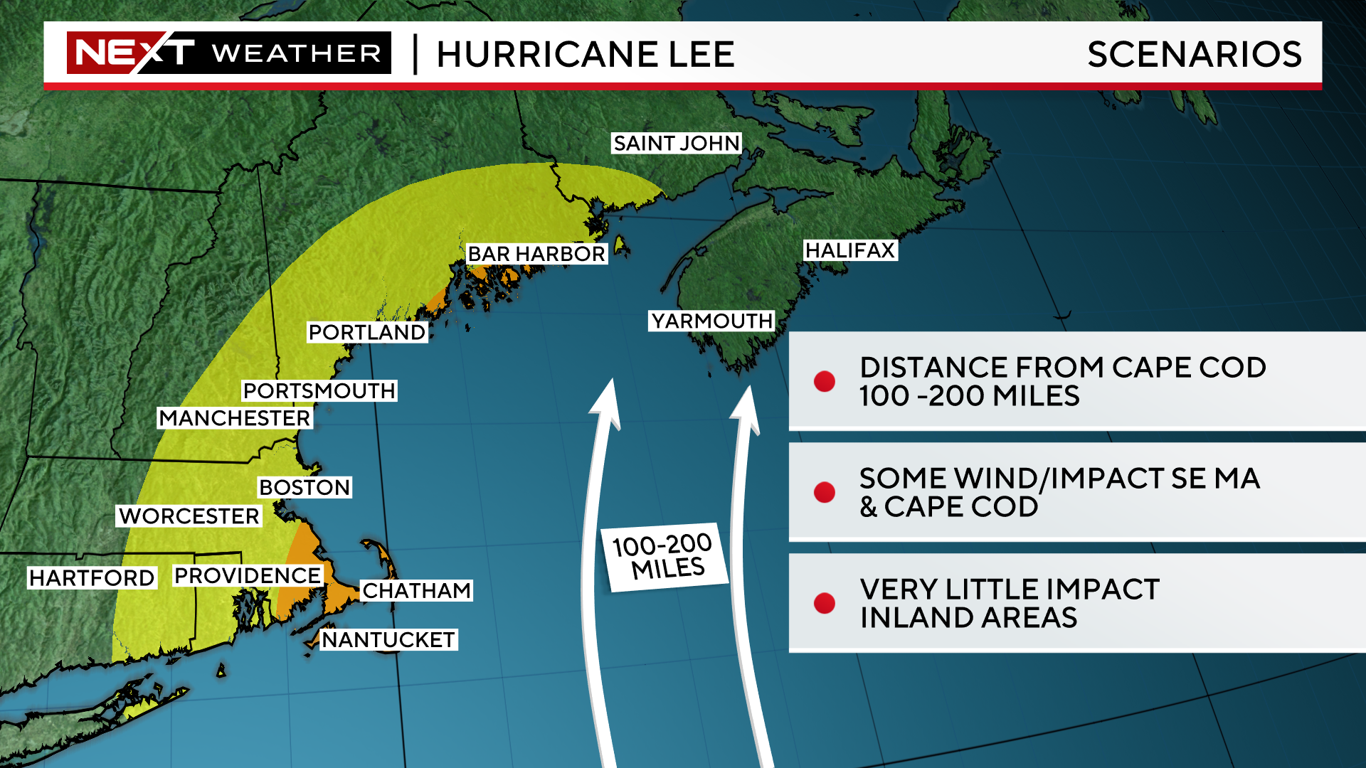
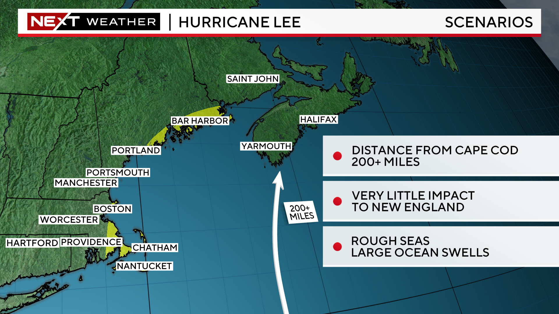
How close will is pass? Currently, most models are forecasting the eye to pass somewhere between 50 and 250 miles east of Cape Cod.
Clearly there is a BIG difference in impacts for southern New England within that window.
A track within 100 miles of the Outer Cape would certainly bring tropical-storm force winds to easternmost areas, with potentially some gusts to hurricane-strength.
The farther away the center passes, the lower the impacts…a track of 200 miles east of the Cape or more would likely mean very little, if any, wind and rain for our area.
All these scenarios remain on the table at this time.
Thankfully, the odds of a direct landfall in New England continue to lower…I would put that, worst-case scenario risk at 10% or less.

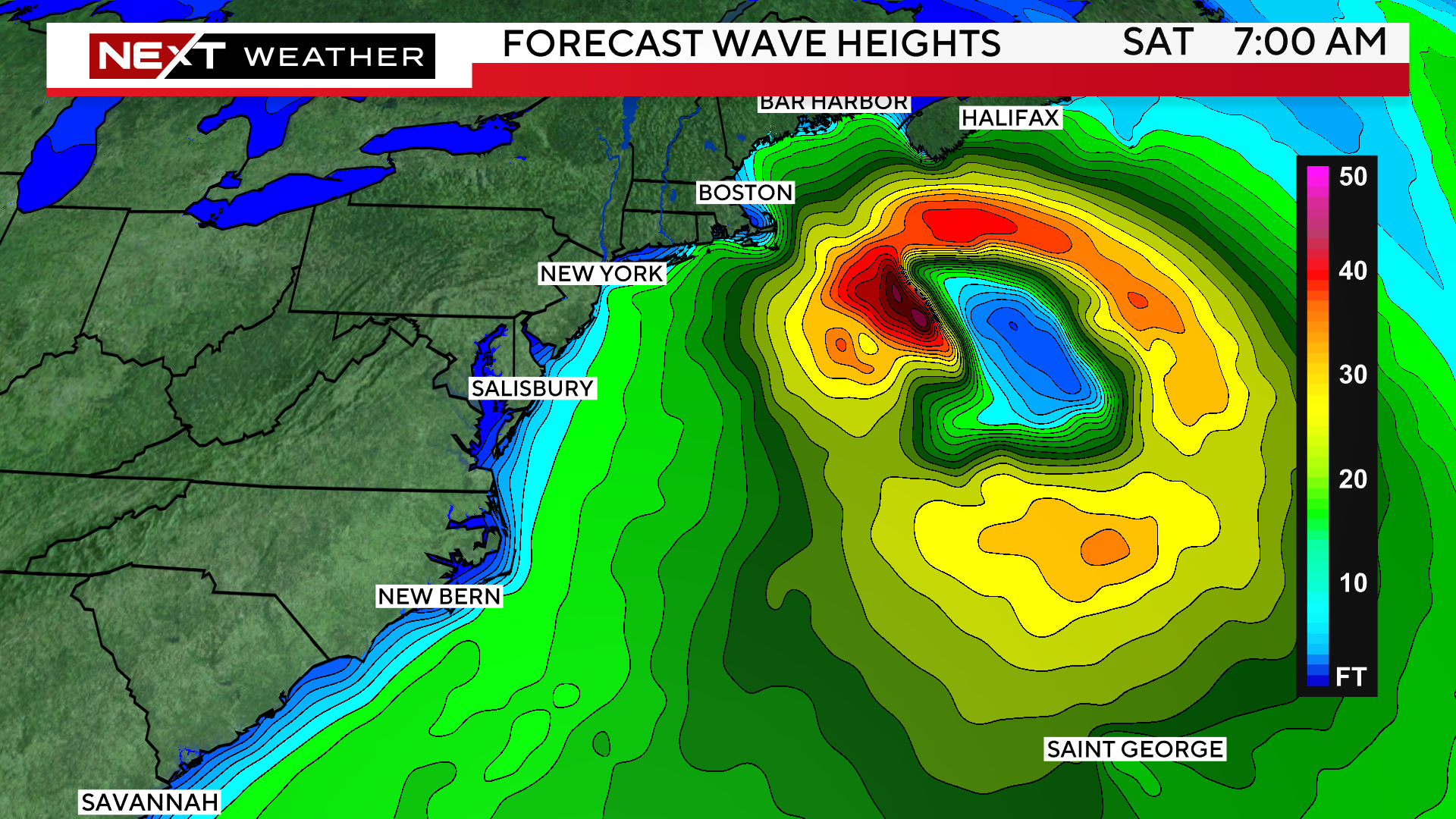
Regardless of the final track, the seas will be extremely rough in the days leading up to and during Lee’s pass by New England. We could see swells of 10-20 feet at our east-facing beaches, absolutely treacherous conditions to be near or out on the water.
The one thing we can be sure of is that Lee will not be able to maintain its “major hurricane” status as it gets farther north in the Atlantic.
Hurricanes get their energy and “fuel” from the warm Ocean water. They generally need water temperatures greater than 80 degrees to continue to thrive.That fuel will exist for the next few days for Lee, but after that, we do expect a gradual weakening in the cooler waters north of Bermuda and off our Coast.
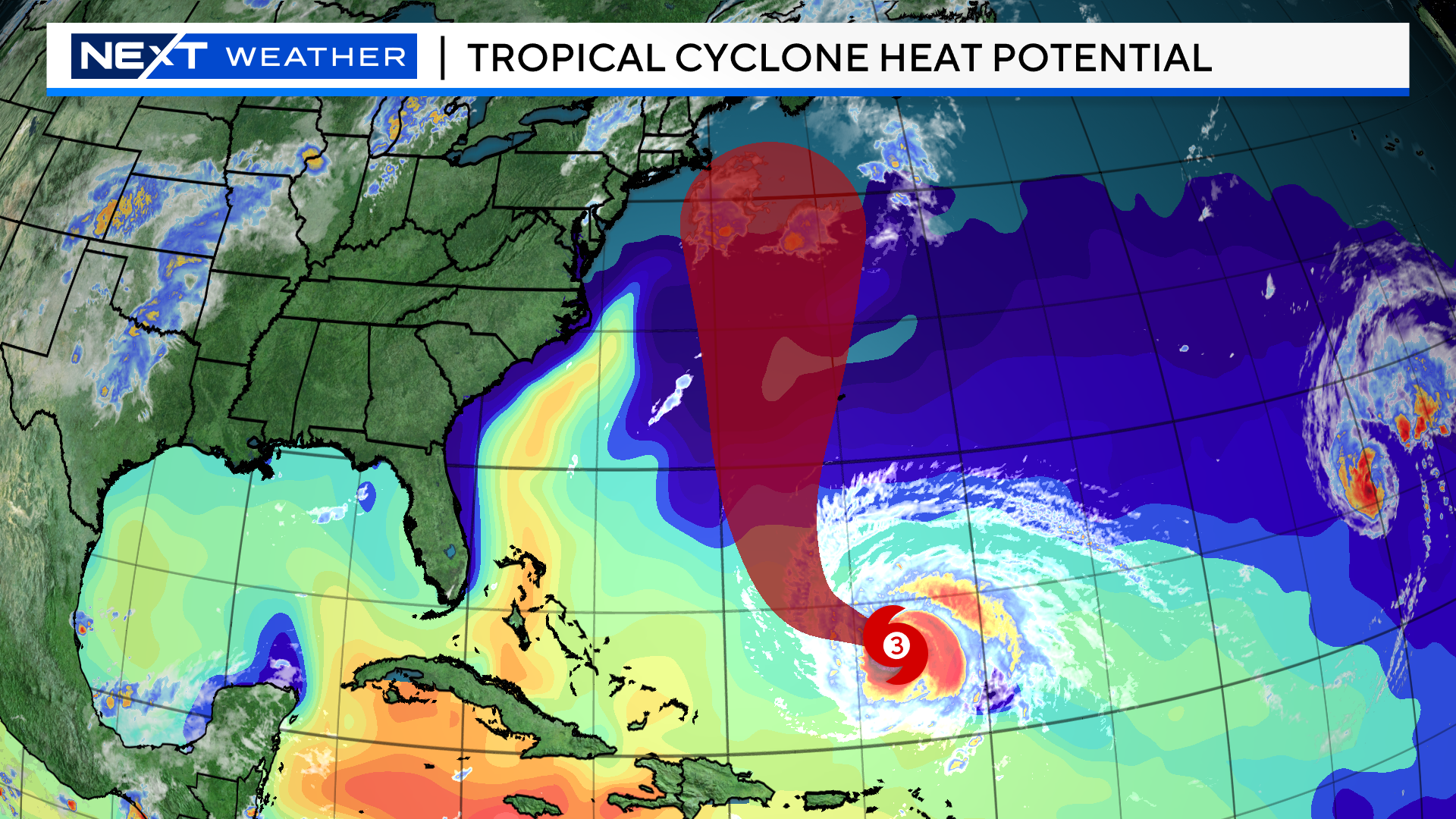
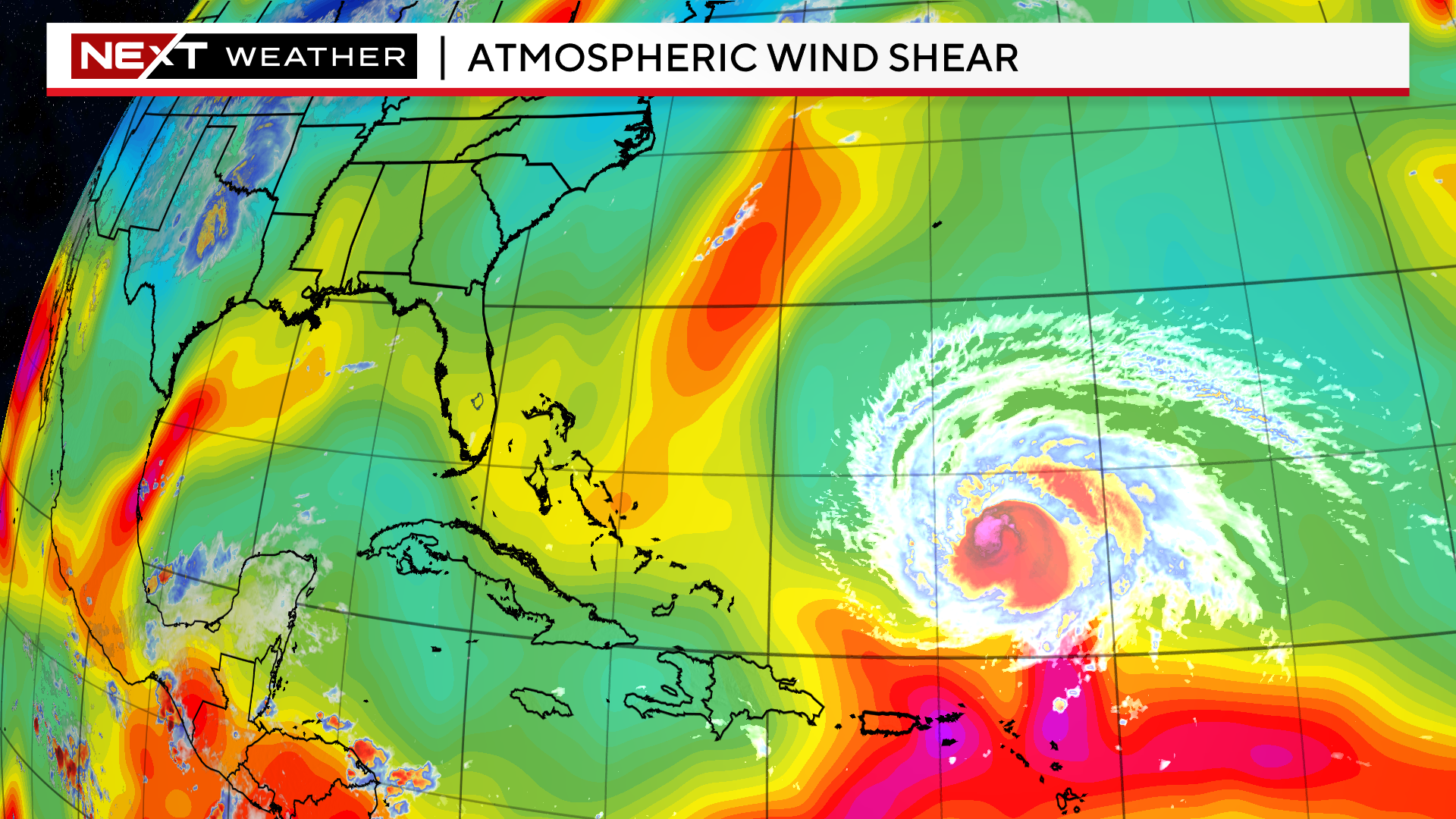
Hurricanes also need a fairly quiet atmospheric environment in order to maintain their strength. Again, currently there is very little in Lee’s way to disturb the circulation and prevent further strengthening. However, as it moves farther north, it will start to encounter some of the mid-latitude winds and a busier atmosphere in general. This “wind shear” will likely also have an adverse impact on Lee and perhaps start to make Lee look more lopsided and less circular.
Given all this, it is likely that Lee will be decreasing in strength as it approaches and passes by New England. However, the overall size of the storm is likely to be increasing. This is a common occurrence for tropical systems as they gain latitude in the Atlantic. So, while the maximum wind speeds are likely to be decreasing, the size of the wind field will be widening, perhaps extending the tropical storm force winds out several hundred miles.
Clearly, there is a LOT of data to ingest and still a lot to determine with respect to Lee’s final track. Nothing is off the table with regards to impacts for New England just yet.
It is imperative that you stay tuned to updated forecasts on WBZ-TV, WBZ.com and CBS News Boston all week long. Our NEXT Weather team has you covered!
Click here for Westford snow storm data and past totals or select “Winter Snowfall“ under “Pages” on the left hand side.
For more up to date forecast information follow me on Twitter (@terrywbz) or follow the WBZ weather team on Facebook, search WBZWeather
Reader Comments