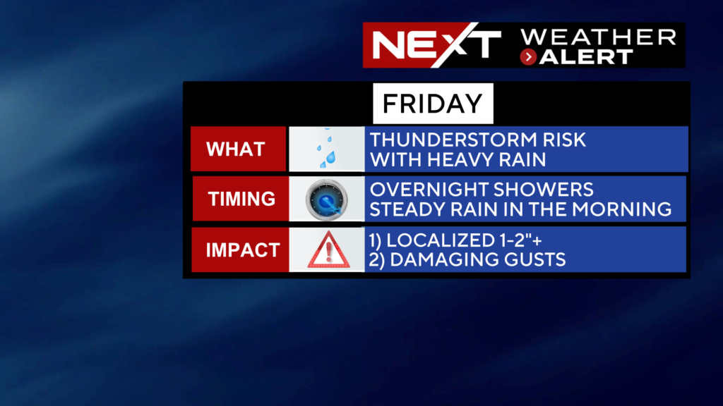
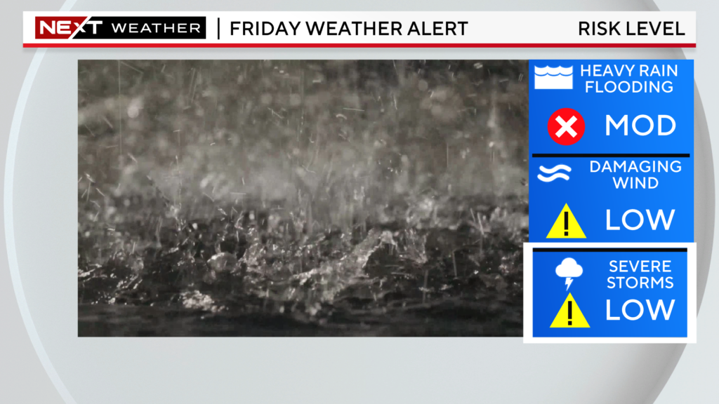
Rainy Friday’s have become a staple this summer, tomorrow making 9 out of 13 Fridays with rain in Boston since June 1. Tomorrow doesn’t look quite as disruptive as some of the past stormy Fridays but, nonetheless, we do anticipate some impacts and delays due to the downpours.
TIMELINE:
Some light showers will overspread the area late tonight, mainly after midnight.
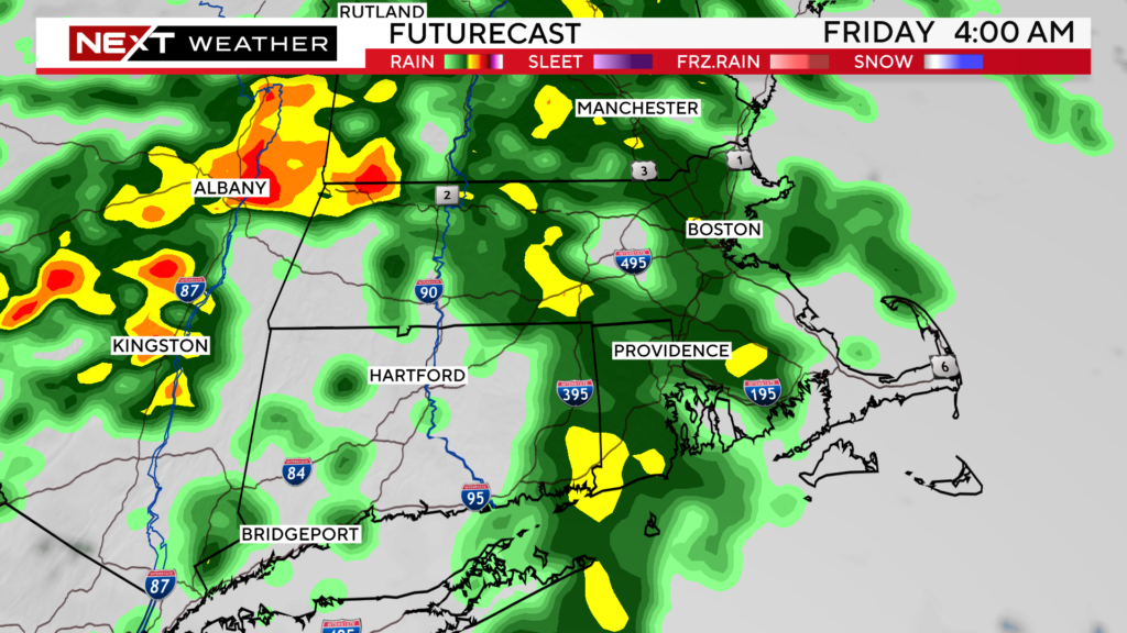
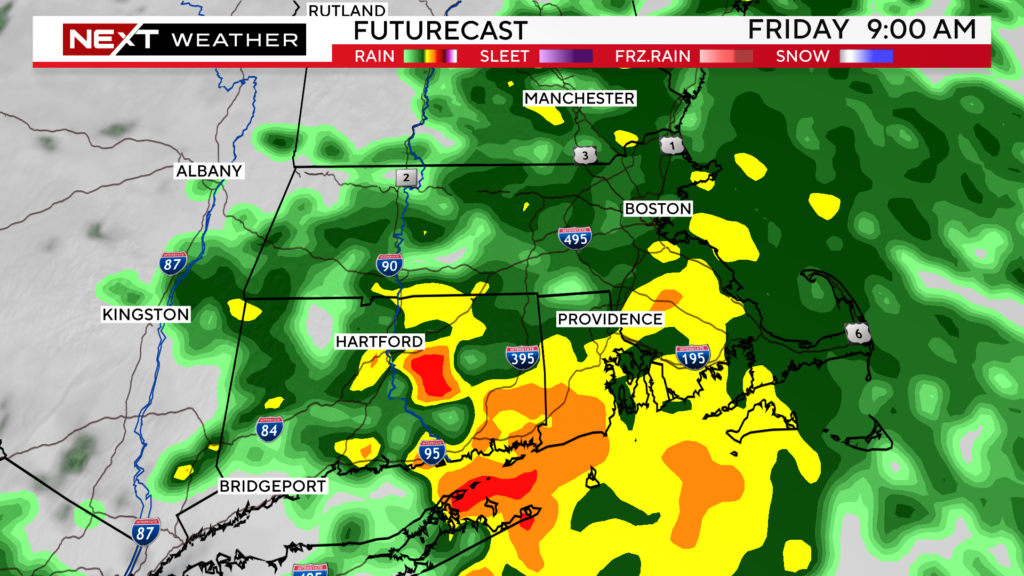
The steadiest and heaviest rainfall will arrive around dawn and continue for much of Friday morning. This is when the risk is highest for any localized flooding.
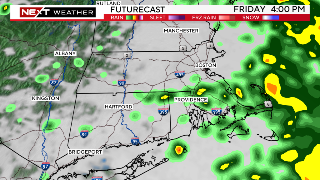
During Friday afternoon, the rain will taper to scattered showers. The area will remain mostly cloudy, and it will continue to feel very humid. There will be some periods of dry weather in the afternoon and evening.
The threat of severe thunderstorms is rather low on Friday. The greatest concern will be for localized flooding from some heavy downpours. We cannot rule out a few embedded thunderstorms and some isolated wind damage.
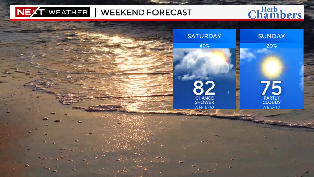
There are likely to be some lingering showers early on Saturday, especially in the morning hours. The air will still be very humid, ripe for the formation of scattered precipitation.
Sunday will absolutely be the pick of the weekend…still a slight risk of a passing shower but largely dry and with partly sunny skies.
We will continue to keep an eye on Tropical Storm Franklin which is forecast to become a hurricane east of the Bahamas this Weekend.
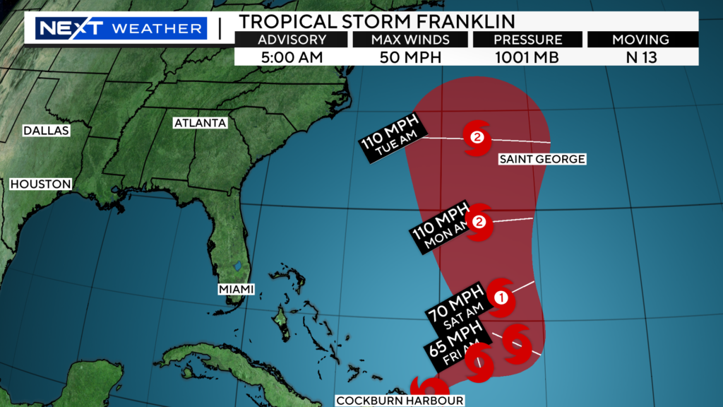
The current forecast is for it to pass west of Bermuda early next week and then well east of New England. Not expecting any impacts locally other than some large swells/waves.
If you are a lover of sunny, hot summer days, this clearly has NOT been your year.
The summers of 2022 and 2023 could not have been more different.
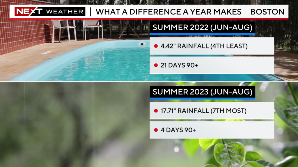
Last year at this time, we were smack dab in the middle of a drought. This summer, we are challenging the all-time seasonal rainfall records in Boston and Worcester.
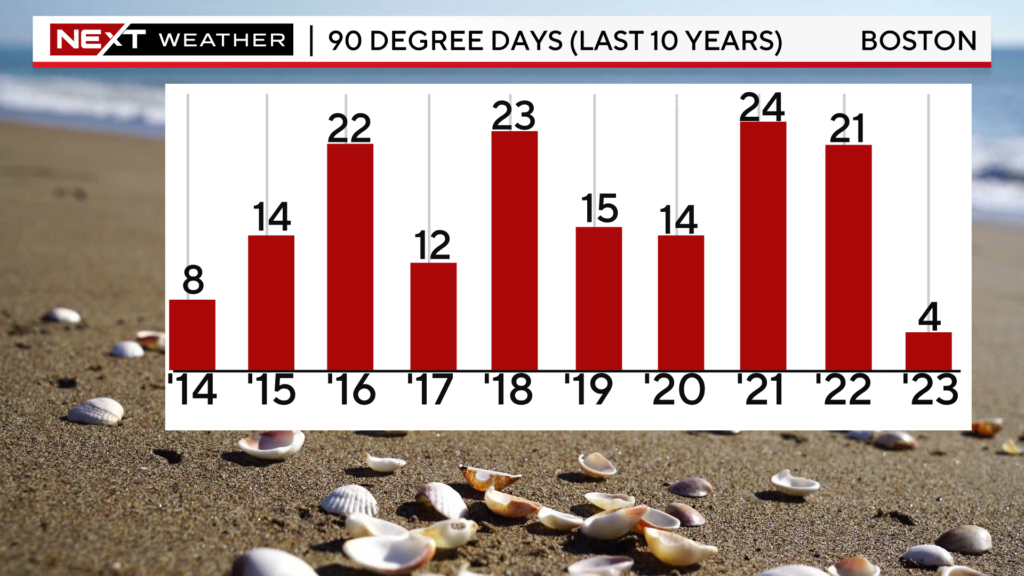
By this date last summer, Boston had 19 days of 90 degrees or higher including a 6-day and 7-day heatwave. This summer, the City has reached 90 just 4 times.
If we were to finish the year with just 4 days of 90+, that would tie Boston for the 4th least on record.
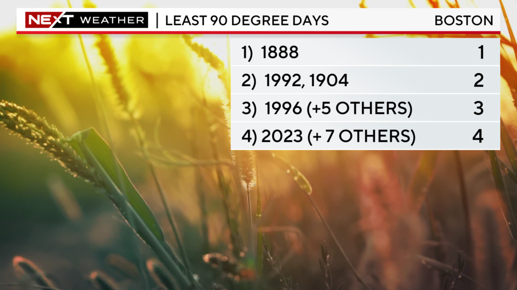
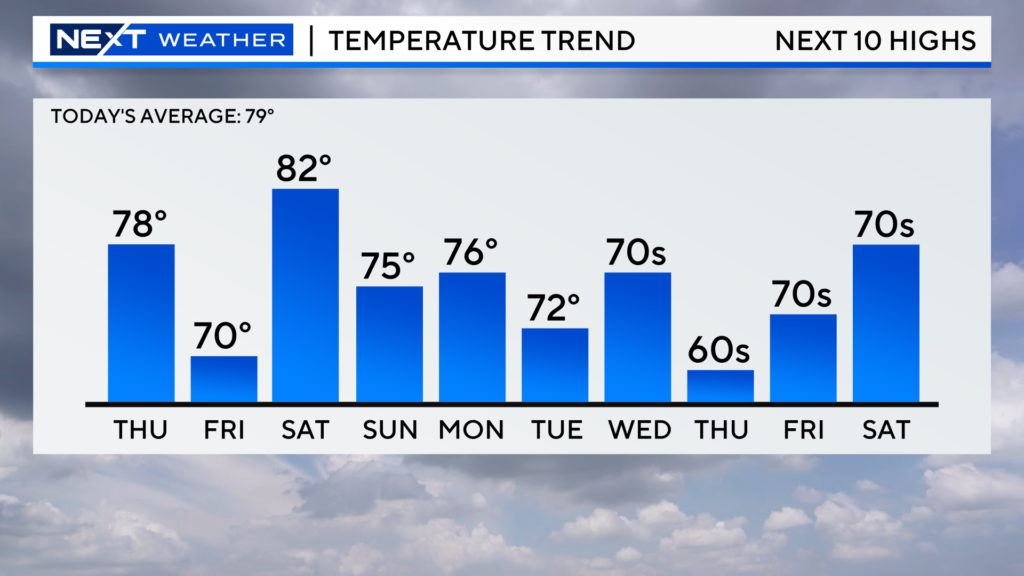
Looking at the next 7-10 days, there is very little chance of temperatures climbing anywhere near 90.
Take a look at the last 10 years…Boston averages about 15 days of 90+ per year and recently the City has been smashing that mark. This summer stands out like a sore thumb any way you slice it.
The weird thing is, I don’t think this summer will be remembered for being “cool”. It has been so darn humid for most of the time, even when we have a below average temperature day, it still feels sticky.
Do we blame El Nino? It is certainly a factor. El Nino’s are famous for causing all sorts of Global weather anomalies.
What about climate change? It is difficult to make the correlation between a single storm or even a single season and the changes going on at a Global level. One thing I would say, is that extreme events (rainfall, temperatures, droughts etc) are certainly more likely to occur with a warmer planet and more so a warmer ocean. Global ocean temperatures right now are at levels never seen before. We cannot compare weather patterns now with any other time in our recorded history simply because our oceans have never been this warm.
Blame the Jetstream…
Put in the most basic terms, the weather pattern has largely been “stuck” for most of this summer.
I am sure you have heard of the “heat dome” that started over portions of the southwestern U.S. and now is sitting over the middle of the Country.
While those areas have been baking under 100 degree heat day after day, New England has largely been on the other side of the Jetstream or sitting right underneath it.
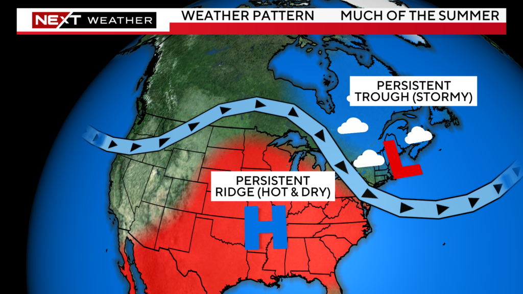
Typically in summer, we get a re-occurring “Bermuda High”. That is what pumps the hot air into the Northeast. That just hasn’t been able to take hold this summer…instead, high pressure has been semi-stationary over the middle of the United States.
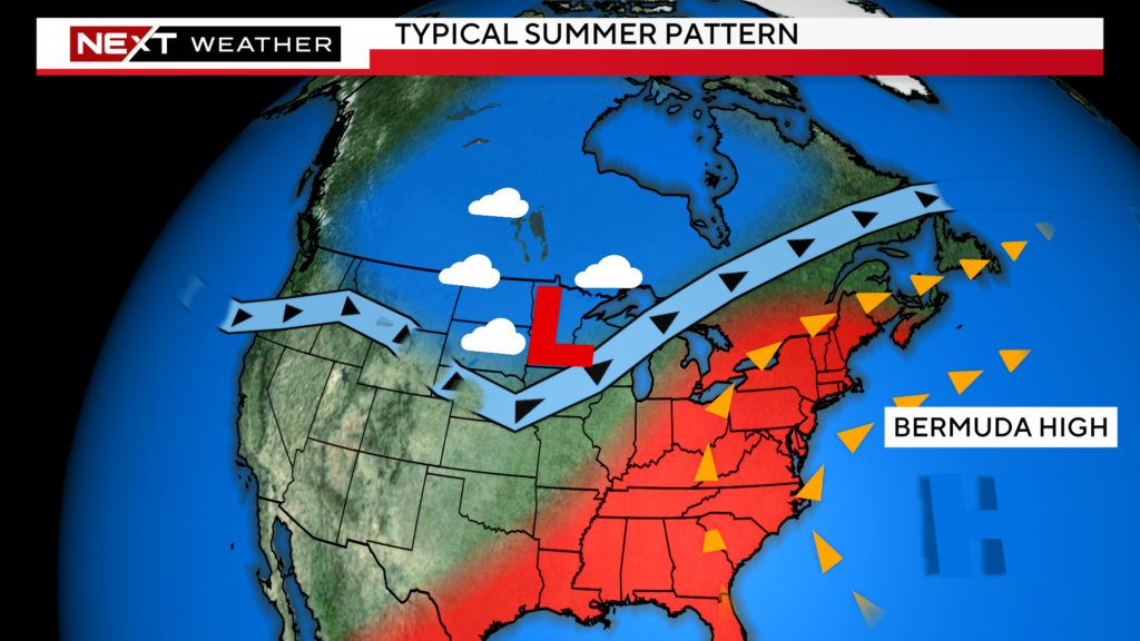
Is summer over? Can we kiss the 90-degree days goodbye?
I am not ready to stick a fork in the season just yet. Would anybody be shocked if suddenly, in September, as the kids go back to school, the real heat finally arrived?
I wouldn’t.
Click here for Westford snow storm data and past totals or select “Winter Snowfall“ under “Pages” on the left hand side.
For more up to date forecast information follow me on Twitter (@terrywbz) or follow the WBZ weather team on Facebook, search WBZWeather


Reader Comments