Friday rainfall amounts as of this writing are generally between 1-2″ in most of Metro West.
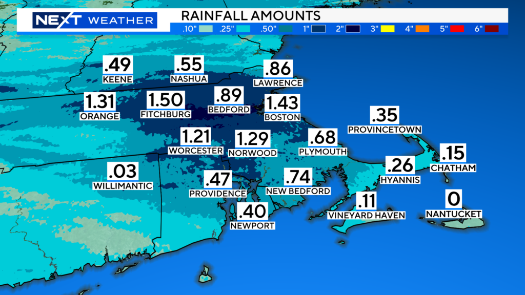
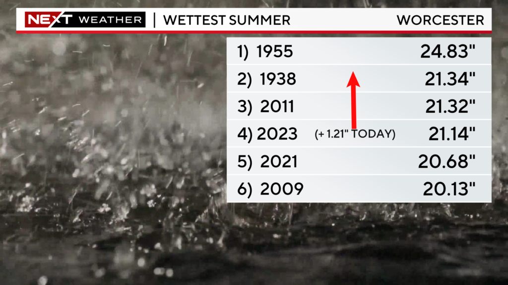
This brings Boston to the 6th wettest summer on record and Worcester to the second wettest.
The heaviest rainfall is now moving offshore, leaving us with scattered showers for the remainder of the afternoon.
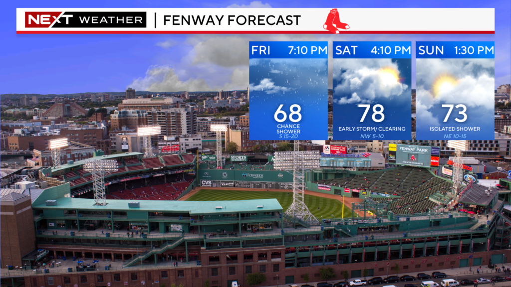
The Sox should be able to play tonight at Fenway, just not an ideal night for those in attendance with rather cool and damp conditions.
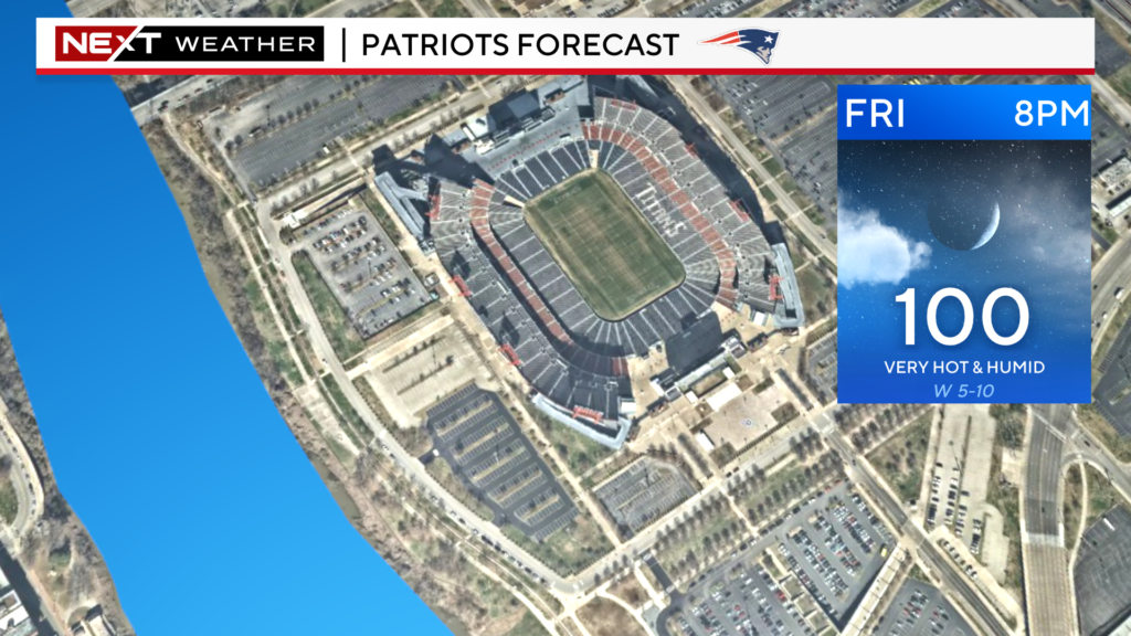
MUCH different weather than the Patriots will face tonight down in Nashville…gametime temperatures will be right around 100 degrees!
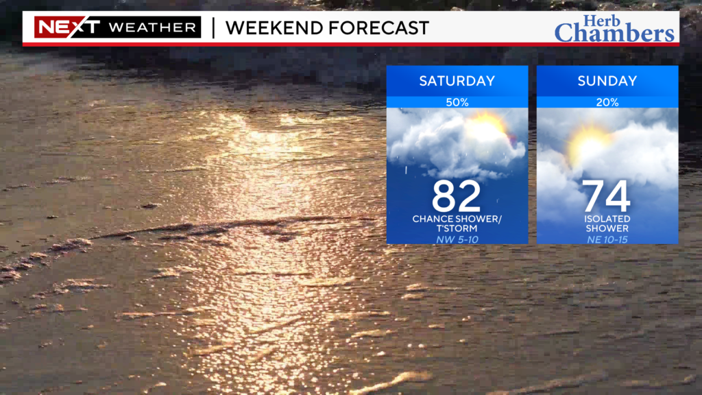
As for the Weekend…there will be a few lingering showers Saturday morning, especially near the Coastline.
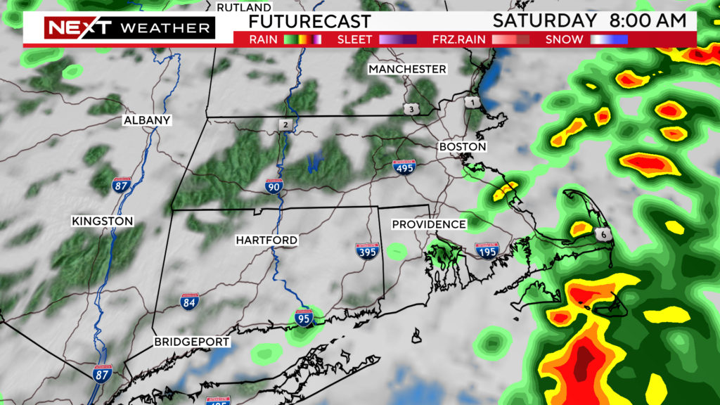
Once those clear, the rest of the Weekend will feature a mix of sun and clouds and a few scattered showers here and there…nothing to washout any plans.
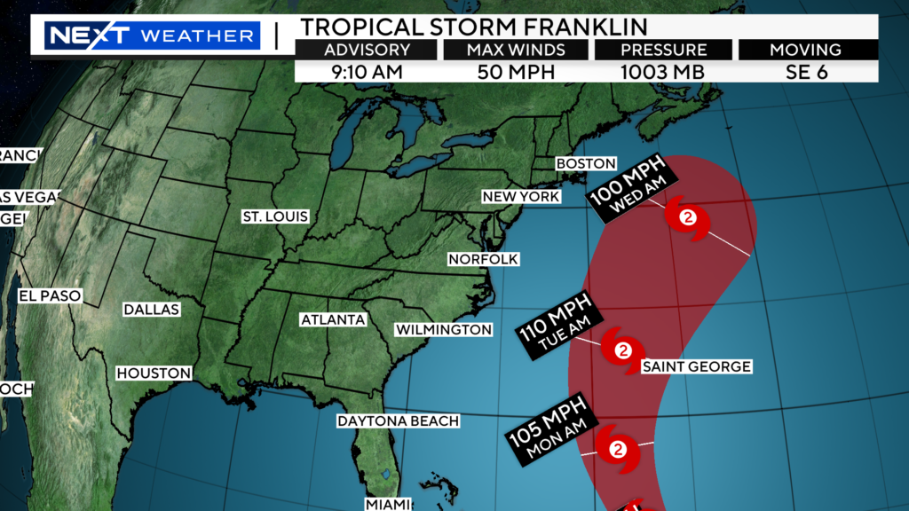
Tropical Storm Franklin will be top of mind next week. It is forecast to pass west of Bermuda this weekend (after becoming a hurricane) and then well east of New England on Wednesday.
At the same time, there will be a fairly robust storm system moving through our area late Tuesday and Wednesday. While this is not directly related to Franklin, there could be a tropical connection of moisture between the two systems. This could mean some very heavy rainfall in our area, exactly what we DO NOT need.
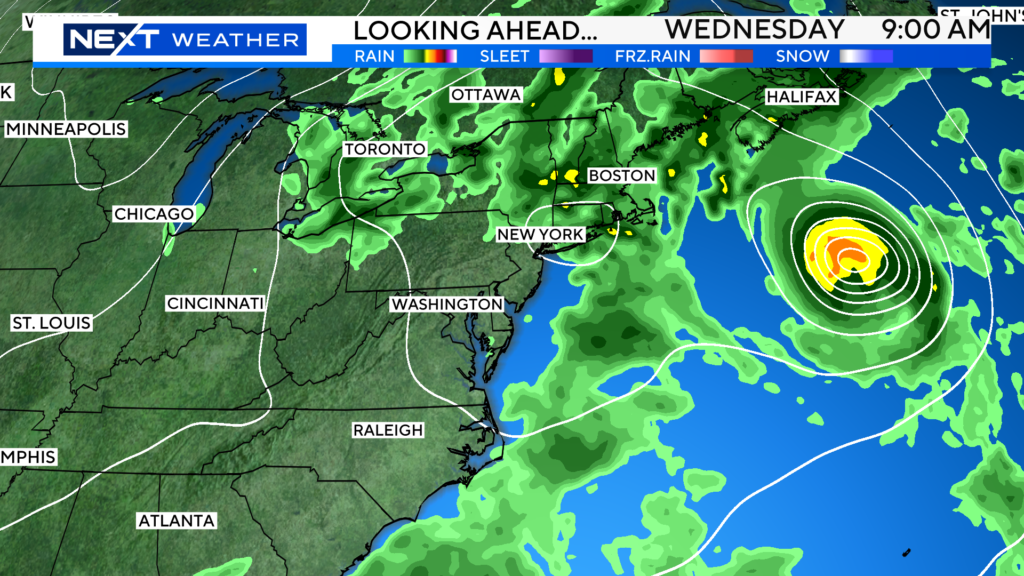
Obviously, we will need to keep a close eye on the forecast over the Weekend. Stakes are higher than usual when it comes to flooding and excessive rainfall given the amount of water we have received in the past few months.
Lastly, in case you missed it…I wrote a blog yesterday on the lack of 90 degree days this summer and what may be causing it…
https://www.cbsnews.com/boston/news/boston-summer-temperatures-90s-climate-change-weather/
Click here for Westford snow storm data and past totals or select “Winter Snowfall“ under “Pages” on the left hand side.
For more up to date forecast information follow me on Twitter (@terrywbz) or follow the WBZ weather team on Facebook, search WBZWeather


Reader Comments