Good morning!
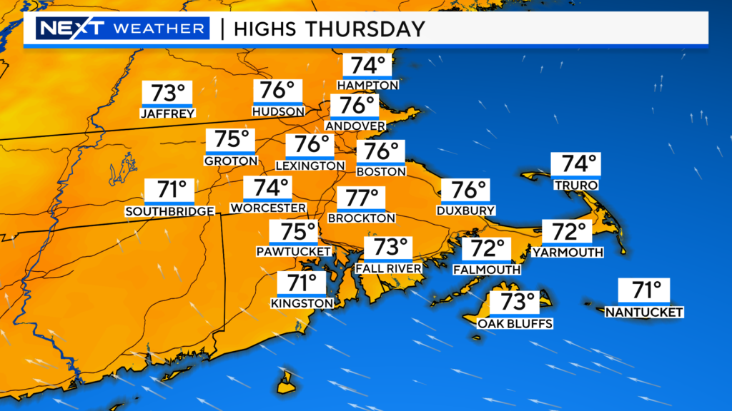
Another beauty of a day today, the only caveat will be a little wildfire smoke at times adding a haze to the sky.
Tomorrow will be a transition day.
Clouds will be rolling back in and thickening during the day.
We should stay dry though, just a few sprinkles after dark…the real rain showers don’t arrive until after Midnight
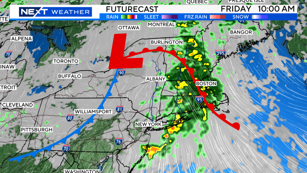
We will likely issue a NEXT Weather alert for Friday’s rain. We will likely see some areas of downpours in the morning and afternoon, perhaps over an inch of water in some towns.
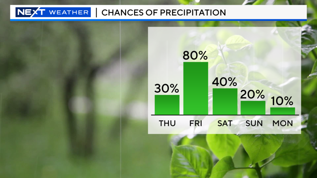
Rain chances lower over the weekend but it won’t be perfect.
We will remain under an unsettled airmass and therefore, will carry a chance of a few showers both Saturday and Sunday.
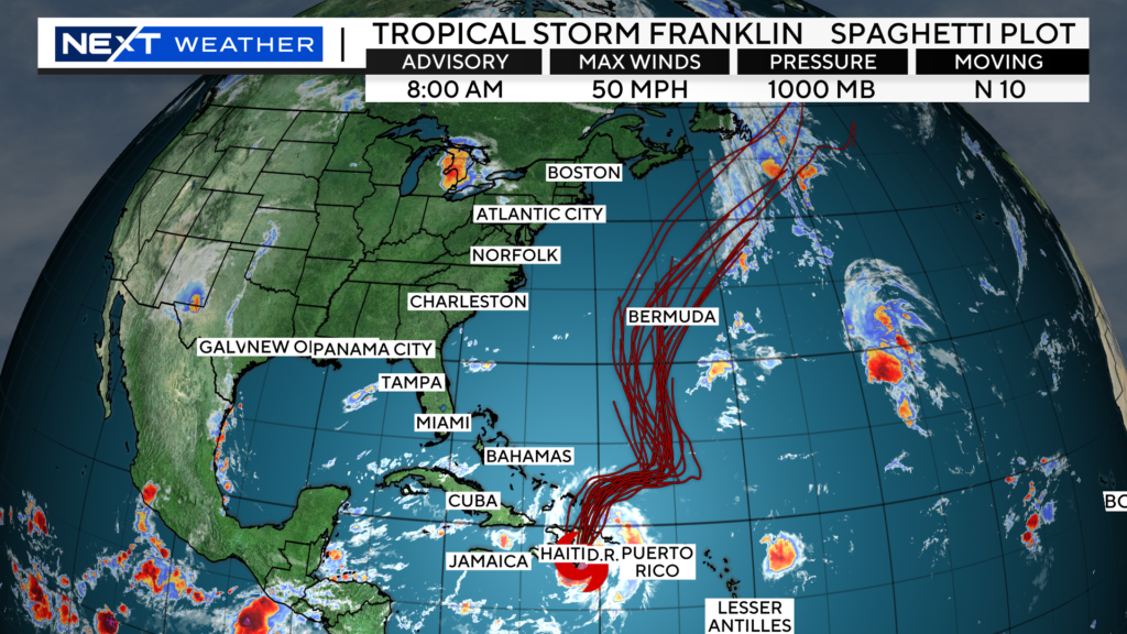
Next week, we will be watching the track of Tropical storm Franklin. It is likely to pass very close to Bermuda and then several hundred miles east of New England.
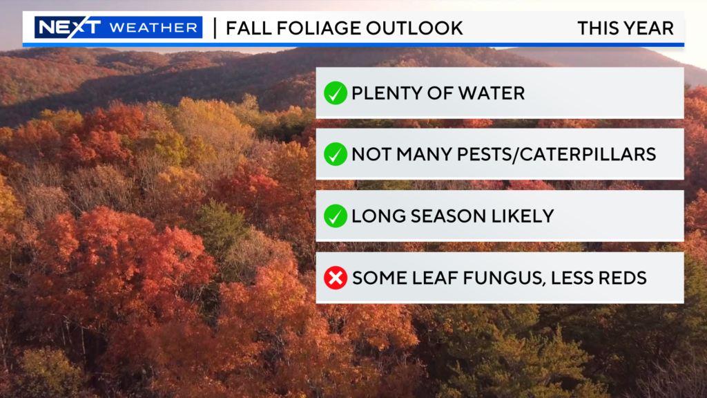
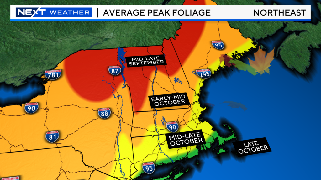
Last but not least…did you catch our fall foliage preview?
The outlook is quite good for this year! Thanks to plenty of water and fewer pests and caterpillars, we should be in for a colorful fall season!
Click here for Westford snow storm data and past totals or select “Winter Snowfall“ under “Pages” on the left hand side.
For more up to date forecast information follow me on Twitter (@terrywbz) or follow the WBZ weather team on Facebook, search WBZWeather


Reader Comments