Happy Hump Day!
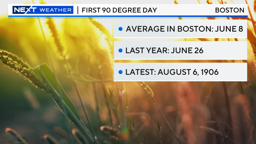
Did you know that the City of Boston has not recorded a temperature of 90 degrees or higher yet this year? Well, today COULD be that day! If we can avoid a very meager seabreeze this afternoon, Boston will hit 90+ for the first time in 316 days (since last August 30).
This is quite late in the summer for the first 90 in Boston, the average being on June 8th.
Of course, you typically need sunshine in order to hit 90 and that has not exactly been at a premium this year.

There will be a few isolated storms well northwest of the City later this afternoon and early tonight. I think the majority of us will stay dry.
Thursday will be a few degrees cooler than today with a bit more cloud cover at times and again, a slight risk of a pop-up shower or storm north and west.

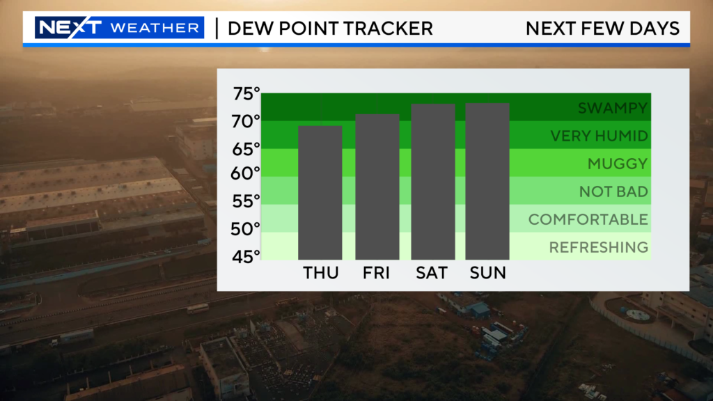
As for Friday and into the Weekend, we go right back into the soup.
Oppressive humidity levels…

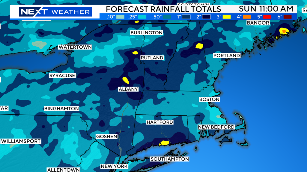
And numerous showers and storms popping each day…

Some areas, including those in western MA and Vermont, could get another 1-3″ of rainfall.

Click here for Westford snow storm data and past totals or select “Winter Snowfall“ under “Pages” on the left hand side.
For more up to date forecast information follow me on Twitter (@terrywbz) or follow the WBZ weather team on Facebook, search WBZWeather


Reader Comments