Happy Thursday!
Pretty good day on tap for today…we will have some increasing clouds in the midday and early afternoon but shower activity looks to be at a minimum.
Highs will once again be near 90 in many areas, Boston officially got its first 90 degree day yesterday!
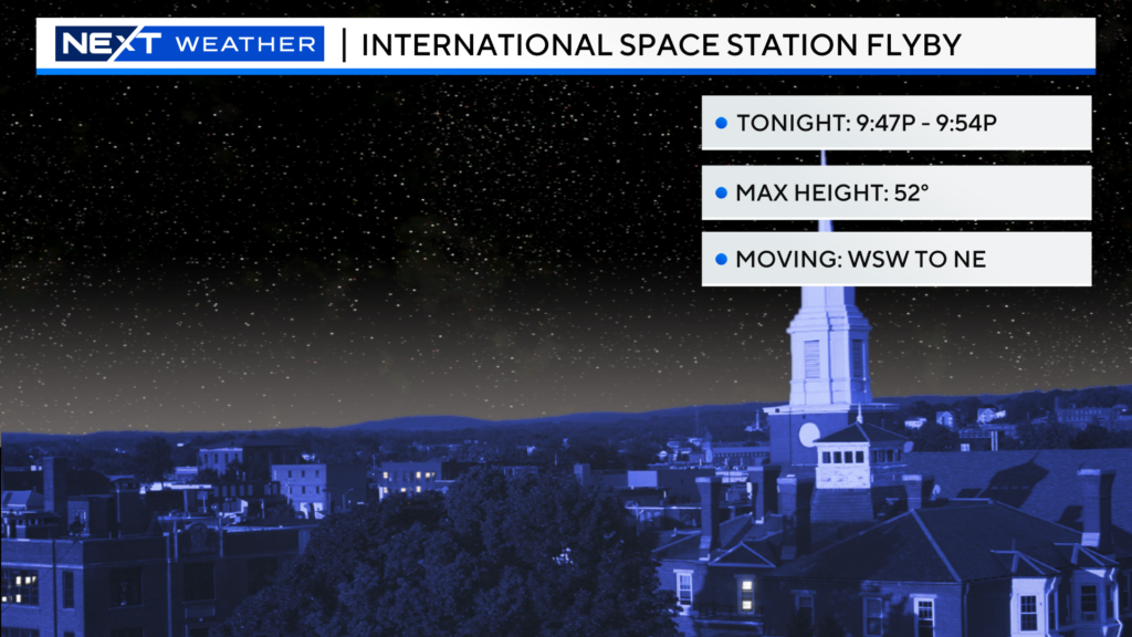
There should be enough clear sky for most of you to check out the International Space Station flyby tonight in the 9pm hour…
Late tonight, there will be a broken line of downpours moving west to east across southern New England. There will likely be some heavy downpours in western MA between 6-8pm. The line gets to central MA between 7-10pm, albeit in a weaker state. Most models indicate that by the time it arrives in eastern MA, much of the energy will be zapped and the likelihood any significant rain is low.
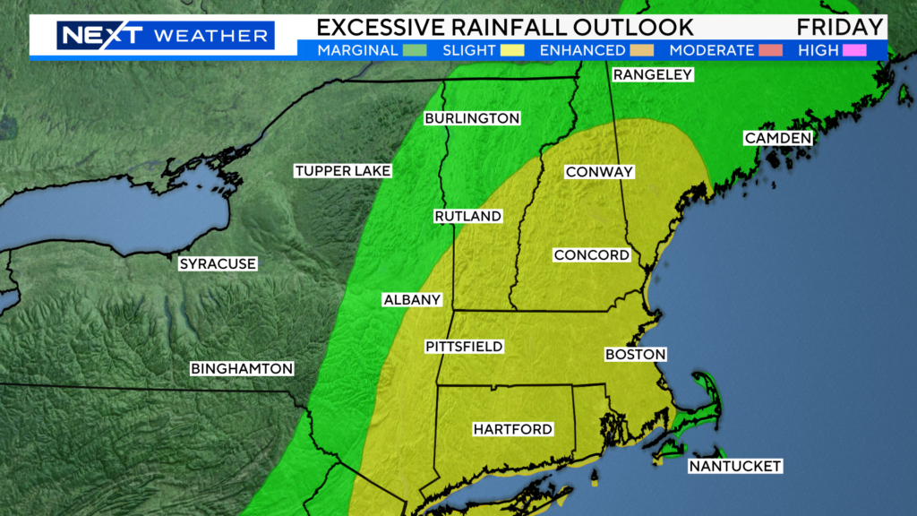
During the day on Friday, we will be under a very warm and humid airmass, ripe for scattered showers and downpours. The Weather Prediction Center has put most of our area under a “slight risk” of excessive rainfall. While the severe threat is rather low, the chance of some slow moving, heavy downpours remain rather high. Obviously not welcome news to those in areas that have seen flooding in recent days. It will not be an all-day washout, but certainly a day to keep an eye to the sky and on radar.
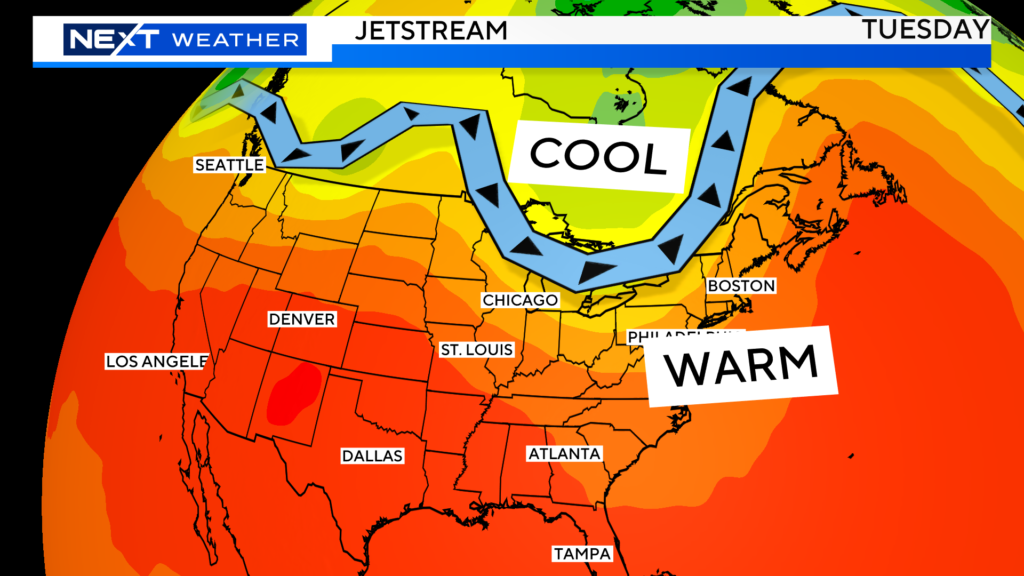
This pattern will persist right through early next week. Very high humidity and daily shower/downpours risks.
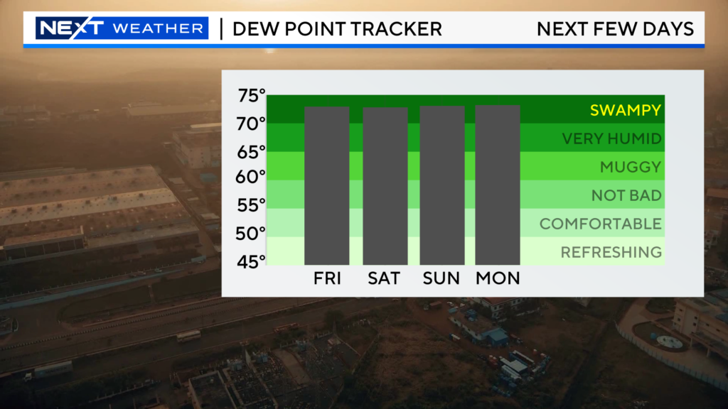
Friday and Sunday look to be the days with the greatest risk of downpours, while Saturday may be a tad quieter.
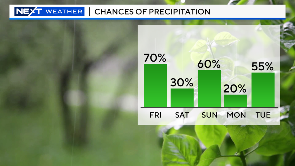
Unfortunately, it looks like more of the same next week with the same ol’ pattern hanging around. Persistent “trough” to our west, high humidity, and daily shower/storm threats.
Click here for Westford snow storm data and past totals or select “Winter Snowfall“ under “Pages” on the left hand side.
For more up to date forecast information follow me on Twitter (@terrywbz) or follow the WBZ weather team on Facebook, search WBZWeather


Reader Comments