After a couple days of rain in some areas, the sun was an awfully welcome sight today.
Unfortunately, the damage has already been done for many towns in Vermont and along the Connecticut River.
Some towns have received upwards of 10″ of rain in just the last week or so.
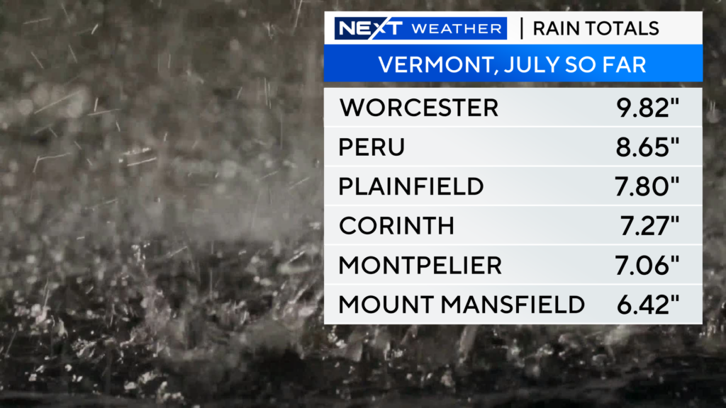
The resultant flooding has been historic in parts of Vermont. Several dams are in jeopardy of breaching and numerous towns are completely under water.
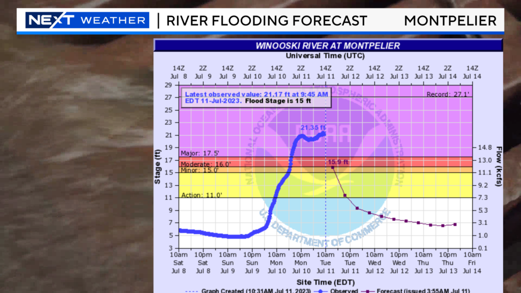
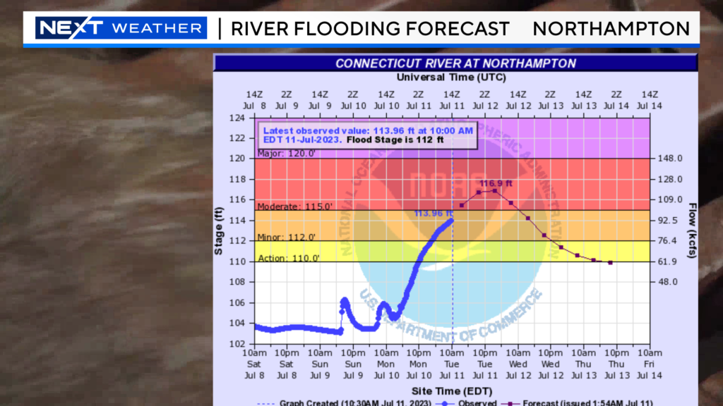
This has caused many rivers, including the Connecticut to go over their banks.
Several towns downstream are in jeopardy of significant flooding in the next 24 hours including Holyoke, Northampton and Greenfield.
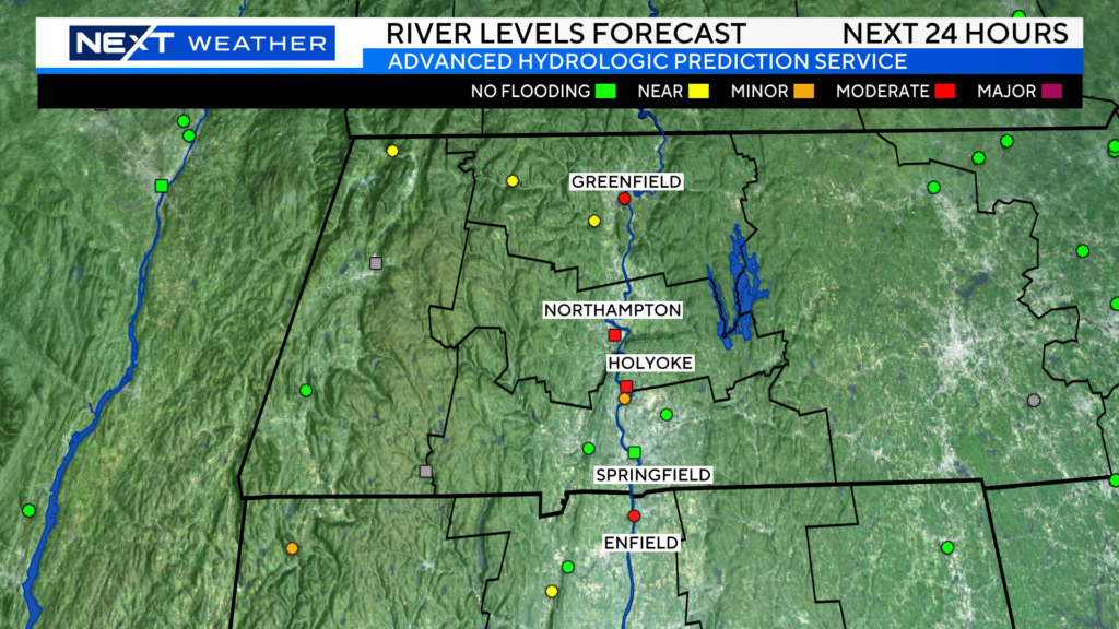
Thankfully, the rain has largely moved on…we are left with just a few showers in northernmost New England.
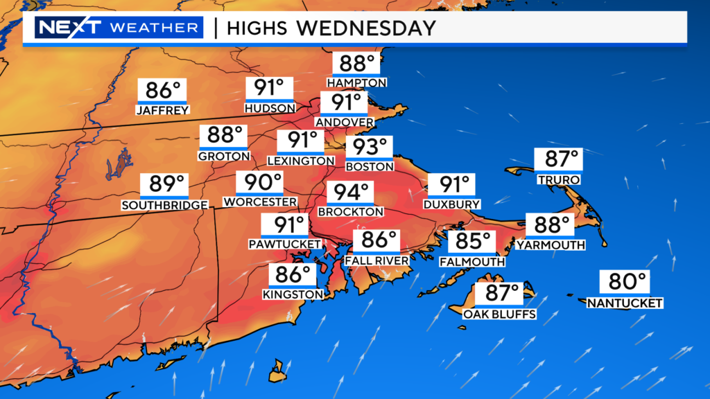
Closer to home, major improvement in the last 24 hours. The sunshine has returned! Highs today will reach the upper 80s, perhaps nicking 90 in a few towns.
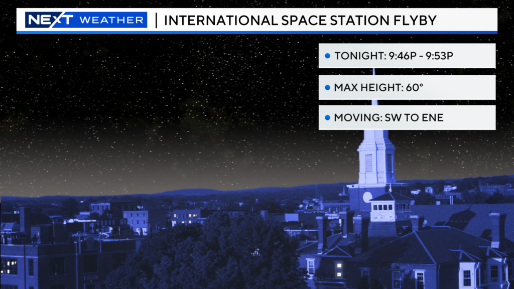
There will be a great opportunity to see the International Space Station tonight…
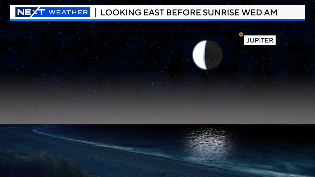
And, more astronomical fun…the Moon will be very close to Jupiter just before sunrise Wednesday!
Tomorrow will be the warmest day of the week and perhaps, Boston’s first 90 of the year!
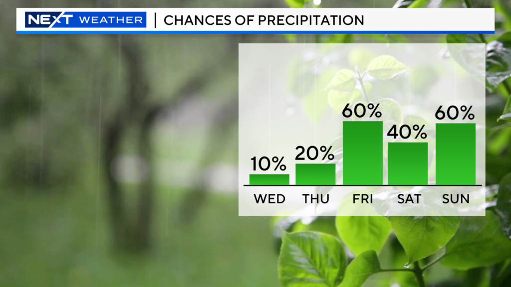
There is a slight chance of a few isolated storms popping tomorrow afternoon, mainly north and west of Boston.
As you can see, the rain chances increase significantly later this week and into the weekend. Back into the soup, literally…Dewpoints will be in the oppressive category and there will be lots of showers and storms around Friday through Sunday.
Click here for Westford snow storm data and past totals or select “Winter Snowfall“ under “Pages” on the left hand side.
For more up to date forecast information follow me on Twitter (@terrywbz) or follow the WBZ weather team on Facebook, search WBZWeather


Reader Comments