Busy Monday in the weather office…
At this hour we have:
-Life threatening flooding occurring in parts of western Massachusetts, southwestern New Hampshire and Vermont
-A NEXT Weather Alert for localized flooding from heavy downpours expected to impact central and eastern MA throughout the day today
-Lastly, there was a solar flare that erupted last night and we may be in for increased Northern Light activity later this week
Over the last 24 hours, parts of western New England have received upwards of 4-8″ of rainfall, the equivalent of 2 months worth of water.
The bullseye has been largely over portions of Vermont and southwestern New Hampshire. Within this area, there have been numerous washed out or roadways and flooding-related rescues. Some experts are comparing this event to the historic flooding that occurred back in 2011 with Irene.
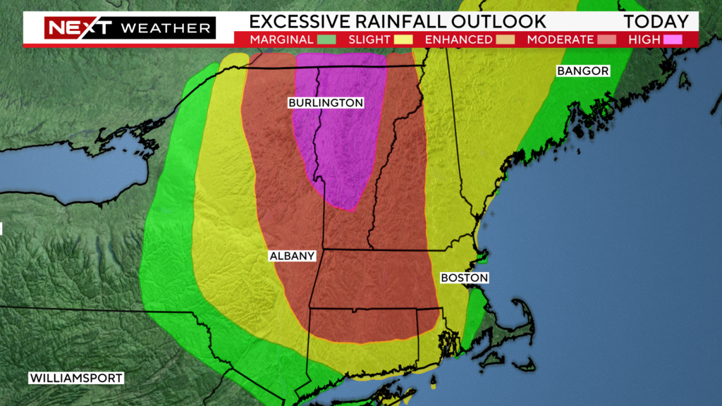
You can see the National Weather Service has highlighted much of central and northern Vermont in the “high risk” category for excessive rainfall…a highly rare occurrence for this area.
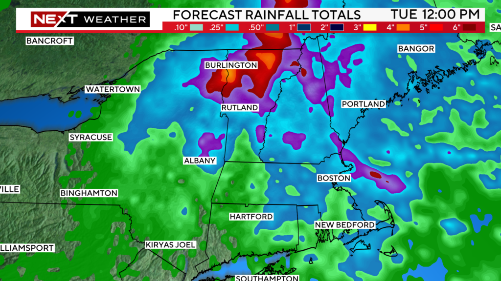
Looking at the rainfall forecast for the next 24 hours, you can see an additional 2-4″+ is expected in parts of Vermont with lower amounts to the east.
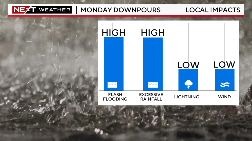
The WBZ Weather Team has issued a NEXT Weather Alert for southern New England for the remainder of the day on Monday. While the rain and flooding won’t be nearly as impactful in eastern MA as it has been in parts of western and northern New England, there will be some local impacts on Monday. The risk of severe thunderstorms is fairly low, the main threat to monitor will be localized flooding from a very slow-moving cluster of downpours.
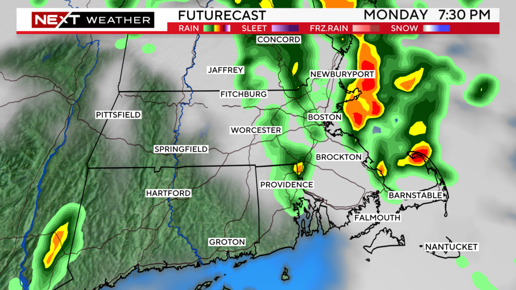
The storms will largely be exiting the coast this evening and we will quiet down and dry out overnight.
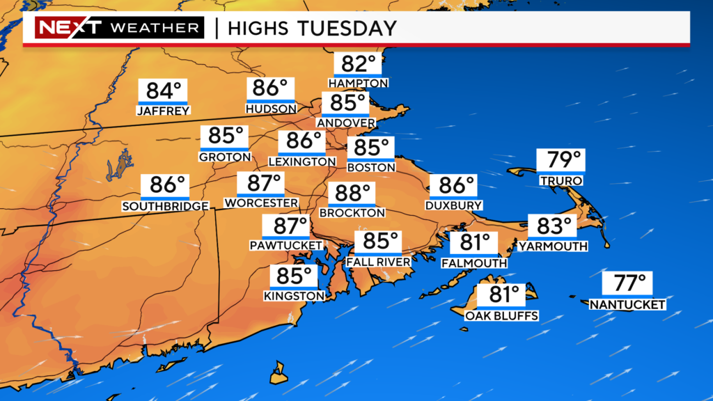
Tuesday will be a much nicer day…increasing sunshine, highs in the 80s and humidity a tad lower.
More importantly, the rain chances will drop to just about 0% after the early morning hours.
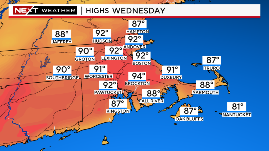
Wednesday will be a scorcher…highs back in the low 90s albeit with reasonable humidity levels.
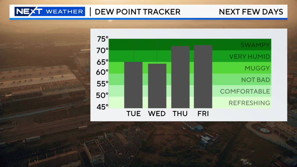
Later this week…that all-too-familiar pattern returns…
High humidity along with a daily threat for pop-up showers and thunderstorms. And that storm threat looks to linger into the upcoming weekend as well…
NORTHERN LIGHTS ALERT!
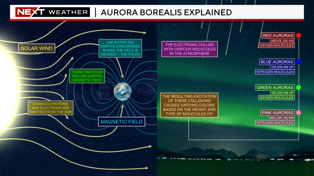
Late last night, 93 million miles away, a solar flare ejected from the surface of the sun. Sunspot AR3358 exploded and produced an “M2 class” solar flare, directed right at Earth.
Over the next few days, that “coronal mass ejection” will hurl towards our planet at a speed of more than 2 million miles per hour. It is expected to reach Earth later on Wednesday and into Thursday.
As we get closer, we will get a better idea as to how the particles will react with the Earth’s upper atmosphere and the level to which Aurora’s will be generated.
As of this writing, there is a decent chance for increased Auroral activity Wednesday night across most of the northern-tier states, including in New England.
Again, best bet would be after 10pm Wednesday night into the early hours of Thursday. You would also increase your odds of seeing the Northern Lights by finding as dark a space of sky as possible, away from artificial light.
Our team will keep you updated in the days ahead as to our chances of seeing anything in New England. These events tend to be rather elusive, so set your expectations low for now.
Click here for Westford snow storm data and past totals or select “Winter Snowfall“ under “Pages” on the left hand side.
For more up to date forecast information follow me on Twitter (@terrywbz) or follow the WBZ weather team on Facebook, search WBZWeather


Reader Comments