


Welcome to June!
It is the official start of meteorological summah!
And, what better way to kick things off than with a couple 90 degree days followed by a couple days in the 50s!
So much going on this weekend from graduation and grad parties to weddings, ball games etc…Sadly, the weather news is not good.
I think the best we can hope for is that much of Saturday and Sunday will just be grey and chilly and NOT soaking wet. This is a distinct possibility. Let’s break it down as best we can right now…
TODAY:
Tons of sun, temperatures will top 90 in many inland locations. A light seabreeze will develop this afternoon, keeping the beaches in the 70s and low 80s.

We will be watching for potential record breaking heat in the inland cities of Worcester and Hartford both today and tomorrow.

FRIDAY:
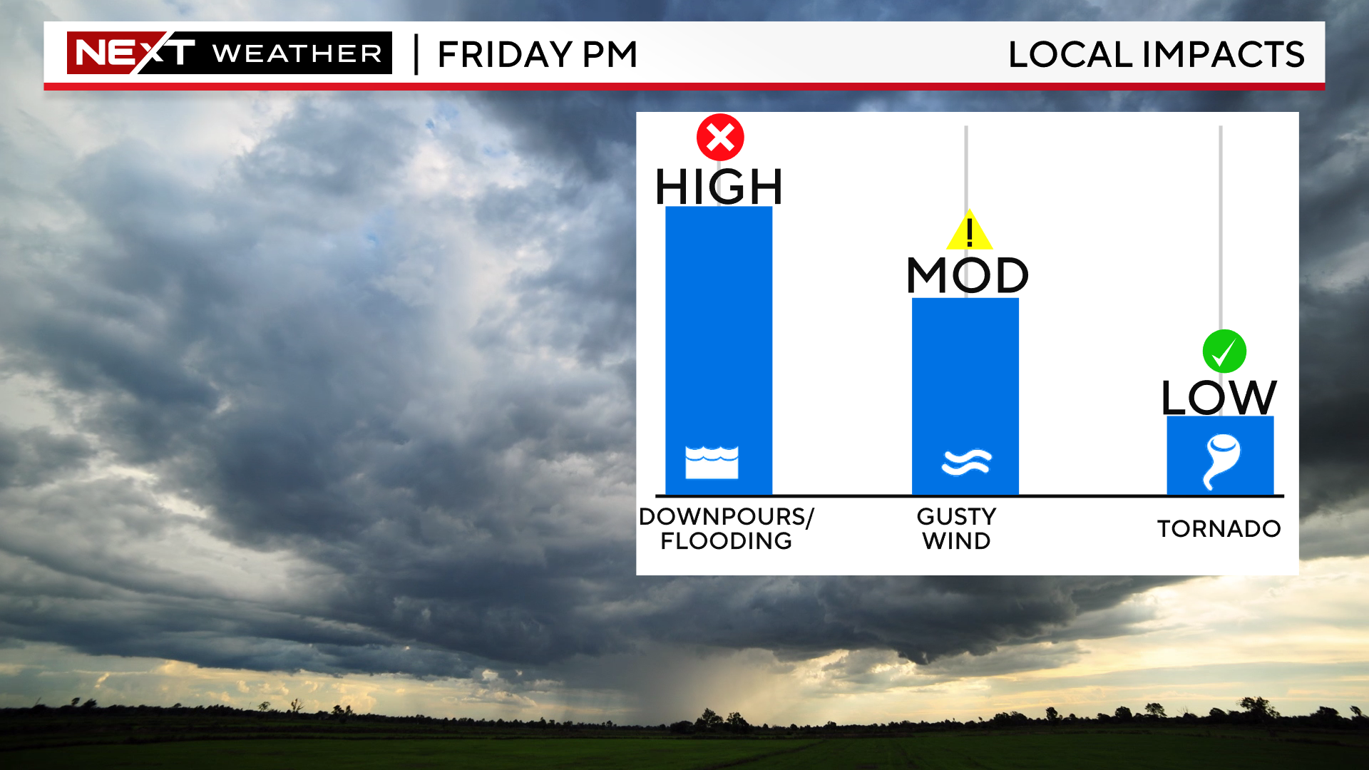
THE WBZ WEATHER TEAM WILL BE ISSUING A NEXT WEATHER ALERT STARTING AT 5PM TODAY FOR THE THREAT OF THUNDERSTORMS ON FRIDAY

Sunny start Friday, but clouds will build by midday and afternoon…we should still be able to reach 90 in many of the inland burbs before a showers and storms begin to pop.
I think the best chance of getting a downpour on Friday afternoon and evening will be inland…say 495ish and points west. This isn’t to say that folks to the east have a 0% chance of rain…but the odds are definitely higher to the west.

Any storms that do form, could contain very heavy downpours, frequent lightning and strong, gusty winds during Friday afternoon and evening.
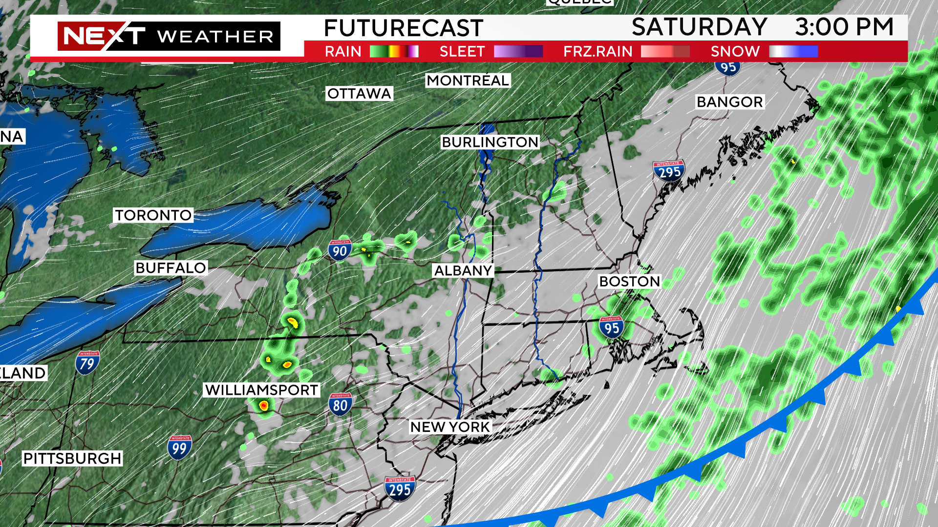
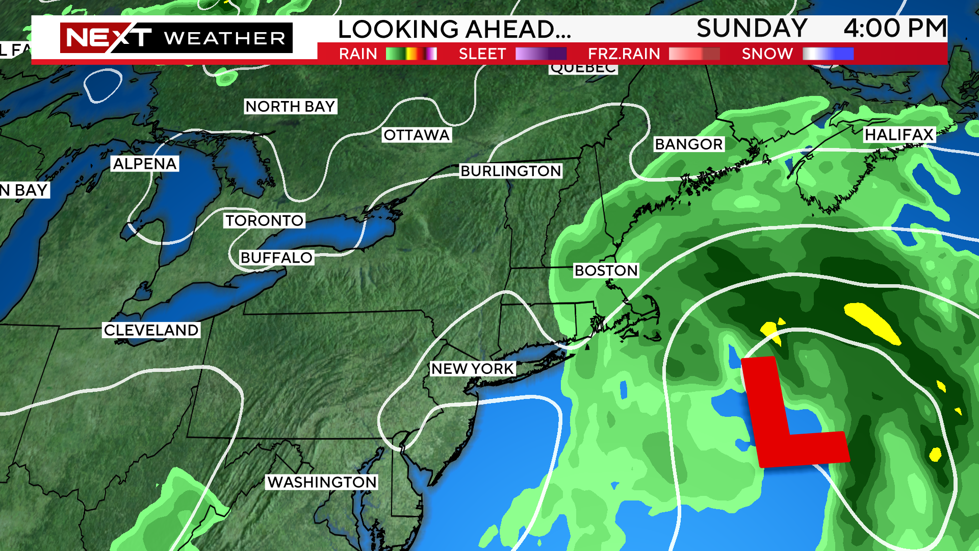
THE WEEKEND:
Remember last weekend? Well, this weekend will be essentially the opposite. High temperatures on both Saturday and Sunday will be in the 50s!
Saturday will be mainly cloudy with a few lighter showers here and there behind the cold front. Not expecting an all day rain or washout but certainly will feel damp.
Sunday has a higher washout potential. An ocean storm will be backing in towards New England. There is still some discrepancy as to how far west it will come. The scenarios right now range from an all-day soaker for much of the area to a “fringe storm” where most of the rain would fall over the Cape, keeping areas west mainly dry but still cloudy and cool. We will keep you posted!
Click here for Westford snow storm data and past totals or select “Winter Snowfall“ under “Pages” on the left hand side.
For more up to date forecast information follow me on Twitter (@terrywbz) or follow the WBZ weather team on Facebook, search WBZWeather
Reader Comments