


Happy Friday! Let’s Go!
Wish I had better news with regards to the weekend weather…even moreso, wish I had more confidence in the weekend forecast! Models are still waffling back and forth, particularly for Sunday. I would advise keeping expectations low and, who knows, maybe we will be pleasantly surprised!
Let’s start with today and our NEXT Weather Alert…
We have a very warm and somewhat humid airmass in place. As a cold front starts to slide down from northern New England this afternoon, we will notice clouds building and showers and storms popping. This could start as early as 1pm and, by later this afternoon, I would expect the radar to be lit up with numerous downpours and thunderstorms.
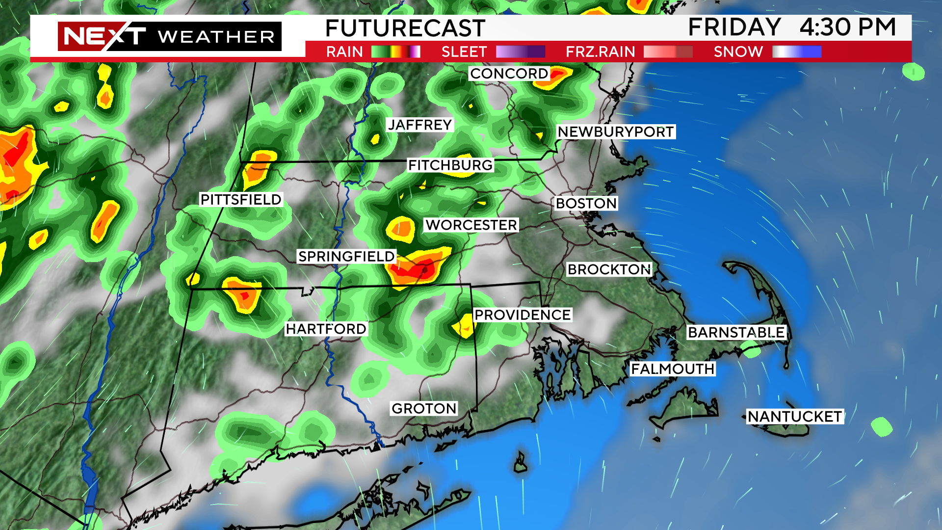
Notice that most of the action should be west of I95 and, perhaps, even west of 495. Therefore, I am slightly more confident and optimistic that graduations and ball games in eastern and southeastern MA will stay dry today as opposed to those to the northwest.
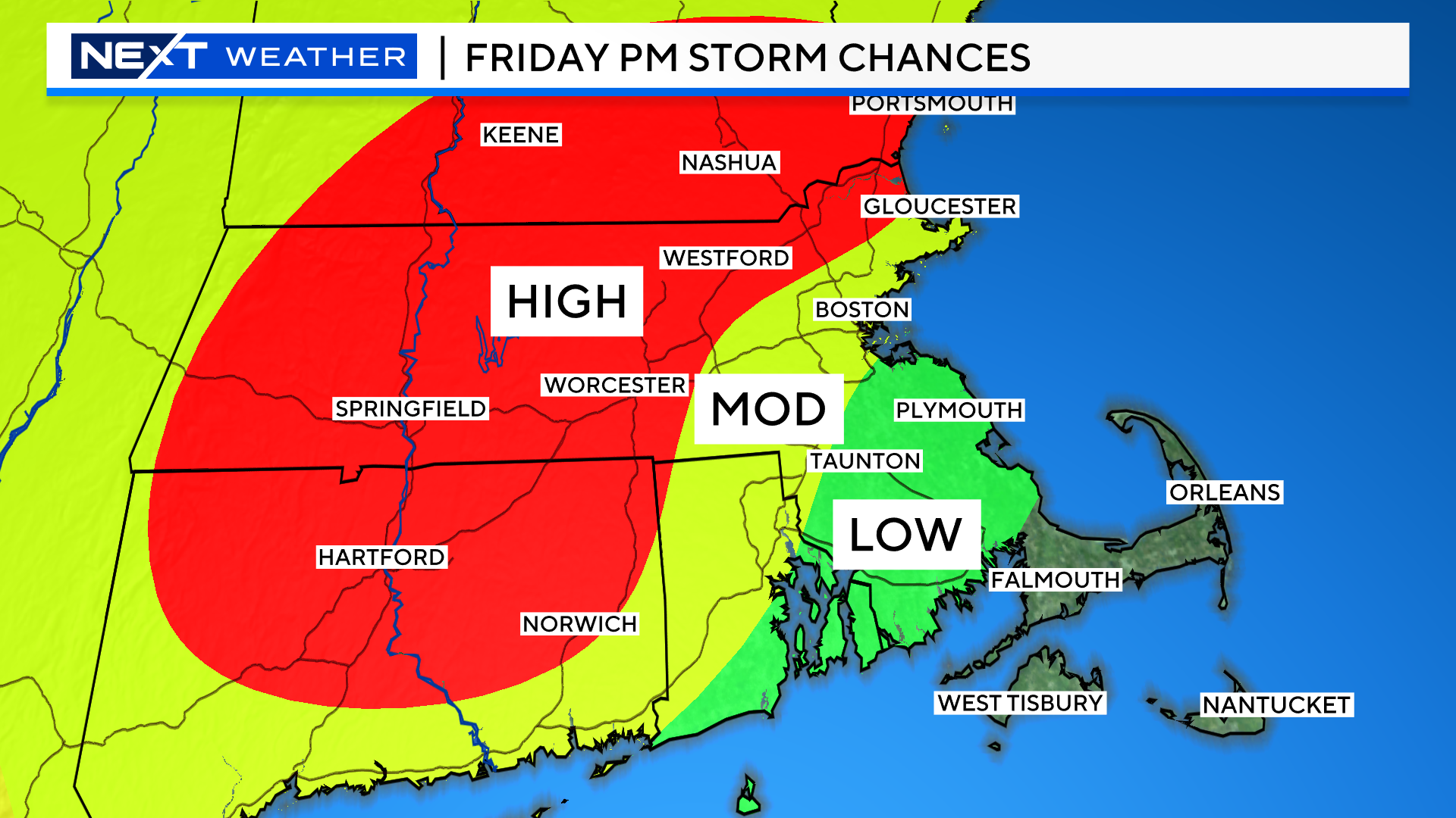
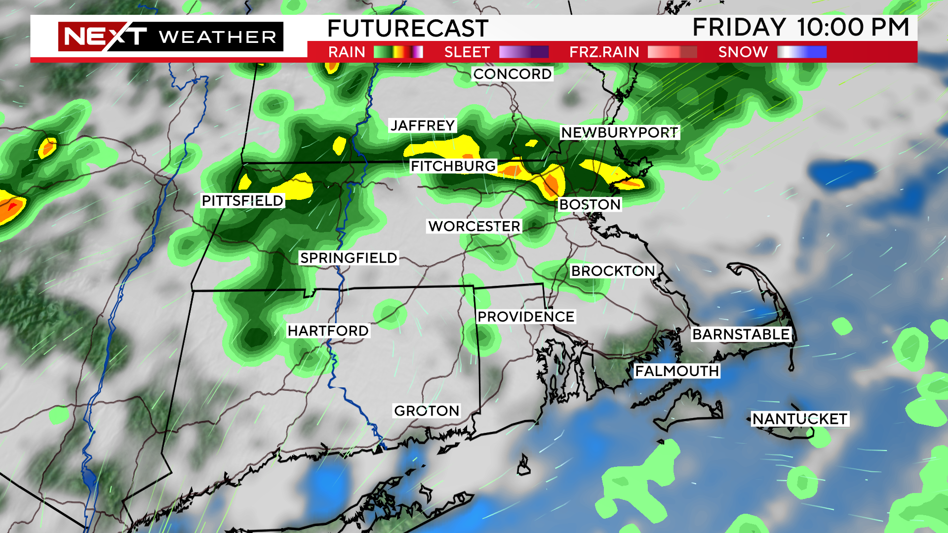
Later this evening, after sunset, we could see some action popping in northeast MA, perhaps closing in on Boston and Fenway Park mid to late game.
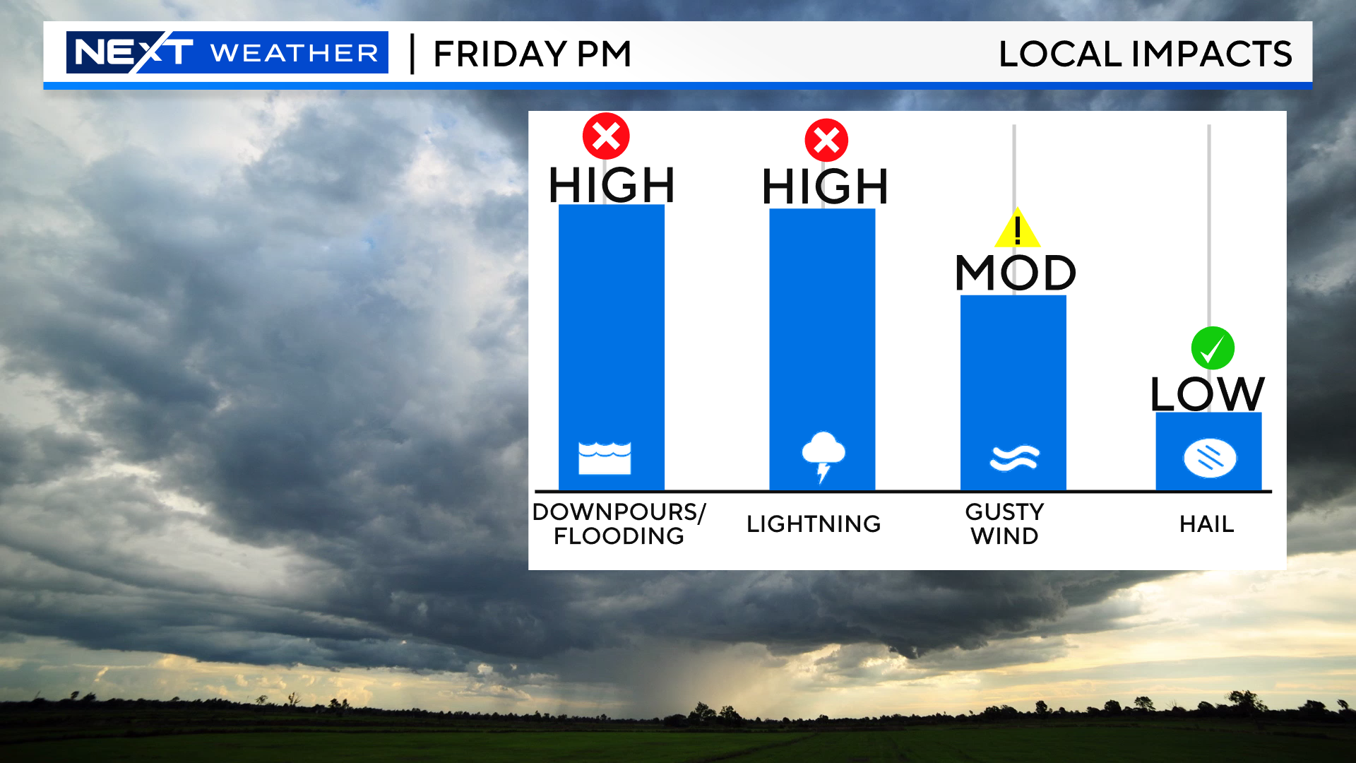
Any storms that do form could contain very heavy downpours, leading to some localized flooding. There may also be frequent lightning and brief, gusty winds as well.
Then we come to the weekend…
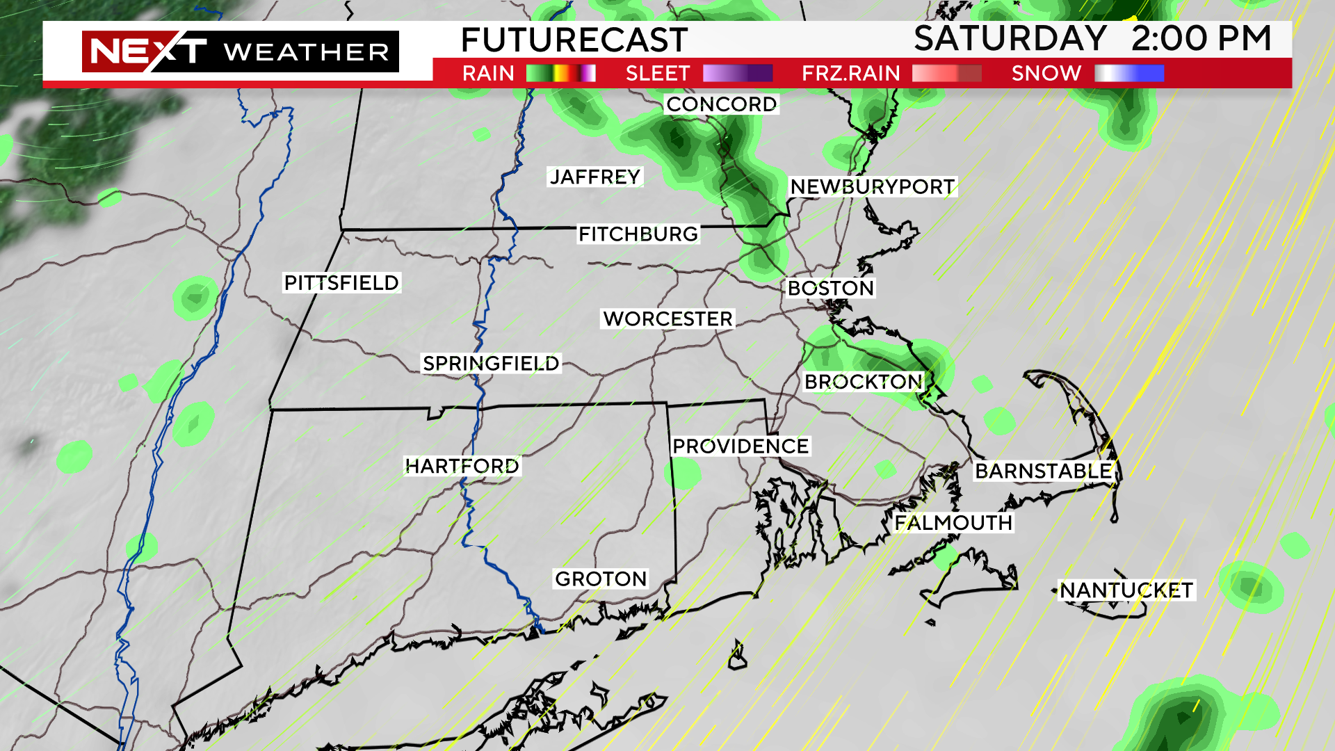
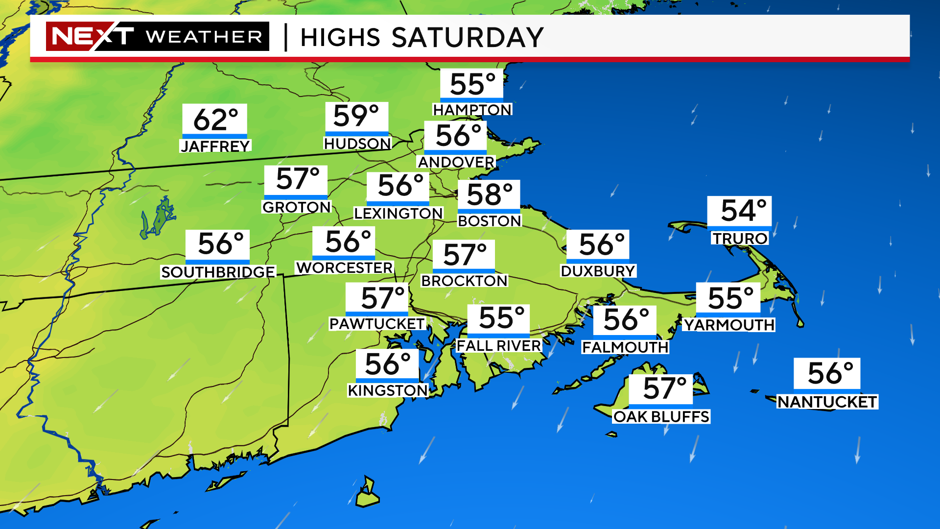
Saturday is the more predictable day of the two…Most of the day will be cloudy and chilly and there will be a few light showers or sprinkles around the area. Not expecting any heavy or long-lasting rainfall.
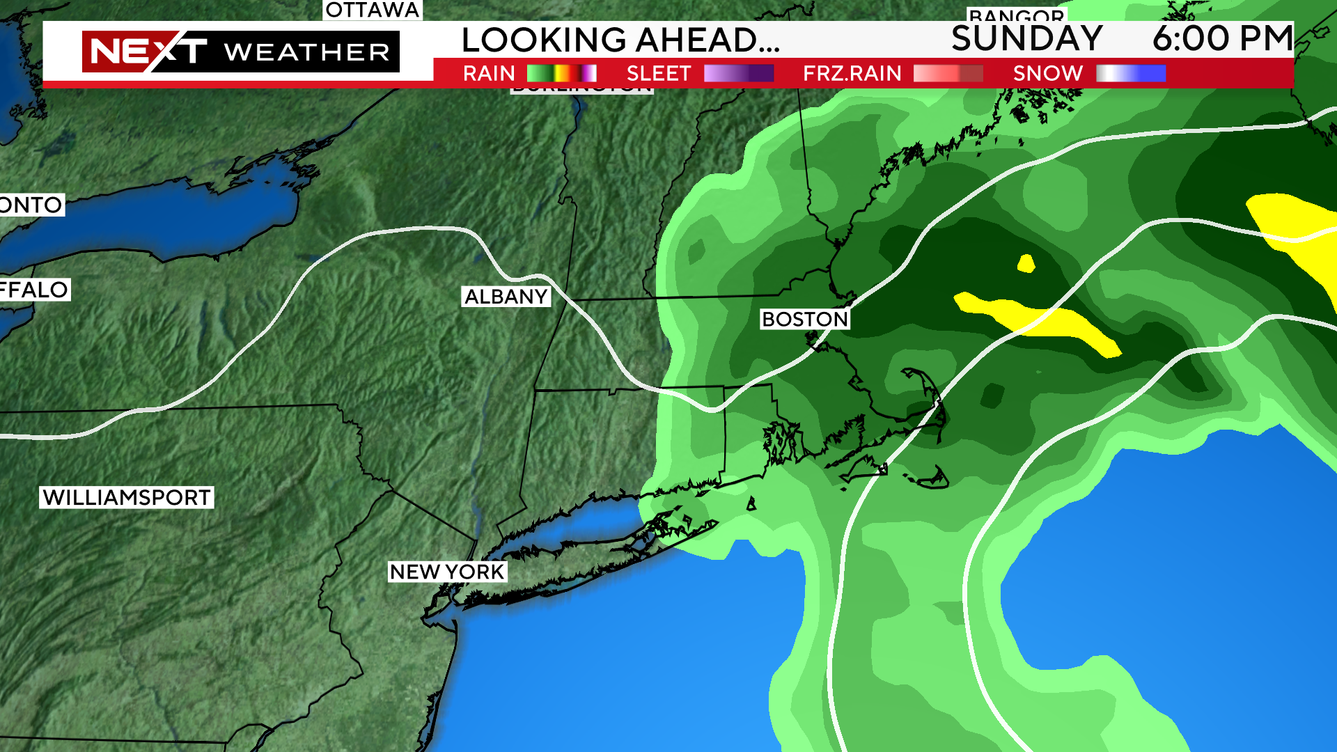
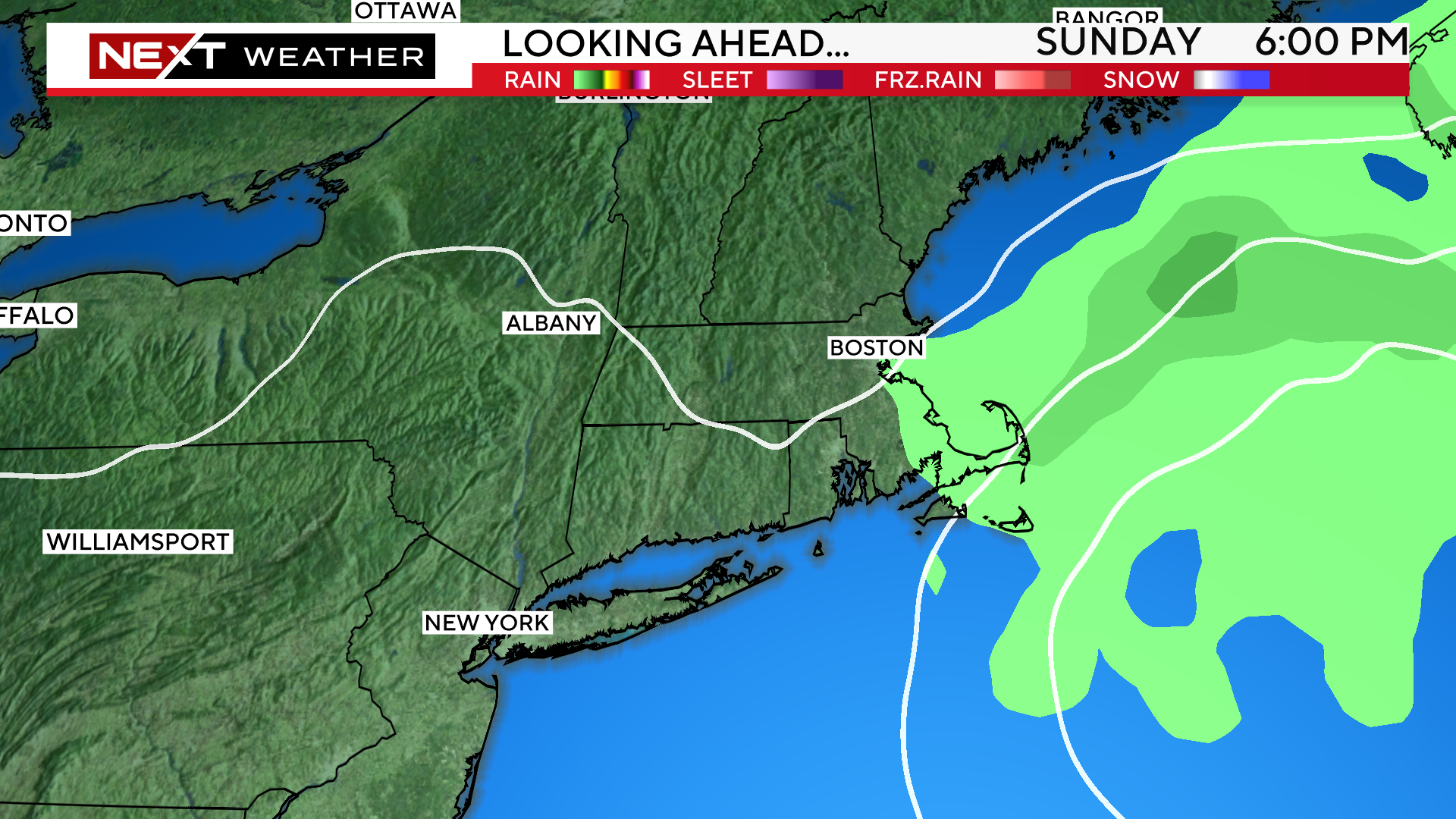
Sunday is much trickier…models have been waffling on the placement and movement of an ocean storm. If it stays far enough out to sea, we stay mainly cloudy, cool and essentially dry. If it retrogrades a bit farther west, we could have a soaker of a Sunday. Yesterday at this time I would have said things were trending towards the drier solution…24 hours later, I am not so sure. Hate to say it, but if you have outdoor plans, you are going to have to stay tuned.
The unsettled pattern remains in place early next week…there will be a daily shower threat and temperatures will generally be near to slightly below normal.
Click here for Westford snow storm data and past totals or select “Winter Snowfall“ under “Pages” on the left hand side.
For more up to date forecast information follow me on Twitter (@terrywbz) or follow the WBZ weather team on Facebook, search WBZWeather
Reader Comments