


Nothing like a good ol’ fashion soaking rainstorm in late January to get the juices flowing! This storm tonight has all the markings of a classic March storm…torrential downpours, street and basement flooding, rapid snowmelt, scattered thunder…

Sure, we will still see a little bit of snow on the front end, but it will quickly be washed away or turned to slop.
TIMELINE:
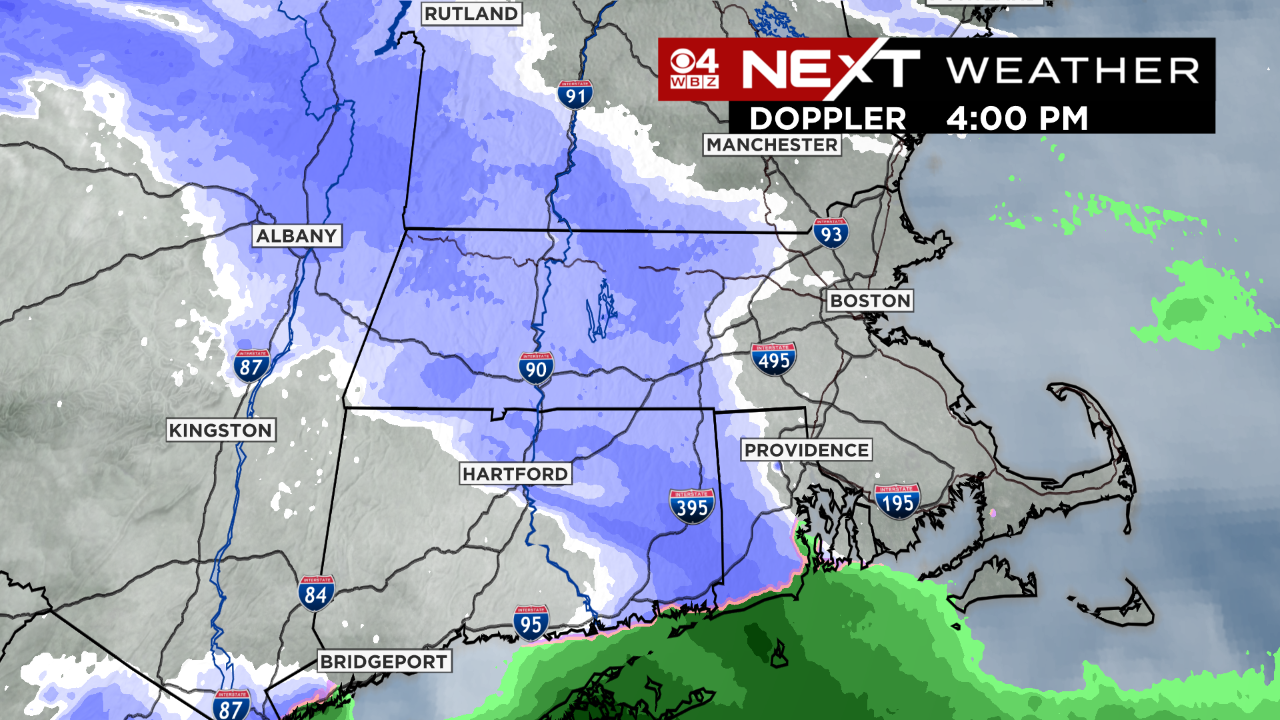
PM Commute…An area of mainly light snow comes through. Not expecting much more than some snow in the air between 4-7pm. Unlikely that any roads become snow covered.
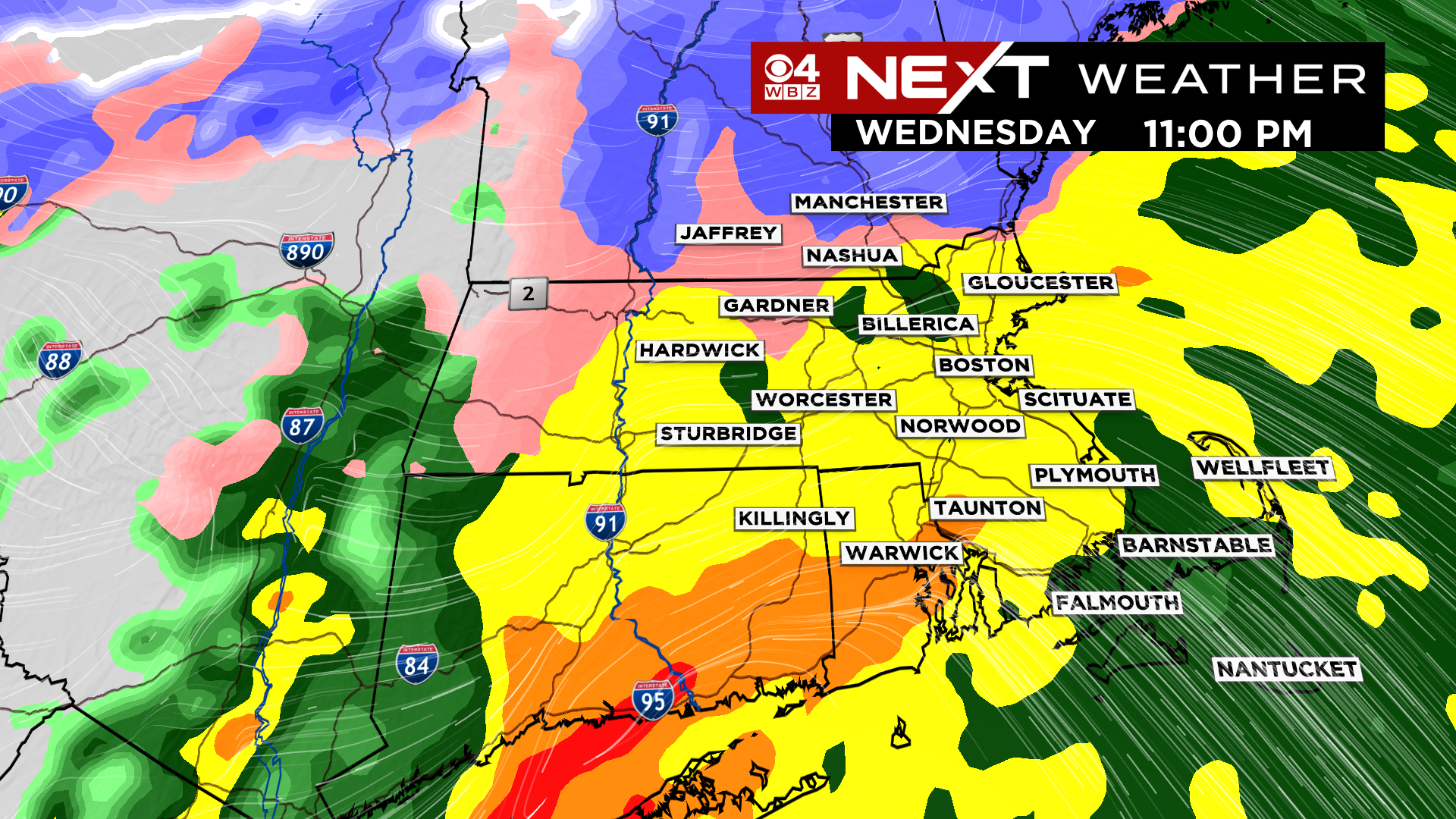
Change to Rain…The warm air charges north tonight very rapidly. By 10-11pm it will be raining in all of southern New England. The rain will come down heavy at times, tapering off between 3-5am Thursday.
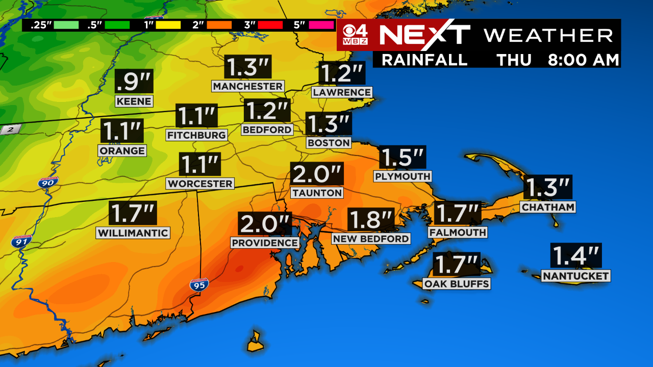
Rainfall totals will be between 1-2″ in most of the area. This could lead to some localized flooding on roadways, backyards and basements.
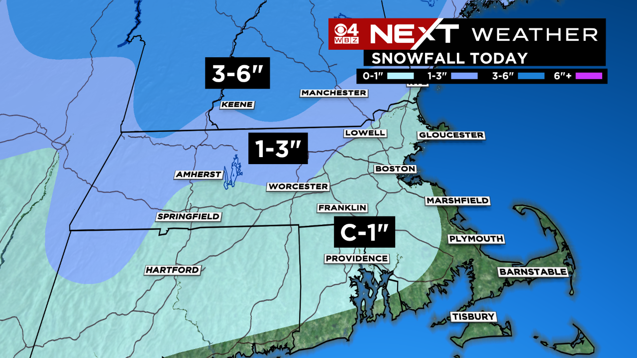
Snowfall totals will be very light. Essentially a coating to an inch for most of our area. There could be a bit more north and west of 495 in the hilly terrain of Worcester county. You really have to head well into Vermont of New Hampshire to see any totals of 3″ or greater with this event.
After this storm passes early Thursday morning, we finally get a break! Dry weather is expected the rest of this week and through most of the weekend. We are watching a weak storm that may pass by late Sunday, but at this point it looks like just a few rain or snow showers and low impact.
Click here for Westford snow storm data and past totals or select “Winter Snowfall“ under “Pages” on the left hand side.
For more up to date forecast information follow me on Twitter (@terrywbz) or follow the WBZ weather team on Facebook, search WBZWeather
Reader Comments