


Happy Monday!
This week will be all about Hurricane Ian.
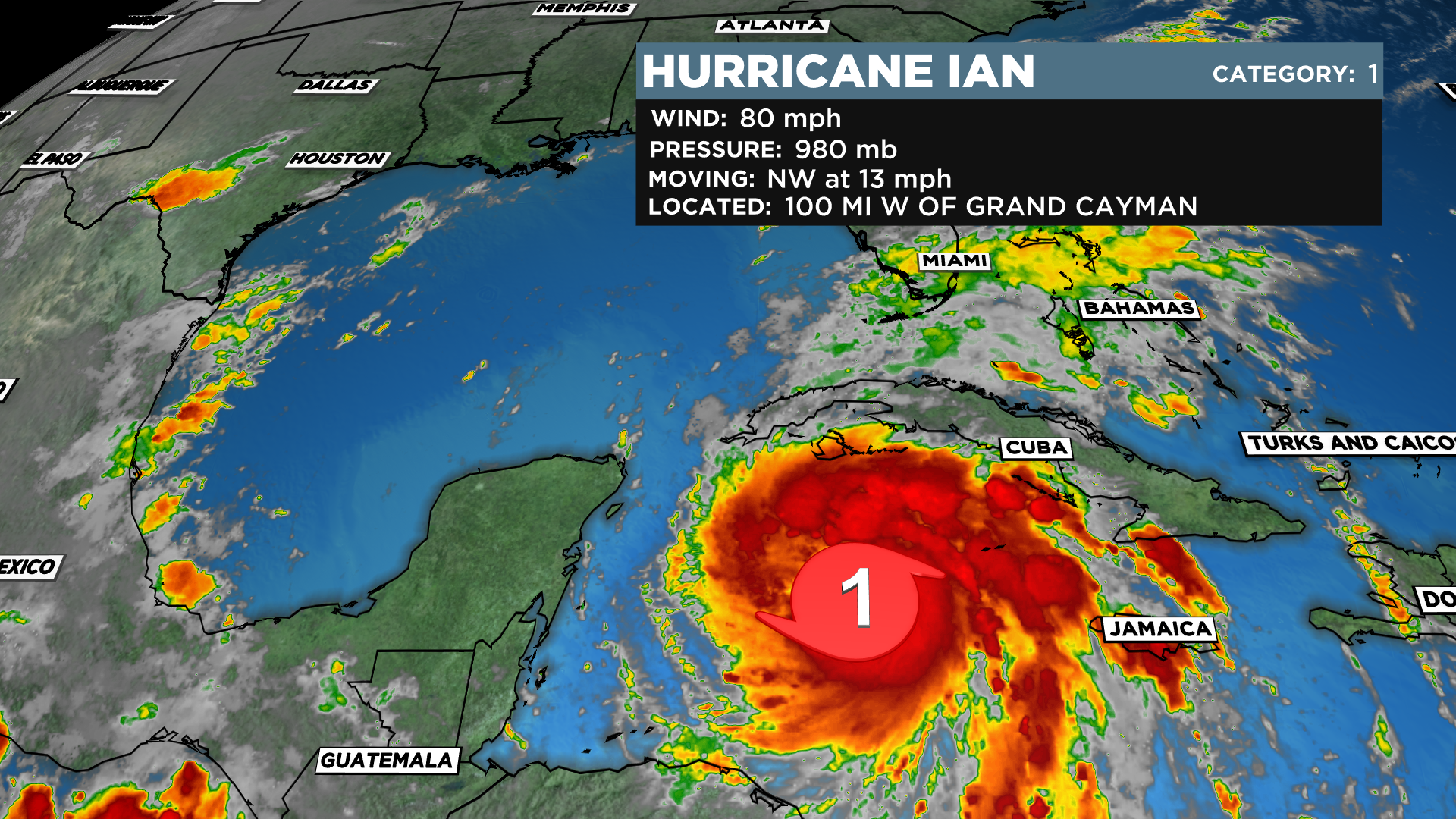
CURRENTLY…Ian is a minimal, category 1 hurricane with max wind gusts to 80 mph. It is moving to the northwest, passing less than 100 miles west of Grand Cayman
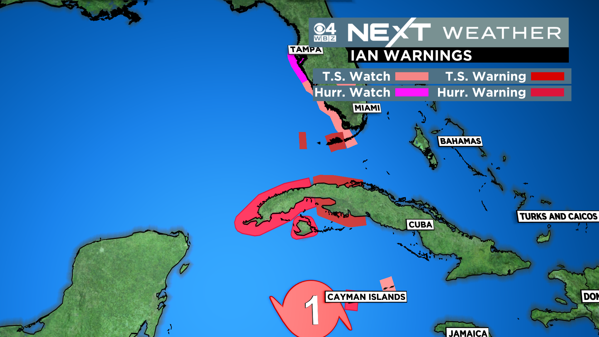
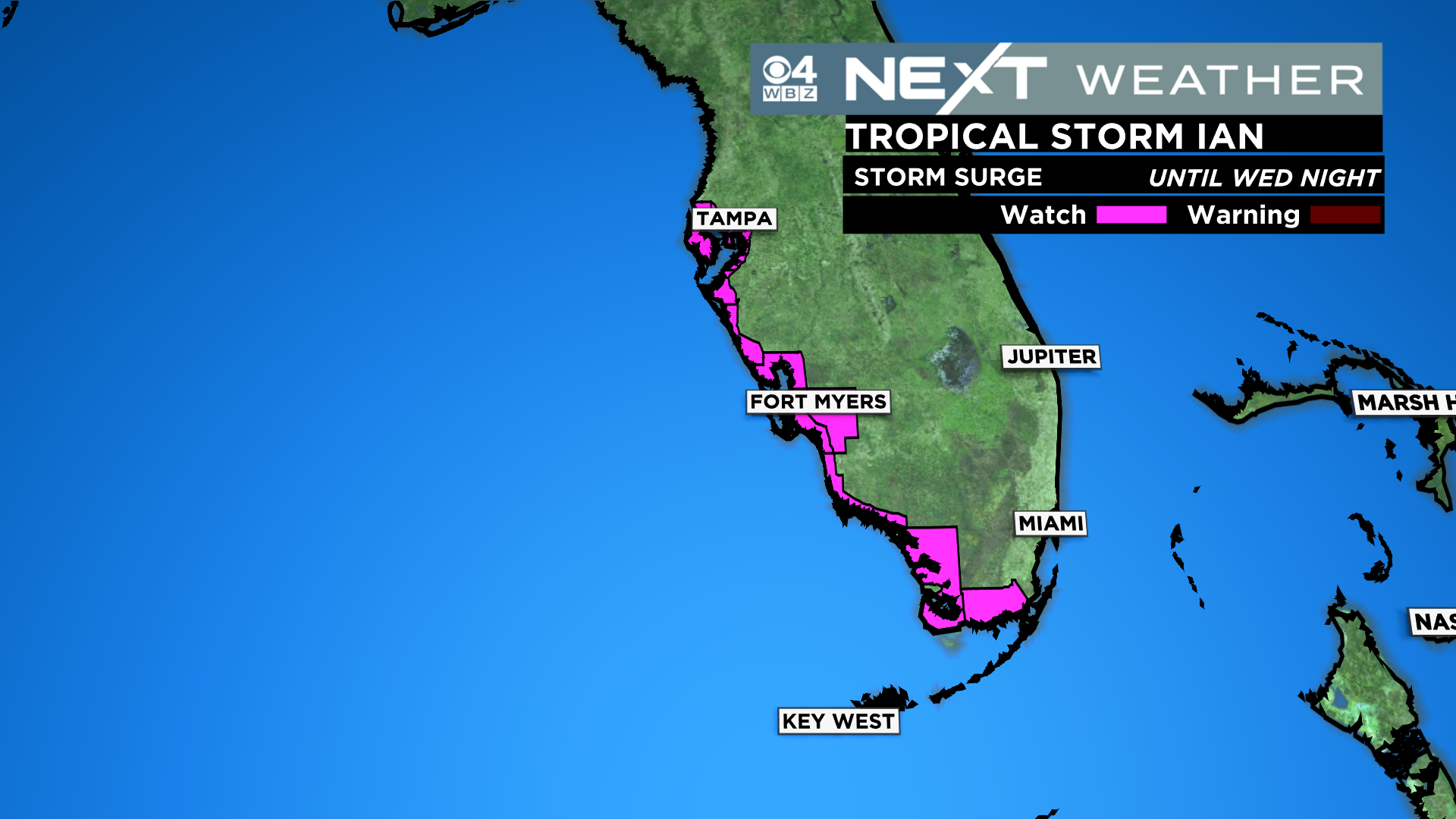
There are numerous hurricane watches and warnings posted for Cuba and the west coast of Florida
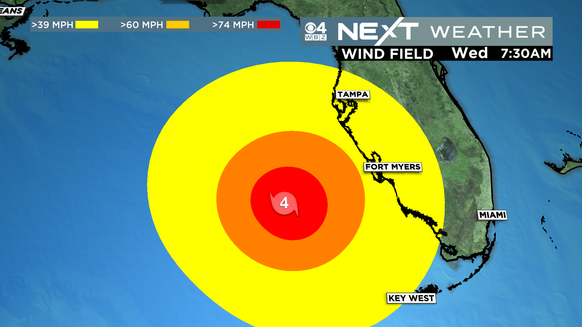
The latest track (11am Mon) has Ian emerging as a major (cat 4) hurricane off the western tip of Cuba on Tuesday…then slowly drifting northward over open (warm) water on Wednesday…by early Thursday it will make its closest pass, just west of Tampa, forecast to be a cat 2 at that point. This is when the Tampa area would be at greatest risk of storm surge/flooding. Ian then continues northward, making landfall near Cedar Key Friday morning.
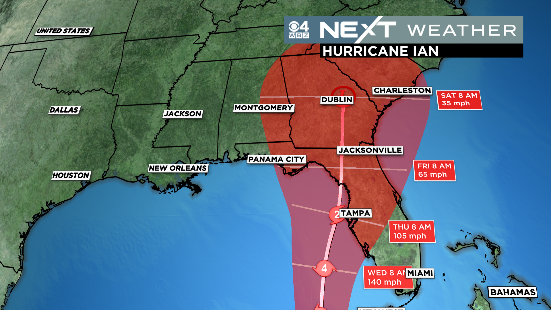
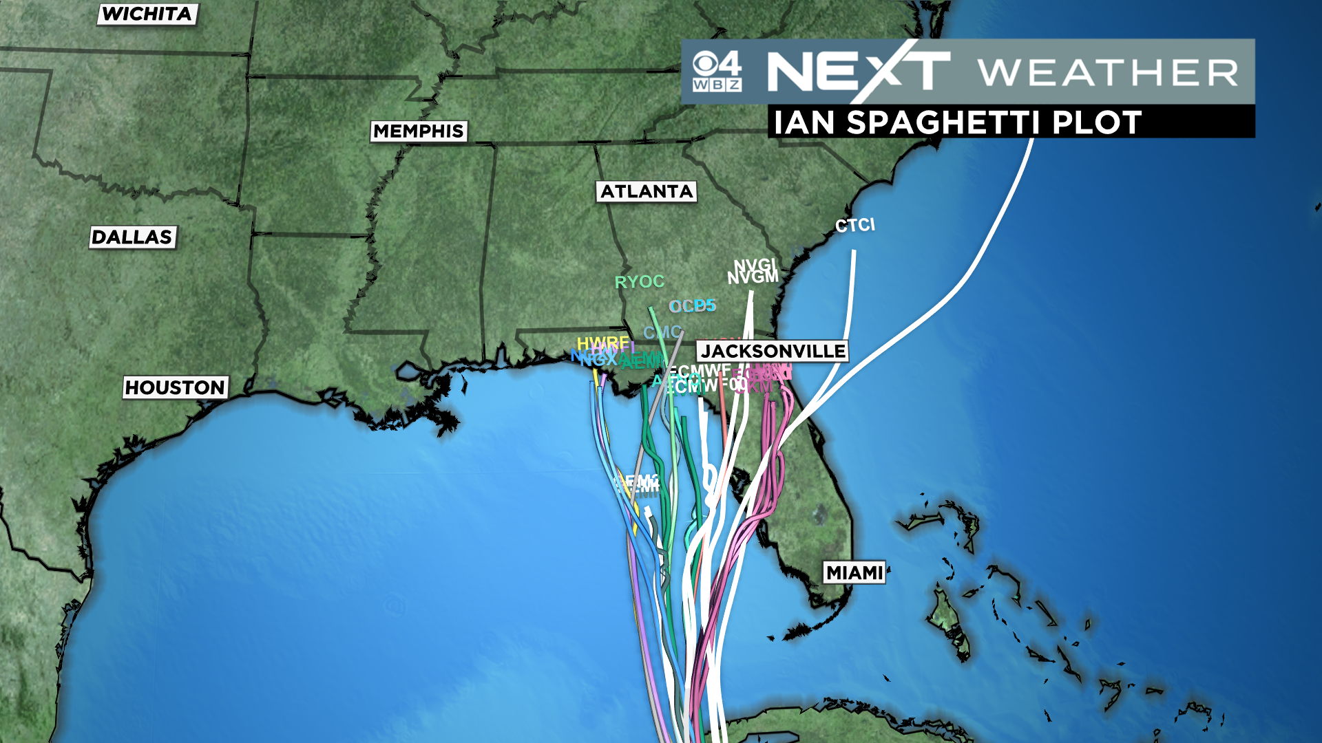
There is still room for some wobbling of the track to the east or west, obviously that will be the key factor in the days ahead.
Storm surge is a major concern, perhaps the greatest threat to the Tampa area…currently there is a storm surge watch up for the entire coastline from Tampa southward.
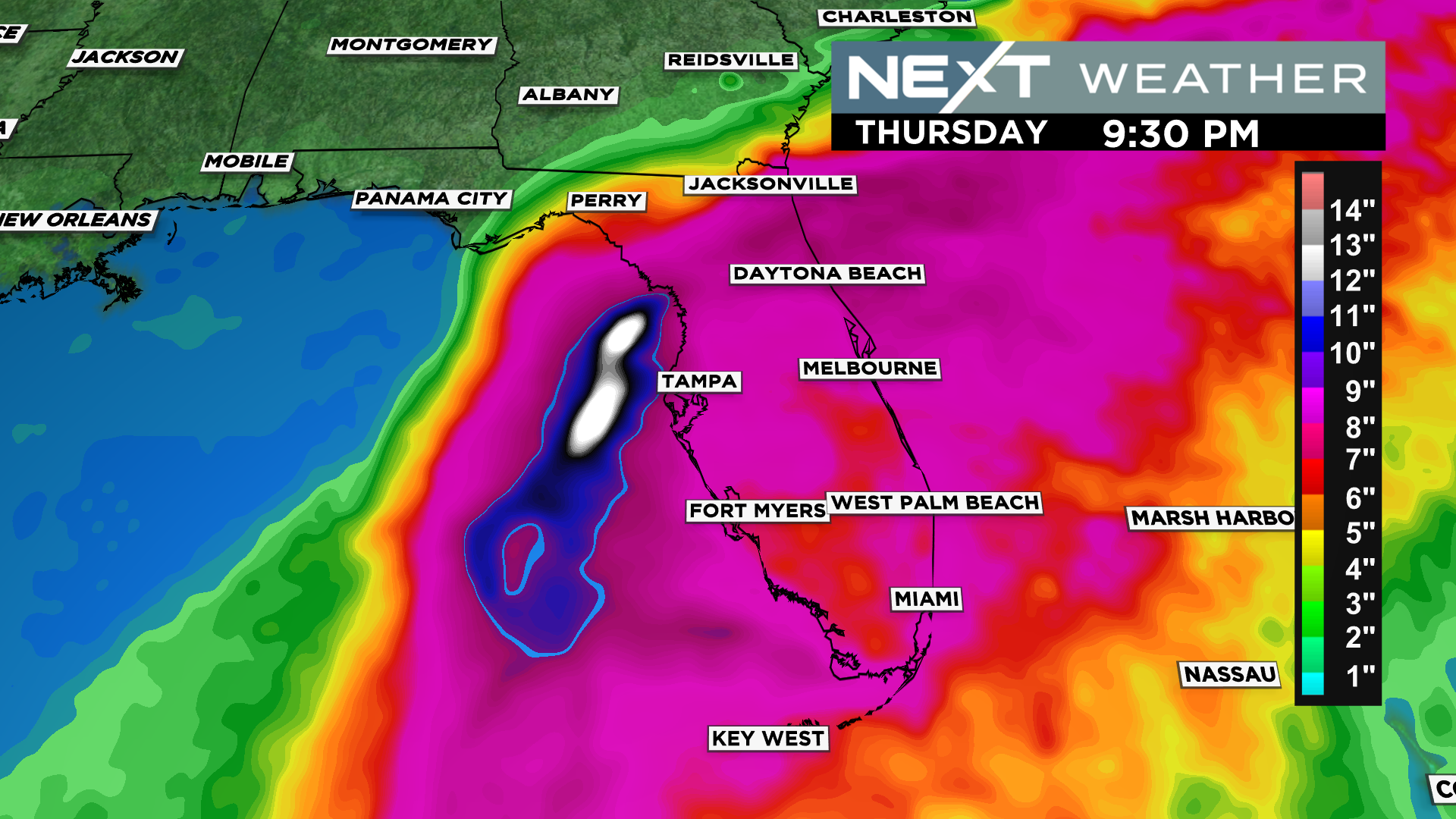
There will be copious amounts of rainfall due to the slow movement of the storm…perhaps 1-2 feet of rainfall in some areas!
As for the wind, the peak winds will occur in the immediate area surrounding the eye…so where it makes landfall is key to the greatest swath of wind damage.
Obviously we will continue to keep everyone updated with each new model run and National Hurricane Center forecast.
As for our local weather…it couldn’t be more quiet! Other than an isolated shower this afternoon and perhaps late Tues/Wednesday, New England will be quiet and dry all week. Highs in the 70s today and tomorrow and a cooler finish with highs in the 60s by Thursday and Friday.
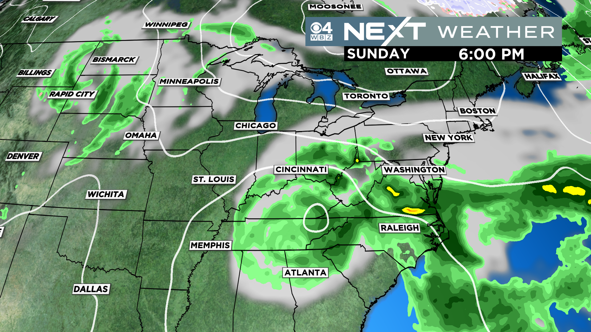
We MAY see some remnants from Ian here late in the Weekend, but at this point it appears most of the leftover rain will be shunted southward.
Last but not least…be sure to check out Jupiter, low in the eastern sky after sunset this week! Jupiter is the closest it will be in its orbit so it will appear larger and brighter than usual.

Click here for Westford snow storm data and past totals or select “Winter Snowfall“ under “Pages” on the left hand side.
For more up to date forecast information follow me on Twitter (@terrywbz) or follow the WBZ weather team on Facebook, search WBZWeather
Reader Comments