


Welcome to a rainy Thursday…In case you are wondering, no, the drought is NOT over yet. In fact, we got an update this morning (which doesn’t include today’s rain) and we did make improvements since last week…
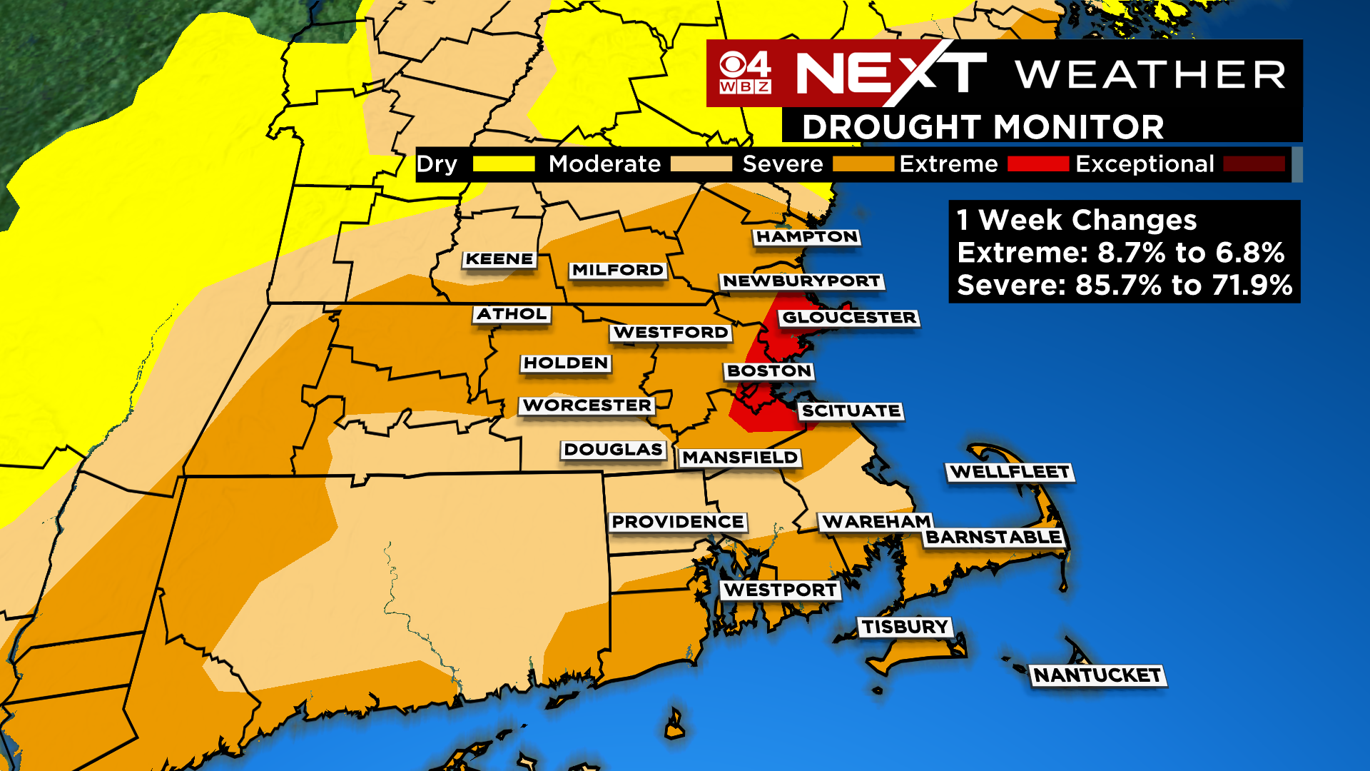
The area of severe drought along the South Coast is now gone, and the total “severe” drought area in MA decreased from 86% to 72%. Clearly we are heading in the right direction and today’s rainfall will make another dent.
Speaking of today…we had one line of downpours come through this morning…round two will arrive along with the actual cold front early this afternoon. Expect another couple hours of embedded downpours and thunderstorms, mainly between noon and 4pm (lasting a bit longer on Cape Cod).

The rain will taper off this evening, just as the Autumnal Equinox (start of fall) arrives! And, how fitting, as fall arrives on the calendar, the coldest air yet will be pouring into New England!
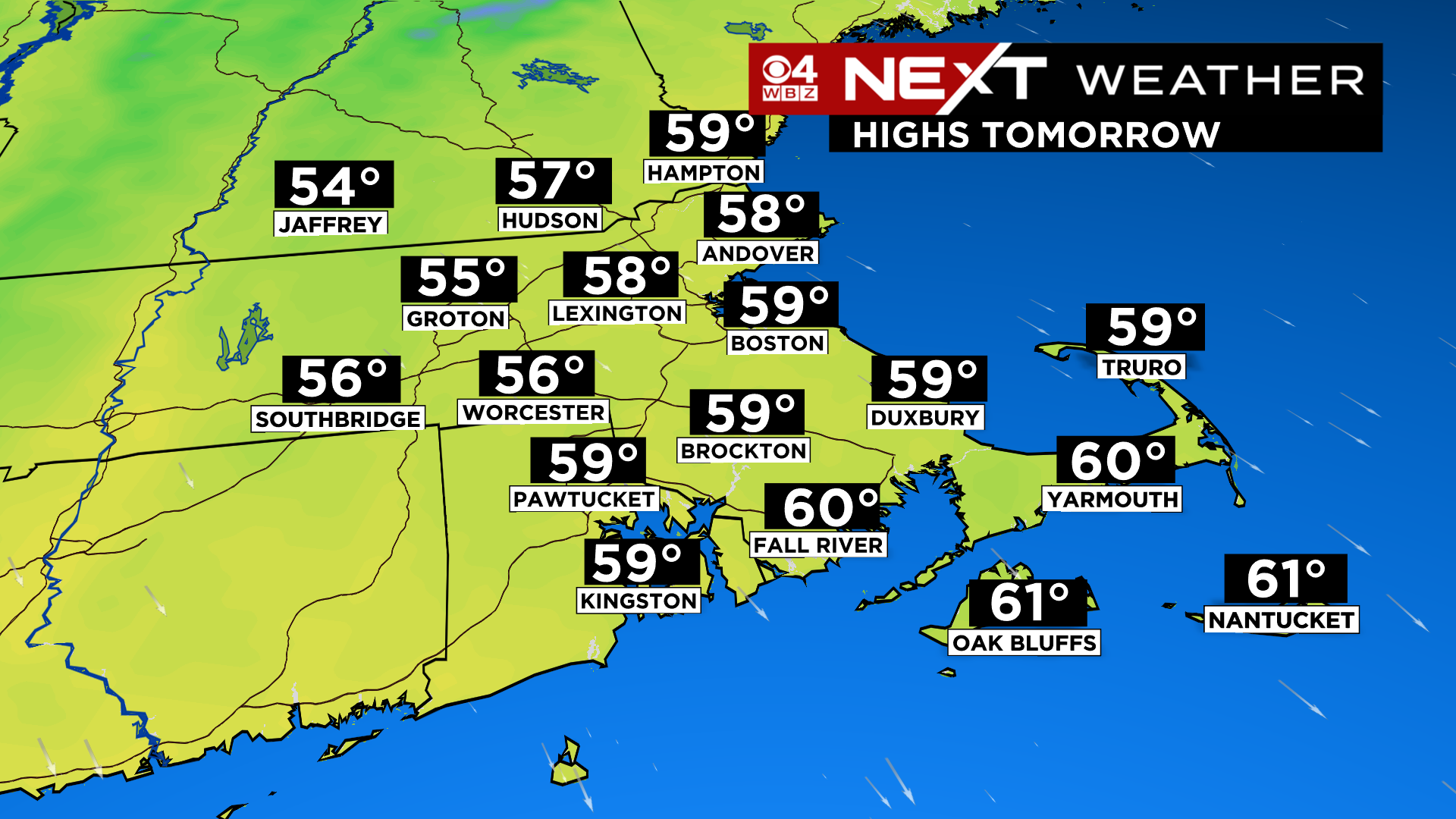
Friday will be brisk, blustery and crisp…highs will struggle to reach 60 degrees. And at night, temperatures will drop into the 40s and even some 30s in the distant suburbs. Given that the wind will stay a bit busy, I am not expecting any frost issues locally.
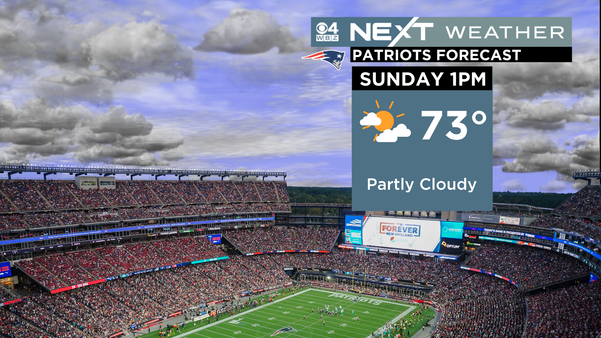
This weekend will be a great first weekend of fall! Highs in the 60s (Saturday) and 70s (Sunday) with dry air and much less wind than Friday. Sunday will be a great day to be at Gillette!

Lastly, all eyes will be on the tropics in the coming weeks…Fiona will head up into the Canadian Maritimes this Weekend…well east of New England.
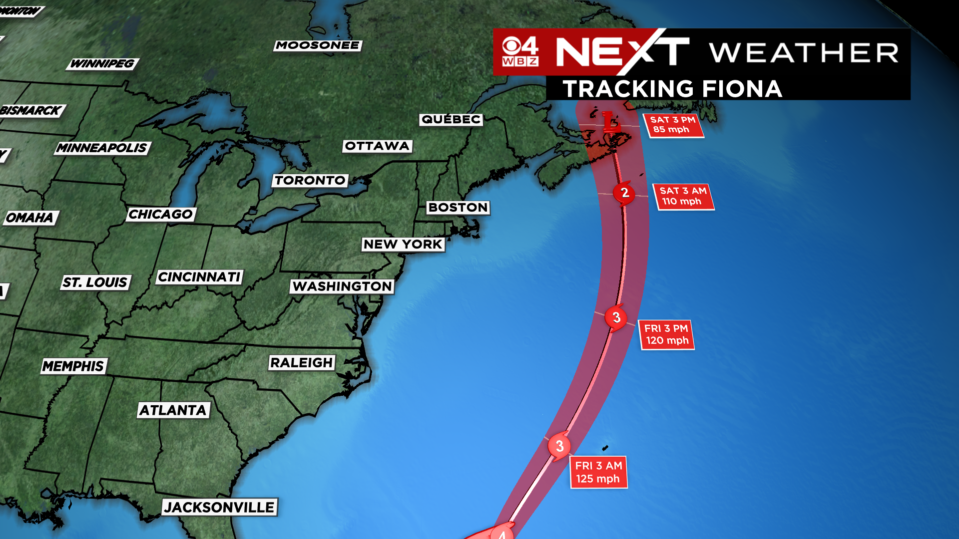

There is a high surf advisory for the South Coast of New England through Friday evening due to some of the outer swells from Fiona. Expecting to see waves 5-9 feet in these areas.
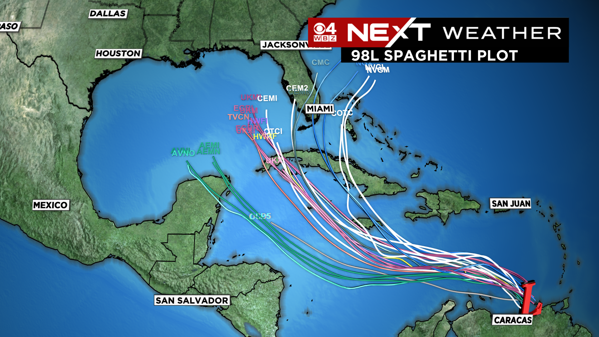
Next week, we will be watching what could eventually be tropical storm/hurricane Hermine…right now it is just an area of disturbed weather off the South American Coast…but most models are forecasting it will get its act together this weekend and threaten some area of the Gulf of Mexico/Cuba/Florida next week.
Click here for Westford snow storm data and past totals or select “Winter Snowfall“ under “Pages” on the left hand side.
For more up to date forecast information follow me on Twitter (@terrywbz) or follow the WBZ weather team on Facebook, search WBZWeather
Reader Comments