


Similar day today to yesterday with a stuff wind off the Ocean keeping the Coastline cooler than areas inland…Still expecting summer to burst on to the scene Thursday and beyond!
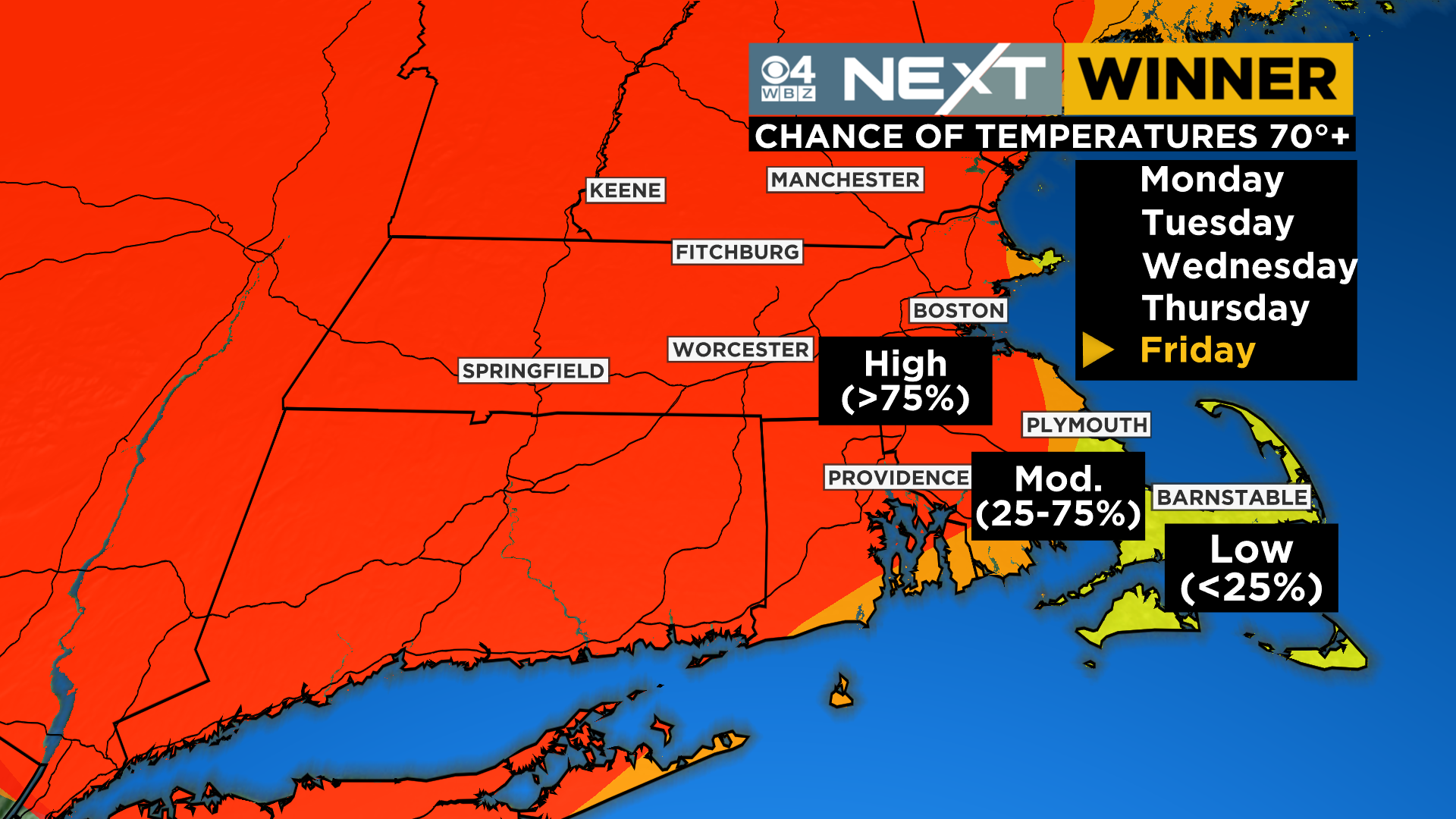
Today: Mainly sunny, 50s along the immediate Coastline, 60s a bit inland, 70+ in parts of Western MA/CT…persistent and gusty northeast wind, strongest over southeastern MA, Cape and Islands
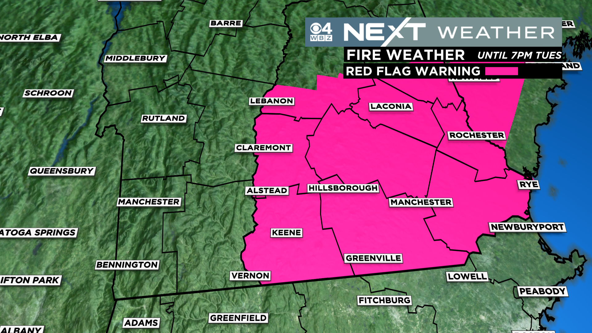
RED FLAG WARNING in effect in parts of southern New Hampshire…increased brush fire danger…
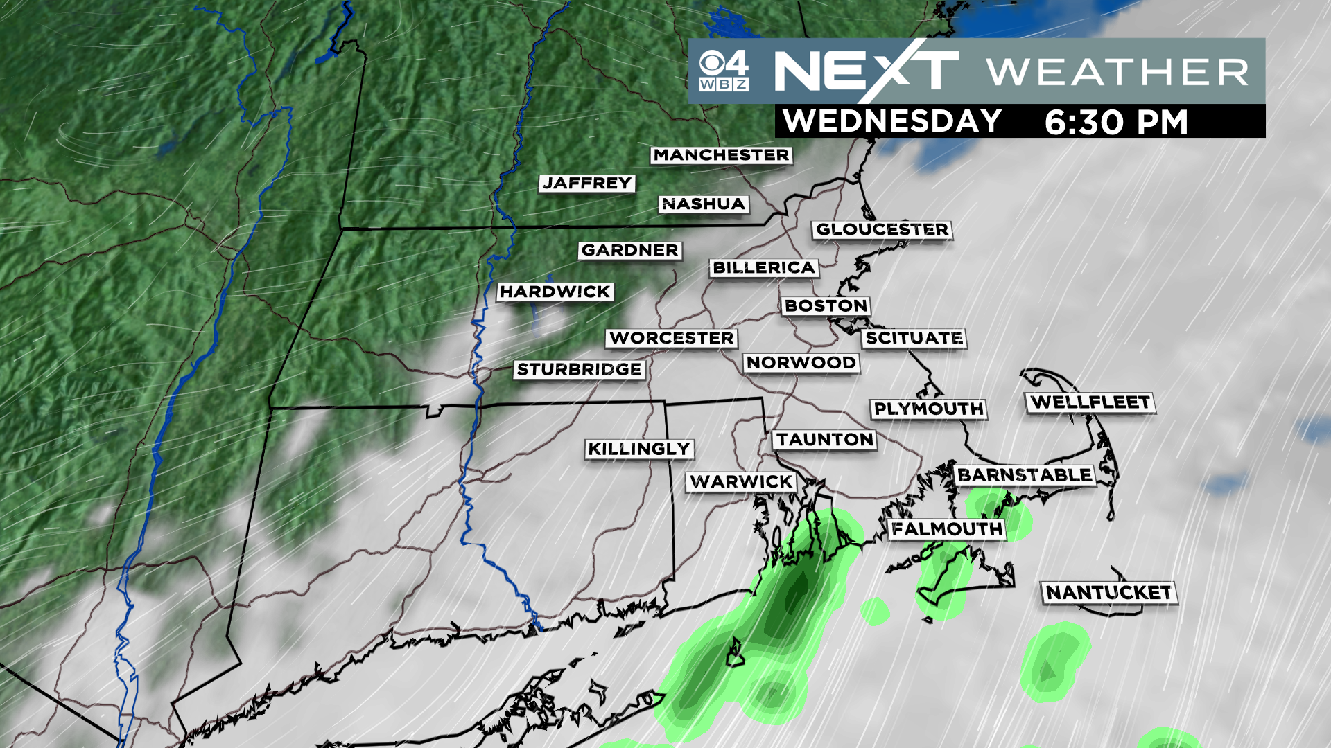
Tomorrow: Low clouds arrive in parts of eastern MA, keeping temperatures in the 50s near the Coastline…more sunshine the farther west you go and therefore milder temperatures as well…60s in parts of central MA and 70s in Western MA…bit less windy
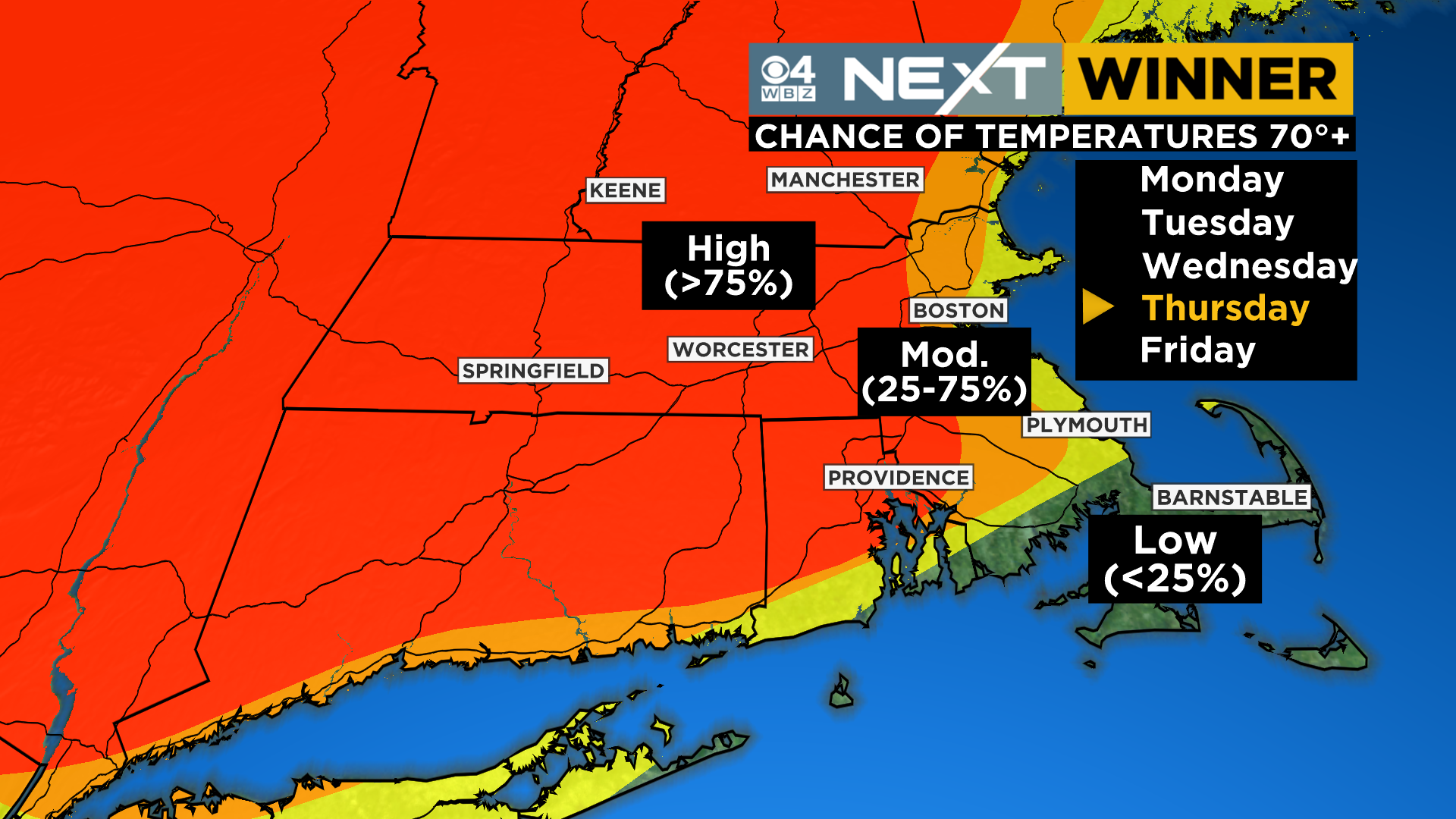
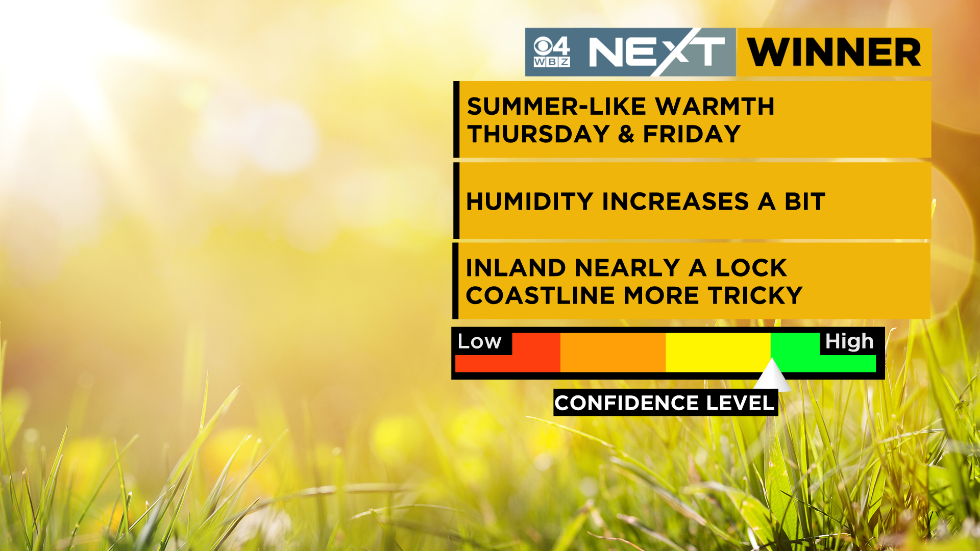
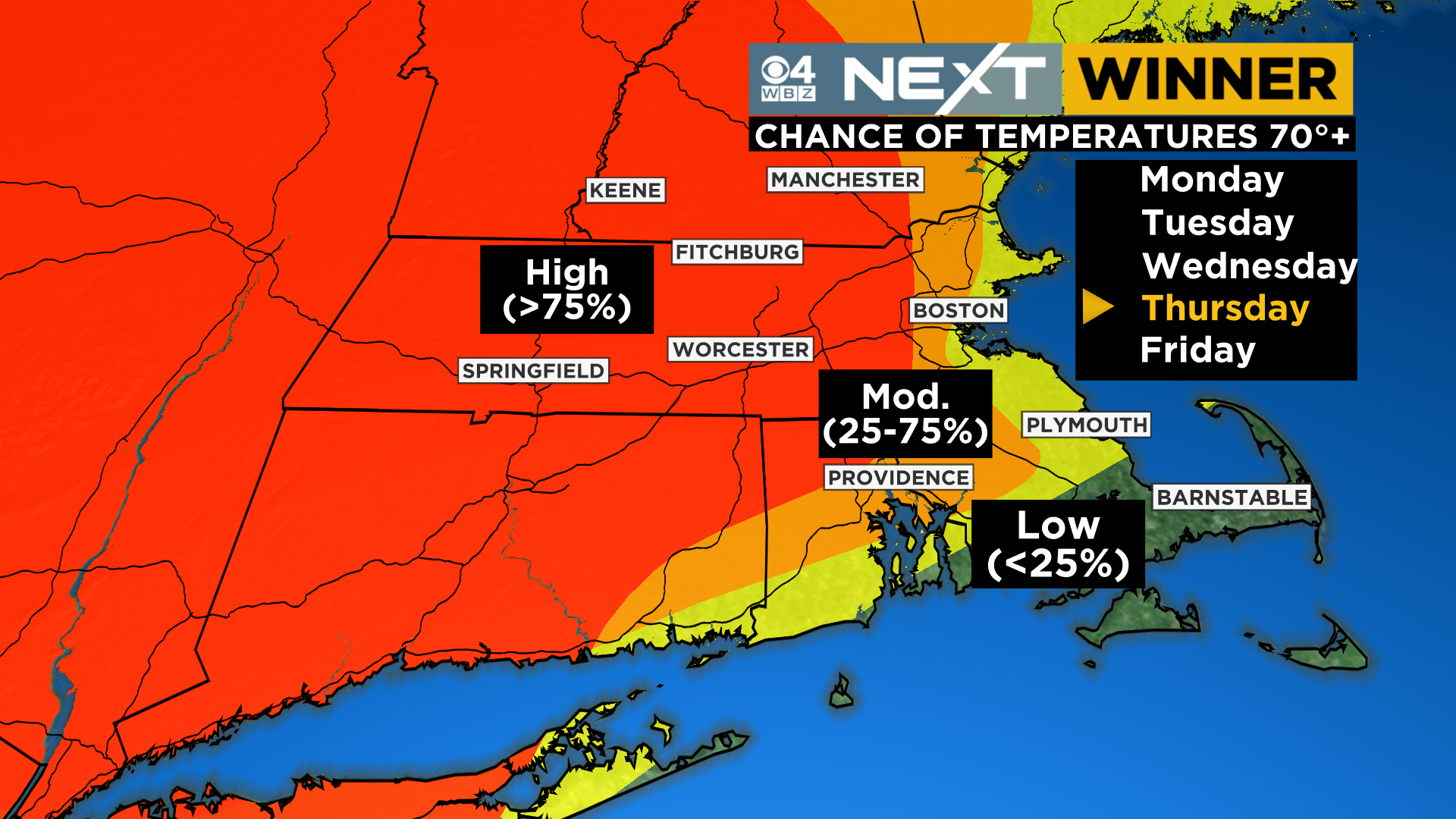
Thursday: Most of southern New England (away from the immediate Coastline) surges into summer with highs in the 70s…some low clouds may get hung up over Coastal southeastern MA
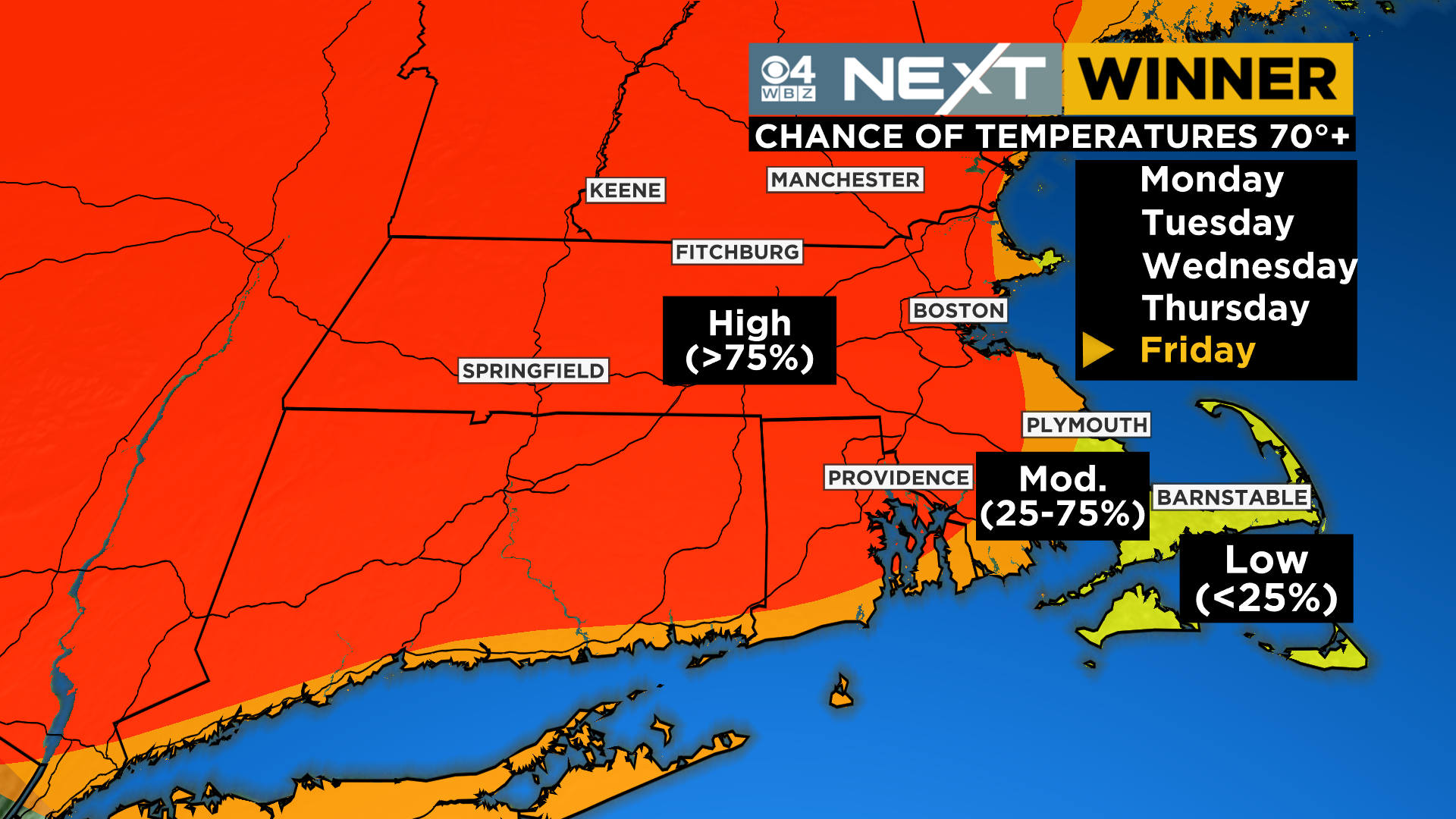
Friday: Mainly sunny and warm for 90% of our area…most folks are well into the 70s and many top 80 degrees! The exception, once again being right at the immediate shoreline where a light southeast breeze will keep highs in the 50s and 60s
The Weekend: The summer-like feel continues with highs in the 80s in many inland locations but with some humidity now added in…cannot rule out a brief, isolated shower but most rain holds off until Monday
Reminder…we have a total lunar eclipse Sunday night!

I believe it is a popular misconception around here that “we don’t have a spring”. How many times have you heard someone say, “we just jump right from winter into summah”…
I guarantee you will hear it (or perhaps say it yourself) later this week.
The sad reality is that spring, in general, kinda stinks here in New England. Put it up against the other seasons and I believe it is either 3rd or 4th in line. Of course, this is totally my opinion, and I am sure there are plenty who would disagree. However, most years spring in the Northeast is cool, cloudy and rainy with a few splashes of sunshine. And, when you finally get a warm and dry day, the pollen spikes and the bugs come out and everyone is miserable all over again.
Inevitably, at some point each May, the tides finally turn and the warm winds of summer start to work their way in. Last year it started right around now. From May 9th through May 27th Boston didn’t dip below the mid 60s for highs and most of the days were spent in the 70s and 80s. We topped out at 92 degrees on the 26th before the complete weather disaster that was Memorial Weekend arrived.
Flash forward to spring of 2022 and here we go again. After spending much of the last 2 weeks below average, this week will be the one that we all look back at as when the “switch flipped”.
While a large portion of the eastern half of the Country is leaping into summer over the next few days, as usual, we will be the last to join in. An offshore, nearly stationary low pressure system will keep our primary wind direction onshore through Wednesday. We don’t expect much (if any) rainfall, but the wind off the cool Ocean will keep eastern MA in the 50s and areas well inland in the 60s. So, through Wednesday, the key will be “patience Daniel-son”.
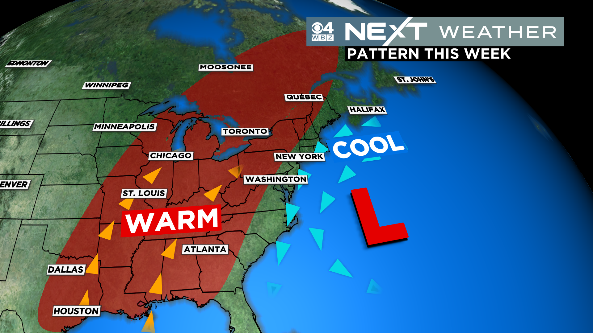
The offshore storm will begin to drift southward on Thursday and finally allow the summer-like airmass to pour into New England. We expect widespread 70s for just about all of New England (except for the very immediate Coastline). In fact, I would bet that some spots touch 80 on Thursday…best bet would be in the valleys, (Merrimack and Connecticut river).
If you didn’t hit 80 on Thursday, pretty much anywhere away from the immediate Coastline should be good for 80+ on Friday. As long as the cloud cover stays minimal, I wouldn’t be shocked if a few spots hit 90! Same deal on Saturday.
It will actually start to get a bit humid this weekend, first time we have said that! I wouldn’t completely rule out a pop up shower at some point either, especially by Sunday.
So, if you haven’t done so already, I would say it is time to set up the patio furniture and take the summer attire out hibernation. Not saying there won’t be some bumps in the road on our way to actual summer, but it’s time to get this party started.
LUNAR ECLIPSE BLOG…
Huge “heads up” for this weekend…
We have an opportunity to see a total lunar eclipse Sunday night!
In fact, the entire eastern half of the Country will be in the “path of totality”, assuring a great lunar show as long as the weather cooperates. This will be our first chance to see a total lunar eclipse here since January of 2019!
First off, the basics. A lunar eclipse occurs when the Sun, Earth and Moon are lined up. The Moon simply moves into the Earth’s shadow created by the sun. Depending on where you live and the timing of the eclipse, some get to see the whole show while others may not be as lucky. This one is lining up perfectly for the Northeast.
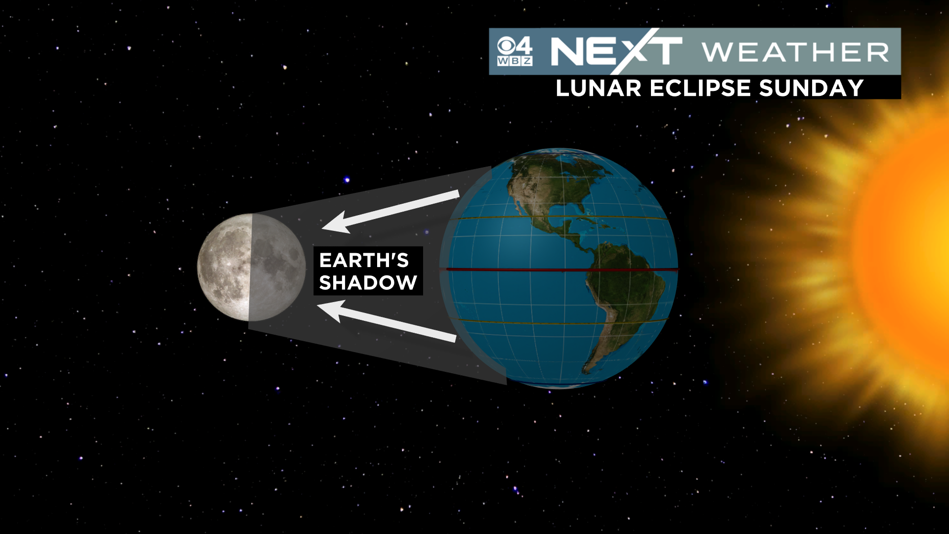
A lunar eclipse happens in phases.
First, the Moon enters the penumbra, which is the faint outer shadow cast by our planet. This is tough to see without a trained eye and really isn’t all that exciting. You may be able to notice a faint shadow on the left side of the Moon beginning around 10:10pm Sunday night.
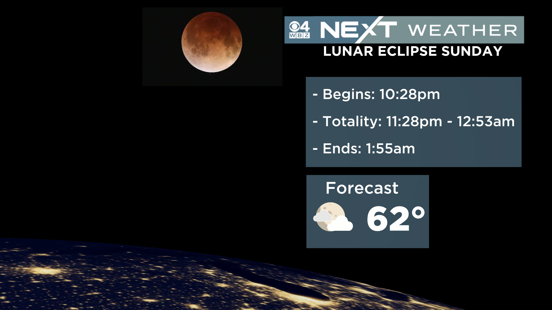
The real show starts when the moon enters the umbra, the true shadow of the Earth. This begins on the lower left corner of the Moon at 10:28pm. This is the beginning of a nearly 3 and a half hour journey the Moon will take through the umbra!
The next phase…totality. The total lunar eclipse will last about 85 minutes and begin at 11:28pm. The coolest part of the whole thing is that the Moon does not completely disappear under total eclipse…Instead it turns a coppery-red because of a refracting of sunlight around the Earth.
The Moon will completely exit the umbra at 1:55am (Monday morning) and the penumbra at 2:12am. Show over.
The biggest wildcard, of course, is the weather. It is a bit early to tell how much cloudiness may or may not be around Sunday night. I do think it is likely that, given the increasing humidity, we will have to deal with some cloud obstruction in some areas. You’ll have to stay tuned for updated forecasts throughout the week. At least it looks warm!
If by chance the clouds do ruin the show, we won’t have to wait too long for another lunar eclipse. Next one arrives in the early morning hours of November 8th, this year.
Click here for Westford snow storm data and past totals or select “Winter Snowfall“ under “Pages” on the left hand side.
For more up to date forecast information follow me on Twitter (@terrywbz) or follow the WBZ weather team on Facebook, search WBZWeather
Reader Comments