Let it snow, let it snow, let it snow…
Are you in the mood yet?
Some would call today’s snowfall “perfect timing” as we head into the final weekend before Christmas. Others, who need to hit the roads today, may not feel quite as festive.
Either way, it appears as though many of us will have a fresh blanket of white before all is said and done tonight.
This storm has been very tricky to forecast. In fact, even now, our confidence is much lower than is typical on the day of the event.
So, what’s going on?
We had a relatively small “Alberta Clipper” system streaking towards us from the Upper Midwest over the last 24 hours. This storm is weakening and essentially disintegrating on its current approach to New England. However, some of its energy is being transferred hundreds of miles away to a developing storm to our south, off the Carolina’s.
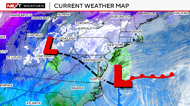
This new and improved storm will travel up towards Nova Scotia in the next 24-48 hours, a few hundred miles offshore of New England. There are two big questions remaining…first, how close does it come to eastern MA? A difference of 50 miles one way or the other will make a BIG difference in snowfall amounts.
Second, how quickly does it intensify? Could we get some fairly robust bands of snow here for a few hours later today?
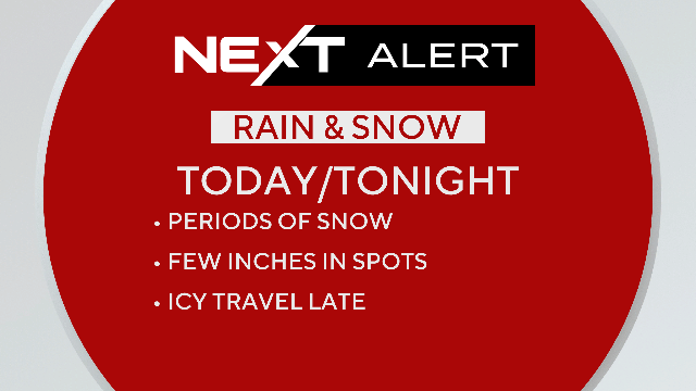
There is enough potential and uncertainty that not only has our Weather Team issued a NEXT Weather Alert…
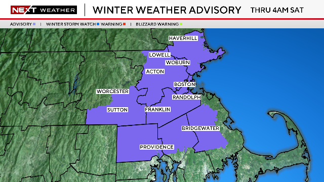
But, the National Weather Service has also issued a Winter Weather Advisory through 4am Saturday for much of Eastern MA.
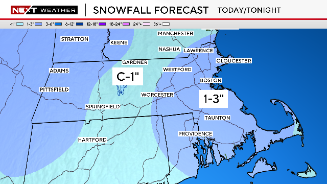
Through 2pm there will be scattered snow showers across eastern MA. While many towns will see just a few stray flurries, others (like Boston earlier Today) could pick up a quick coating to an inch of snow. The snow will be steadiest and most widespread between 3pm and about 10pm over central and eastern MA. This is when the majority of the snow accumulation will occur and travel will be most treacherous.
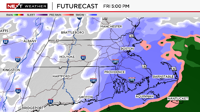

Our snowfall forecast is for 1-3″ of accumulation for just about the entire area east of Worcester.
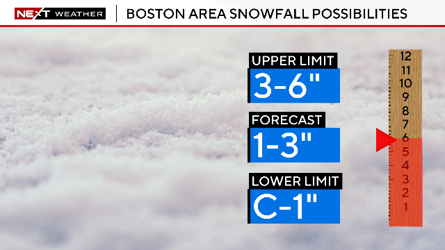
I would say there is about a 25% chance that some more intense bands of snow form and push the accumulations to “over produce” this evening in isolated spots.
Therefore, we cannot rule out pockets of 3-6″. Again, this is not our forecast, but it remains a possibility that we want our viewers to be aware of.
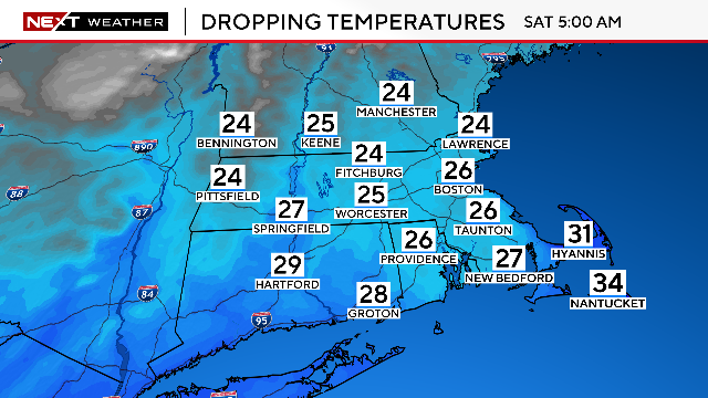
As the snow is tapering off later tonight, temperatures will be dropping. Areas that had previously been above freezing, including the immediate Coastline and southeastern MA will drop several degrees overnight. Any untreated surfaces will ice over and become very slippery.
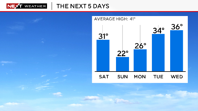
Finally, temperatures will remain below freezing for several days through early next week. So, any snow that does accumulate, will be sticking around for a bit, perhaps right through Christmas Day!
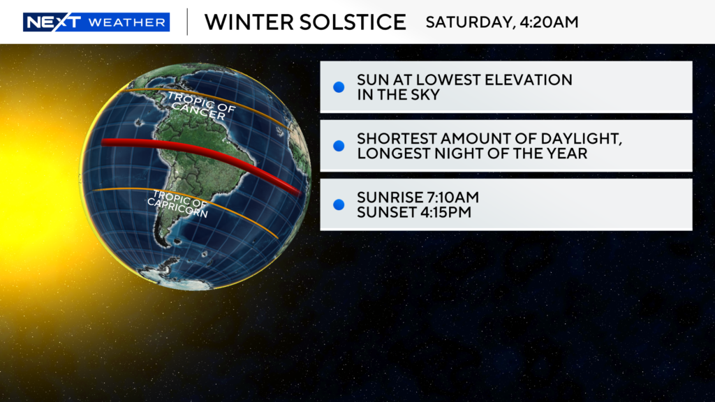
This Saturday, December 21st is the official, astronomical start of the winter season, otherwise known as the winter solstice.
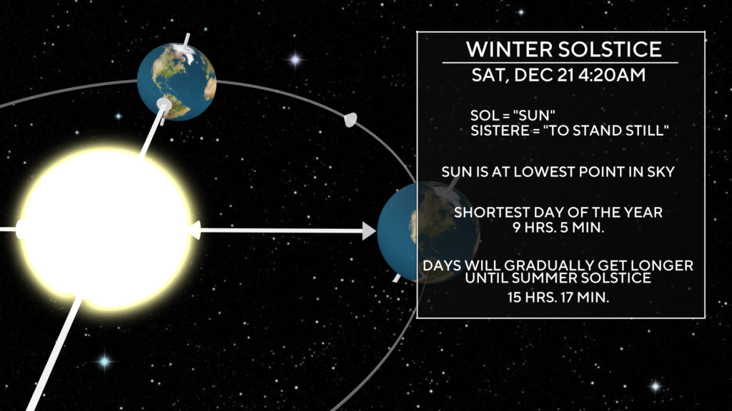
At 4:20am on Saturday, the Earth’s tilt will be at its farthest point AWAY from the Sun in the northern hemisphere. The Sun will be situated directly over the Tropic of Capricorn..
This means a few things…
The sun will be at its lowest elevation in the sky.
Saturday will also be the shortest day of the year with only 9 hours and 5 minutes of daylight.
I guess you could look at this two ways, glass half full or half empty.
Sure, we are currently in our darkest days of the year but I like to take the more optimistic approach.
Starting on Sunday, we will be gaining daylight each and every day until the summer solstice!
And, the farther north you live in latitude, the faster you will gain back your daylight…something we can brag to our friends about who flee to Florida this time of year!
Here is a weird fact you can throw out at the Christmas dinner table…The Earth is actually closer to the Sun during the winter solstice than during the summer!
The Earth reaches perihelion (its closest point to the Sun in its orbit) just a few weeks after the winter solstice and is at its farthest point (aphelion) in the summer.
Our seasons have everything to do with the tilt of the Earth and NOT its orbit.
Right on cue, the coldest air of the season thus far will arrive this weekend, during the solstice.
Temperatures for the majority of our area are likely to remain below freezing from Friday night through Tuesday morning!
Click here for Westford snow storm data and past totals or select “Winter Snowfall“ under “Pages” on the left hand side.
For more up to date forecast information follow me on Twitter (@terrywbz) or follow the WBZ weather team on Facebook, search WBZWeather


Reader Comments