


Happy Friday!
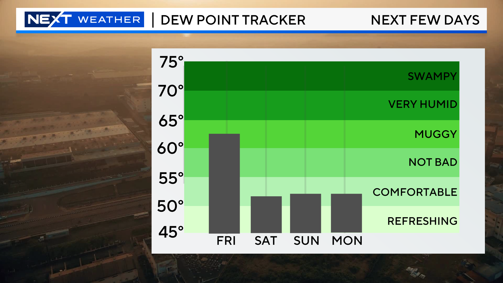
Still a bit “sticky” outside today, a little leftover moisture from yesterday. Those dewpoints will be crashing and much more comfortable air will arrive tonight and throughout the Weekend.
That doesn’t mean we are out of the woods as far as showers go…
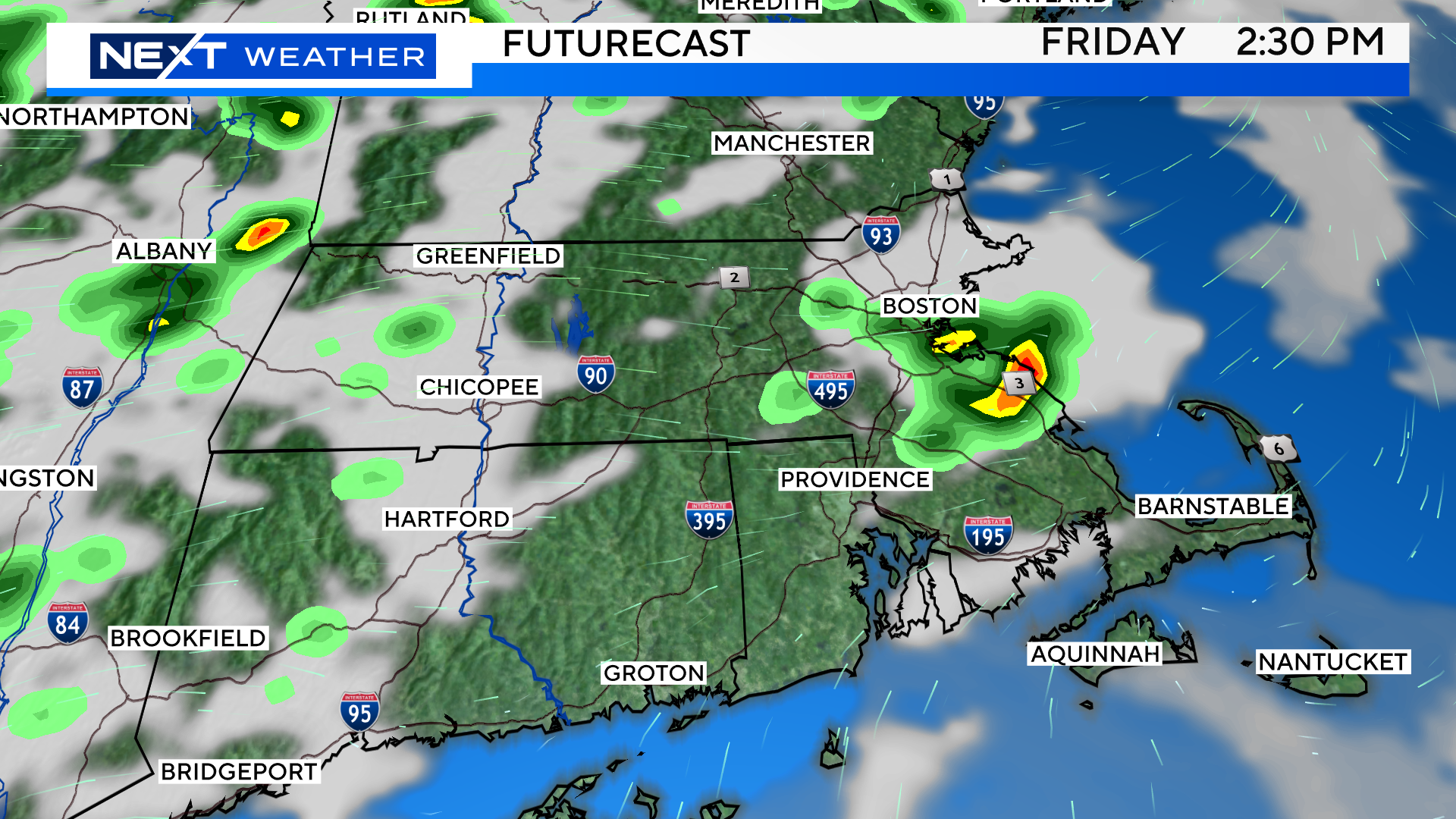
Lots of high school graduations are taking place this evening and there will be some scattered, pop-up showers around. Very hit and miss, most towns will remain dry.
The Weekend will not be perfect but, I think for the most part, we can maneuver around the few chances of rain.
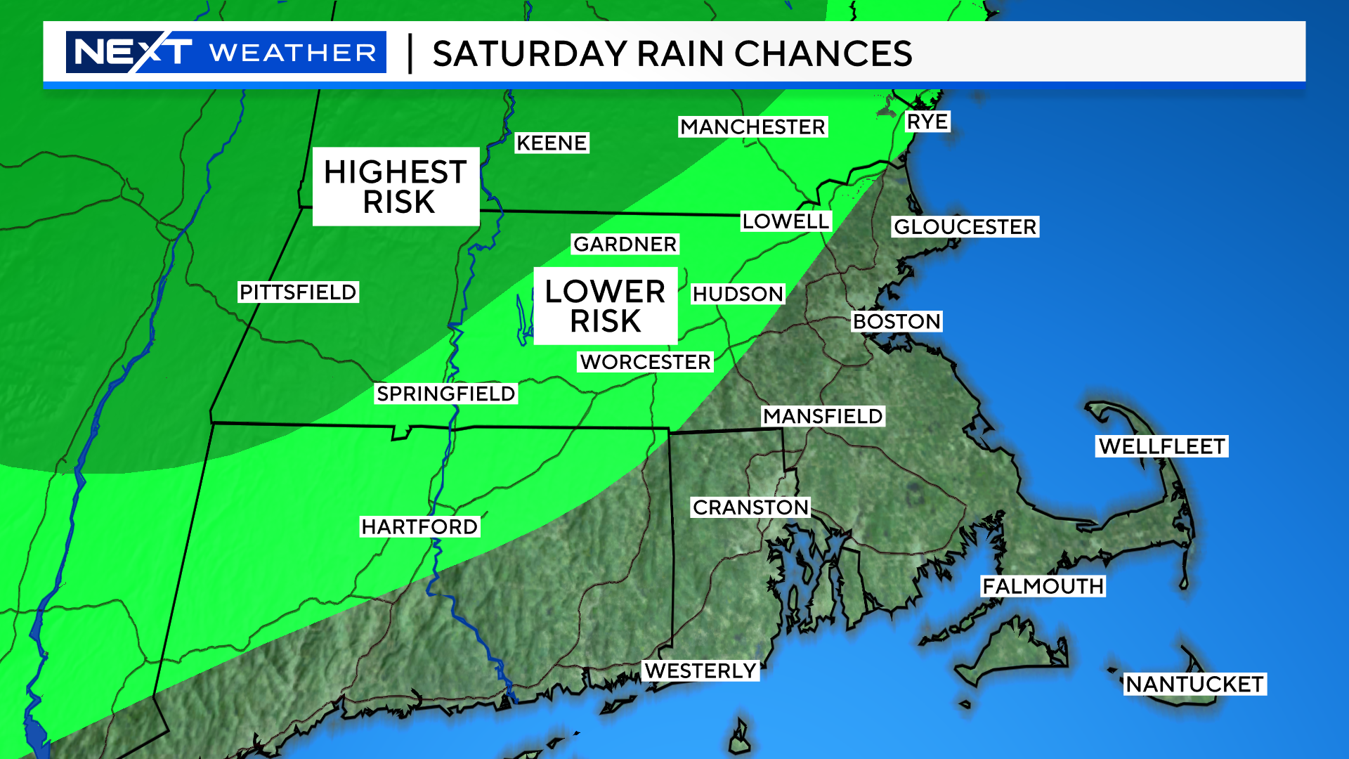
SATURDAY:
Some widely scattered pop-up showers in the midday/afternoon timeframe.
Highest risk of a quick shower is in far western and northern New England. Again, most of us in southern New England, including the beaches, will stay dry.
Saturday will be a bit windy…a fairly persistent 10-20mph wind out of the west all day with gusts as high as 30-35mph.
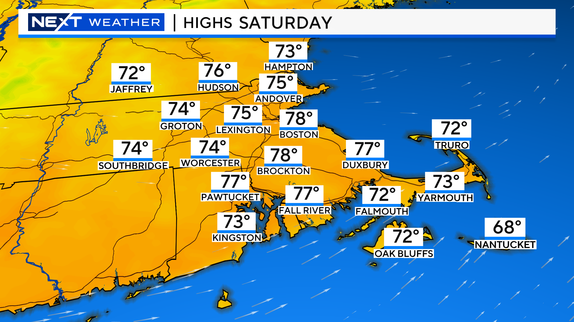
Temperatures will top out in the mid to upper 70s in most of central and eastern MA…a bit cooler over the Cape and Islands.
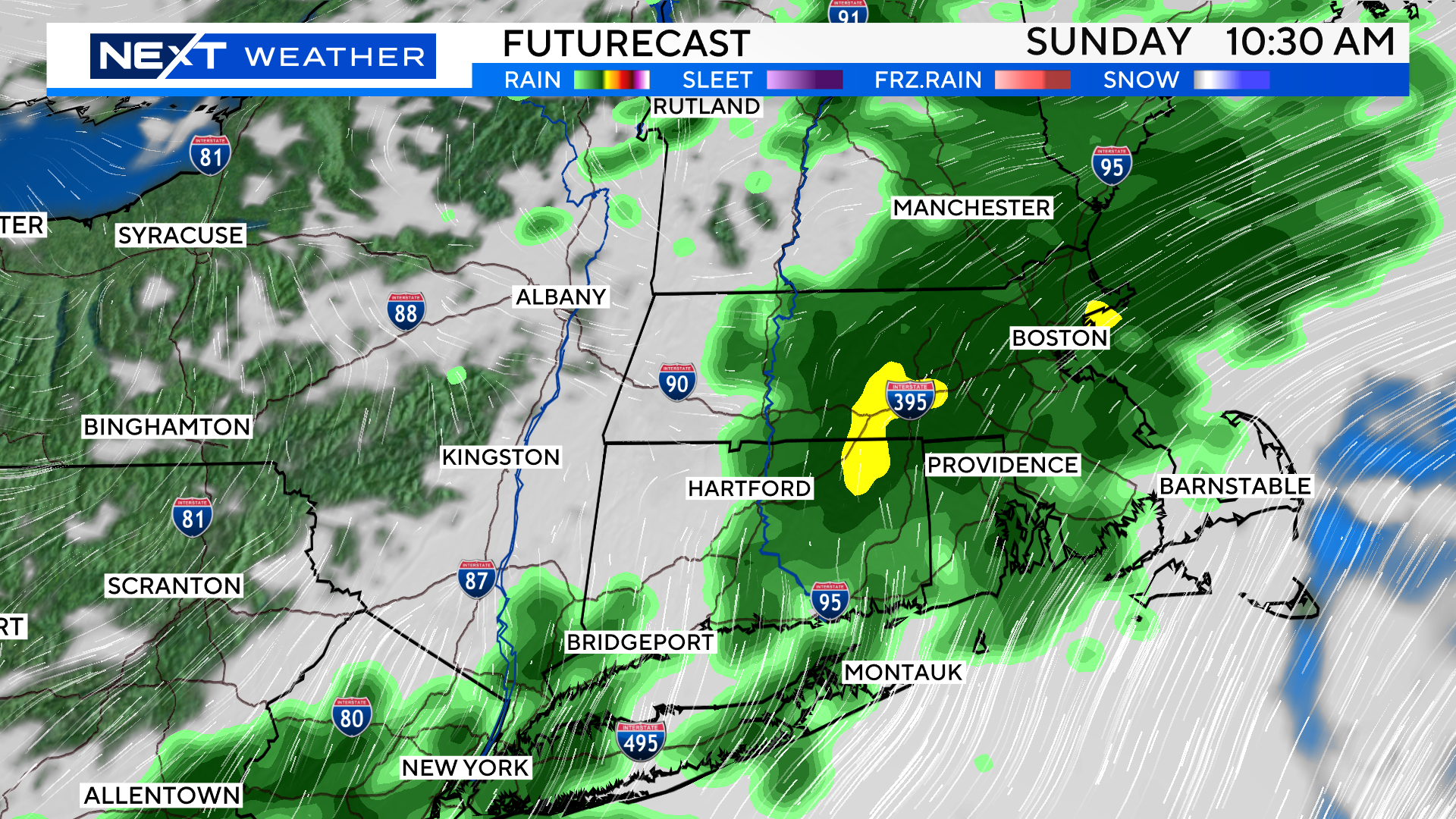
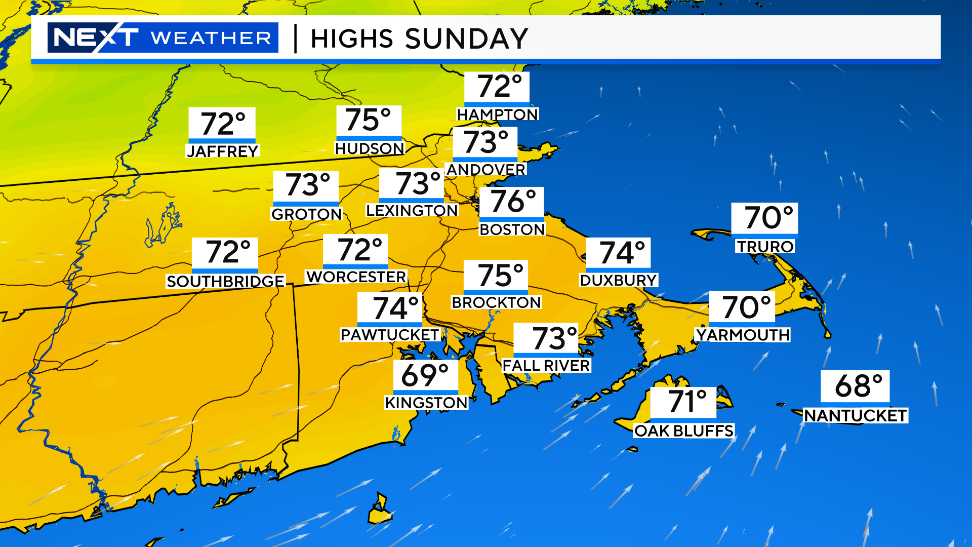
SUNDAY:
Models are hinting at a higher risk of rain on Sunday, particularly in the late morning-midday-early afternoon timeframe.
These showers are likely to impact a much wider area than Saturday and also come farther east.
Sunday will NOT be a washout…the showers will move through fairly quickly and I do think we will see some sunshine return in the afternoon.
High temperatures will be a few degrees cooler on Sunday and with much less wind than Saturday.
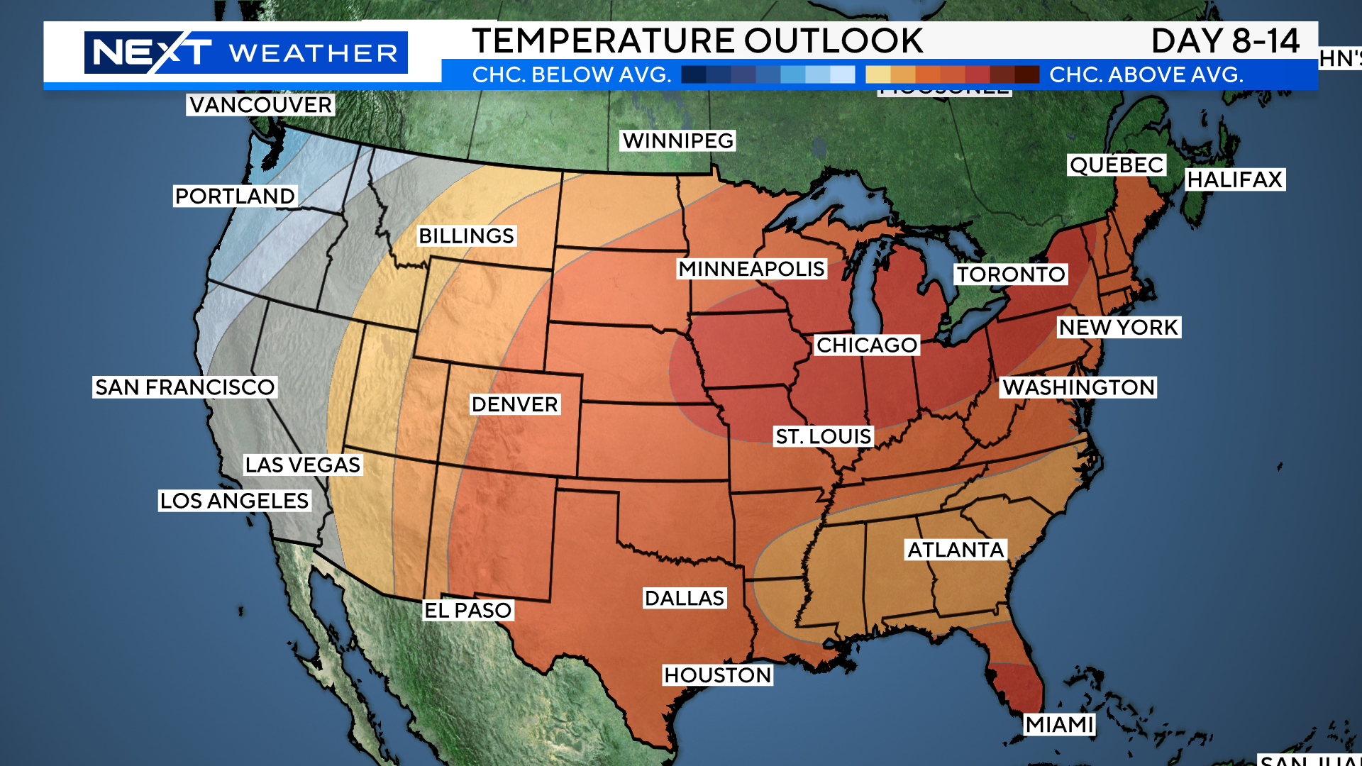
Looking ahead…next week will start with a similar pattern…a few pop-up showers and highs in the 70s. However, looking farther down the line, it appears that by later next week we will rise into the 80s. The longer-range outlook is for some decent heat across much of the Midwest and Northeast by mid-month.
Click here for Westford snow storm data and past totals or select “Winter Snowfall“ under “Pages” on the left hand side.
For more up to date forecast information follow me on Twitter (@terrywbz) or follow the WBZ weather team on Facebook, search WBZWeather
Reader Comments