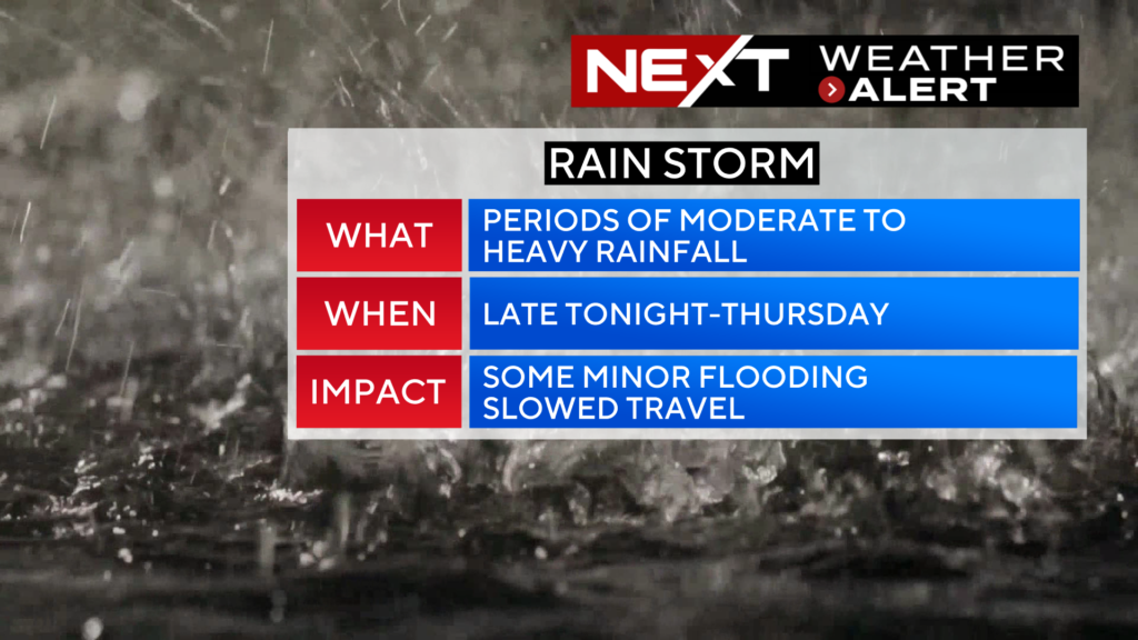
An area of low pressure will be hanging around south of New England for the next 24 hours or so. Its rain shield has mainly been impacting the South Coast during the day on Wednesday, however it is forecast to move northward tonight.
TIMELINE:
Through Midnight…Moderate to heavy rain pivots north with the heaviest rain along and south of the Mass Pike.
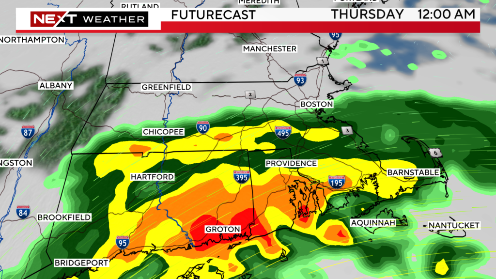
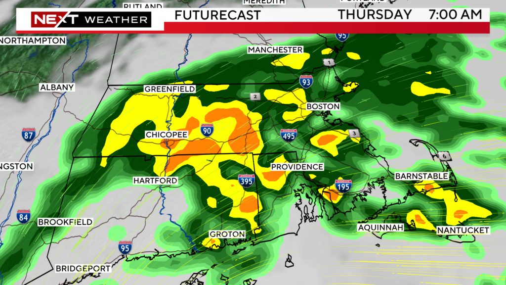
After Midnight through Thursday AM Commute…Rain shield pushes north through the MA/NH border. Periods of moderate to heavy rain throughout the morning commute.
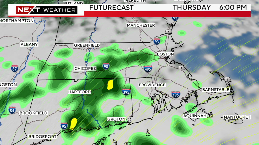
Thursday Midday-PM…The storm begins to slowly drift farther south and east, dragging its rain shield out to sea.
Rain will taper to showers in the afternoon and will completely shut off by evening.
RAINFALL TOTALS:
In general, we expect .5″-1.0″ north of the Pike, tapering to less than 0.5″ north of the MA/NH border.
South of the Pike, there will be around 1-2″.
There may be some areas that receive above 2″, highest threat in Rhode Island and Connecticut.
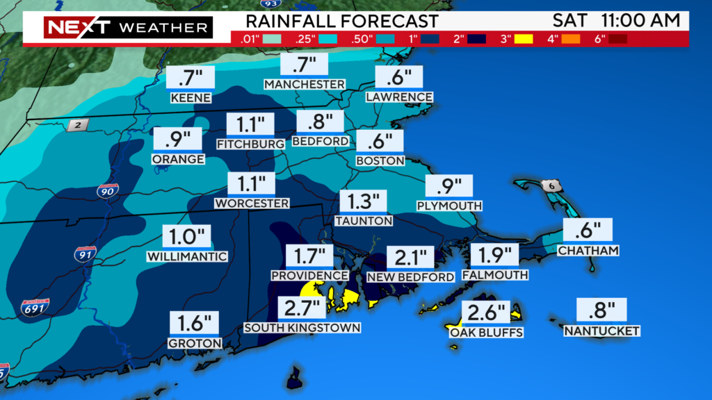
While we don’t expect any significant flooding with this event. Given the peak will occur during the Thursday morning commute, we would advise leaving extra time for travel.
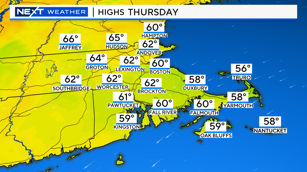
Cooler temperatures Thursday with the cloud cover and rainfall.
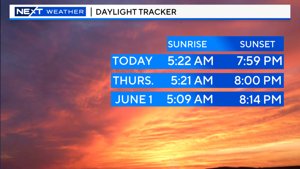
One final note on Thursday…it is our first day with 8pm sunsets! YAHOOOO!
FRIDAY:
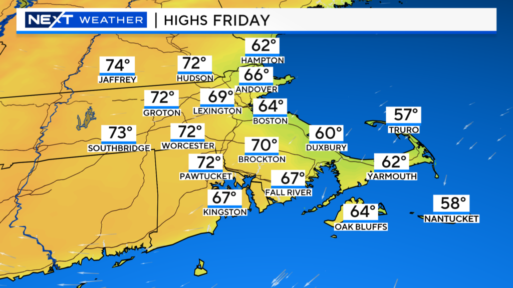
A dry and fairly comfy day. Coolest along the Coastline (60s) with highs 70-75 inland.
A mix of sun and clouds, cloudiest in eastern MA with more sunshine inland.
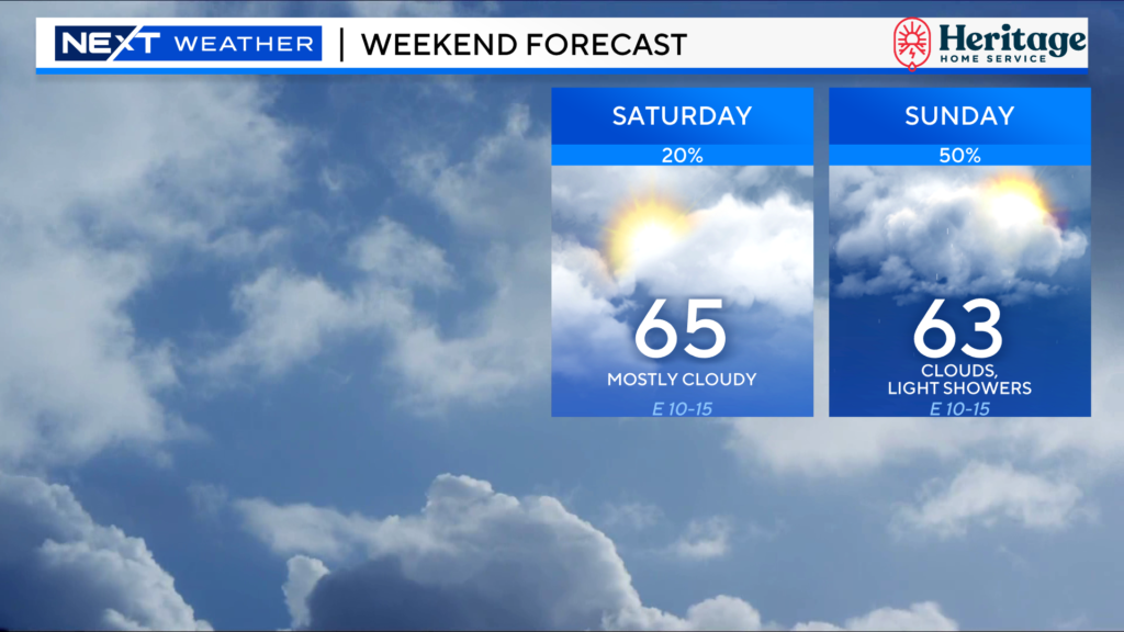
THE WEEKEND:
Meh…Much like last weekend, it won’t be terrible but it also won’t be anything to write home about.
Lots of clouds around both days with cool onshore winds.
Saturday would be the pick as it will stay dry with splashes of sunshine inland.
There may be some pockets of drizzle or a few light showers on Sunday.
Click here for Westford snow storm data and past totals or select “Winter Snowfall“ under “Pages” on the left hand side.
For more up to date forecast information follow me on Twitter (@terrywbz) or follow the WBZ weather team on Facebook, search WBZWeather


Reader Comments